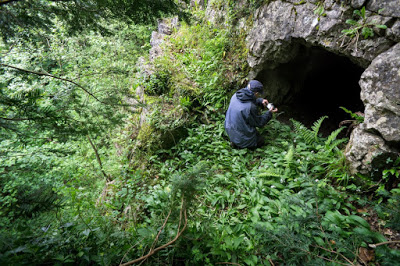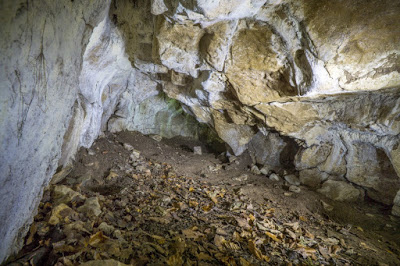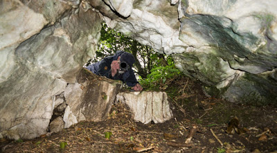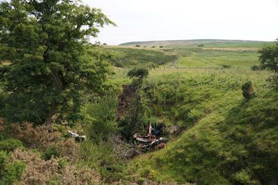
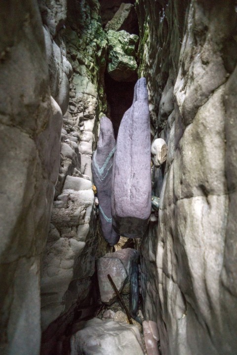
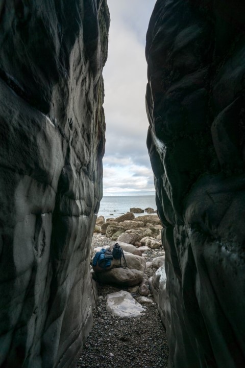
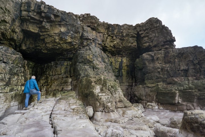
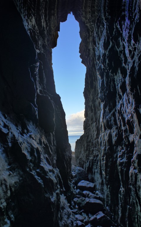
Four sea caves found in an isolated, small, limestone outcrop (Tan Penmaen Head) jutting out into the sea. At least half the height of the outcrop has been removed by quarrying, but the caves show no signs of damage. Although a couple of the entrances may seem inviting, they soon close down. Sea caves are not generally described on this site, but Penmaenrhos Caves have been the subject of at least two old postcards, and are to be found at a location not normally visited by cavers.
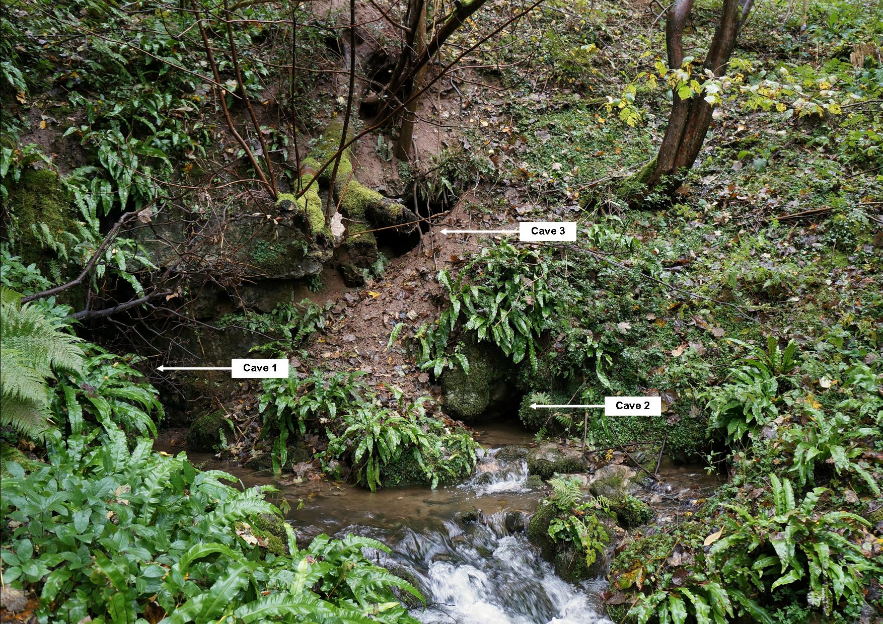
The caves are numbered from west to east.
Cave 1: Appears to be merely a vertical rift open to surface about 8m+ in length, although the end was not inspected when visited in 2020.
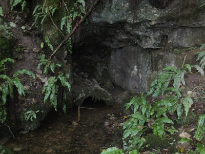
Cave 2: Just a recess in the rock-face. A trickle of water issues from a bedding plane at roof level, but there is no way on.
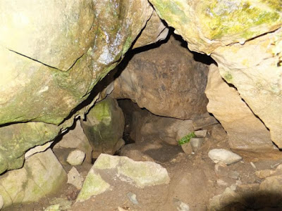
Cave 3: A tapering rift no longer than 10m in length.
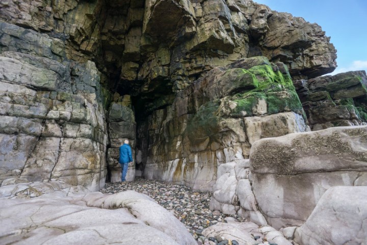
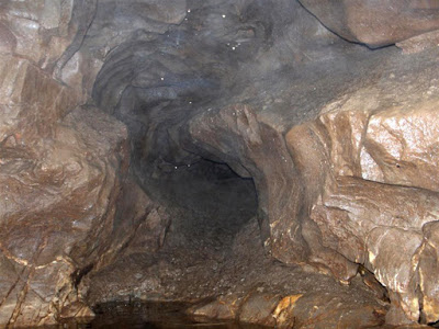
Cave 4: The largest of the four, being a 5m high rift terminating after 15m at a small void with no way on, inhabited by many pigeons.
Directions: As access onto the beach is difficult, the easiest and quickest approach is from the west. By parking south of the expressway at (SH87607863), a short footpath leads over the expressway and under the railway to the top of the only steps down onto the beach. Walk east along the beach for 400m to the limestone outcrop ahead, skirting round it on the seaward side. The caves are only accessible for an hour or so either side of low tide, hence consult tide tables before planning a visit. A concrete slipway leading down to the caves lies much closer, but this is covered in dangerously slimey algae, as are the surrounding boulders, and is best avoided without crampons!
--------------------------------------------------------------------------------------------------------------
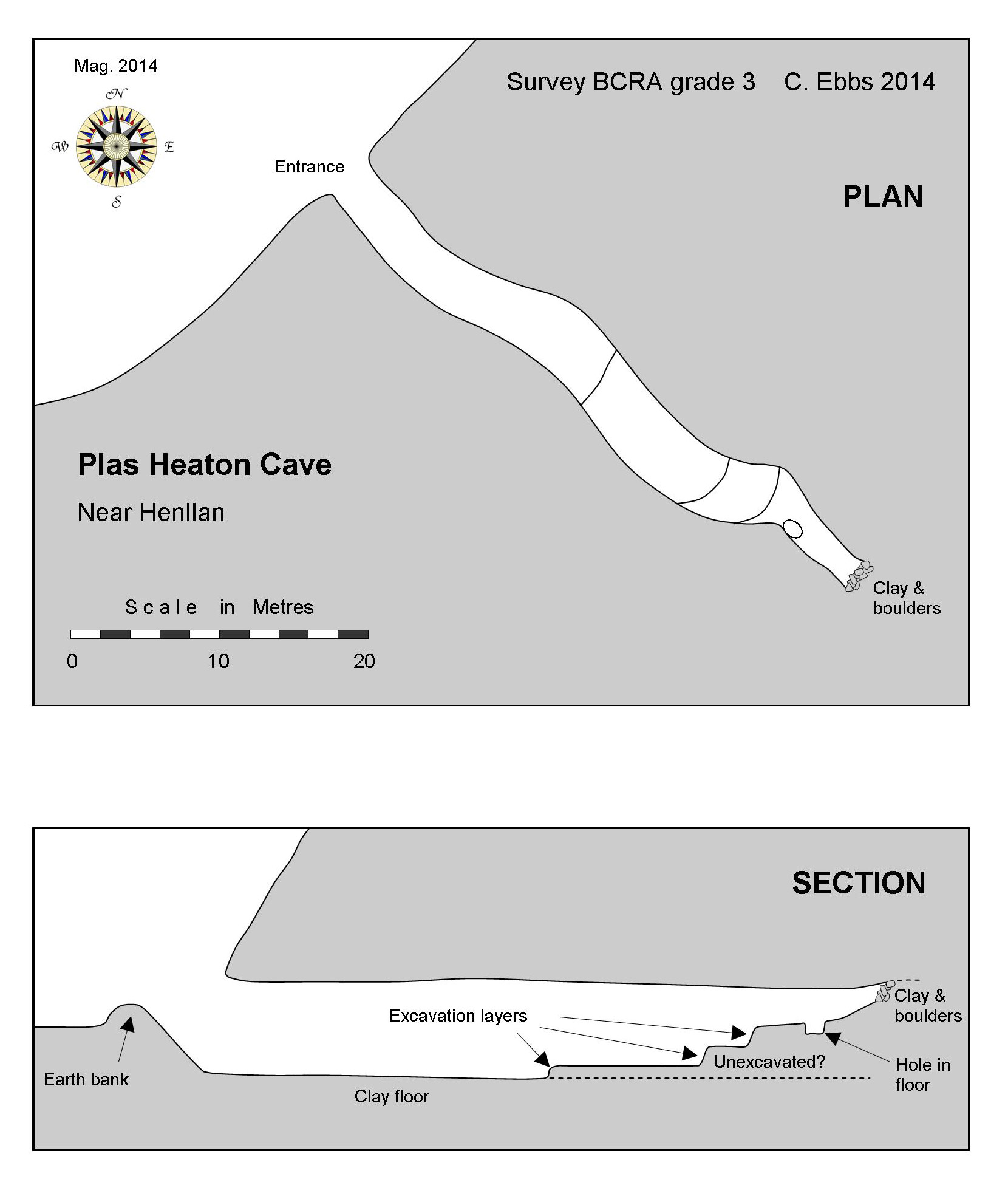
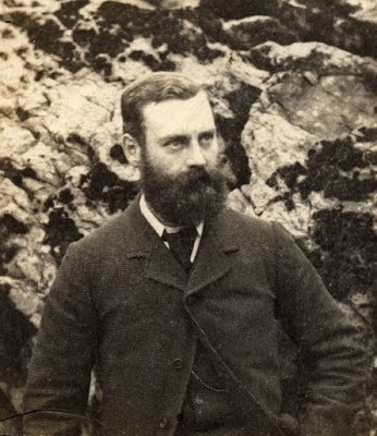
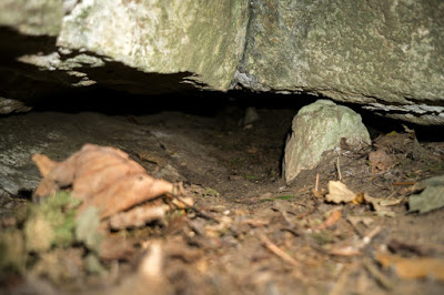
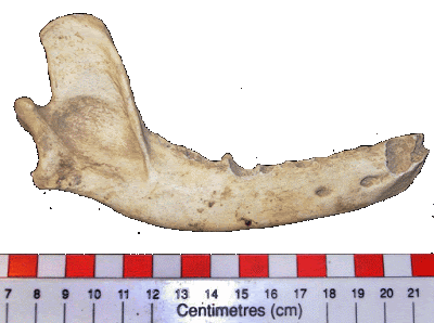
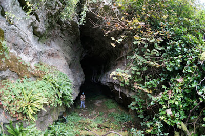
First excavated by Colonel J. R. Heaton and T. McKenny Hughes in 1870.
Finds included a human jaw bone, a flint and bones of cave bear, hyena and 'glutton' (wolverine) 10,000 to 12,000 years of age.
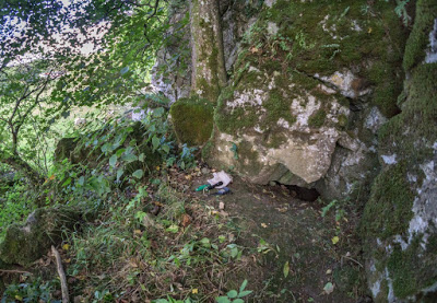
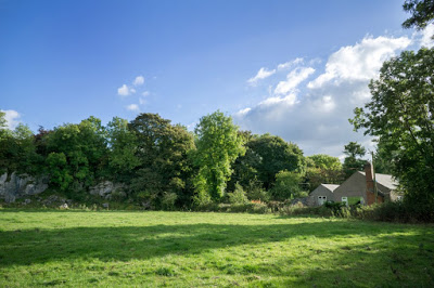
Cave entrance lies within about 50 metres of the stables of Plas Heaton Hall where prior permission must be sought.
SMR: 100568, 100569, 100570
Excavation: J.R. Heaton, W.B. Dawkins & T.M. Hughes, 1860s
Curation: Chester Museum; National Museum of Wales, Cardiff (31.587, 92.234H)
Burials: 1
Finds: worked flints, bone implements, animal bones
Date: ?Mesolithic or Neolithic (4)
Source: http://caveburial.ubss.org.uk/wales/wales.htm
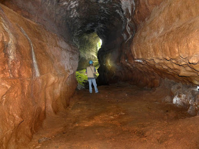
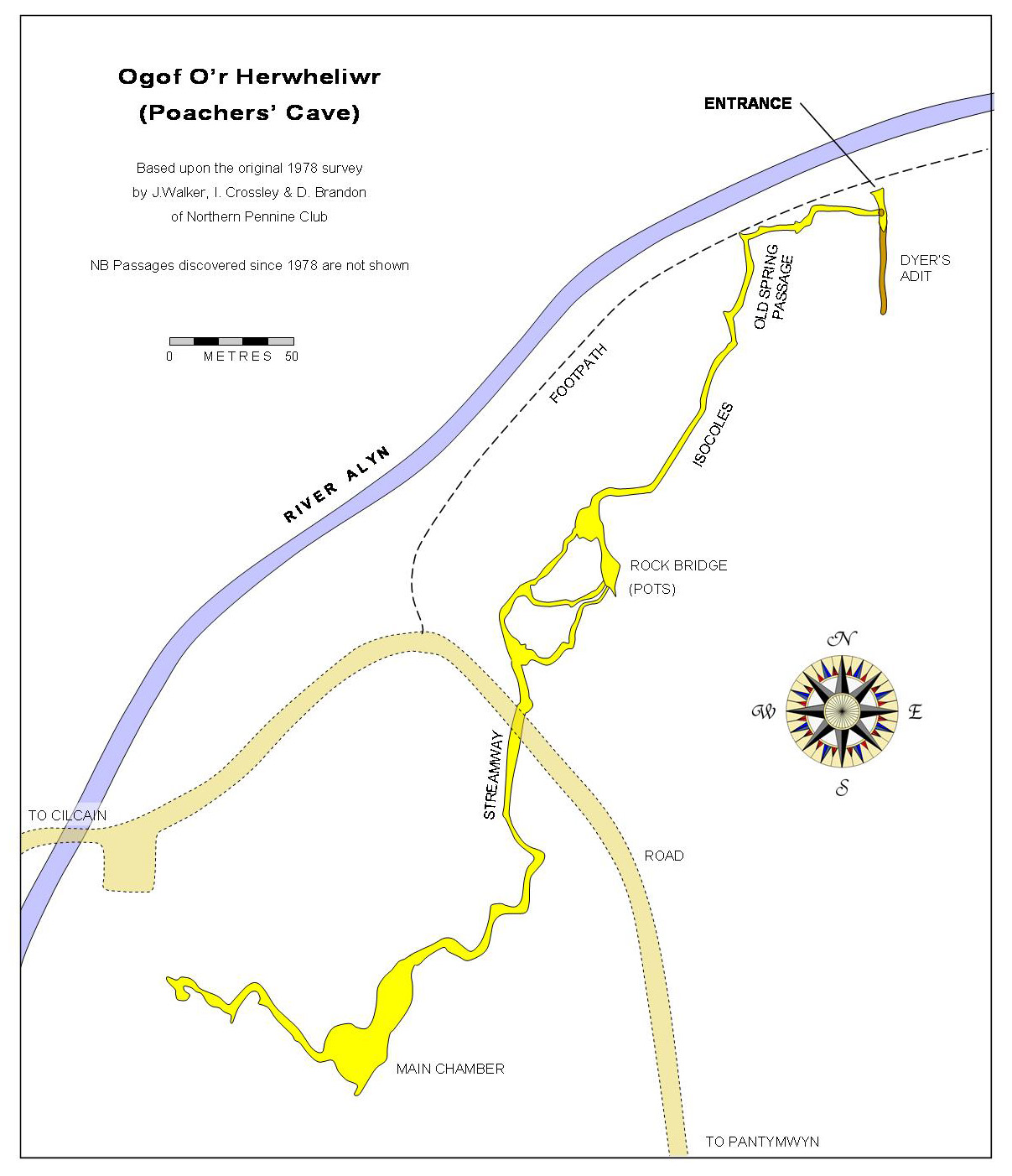
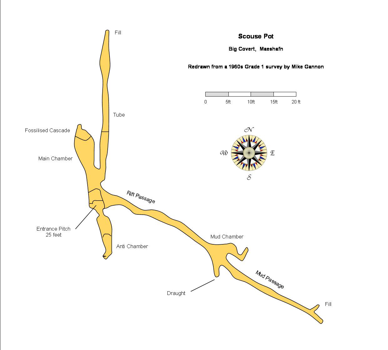
Poacher's Cave SJ19086547 Length 900m Alyn Gorge
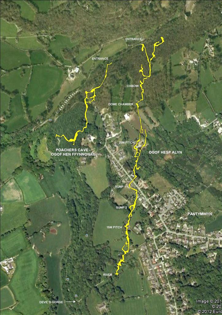
Poacher's Cave (or Ogof Hen Ffynnonau) & Ogof Hesp Alyn
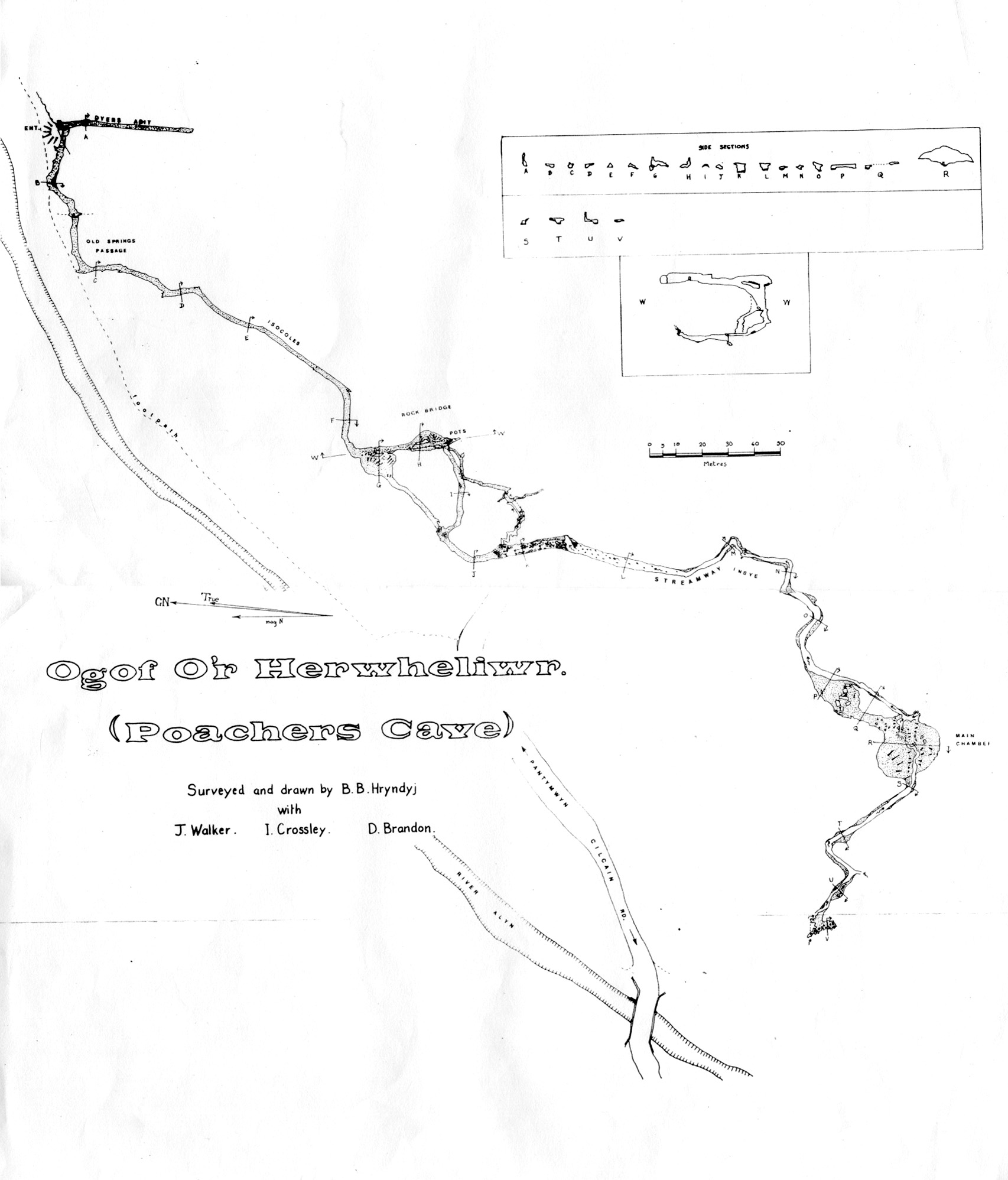
Northern Pennine Club 1978 survey
Access: Currently unlocked.
Warning: The cave can flood after heavy rains when the streamway fills to the roof and the cave resurges.
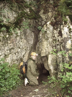
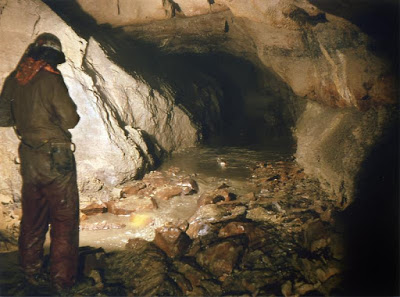
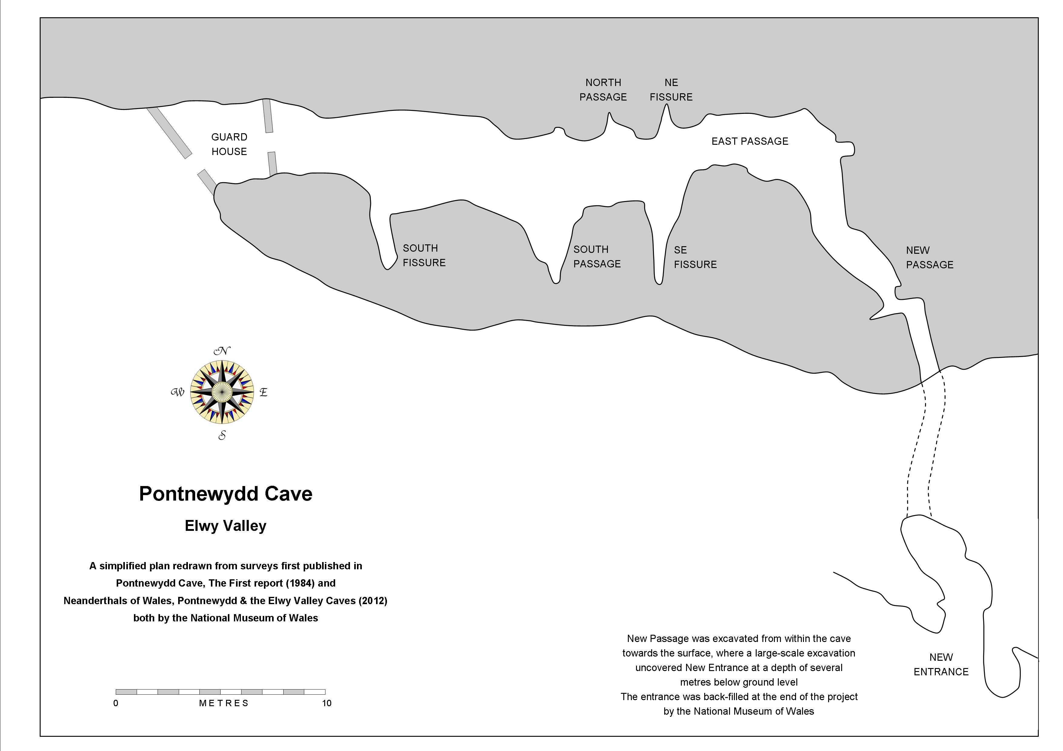
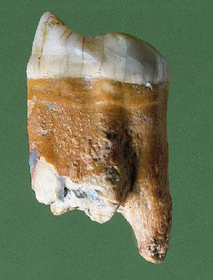
Pontnewydd Cave
SJ0152171029 +/-14ft
Length 45m
River Elwy
Archaeological (human)
Designated a Scheduled Ancient Monument ref: DE 116
Clarification of Boyd Dawkins' involvement:
Several sources claim that Boyd Dawkins was the first to excavate at Cefn Cave. It appears however that this was not the case, as explained in this extract (Pg 54-55) from the book: "William Boyd Dawkins and the Victorian Science of Cave Hunting: Three men in a Cavern" (2017) by Mark J. White.......
Pontnewydd Cave was “first noted by (the Reverend Edward) Stanley in 1832, who remarked that it had never been opened, it remained untouched for decades. The first excavation on record involved Dawkins, although his report in 'Cave Hunting' could hardly have been more superficial”. He described in seventy words finding brown, grizzly and cave bear in clay and water-worn boulders. “These seventy words tell us almost nothing. It does not even say when Dawkins was at the cave, although it must have been prior to 1874 (actually 1871), because Hughes had started to excavate by then. When T. McKenny Hughes and Rev. D.R. Thomas began their work at Pontnewydd in 1874, they noted that 25 yards of sediment had already been removed from the cave. This has often been assumed to have been largely Dawkins' doing. That Hughes and Thomas found felstone artefacts and a human tooth in the spoil thrown out by earlier workers is certainly consistent with the supposition that Dawkins was involved. As one critic would later remark "….. Boyd Dawkins... Same old tale! Pick axe and shovel! Nothing smaller than a horse. It was always the same. He never [worked?] material as it should have been, so that he never got any small things. I have sent my friends and students behind him in the Caves and they have recovered lots of the small vertebrates, and from one of the most important caves one of my friends brought me out of material rejected by B.D. Human toe bones!'.
“Yet there are good reasons to believe that Dawkins has been unfairly accused of despoiling the entrance to Pontnewydd. In the opening sentence of their first report, Hughes and Thomas stated in perfectly plain terms and with no room for misunderstanding that it was the landowner Mr Williams Wynn who had partly excavated the cave 'some years ago'. This refers to Herbert Watkin Williams Wynn (1822-1862), husband of Anna, which dates the work to sometime before his death in 1862. They did not mention Dawkins once in relation to the earlier clearances”."The Palaeolithic settlement of Wales research project: a review of progress 1978–1985" (1986) Green, H. S. In S. N. Collcutt (ed.) The Palaeolithic of Britain and its Nearest Neighbours: recent trends, 36–42. Sheffield, University of Sheffield
SMR: 102132
SAM: De 116
Excavation: T. McKenny Hughes, 1870s; S. Green, 1978-96
Curation: National Museum of Wales, Cardiff ( Accession numbers: 83.107H, 84.70H, 86.31H, 87.93H, 88.166H, 89.168H, 93.40H),
Burials: 3+
Finds: Microlith
Date: Palaeolithic, Mesolithic and Neolithic (1)
14C: 7420 bp (OxA-5819), 4495 bp (OxA-5820) on human bone
Source: http://caveburial.ubss.org.uk/wales/wales.htm
Examples from the collections held by the National Museum of Wales:
Bear femur (acc. No. 86.31H/3.F775) 40000 +/- 600BP
Lion phalange (acc. No. 86.31H/3.F1014) 40300 +/-750 BP
Reindeer humerus (acc. No. 89.93H/2.F1186) about 36700 BP
Woolly rhinoceros phalange (acc. No. 94.38H/3.F4515) 33200 +/-650 BP
Source: http://palaeo.gly.bris.ac.uk/Fossilsites/page48.html
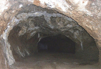
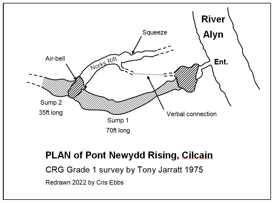
Pont Newydd Rising SJ1866964997 Length 110m+ Alyn Gorge
Also known as Jarratt's Resurgence
A resurgence cave
between the villages of Cilcain and Pantymwyn,
explored by cave divers for 110m, .
From the entrance, a low wet passage can be followed for 4m to Sump 1, the limit for non-divers.
Sump
1 is 22m long to an airbell where a dry passage 24m long heads back
towards the entrance 1m above water level. There is a verbal
connection from the end of this passage to the dry passage inside the
entrance.
Sump 2 is 9m long to an airbell.
Sump 3 is 53m long to another airbell.
Sump
4 has been dived for 6m to where the passage divides at a depth of 3m.
The passage was seen to continue ahead, but bad visibility hampered
further progress.
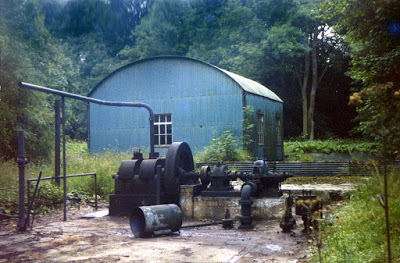
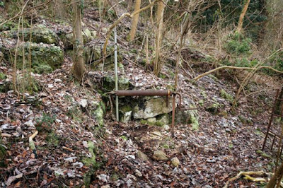
The
entrance culvert is man-made, as water resurging here was once piped across
the river to a pumping station (see photo below), the remains of which were removed in the late 1970s.
The source of the water rising here is the small dingle of nearby Coed Nant Gain (see Nant Gain Caves). Surface water flowing eastwards towards the River Alyn disappears into numerous stream bed swallows to resurge at Pont Newydd Rising. With landowners consent, several attempts have been made to open some of these swallows (and re-seal them), so far without success.
Diving chronology:
Sump 1 first dived 23rd Jan 1971 by Tony Jarratt for 9m
Sump 1 first dived 26th Oct 1972 by Tony Jarratt for 22m to airbell
Sump 2 first dived 28th Jan 1973 by Tony Jarratt & Dick Pike for 9m to airbell
Sump 3 first dived 28th March 1973 by Tony Jarratt & Dick Pike for 16m
Sump 3 to airbell & Sump 4 first dived 9th March 1974 by Martyn Farr & Rod Beaumont for 6m
(Source: Typed 1970s unpublished report by Martyn Farr)
Entrance is the west bank of the Alyn, 100m upstream from the Nant Gain confluence.
1) The longest passages shown on the plan above may be blocked with soil and leaves, as when visited by the writer in 1976 neither were accessible.
3) The entrance pot was filled with small pine trunks (see photos below) by the new owner in 2013.
Could this also be the source of the draught shown on the above survey? If so, a dig to the pot from here could establish if the deposits hold any archaeological potential.
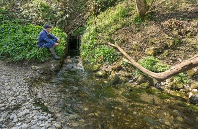
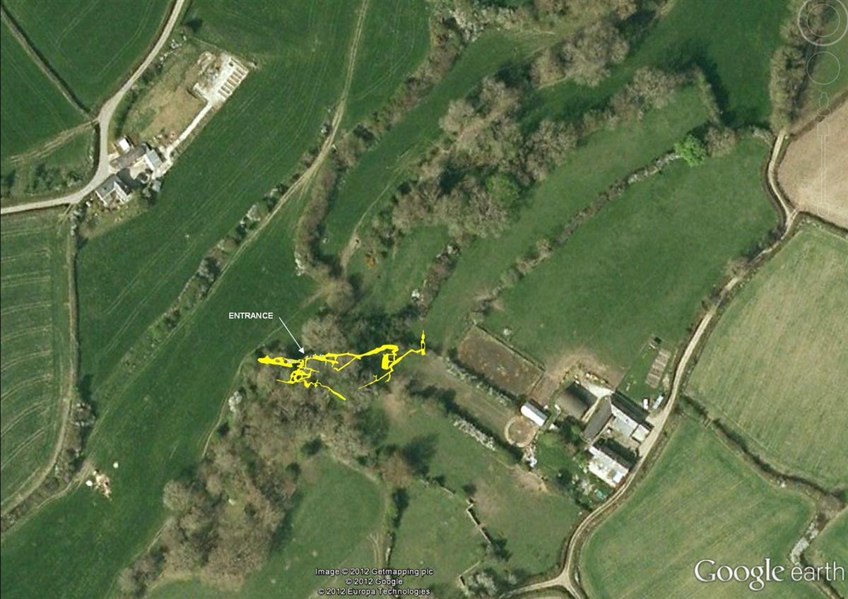
Siamber Wen Caves 1-3 SJ1753767491 +/-37ft Cilcain
Cave 1: Length: 4m
An active resurgence and t he most obvious of the three caves. Access is via an old pipe built into the entrance
'Caves of North Wales' (1960) by Davies & Ellis of Shepton Mallet Caving Club states: "In July 1960 Fred Davies crawled up the water pipe. At the far end the water rose from a six inch wide rift to the left. The right wall was artificial".The source of water resurging here lies to the south-west 600 metres away at Siamber Wen Sink Cave (see below).
A low, wet, awkward crawl eventually becoming too tight.
Obscured entrance 2m to the right of Cave 1 at stream level.
A short passage leads to a rift in the floor down to water. Excavated in 1981 by NWCC.
Entrance is 3m above Cave 2.
Another nearby resurgence
Two further resurgences lie a couple of hundred metres to the north-east, the furthest of which is merely a small trickle and lies in the garden of a private home. It is of little speleological interest.
The other, at SJ178675, is more copious, and has never been excavated by cavers, despite there being about 60 metres of limestone above the spring in the direction of Garreg Boeth vein. The source of this water is unproven.
Park at the pull-in by Siamber Wen Caves, then walk 50 metres back along the road towards Cilcain. Take the style on the north side of the road and walk east to the spring.
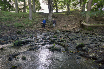
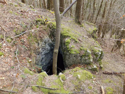
Siamber Wen Sink Cave SJ17046724 Length 250m Cilcain
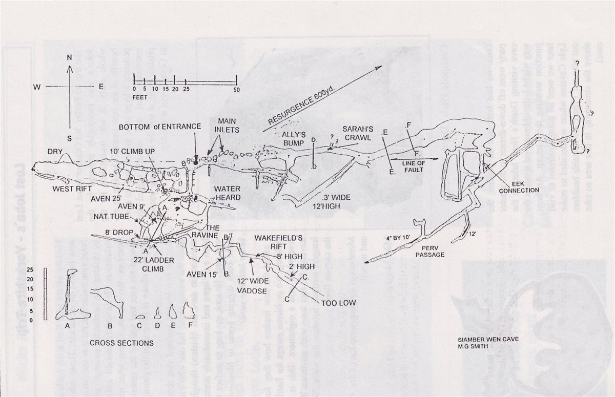
Based on the above survey by Mike Smith
V-notch weirs were erected by caver Graham Woolley at both sink and resurgence in 1974 to monitor flow rates. Interestingly, the sink only accounted for half the flow emerging from the resurgence of Siamber Wen Caves 600 metres to the north-east.
One of the earliest published references to 'Siamber Wen Swallet' are:
Stride, A.H. & R.D. (1953) Britain Underground, by Dalesman Publishing
.
Warning: Parts of the cave, particularly the entrance area, are unstable. The sink has a large catchment area which reacts rapidly to heavy rain.
Access or further information: Contact GCC or UCET.
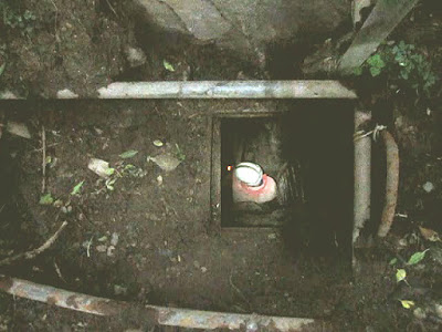
Photo: Tim Watts
Skull Pot
SJ1934665524 +/-18ft
Depth 15m+
Alyn Gorge
Archaeological (animal only)
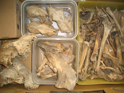
First found in 1984 by GCC when a mandible of wild boar and many other animal bones were found lying on the floor of the pot. The mandible was identified in 1998 by Paul Finnegan, Natural History Centre, Liverpool Museum, who described it as "Wild Boar (sus scrofa) which has been sub-fossilized. The age of the bone is probably around 5,000 years, may be older, but no more than 10,000 years old" (Source: Pers. Comm between Dr Dave Merchant and Paul Finnegan Oct 16th 1998).
Excavations in the floor of the pot, found no bones below the initial surface layer.
In the absence of a suitable local museum, the mandible is currently on display in a glass case at the Colomendy Arms, Cadole, near Loggerheads.
Access: Contact GCC or UCET for details
-----------------------------------------------------------------------------------------------------------------------