L:440
V:34 |
Pwll y Pasg, Pwll-y-pasc
NGR: SO 18233 16082
479 m.asl
Powys
, Northern Outcrop - East (Morlais to Abergavenny)
|
map using leaflet map:
|
|
Cave |
| Access |
The cave lies in a doline, 410m North of Waen Rudd. It is marked by a cairn. |
| Description |
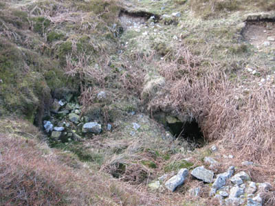
A typical shakehole cave developed just below the surface of the moor consisting of crawls and 2 shafts, each around 15m deep.
|
| History |
Technical Speleological Unit. Extended 1992 by Chelsea SS. |
|
| Hydrology |
|
| Conservation |
SSSI: 0080 Mynydd Llangatwg (Mixed) |
| Gallery |

Brendan Marris
2009 |
| Survey |
| D.A.Jenkins, Inett Homes, C.J.Williams, R.Williams: HCC, 1963 |
| D.A.Jenkins and C.J.Williams. CSS Records 19 |
| CSS 1984/1992, nl 34/5, 1992 |
| References |
| HCC nl. Caves in the Twyn-pen-Rhiw Area, Llangattock |
| BCRA Trans 1(3) p.150, Trevor M.Thomas, The South Wales Interstratal Karst (1974) [as Pwll-y-pasc]] |
| Gascoine,W. (1982) Trans.BCRA 9(3), pp.165-175, The formation of black deposits in some caves in South East Wales |
| Descent 58, p.13, 1984, Better than par in Pwll y Pasg |
| CS v12(4), p.133, 1985, M.Noel, Geothermal detection of shallow cavities - Results from the South Wales karst |
| CSS nl 34/5, pp.58-63, Pwll y Pasg - the true story, Clive Gardener |
| Caves of South Wales, Stratford, T., 1995 |
| A Caver's View of the Clydach River (Cwmbran Caving Club, 1986), Schuurmans, T. |
| Brendan Marris Caves of South Wales |
| Search for further records |
Browse registry map |
Cambrian Cave Registry entry 803 |
© Cambrian Caving Council ⓗ |


