
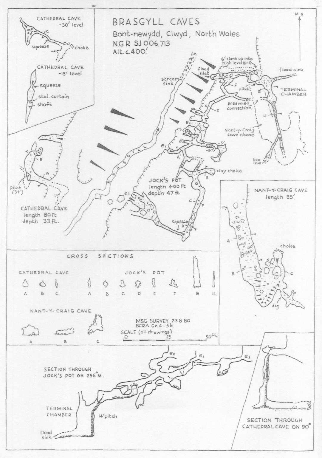
Source of original 1964 survey:
'Some Caves of North Wales'. Shepton Mallet Caving Club Journal Series Four, No1, June 1966
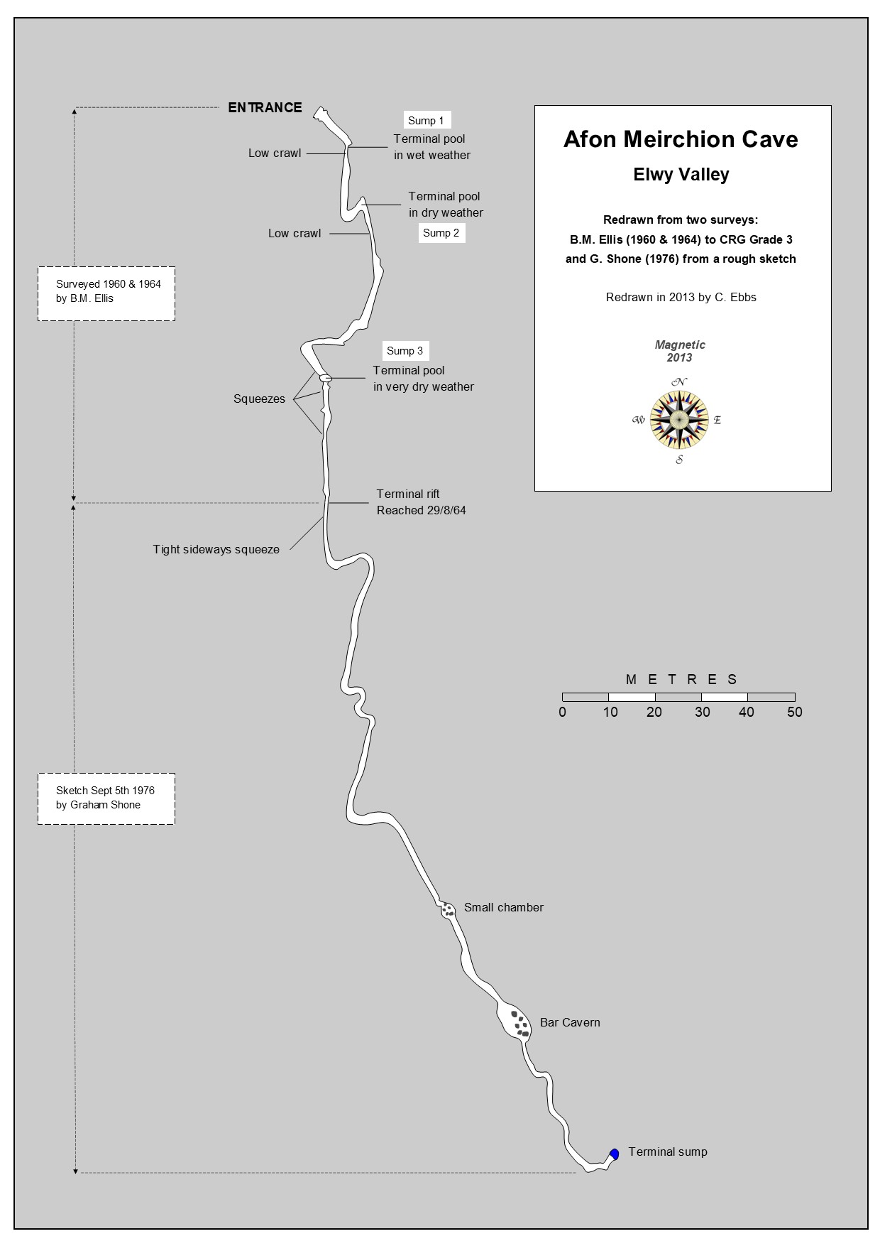
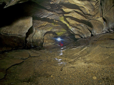
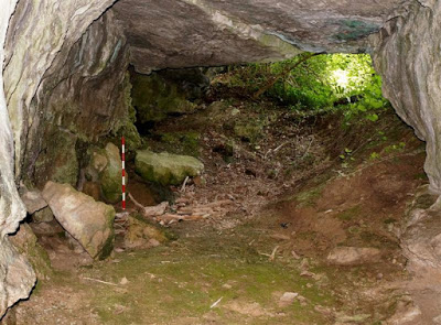
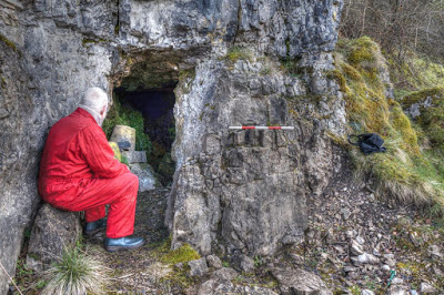
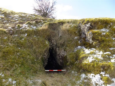
A low area a few metres from the entrance, Sump 1 can be dry, but becomes wet or a sump in wetter weather. The passage then enlarges leading to Sump 2 about 27 metres from the entrance. This can be passed in dry periods and leads after a further 50m or so, to Sump 3. This only dries out after periods of prolonged or extreme drought. The end of the cave, just beyond Bar Cavern, is thought to be close to the termination of Dell Cave. The entire cave was explored again in September 2022 (see description below), and finally surveyed to Grade 5c in the drought of August 2025.
Warning: Sump 2 can fill with no stream flowing through the cave. The cave also becomes active very quickly after rain. Exploration beyond Sump 2 should only be attempted in settled weather conditions.
Driving north out of Henllan village on the B5428, take the first 'C' road off on the left (signposted Bont Newydd).
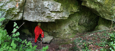
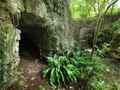
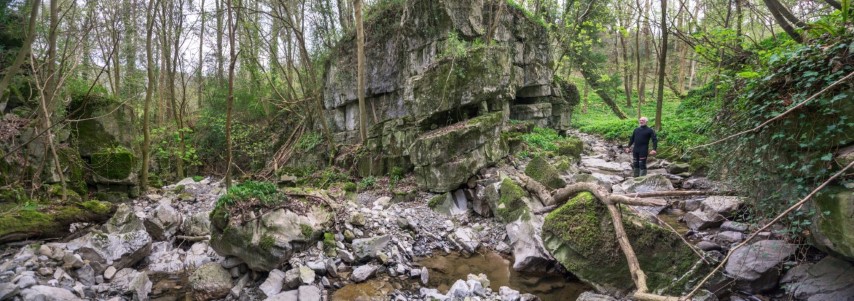
Follow this C road for two thirds of a mile then find a place to park. Take the footpath from SJ023698, which leads down towards the Afon Meirchion stream. Continue along the path heading south (-ish) for about 200 metres. Then leave the path, climbing down to the stream and continue south, upstream. The entrance should be easily visible in the east bank near stream level.
History of exploration
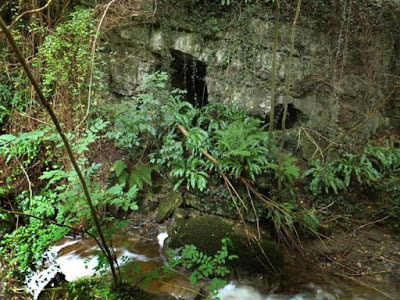
1960: The passage between Sumps 2 & 3 was explored by Shepton Mallet Caving Club who wrote: "On a beautiful white stal we were surprised to find some indecipherable initials and a date which seemed to be either 193- or 195- smoked on the stal with an acetylene lamp......... a small resurgence in the right bank about 50 yards below Afon Meirchion Cave......... emerged from a gap six inches by three inches in the rock at the level of the river ".
Source: Davies & Ellis (1960). Caving in North Wales. Occasional Paper No.2. Shepton Mallet Caving Club.
1964: Then in 1964 SMCC explored beyond Sump 3 a further 75 feet of constricted passage.
In 1965 fluorescein dye was introduced by the club into the water sinking at Dell Cave, and activated charcoal detectors were placed at the entrance to Afon Meichion Cave and also at a small resurgence 50 yards downstream. Both proved positive.
Source: Ellis, B.M. (1966) Journal No 1 Shepton Mallet Caving Club.
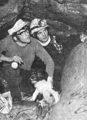
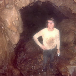
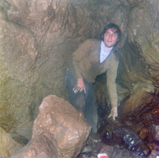
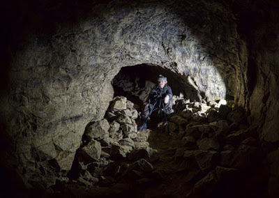
1976: After a period of prolonged drought, Sump 3 dried up and the cave beyond was explored by local cavers Grahame Shone with his dog Patch of Henllan, and Alan Jones (see photo). After excavating a blockage 30 metres beyond Sump 3, they extended the cave to a total length of approximately 1000 feet. A week later, the writer and a few others managed to explore the new extension, but days after this, the sumps once again became flooded.
2022: It appears that Sump 3 remained flooded for 46 years. At the end of the prolonged drought of 2022 however, the sump again dried up, allowing Chris Mitchell and Tony Smith to excavate their way through the blockages and explore the known cave. The description below may be helpful to cavers when the next drought occurs….
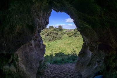
“A short but fascinating sporting cave set in the beautiful Elwy Valley, one of the most picturesque spots in North Wales, second only to the Ceiriog Valley.
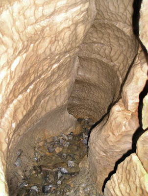
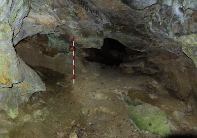
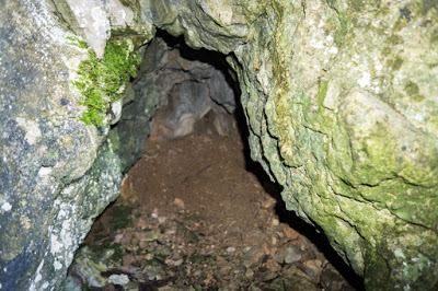
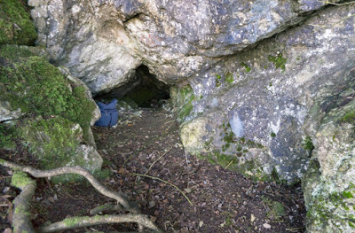
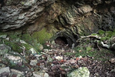
The initial impressive entrance soon leads to a damp low section of Sump 1 (no sump in dry weather). Once this is passed, the cave pleasantly opens up to stooping sized passage where fast progress can be made to Sump 2 (negotiable by shifting small pebbles for an hour or so).
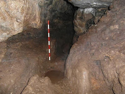
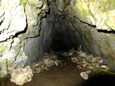
From here, a steep drop of a metre or so (slightly awkward climbing back out) leads to a gravel tube and where Sump 3 would be. I spent a couple of hours here with garden hoe and trowel dragging small pebbles up and generally enlarging the hole (the 2nd and 3rd squeezes shown on the survey were not seen, so must have been washed out).
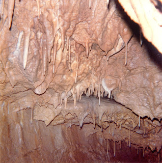
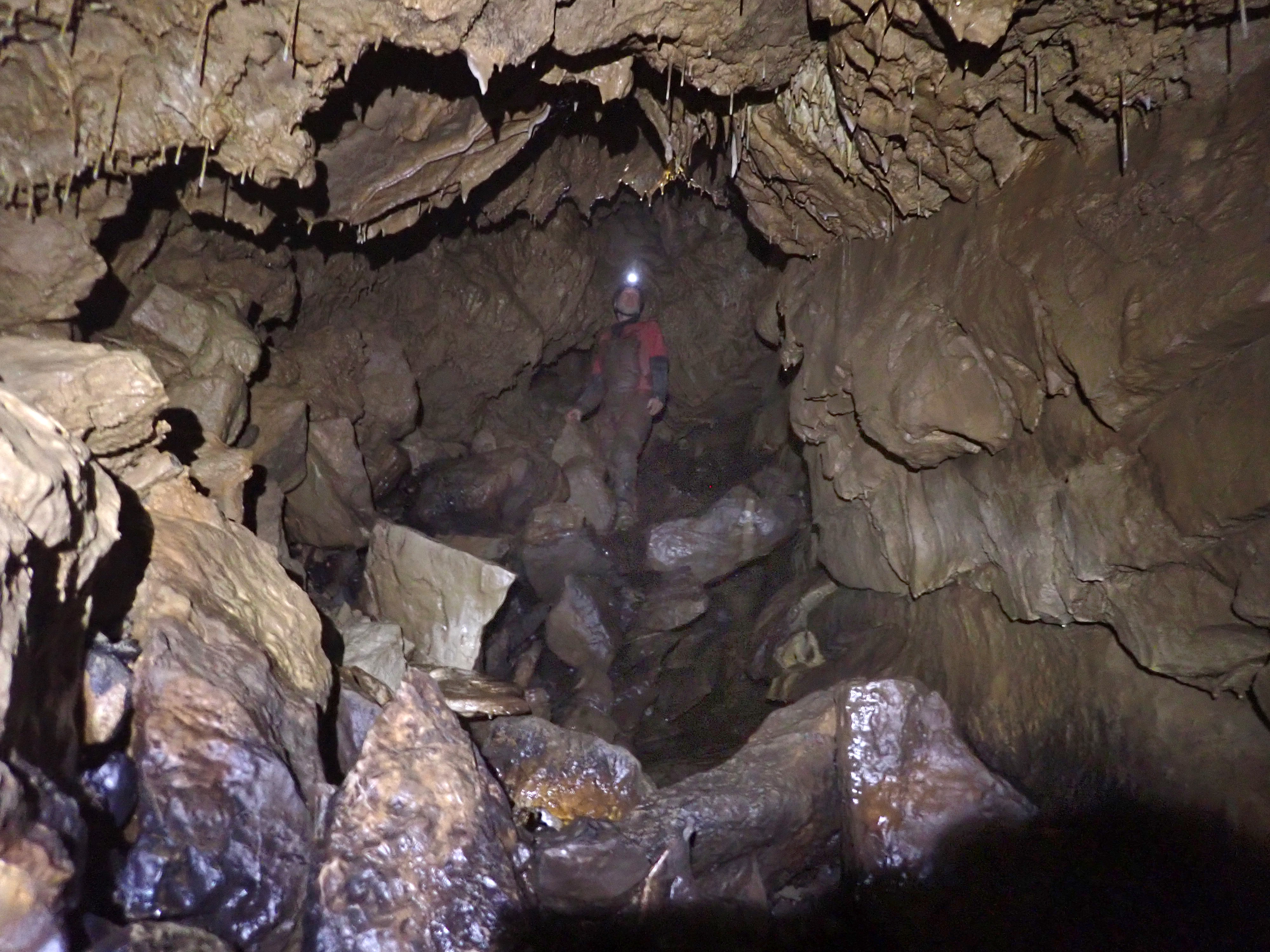
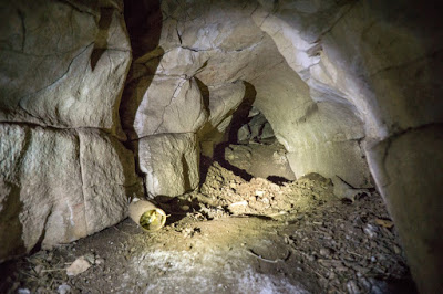
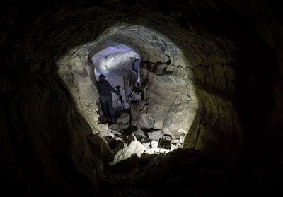
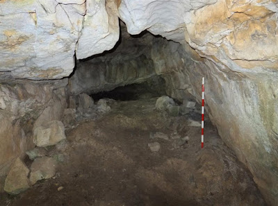
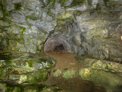
Beyond Sump 3, hands and knees (and occasionally flat out) crawling leads eventually to a 3m high rift which might require digging out at the base. Beyond the rift are a couple of metres of low ascending passage changing to stooping size again. From here the cave changes to a clean washed superb small canyon-style passage, leading first to Small Chamber (where nature has been kind enough to allow one of the 2 or 3 gaps in the rock just big enough to allow entry), then onwards to Bar Cavern, both chambers are well decorated. At the far side of Bar Cavern an easy squeeze leads to a bigger rift and eventually the present end.
A short but fascinating, sporting cave”.
Chris Mitchell September 1st 2022.

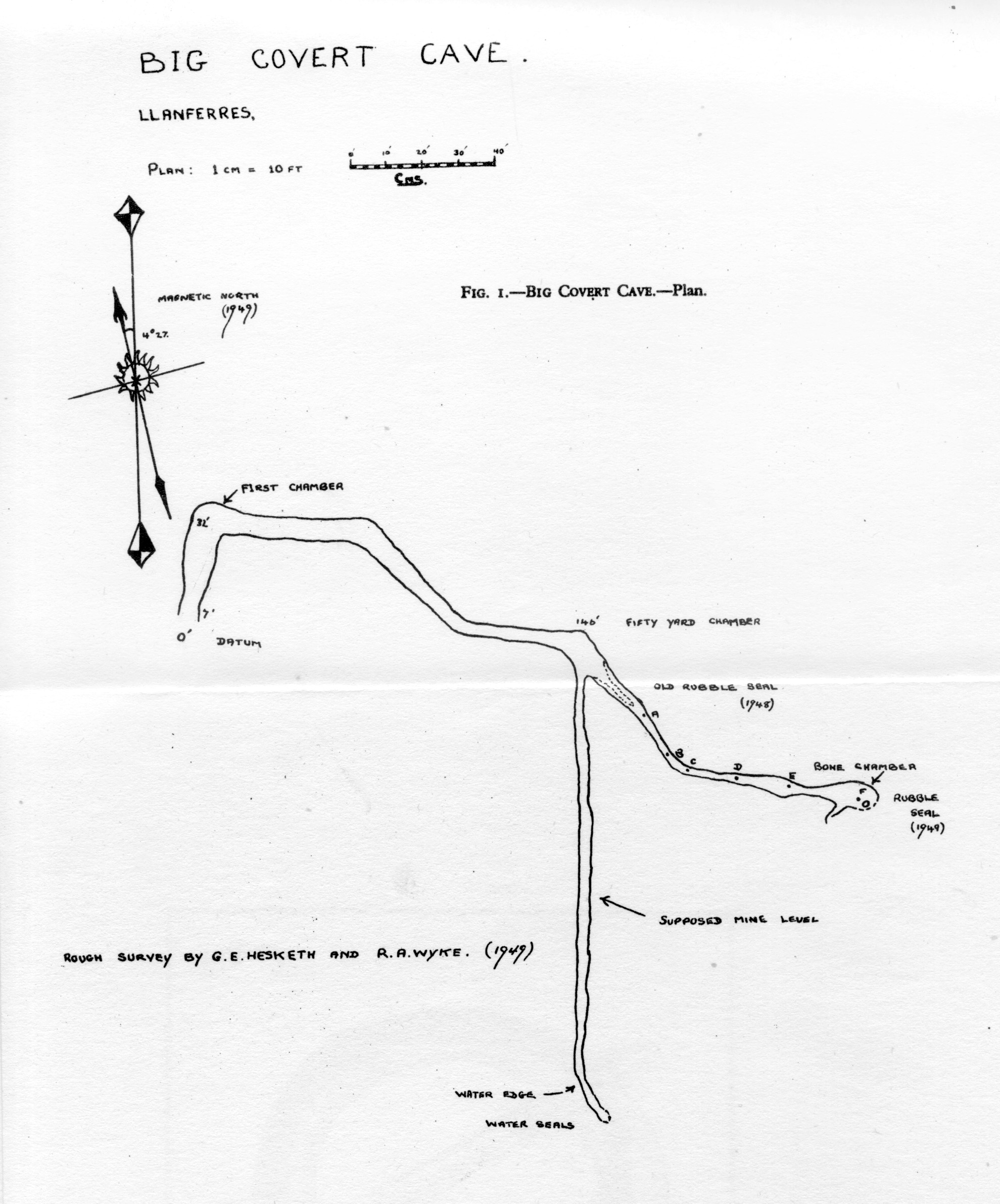
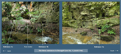
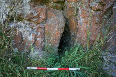
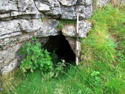
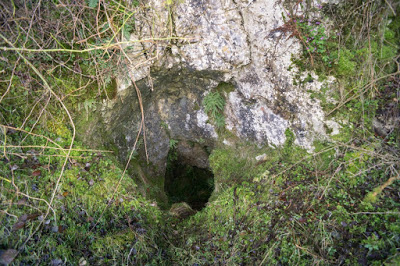
Afon Meirchion Cave, Upper SJ0211569213 +/-20ft River Elwy
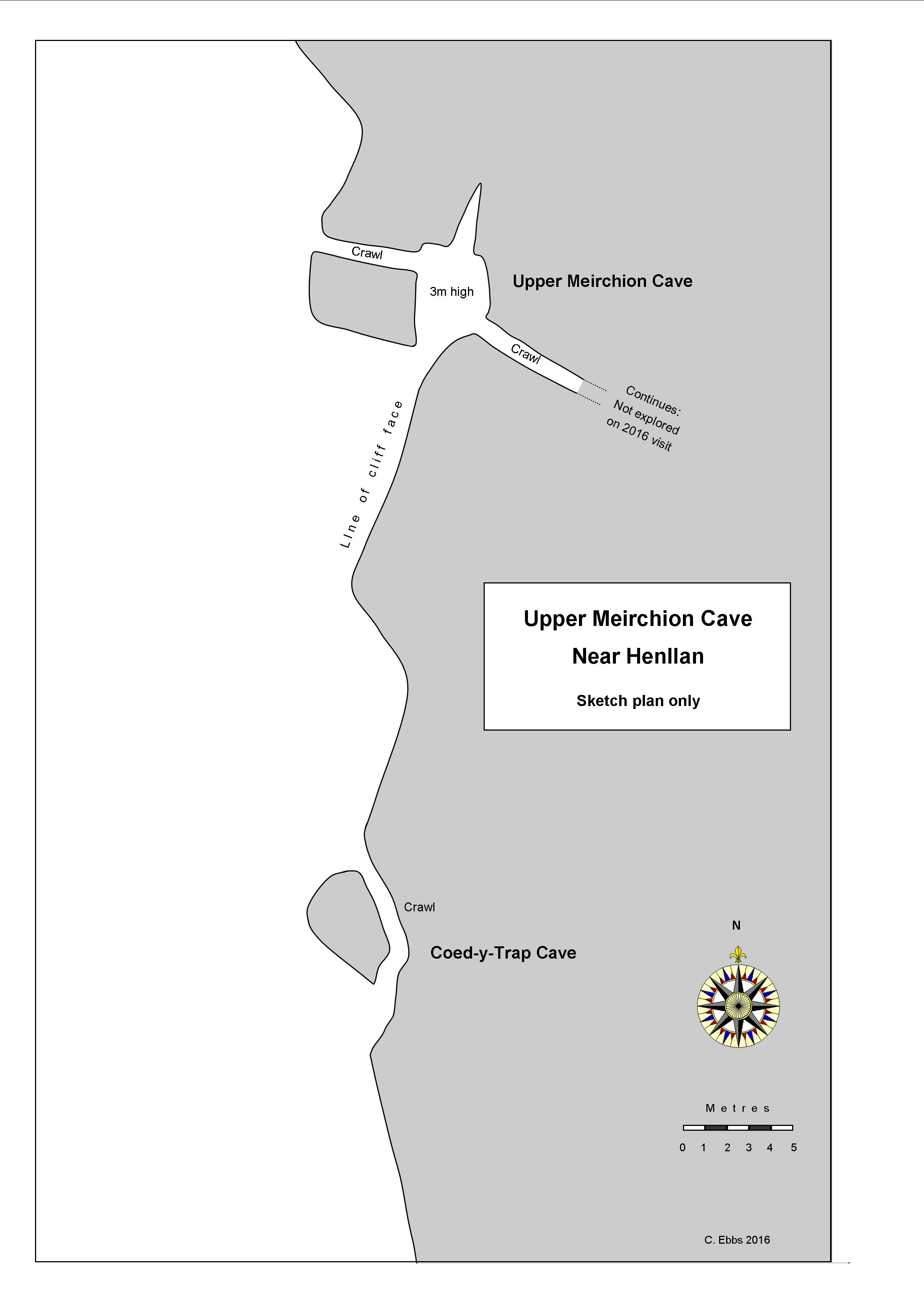
Afon Meirchion Cave, Upper
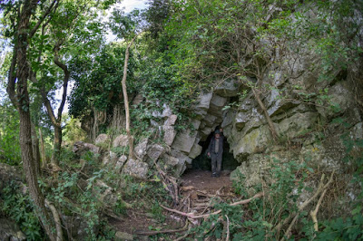
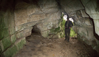
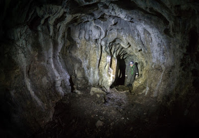
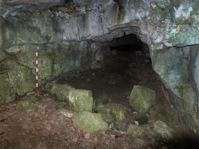
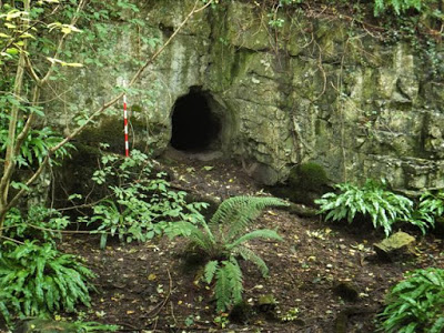
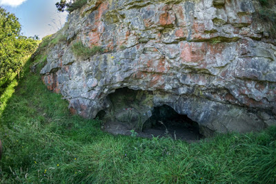
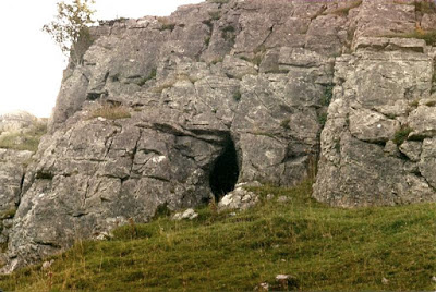
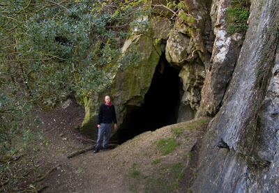
A walk-in entrance chamber 3m in diameter has a 5m high aven in the roof.
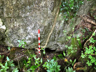
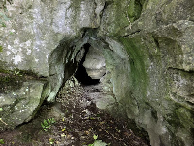
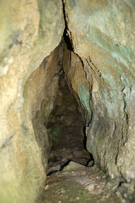
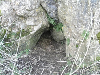
Lying 20 metres south (to the right) of Upper Meirchion Cave as shown on plan above. It is merely a 4m crawl which re-emerges at a second entrance just around the corner.
------------------------------------------------------------------------------------------------------------------------------------------------------------
A
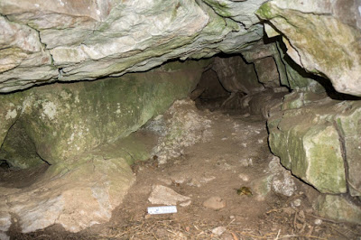
stooping-sized entrance opens into a horizontal passage about 3m wide x 4m long
x almost 2m high. At the rear, the passage passage turns to the
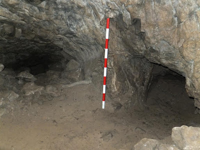
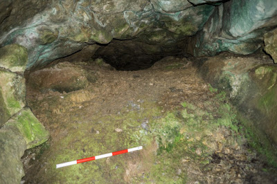
right and descends steeply for 30m to a small chamber with a junction. Straight ahead, the cave continues as a crawl over rocks, descending to a clay-floored space giving just enough room to turn around, in what is known as the 'bone chamber'. To the right at the junction
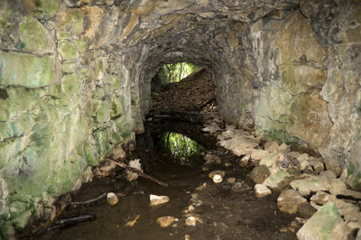
is a 30m mined passage which was not driven any further than can be seen beyond a pool of
water. This passage was mined in the 1700s or 1800s when the resulting waste rock was thrown down the last section of the natural cave, sealing it off. The blockage was cleared just enough to permit crawling through in 1949 by archaeologists. Where the
cave terminates at the 'bone chamber', a clay-filled blockage and shallow pool prevent further progress.
The bone chamber was first excavated in 1948. Working space is limited at this point and the floor is subject to seasonal flooding, but further clay deposits remain untouched. Working conditions however might be difficult without first draining the shallow pool of water, although it appears from the earliest reports, that it may dry out in warm periods.
The
first archaeological discovery in the cave was made by J. L. Williams some time before 1948.
He had the bones identified by Dr. Gamble of Holywell (source: personal
communication with one of the original excavators, Mr Birchall, Corwen
Road, Trueddyn in 1985).
Exploration was then "taken in hand in 1948 by Mr G. E. Hesketh, master at Ruthin School, and Mr R. A. Wyke, who, to begin with, concentrated on clearing the 'old rubble seal' where the cave was blocked some 60 yards from the entrance. In October 1949 the explorers penetrated about 20 yards further, to a 'chamber''" (bone chamber).
Source: "Cave Exploration at Maes Hafn, Llanferres" by Ellis Davies. Denbighshire Historical Society Transactions, Vol 2, 1953.
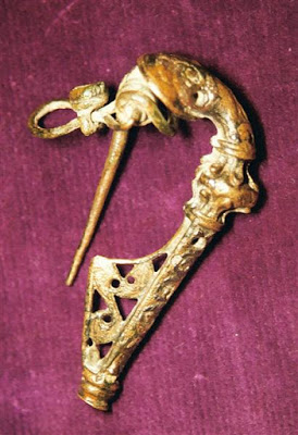
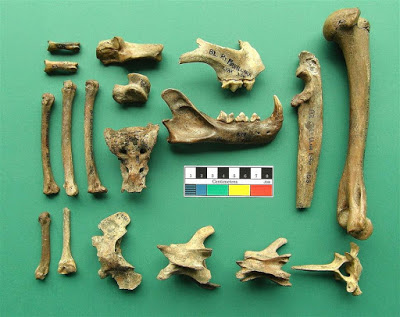
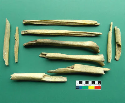
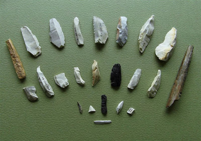
Several other excavations then took place during the 1950s, both in the entrance passage and the bone chamber at the end of the cave. Amongst the finds were bronze brooches and a ring, a flint arrowhead and numerous hominin remains (5 adults, 1 child.
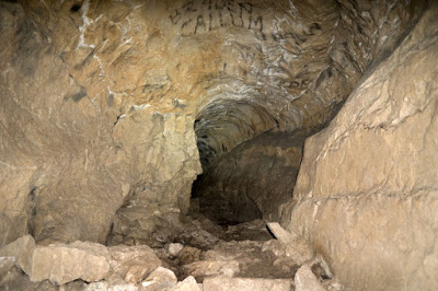
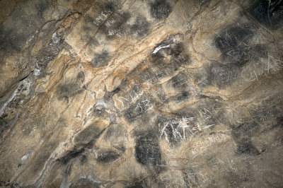
The cave contains 'multitudinous' graffitti from the seventeenth century to the present day. Examples of the earliest documented dates include:
A.T. 1698 (below 50 yard chamber).
Thos Allin May 12th. 1753 (Beautifully carved on the north wall, about 115 feet from datum).
Most graffitti appears to be 20th century or more recent, and this has helped obscure some of the more interesting inscriptions.
Source: "An Account of Excavations in the Cave in the Big Covert , Maeshafn, Llanferres" by G.E. Hesketh. Flintshire Historical Society, Vol 15, 1954-55.
Incorrect claims by professionals state that "Cavers have been active in the cave digging in various places. There is little left of the deposits still undisturbed"
(Valdemar & Jones 1970). A modern survey of the cave however, shows it to be
identical to the 1949 survey shown above and has not been subject to digging by cavers at all.
It has also been wrongly claimed by professionals that the boulder blockage immediately beyond the mine passage was the result of cavers work. The original 1953 account by Ellis Davies however (see Source above) states: "About 50 yards from the entrance Mr Hesketh came across what
he regarded as an artificial excavation resembling a mine level. Mr
Hesketh thinks the rubble blocking the cave (ahead) might have come from this level". A subsequent account by Hesketh adds: "This level has been timbered in places". Little trace of timbering now remains.
The
cave has been recommended for scheduling as an Ancient Monument by
CPAT (Report 980, 2009).
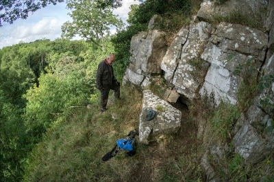
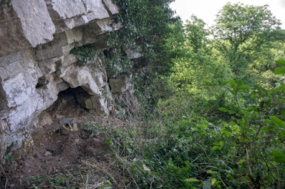
From Maeshafn village, take the road west down the hill. Park about 100 metres down the hill where a track forks off to the left. Take the track on the left into the ’Big Covert' on foot. After a few hundred metres, take the footpath through the gate on left. Follow the track to the top of a rise after about 150m. Almost 50m beyond the rise is an indistinct footpath off to the right. The entrance can almost be seen from the track.
Denbighshire Historical Society Transactions, Vol 2, 1953.
Archaeological:
SMR: 102318, 102319
Excavation: C.E. Hesketh, N. Pritchard, 1948-50; J.G. Morris, 1954
Curation: National Museum of Wales, Cardiff (33.22/2, 57.159/1-3, 83.55H, 89.30H)
Burials: 6 (5 adults, 1 child)
Finds: Barbed and tanged arrowhead, flint artefacts, RB finds, animal bones (in NMW)
Date: Unknown (5)
Source and further references: http://caveburial.ubss.org.uk/wales/wales.htm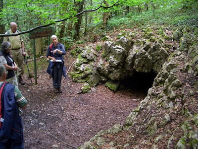
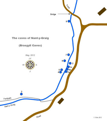
1987 survey by Moldywarps Speleological Group
Access: The gorge forms part of Cefn Estate belonging to Sir Watkin Williams Wynn and is therefore on private property. Prior permission should be sought from the estate office at Cefn. Normally just a phone call in advance is required, then call in at the office on the day to sign a disclaimer.
Although previously excavated, all three caves appear to contain further undisturbed deposits.
Some confusion exists over which archaeological caves are referred to in documentary sources.
Because of the difficulty obtaining accurate GPS locations at some of the caves, only Caves 3, 6 and 8 are shown as having 10 figure locations.
Stated by CPAT as being Nant-y-Graig Cave B (CPAT 2009)
Archaeological:
NGR: SJ00557128
SMR: 19309, 102147, 101424
Excavation: C.S. Mainwaring & Mrs Williams Wynn, 1871; J.H. Owen, 1946-48
Curation: National Museum of Wales, Cardiff (68.88/8-9)
Burials: 6+
Finds: Flint arrowhead, flakes, core; RB artefacts; animal bones
Date: ?Neolithic (2)
Source: http://caveburial.ubss.org.uk/wales/wales.htm
Cave 2 entrance
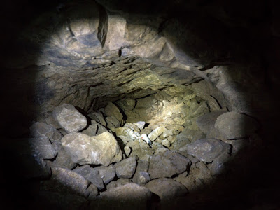
Cave 3 (B.S. Pot) SJ0049971259 +/-14ft Length 110m
When visited by the writer in 2014, the hole below the entrance appeared to need some work in moving boulders to gain entry.
Cave 4 (Cathedral Cave) Length: 24m
See 1987 survey above
Cave 5
A stooping-sized passage becomes silted after 2m at a point close to Cave 4. A coup!e of metres to the right of the entrance is a crawl which is blocked by clay.
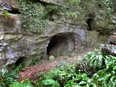
From Cave 5, continue following the ascending bank for a further 25 paces or so. The entrance lies about 10m above stream level.
Warning: A large limestone block forming the roof of the rock-shelter is unstable.
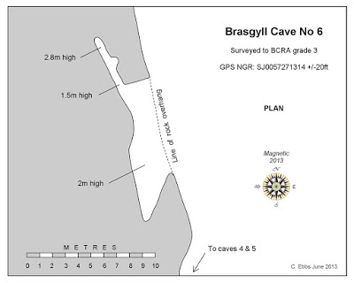
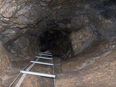
Cave 7
Length: 4m
A tube which re-emerges just round the corner at a second entrance.
Can be found where the gorge narrows and the c!iffs meet the stream.

The two entrances of Cave 7
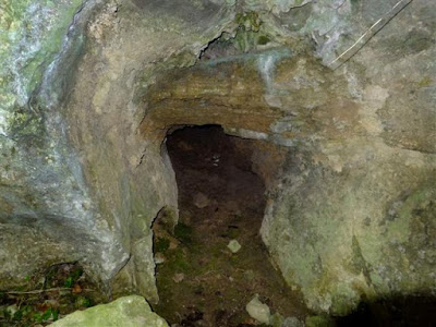
Cave 8
SJ0060571416 +/-42ft Length: 7m
Archaeological
(Human)
An obvious entrance about 1.5m in
diameter, leads after a few metres to a chamber about 2 or 3 metres in
diameter. It has a second smaller entrance just 3 metres to the right.
The cave has been recommended for scheduling as an Ancient Monument (CPAT Report 980: 'Caves: The Scheduling Enhancement Programme' 2009)
The northernmost cave in the gorge, just 20 paces upstream from the stone bridge shown on the area plan above
Archaeological
SMR: 19309, 102147, 101424
Excavation: C.S. Mainwaring & Mrs Williams Wynn, 1871; J.H. Owen, 1946-48
Curation: National Museum of Wales, Cardiff (68.88/8-9)
Burials: 6+
Finds: Flint arrowhead, flakes, core; RB artefacts; animal bones
Date: ?Neolithic (2)
14C: -
The two entrances of Cave 8
Main entrance, Cave 8
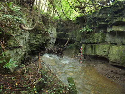
Another small, but interesting limestone gorge lies just 200m south-east of Brasgyll Caves. Although no caves have been documented here, there appears to be good potential for the keen fossicker.
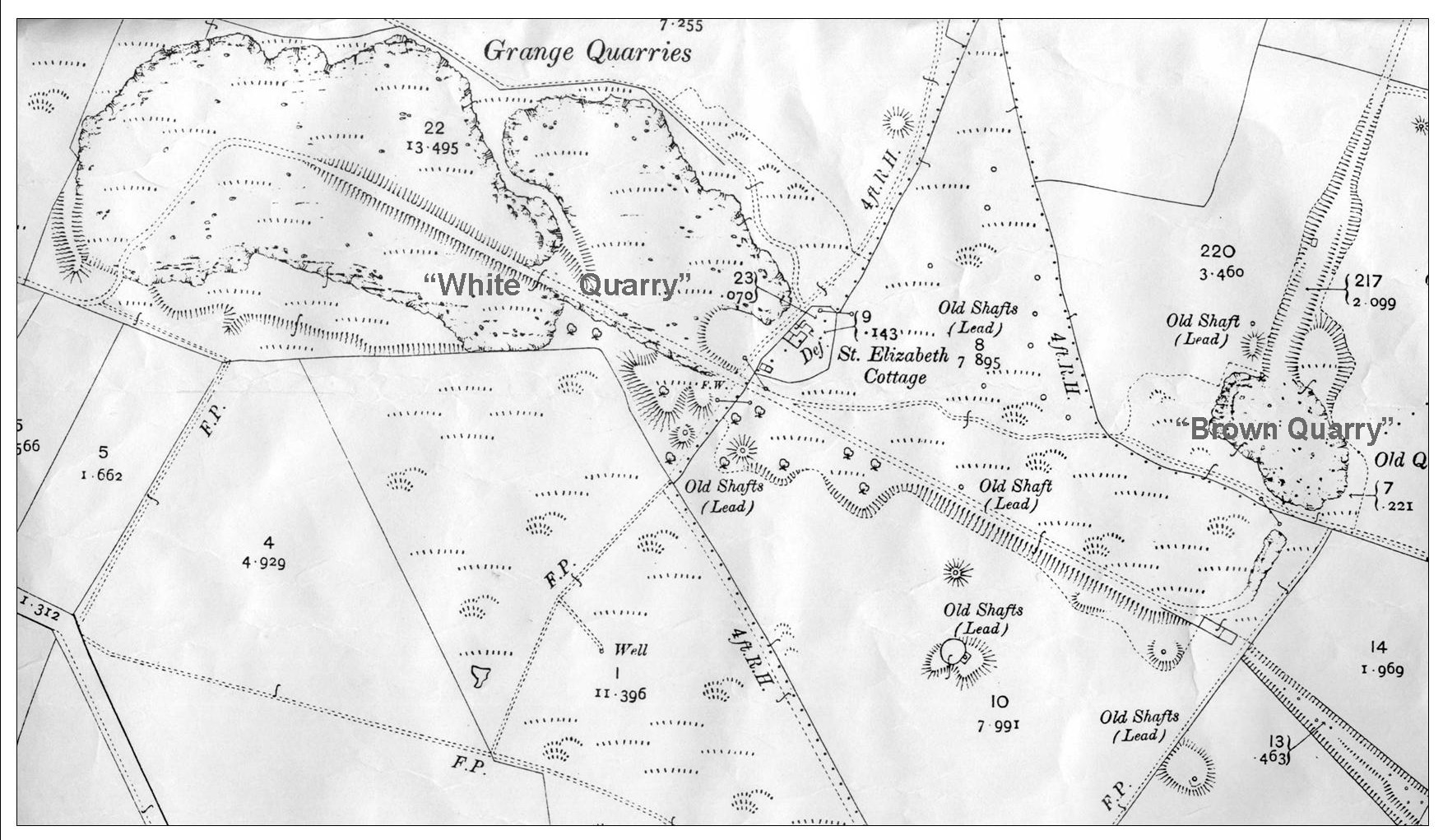
Brown Quarry Caves 1 - 3 SJ171758 Pantasaph
Information updated August 2016
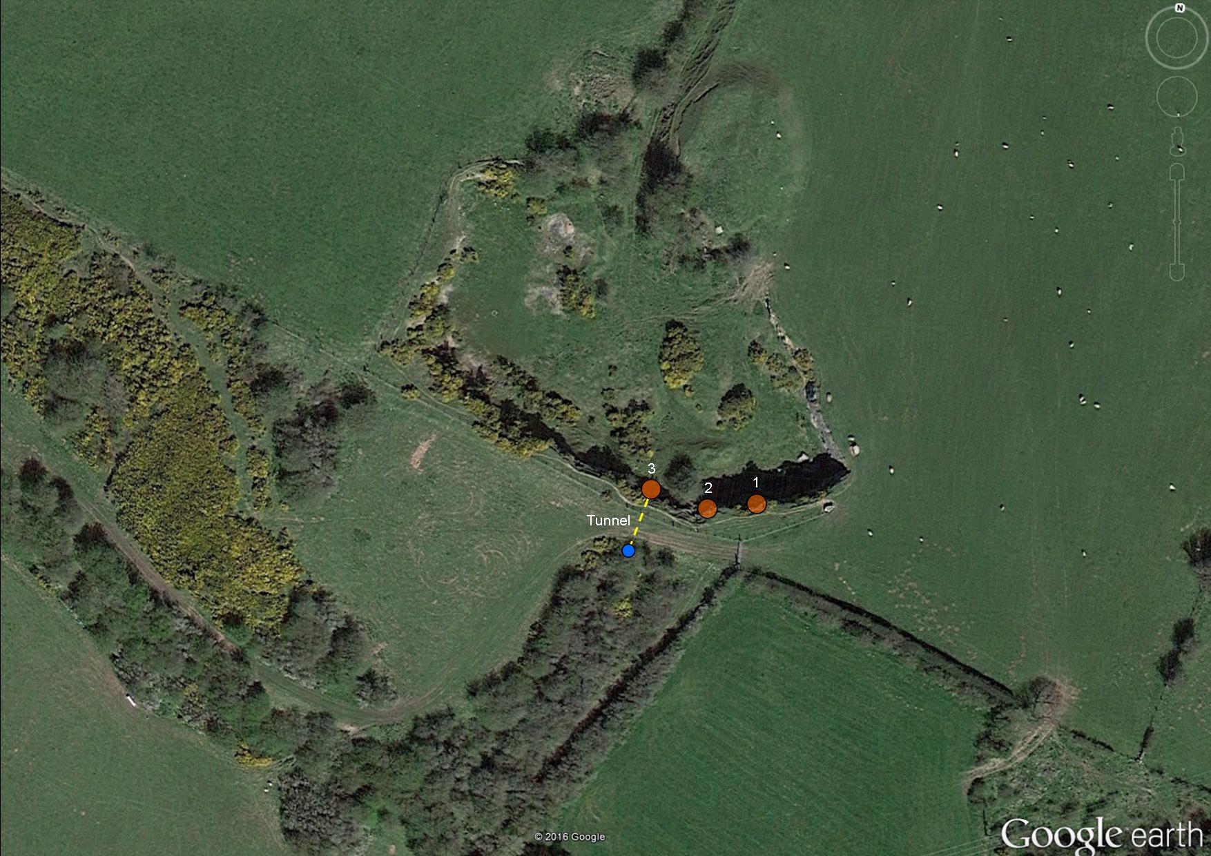
Location of the three caves and mined access tunnel
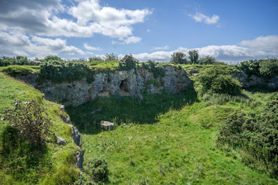
The quarry viewed looking south-west
Three caves in a small abandoned quarry overlooking the Dee Estuary. Although only short, the en situ deposits they contain could hold archaeological potential.
There is no record of archaeological excavation having taken place at this quarry.
From a bend on the Brynford road a quarter of a mile east of Pantasaph Priory, take the signed public footpath north for 200m.
Just before White Quarry, turn right and walk eastwards (White Quarry is gated at its east end, so don't walk through White Quarry to reach Brown Quarry ...... a house overlooks the gate). Just after passing White Quarry you will see a house off to your left. Continue walking east along the northern boundary of a large field to a stile at the far side. After this stile, turn left and over another stile walking north, keeping to the east side of the field. The track continues north beyond this field directly to Brown Quarry.
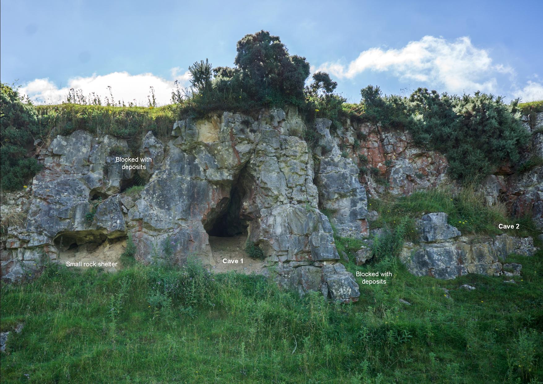
Cave 1: SJ1713675787 +/-12ft Length: 8m
A 2m wide by 2m high entrance lowers to an excavated crawl after 3m. Near the end it turns left then becomes too tight. The cave contains abundant undisturbed deposits.
A blocked passage lies 2m to the left and 2m above Cave 1 containing further deposits.
Yet another blocked passage about a metre wide lies 2m to the right if Cave 1.
The left-hand entrance of the three.
Location of Caves 1 & 2
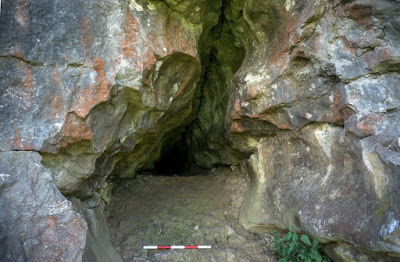
Cave 1 showing unexcavated deposits
Cave 2: SJ1713075789 +/-12ft Length: 4m
A tight entrance squeeze opens a little after a metre but appears blocked 4m from the entrance. A crawl at floor level on the right is partially blocked.
A few metres to the right of Cave 1.
The crawl to the right cannot be seen from this angle
Cave 3: SJ1710975784 +/-13ft Length: 5m
A large mined passage 3m wide by 2m high runs for about 10m before opening to surface. This presumably served as a rail transport route from the quarry. Just inside the entrance is a natural cave passage on the left. This measures 1.5m wide by 1m high which soon reduces to a crawl over abundant undisturbed deposits.
15m to the right of Cave 2
Cave 3 showing the amount of undisturbed deposits almost filling the passage
---------------------------------------------------------------------------------------------------------------------------------------------------------------------
Bryn Alyn Caves 1 - 12 Llanferres
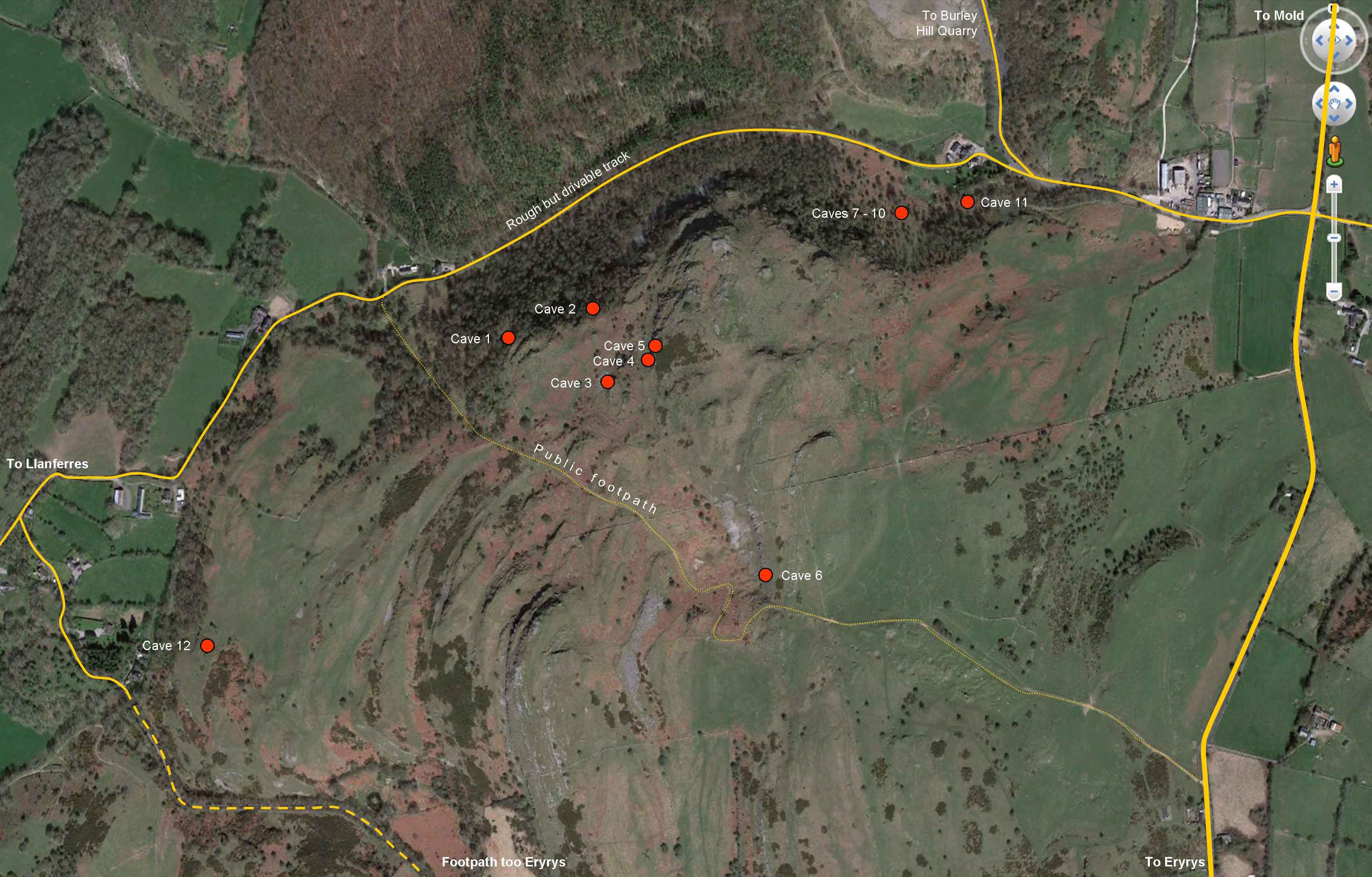
APPROXIMATE locations of Bryn Alyn caves
Cave 1 (Lynx Cave)
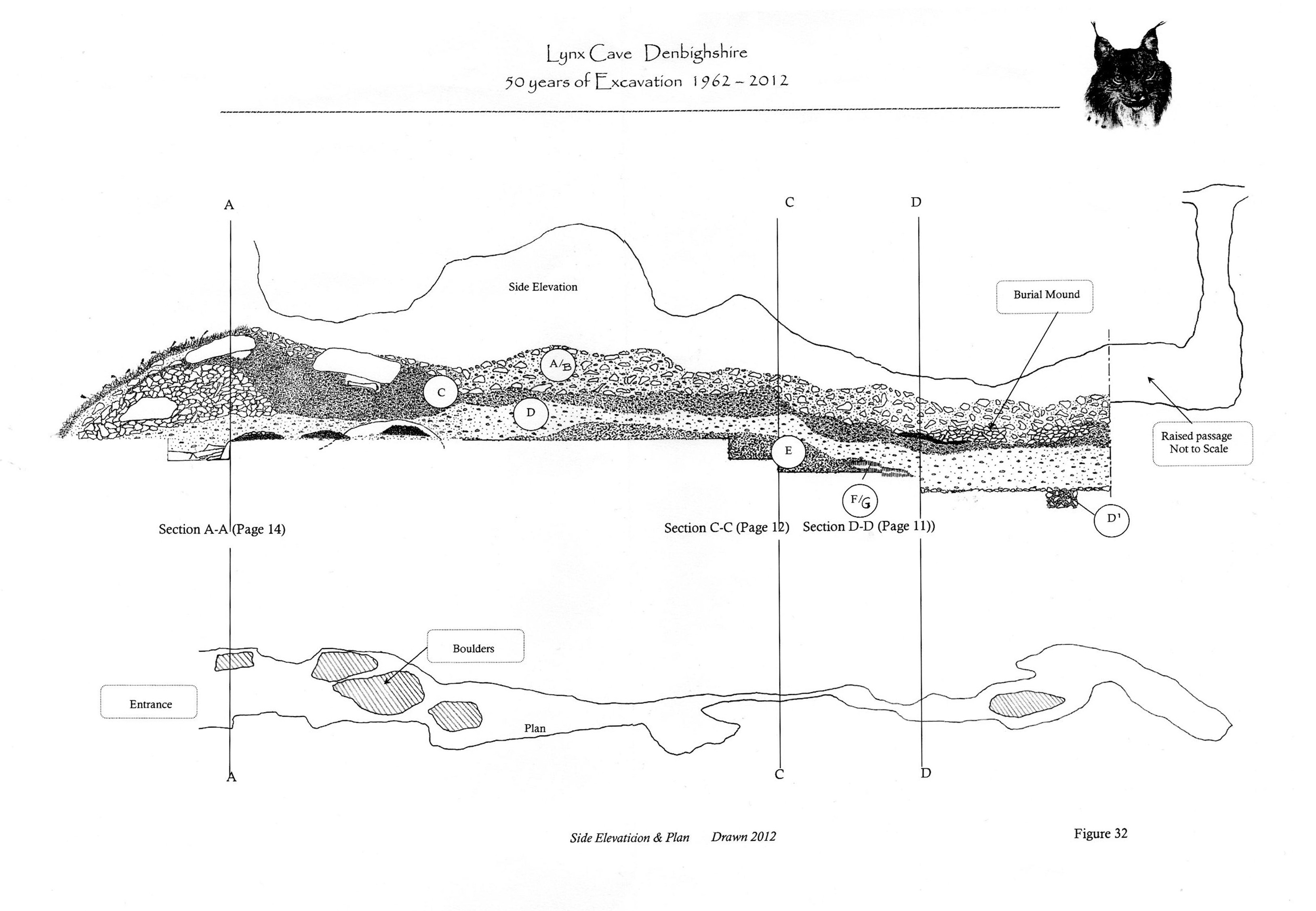
Lynx Cave survey by John Blore
Length 15m approx
SJ197593
Archaeological
(Human)
Earliest find: Bone spear-point 11,700BP
John Blore's dedicated website (2011): http://lynxcave.webs.com/
In June 2015, John Blore handed his entire Lynx Cave collection to the National Museum of Wales (accession number: 2015.11H).
"Dr. Juliet Jewel, Dr Oakley, Dr C Stringer and Dr. Anthony Sutcliffe, (British Museum). Tom Lord, (Lower Winskill, Settle). Dr C B McBurney, (Cambridge University). F H Thomson, (Grosvenor Museum Chester). Dr. P O’Donoghue (Chester University), Dr. P. Thomas, (Keele University). Dr. J Lageard and James Hegarty, (Manchester Metropolitan University). Clem Fisher and Philip Phillips, (Merseyside County Museum). J M Lewis, Ministry of Public Buildings & Works. Jo Bailey, (Natural History Museum, Tring). The Oxford Accelerator Unit. Pengelly Cave Research Centre. John Wymer, (Reading Museum). Mrs J Chance, University of Liverpool, (Small Animal Practice). Prof. K Branigan Dr M Dearne, and Dr. P Pettitt (University of Sheffield). & The Ancient Human Occupation of Britain project (AHOB) for funding, in part, some of the Radiocarbon tests.
Special thanks go to Dr. Roger Jacobi, from the British Museum, who was without doubt the leading authority on the stone and bone tools from the Upper Palaeolithic. He started work on the flint implements in 1980 whilst at Lancaster University and continued right through until his untimely death in 2009. His contribution to the dig has been immeasurable, obtaining identification of some of the more difficult fragments of bone, acquiring radiocarbon dating on some of the more important finds; (most of what is not accessible to the amateur), and leaving no stone unturned in his quest for answers to some of the issues raised by the excavation, but most of all for sharing his unrivalled knowledge of the subject, on a personal basis".
Clwyd Powys Archaeological Trust quote of the year 2009:
In 2009 Clwyd Powys Archaeological Trust (CPAT) published their Report No 980: "Caves: The Scheduling Enhancement Programme" intended to inform future scheduling decisions relating to archaeological caves of Wales. It is however, poorly researched and rather inaccurate. A typical example can be found in the opening pages.......
It is inconceivable that the authors of the report were unaware of the
history of this site, particularly as John Blore supplied CPAT with each of his progress reports over the years (see
Primary Sources below). It clearly demonstrates the degree to which
professionals disregard work by the amateur sector in North Wales. Papers such
as 'Report 980' are then widely circulated among other professionals
and are wrongly assumed to be authoritative. Consequently they in turn
continue to be cited in bibliographies, further degrading the
documentary resource for generations to come.
Original consent granted in 1962: It should also be noted that documented claims by professionals that excavation of Lynx Cave took place without consent, are untrue. "W
e
were given permission to erect a steel door over the entrance to the
cave in May 1962. This was granted through Cooke & Arkwright, the
then agents for W R Lloyd, providing that the tenant farmer (Tudor
Jones) had no objection, which he did not".
Blore was then granted consent by archaeologists:
"The Ministry of Public Buildings & Works, Ancient Monuments department
were informed of me excavating Lynx Cave and notified of some of the
exciting early finds that we had made. The inspector of Monuments Mr. J M Lewis
visited the cave and viewed the collection of bones and artefacts and more importantly
my records of the excavation. Satisfied that they were being recorded properly
and that I had the backing of Dr. D Bramwell (Peakland Archaeological Society)
as my mentor, he gave me permission to excavate with the proviso that reports
were written and the Ancient Monuments Department were informed"
(Pers. comm. with John Blore 2017).
Lynx Cave has never been Scheduled
Despite CPATs claim in their Report 980 that the cave had been Scheduled, this was not the case: John Blore informed professionals of the importance of his finds from the cave, after which
an attempt was made to schedule the cave in 1964. This
would have prevented Blore carrying out any further work. Due to professional ineptitude however, an adjoining, but incorrect area was scheduled by mistake: "......it turns out that the cave itself is not included and that a stretch of uninteresting cliff is receiving state protection" (Source: A Survey of English & Welsh Palaeolithic Cave Sites, by Barton and Collcutt, 1986). Hence this wrongly protected area subsequently had its scheduling removed, and the cave remains unscheduled to this day. The survey by Barton and Collcutt goes on to say: "In 1986 when the site was visited by the present authors, the cave had been all but emptied of its deposits"; a detail that was clearly misguided, as Blore continued excavating at the cave for a further three decades!
Although he received a great deal of help from many professionals outside North Wales, i
t is clear from documentary sources that John Blore has, for over 40 years, been shamefully treated and marginalised by local professional organisations. Attempts by this writer to identify the rationale behind this have been met with silence. His treatment will long remain a sad reflection of a (locally) arrogant profession with little interest in most archaeological caves.
Archaeological:
HER: PRN 100947 to 100950
SAM: De 176
Curation: National Museum of Wales, Cardiff (accession number: 83.98H); Grosvenor Museum, Chester
Burials: 6+ (now known to be 8 including 1 infant: See 2012 reference below)
Finds: Upper Palaeolithic flint artefacts; bone point; RB artefacts; animal bones
14C: 2945 bp (OxA-8070) on cut-marked bird bone
Source: http://caveburial.ubss.org.uk/wales/wales.htm
Examples from the collections held by the National Museum of Wales:
Red deer tibia (2015.11H/106.3) 11680 +/-45 BP
Reindeer humerus (2015.11H/126) 11145 +/-80 BP
Blore, J.D., Lynx Cave Preliminary report 1962-1964, Newsletter No. 21, Peakland Archaeological Society
-------------------------------------
Cave 2 Length 12m SJ19865940
A low crawl with a healthy draught, but possibly connecting with a hole 30m to the south-west.
From Cave 1, walk east, skirting any outcrops for about 100m until absence of trees gives a clear view of the quarry ahead. The cave lies about 70 paces further on, just at top of scree slope at foot of small outcrop.
--------------------------------------Cave 3 Length 20m SJ1987059257
Examined in 1959 by John Blore who named it Top Ridge Cave. It was first documented as Windy Cave (Shepton Mallet Caving Club Journal, Series Four, No 1, June 1966).
Cave 4 Length 10m SJ19805930
A low crawl into a small chamber in the 1970s. It has since been occupied by badgers who have blocked the entrance, although badgers were not using the cave in 2012.
From the 'daylight rift' above Cave 3, follow the same bedding in the limestone left (which slowly rises) for 55 paces.
---------------------------------------------
Cave 5 (Hawthorn Cave) Length 10m SJ19805931
About ten paces east of Cave 4.
----------------------------------------
Cave 6 Length 9m SJ2001558972
Entrance is a narrow, vertical rift. Climb down 3m into a 7m long, but narrow rift chamber. A hole at floor level at the eastern end of the rift leads into a further tiny chamber. Rope useful for entrance rift.
Returning again to the footpath leading up from the road, continue uphill to Pwll Iwrach (Pool of the roebuck). Follow the track beyond the far side of the 'hidden valley’ but 10m before the highest point turn off to the left. Follow top edge of crags northward for 60 paces.
--------------------------------------------
Caves 7 - 10
Updated January 2020
Directions: These four small caves lie close together but are now difficult to reach due to the steep hillside and 'venomous' hawthorn. The least arduous route begins at the stile
at
SJ205593. From here take the footpath diagonally up Bryn Alyn for about 200m until you reach a large open mine adit on the left (used for private water supply). From here climb
directly up for about 25m bearing off slightly to the left as you gain height. Then follow any horizontal route off to the left (east). After about 50 metres you may see an area above clear of vegetation. Do NOT be tempted to take this easier route, but continue east for a further 40 metres or so though difficult hawthorn. You should then reach a cliff-face with Cave 7 at its base. Caves 8, 9 & 10 can be found within 20 metres further east being in, or close to, a small gully. If looking up and expecting an easier route back down to the track, don't attempt to climb up where it appears to be free of undergrowth, as the hawthorns are far worse. A pair of branch loppers should help in reaching the caves.
The caves are described below
Two photos of the gulley to look for.......
Cave 7 lies a few metres off to the right of photo at bottom of gulley
Note the flow marks in right-hand wall
------------------------------
Cave 7
SJ2015659366
A three metre steep slope down into a chamber no more than 2m x 2m x 2m. When last visited by the writer in the 1970s, a blocked passage could be seen at floor level. No trace of this however was visible in 2020.

-----------------------------------------
Cave 8 SJ20235935
A 9m deep pot modified by mining containing a 9m mined passage. Entrance covered by large boulder. Tackle required. (1970s description)
(Not seen during 2020 visit). A mine level lies about 4 metres lower down the hillside. This appears to have run in about 4m from the entrance.
Just in front of the bottom of the small gully
----------------------------------------
Cave 9 Length 2m SJ2015659366
An insignificant 2m low crawl, although it may repay a little work.
Near top of gully on the right, immediately in front of the entrance to Cave 10.
-------------------------------------------
Cave 10
Length 9m
SJ2016659371
Not pushed in 2020, but in the 1970s it was described as "a 9m crawl with a small aven on the right near the entrance".
Near the top of gully
-----------------------------------
Cave 11 Depth 2m SJ2030659369 +/-9ft
The most easterly of the caves about 30m above road level
------------------------------------
A previously undocumented cave found by the writer in March 2013. Although merely a 3m crawl, the end is blocked with loose stones and could be extended a little further. The angle of the passage walls suggest the cave enlarges below the earth and clay floor, hence it could have archaeological potential.
Bryn Alyn Cave No 12
Bryngwyn Quarry Caves 1 – 3 SJ214614 Maeshafn
Three caves in a small disused quarry popular with rock climbers. Seek permission at the nearby Bryngwyn Farm.
The quarry lies 300 metres north-west of the Owain Glyndwr Inn. From the inn, take the lane towards Maeshafn for a hundred metres or so, and before a farm on the left, take the track off on the right.
Cave 1 SJ2144561438 (+/-12ft)
A roomy chamber 6m x 6m x 4m with blocked tube at floor level.
In south facing end of Quarry.
Cave 2
Small rock shelter. Entrance may now be blocked.
Faces west and is north of Cave 1.
Cave 3 SJ2141561472 (+/-12ft)
Also known as Bryngwyn Bone Cave
The
original entrance has been walled-up and obscured with earth which had fallen from above. A small
hole at the top of this wall provides access down into a small
chamber, no more than 1 metre in height, where archaeological work may
have been carried out, although no evidence have been found to support
this. The name 'Bryngwyn Bone Cave' was seen by the writer many years
ago, although the source cannot now be found.
It is possible that the cave was adapted for use as a blast shelter for quarry workers. A closer examination is therefore required.
An
archaeological assessment of Bryngwyn Quarry has been carried out by
CPAT for a private company. A request for the report was made in 2012 in order to see which of
the caves are mentioned, but this was rejected on copyright grounds, despite the company in question no longer existing.
Opposite the south end of the quarry face, the entrance is found in small east-facing outcrop. Lies about 50m north-west of Cave number 1.