Cavers
have long hoped that Anglesey might hold some caving potential. Unfortunately however, the
island has only a dozen or so limestone caves, all of which are short and hold limited prospects of being extended by
excavation.
A quick glance at the two modern 1:25,000
Ordnance Survey sheets of the island shows over 30 caves marked around the coast.
Most of these however, are also simply erosional sea caves formed by wave action, and
are not formed in (cave-bearing) carboniferous limestone. Many more
non-limestone caves exist which are not shown on OS sheets. Although some may
have large entrances, they have no speleological potential, and are therefore
not described here (although a few links at the bottom of this page lead to photos of typical examples).
The three limestone areas of the island are shaded in
blue on the image below. Although they cover quite large areas, they only contain a dozen or
so caves.
NB
A few limestone caves can also be found in the area around Cemaes Bay on the north side of Anglesey, in what is described as a 'Gwna Group melange' (named after the River Gwna near Bodorgan on the island)
, otherwise described as a chaotic jumble of assorted deposits, but containing some enormous blocks of limestone, as large as 200m across . Any caves in this unusual area of melange are of limited extent and appear to simply be erosional sea caves formed by wave action, but details are wanting.
(with thanks to Robin Griffiths for this information).
Although outcrops of carboniferous
limestone exist along the Menai Straight, no caves are
known along this stretch. One location does exist however, that was documented in 2015 as
containing "at least two caves". The site is described on Page
14: Lost & Non-caves, under
Plas Newydd Caves.
The late
Mel Davies searched Anglesey's limestone areas including Puffin Island, in the 1970s and
reported a handful of short caves, but virtually nothing of speleological potential. Also in the 1970s, the late Tony Jarratt examined many of the islands caves, some in the company of this writer. He made a record of his UK caving exploits in several log books. These are now available on-line as PDF files.
His visits to Anglesey caves are included in
Volume 2:
http://www.mcra.org.uk/logbooks/files/JRatVol2.pdf
.
Some years later, Robin Griffiths and Gus Horsley also
searched long and hard, and although they added to our knowledge of the
islands limestone and its hydrology, no extensive caves have yet been
found. The short phreatic caves of the Castell Mawr area, Red Wharf Bay may have archaeological potential, as undisturbed in situ floor deposits can still be seen (see under Castell Mawr Caves).
Links to Internet images of a few NON-limestone caves can be found at the very bottom of this page.
The Geology of Anglesey
The geology of the island is complex and interesting. A full description is provided in "The Geology of Anglesey" volumes 1 and 2 (1919) by Edward Greenly. Both are available on-line on the BGS website:
A particularly helpful geological map of the island can be viewed here (double-click the map to zoom in) :
http://www.largeimages.bgs.ac.uk/iip/mapsportal.html?id=1001841
(link kindly provided by Robin Griffiths)
British
Geological Survey also have an excellent interactive geological map of
the British Isles. Use their slider on the right to see the map beneath
and the Key on the left to understand the colours. Simply enter a
location in the centre of their homepage: http://www.bgs.ac.uk/
-----------------------------------------------------------------------------------------------------
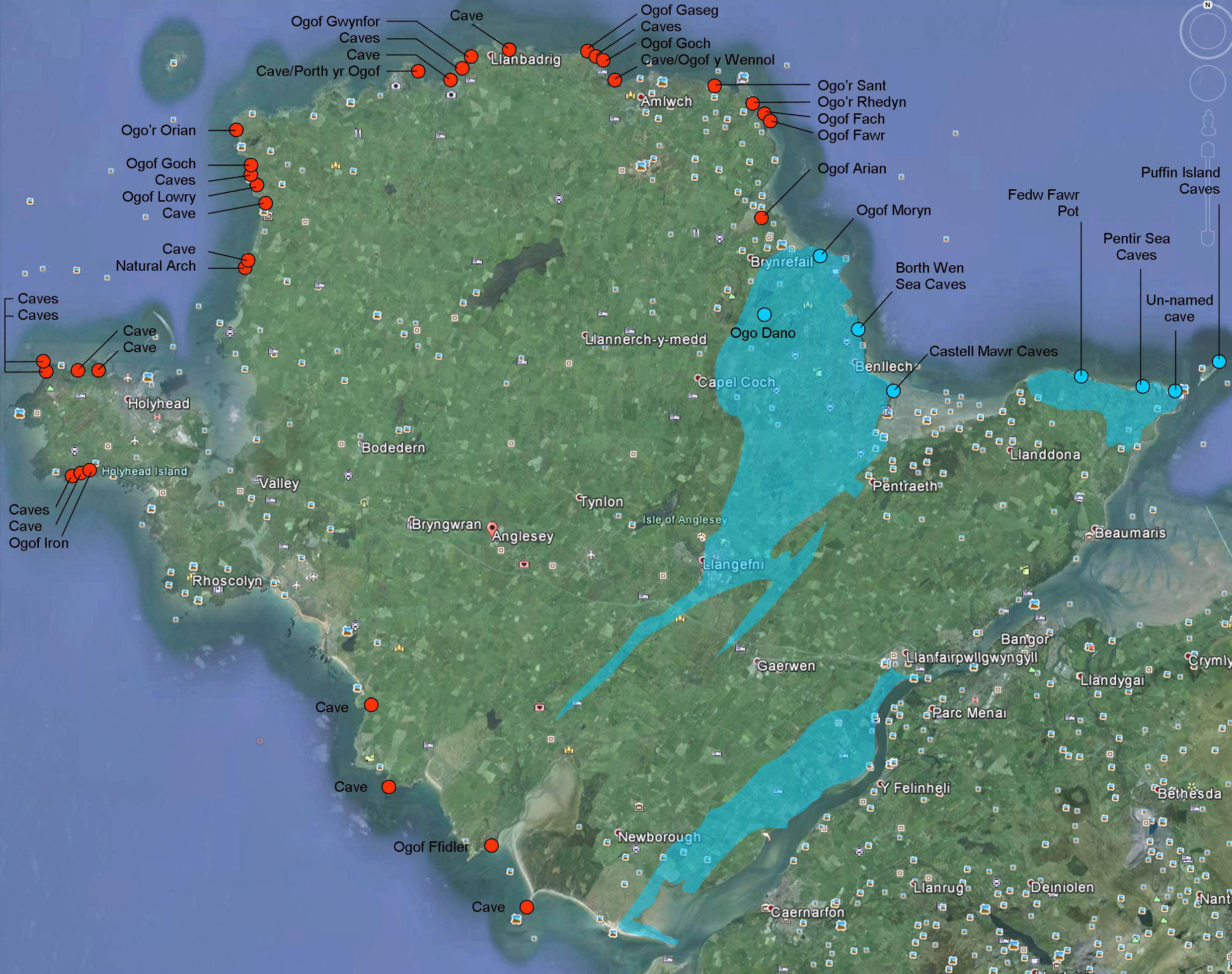
The few limestone caves.....
CLICK IMAGE TO ENLARGE
(click BACK button to return to this page)
Red circles: A sample of non-limestone caves (mainly from the 1:25,000 OS sheet)
Blue circles: Limestone caves
The three limestone areas are shaded in blue
CLICK IMAGE TO ENLARGE
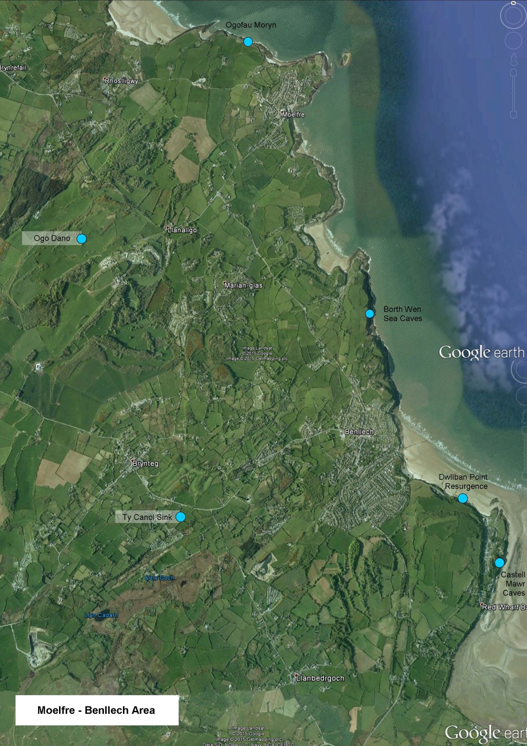
Caves of the central area (Moelfre to Benllech)
CLICK IMAGE TO ENLARGE
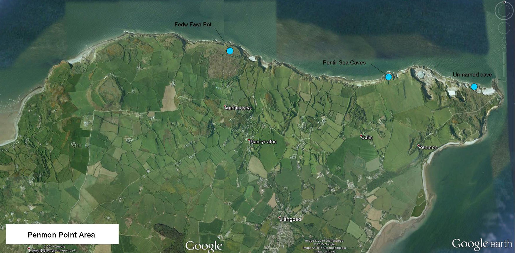
Caves of the eastern area (Penmon Point)
...................................................................................
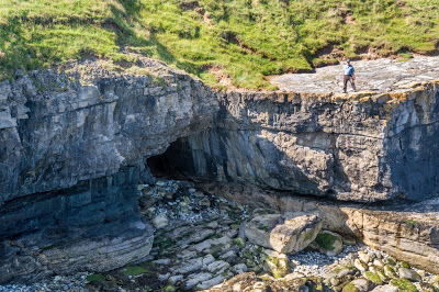
Borth Wen Sea Caves 1 - 2
"A typical smooth-walled sea cave tapering down at the end. Most easily accessible at low tide.
The entrance is 3m wide by 2m high and faces east. A small rock-shelter-type cave lies 50m to the south" (visit by C. Ebbs 2016). Cave 2 was not visited.
"A 20m long sea cave at the south end of Borth Wen....... It consisted of a beautifully smooth walled tube, some 2m high ending in a too tight rift choked with boulders and seaweed - emitting a small stream.
(Source: The on-line diaries of Tony Jarratt, Volume 2, page 18 at: http://www.mcra.org.uk/logbooks/?dir=jrat ).
Directions: The coastal path passes high above this cave where no direct route down exists. The best route is to be found a little further north, leaving the coastal path at SH5196883865 +/-12ft. Here a tiny steep, barely visible path leads down to the sea with wooden steps. Facing the sea, follow the cliff around to the right and the cave is just 50m around the corner
(Ebbs, C. 2015).
Cave 2
SH522835 Length: 5m
Some 200m south of this (Cave 1)
is a 5m long cave emitting a small stream and heavily coated with stal -
nice flowstone and gours. Becomes too tight for further progress".
(Source: The on-line diaries of Tony Jarratt, Volume 2, page 18 at: http://www.mcra.org.uk/logbooks/?dir=jrat ).
"About 50m further north along the beach there was a small arch type of cave formed in a strata of shale with limestone above it
”
, with "
substantial amounts of flowstone
".
(Griffiths 1994b).
"Caves at Borth Wen" by Kieth Williamson
..................................................................................
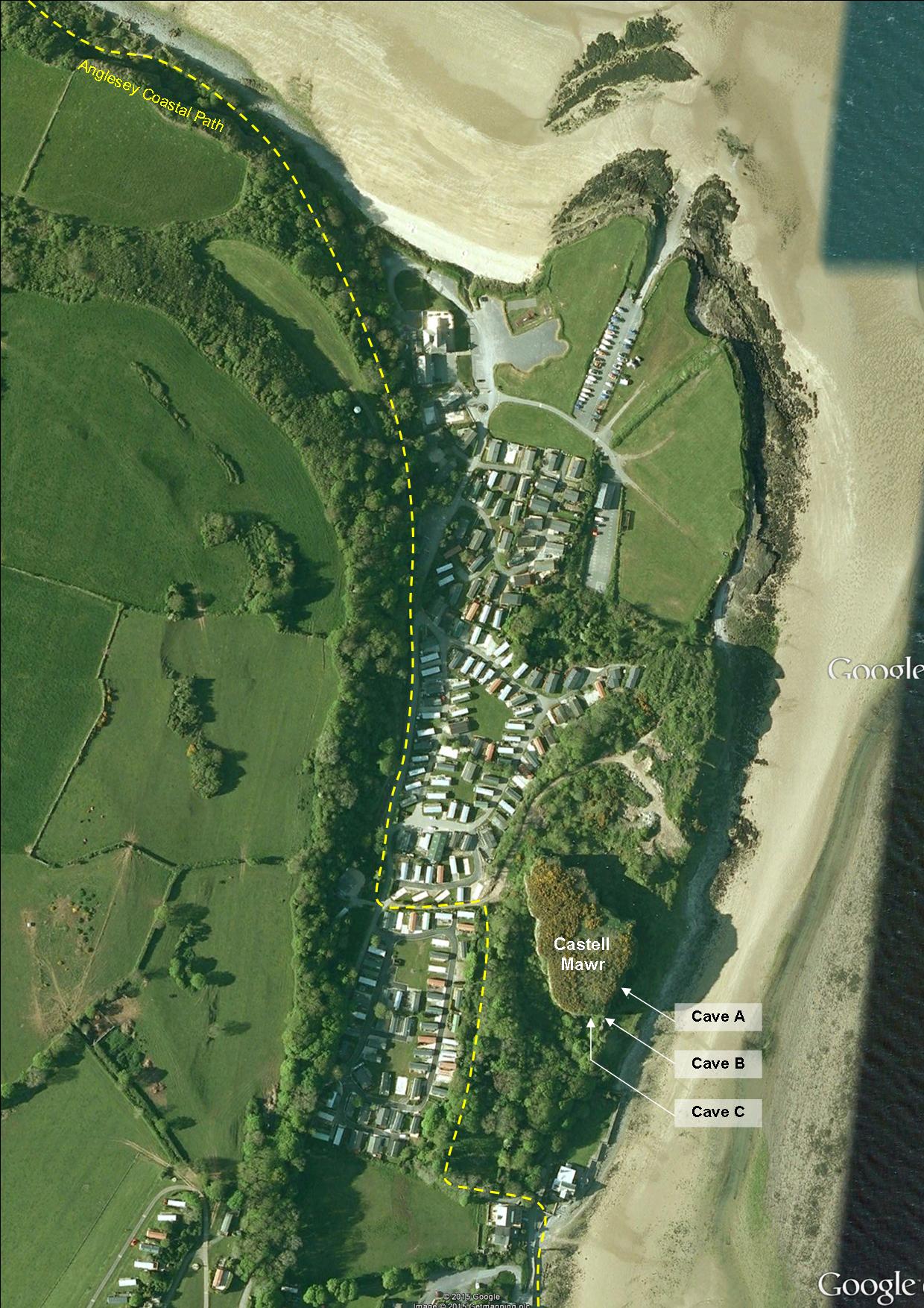
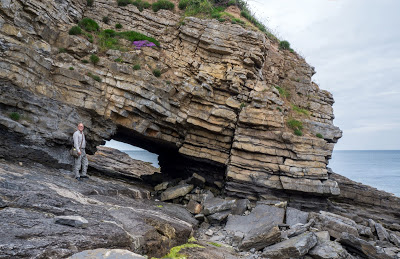
Castell Mawr Caves 1 - 3
+
NGR: SH532817
Also previously named as Dwllban Point Caves
CLICK IMAGE TO ENLARGE
Google Earth view of Castell Mawr
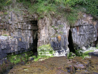
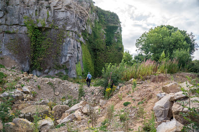
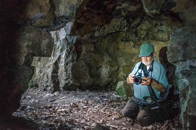
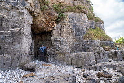
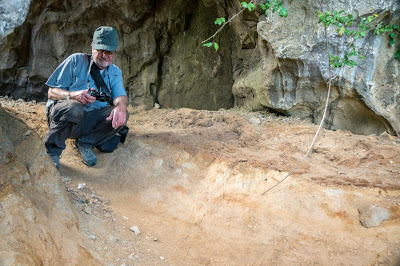
 This large isolated block of limestone is known as Castell Mawr. It contains a number of small caves, all of which appear to be remnants of larger caves.
View looking inland from the seaward side.
Much earth movement has been carried out in recent years. This may have resulted in the loss of one or two caves. The disturbed material contains many blocks of speleothem, stal flloors or stal bosses.
Notes:
One or two documentary sources have in the past described both Castell Mawr Caves AND Dwllban Point Caves. Following a visit to the area in 2015, it appears that the two are one and the same. This website has therefore adopted the name of Castell Mawr Caves, as the block of limestone containing the caves is named as Castell Mawr on modern 1:25000 OS sheets.
Three caves are named A, B & C in accordance with Gwynedd Cave & Pothole Club Journal No. 2 (1994). This source also mentions several other possible digging sites a few metres north of Cave A. When visited by the writer in 2015, these were not located and may be hidden by dense undergrowth. A fourth cave as described after the photos below was also not found on the 2015 visit. The writer would welcome any further information or photos of any caves at or near Castell Mawr.
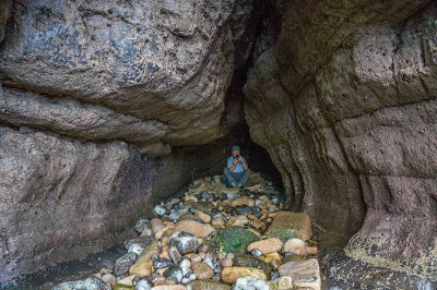
Cave 1 ('A' on image above)
SH53128149
Length: 22m
Known as The Dungeon, it is a muddy passage of crawling dimensions excavated in 1994 by Robin Griffiths of the Gwynedd Cave & Pothole Club.
At the end of the GCPC dig, "...... the passage could be seen continuing another 10 feet or so" over the top of the infill (Source:
Gwynedd Cave & Pothole Club Journal No. 2, 1994)
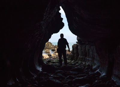
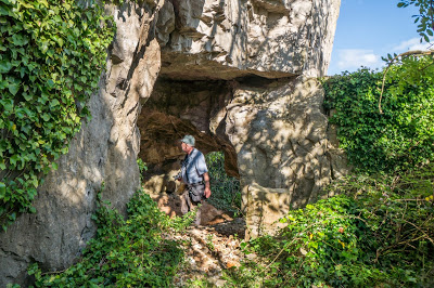
Cave 2
('B' on image above)
SH5312681491
+/-12ft Length: 4m
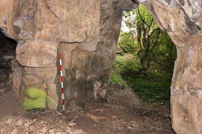
The most southerly of the Castell Mawr Caves is all that remains of a once longer cave. It is a 2m x 2m phreatic passage 4 metres in length passing through a quarried rock face, one entrance facing the sea. Although very short, the passage does contain undisturbed clay deposits. They do not however, appear to show any signs of archaeological potential without excavating.
Cave B viewed looking towards the sea
 Cave B Clay floor deposits
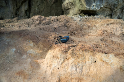 Cave B Clay floor deposits
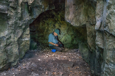
Cave 3
('C' on image above)
SH5312681491 +/-30ft Length: 5m
Passing through and out of Cave B
(with the sea behind you), keep to the right where just 18 paces away
lies the phreatic Cave C
about 5 metres in length
.
The entrance shown in the photo below immediately turns to the right to a chamber about 2 metres square.
Cave C
The area is described in 1975 by Tony Jarratt: "Looked at four interesting and roomy phreatic caves in an isolated block of limestone near the hotel in Red Wharf. At least two of the caves are worth digging. It seems that much larger and well decorated caves once existed here - as can be seen by the extensive stalactite and stalagmite formation on the cliffs"
(Source: The on-line diaries of Tony Jarratt, Volume 2,
entry for 17/5/75
at: http://www.mcra.org.uk/logbooks/?dir=jrat )
.
Four roomy phreatic caves, two of which are worth digging. The main cave is called The Dungeon and is 22m long.
“The Dungeon is actually a low muddy grovel. It is however fairly easy
to dig…. There is another cave on the south west face of the cliff but
there are no potential extensions here.” (Griffiths 1993).
Near Cave A is
another cave 6 feet up the rock-face obscured by brambles just 2.5m
long. There is also a rock arch 2m high and wide x over 1m long (Griffiths 1994a).
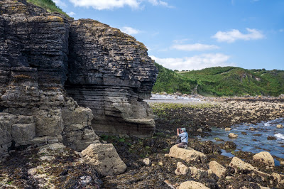
About 150m to the north of these caves at SH5322481730 is a rock shelter in cliffs at the level of high water (shown below). The entrance is 3m high by 1.5m wide but only extends for 2m and is of no speleological interest.
...............................................................................
Fedw Fawr Pot
NGR:
SH60268211
(Mel Davies)
First documented by Mel Davies in 1975: "A small stream, now dry because of the very dry weather, runs northwards over limestone towards the sea cliffs, but never gets there, above ground anyway. For about 300 yards it cuts a gradually deepening gulley which is painfully filled with brambles, and arrives at the edge of an open pot. Looking down this I could see about 10ft down and it was only contaminated with one oil drum and something odd wrapped up in a sheet. There were no dead sheep and the descent looked quite pleasant. On the pebbly floor of the pot was about half an inch of clean but stagnant water. The stream probably sinks here in all weathers, but a few yards further on there is a much larger pot. I climbed down into this - all of 20ft., with sheer walls except on the north side, and it was extremely cool ............... The water must resurge on the beach 80 yards away ............ the water exit should be sought in wet weather, and at low tide".
Robin Griffiths also documented the site in 1994: "A pothole about 40m back from the cliff......... A muddy slope leads downwards to a 2m drop. The pot is about 7m deep and about 5m x 5m in size. The walls are sheer showing signs of bedding. The pot has a mud floor and the walls are undercut at the bottom.
“There
are a number of potential digging sites in the pot. On the left are
some boulders. These could be dug out. Around the corner to the right
there is a tight passage. Most of the mud in the pot could be dug.
Going up the slope there are a further two small holes in the floor.
These appear to be 2m deep with clean walls. One of them is too tight
for entry (but some dirt could be dug out). The other one might be
enterable (not attempted this time due to this being a solo visit)......
The valley to the south of Bwrdd Arthur might be worth investigating. This appears to be quite wet and a stream flows eastwards towards Llangoed". Takes water in wet weather, when it is reported to resurge at the beach below
(Griffiths 1994b).
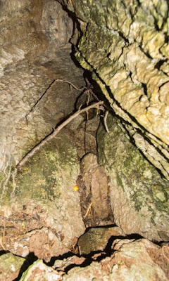
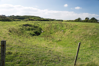
The area was visited in June 2017 by the writer, who found a swallow at SH60408200: A trickle of water runs down into a depression surrounded by dense ferns
(see image below)
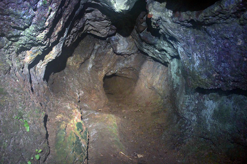
. The trickle dries up about 20 paces before a small cave at the lowest point (about 4m below field level). The cave terminates at what appears to be an impenetrable vertical rift in the floor
. The pot described above by Mel Davies and Robin Griffiths was not found on this visit. Mels grid reference suggest his pot lies another hundred meters of so to the north west.
Park at the small car park at the end of the lane at SH604819. Walk 50 paces west following a rough track, and then bear off to the right at about 45 degrees for about 100 paces, initially downhill then through a narrow clearing in the vegetation. The first shakehole should be easy to spot and lies 50m from the cliff-top. Presumably the main pot lies another 100 metres or so to the north west.
The Fewd Fawr area is now managed by the National Trust and permission is not required.
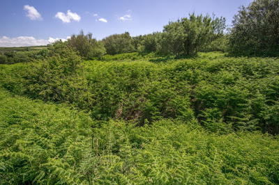
A small trickle (in dry weather) enters this depression from the east
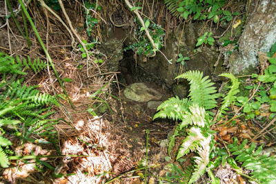
The point where the cave begins......
.... and the point where it ends after just 3 metres
.... unless a 3m pot lies under boulders
.................................................................................
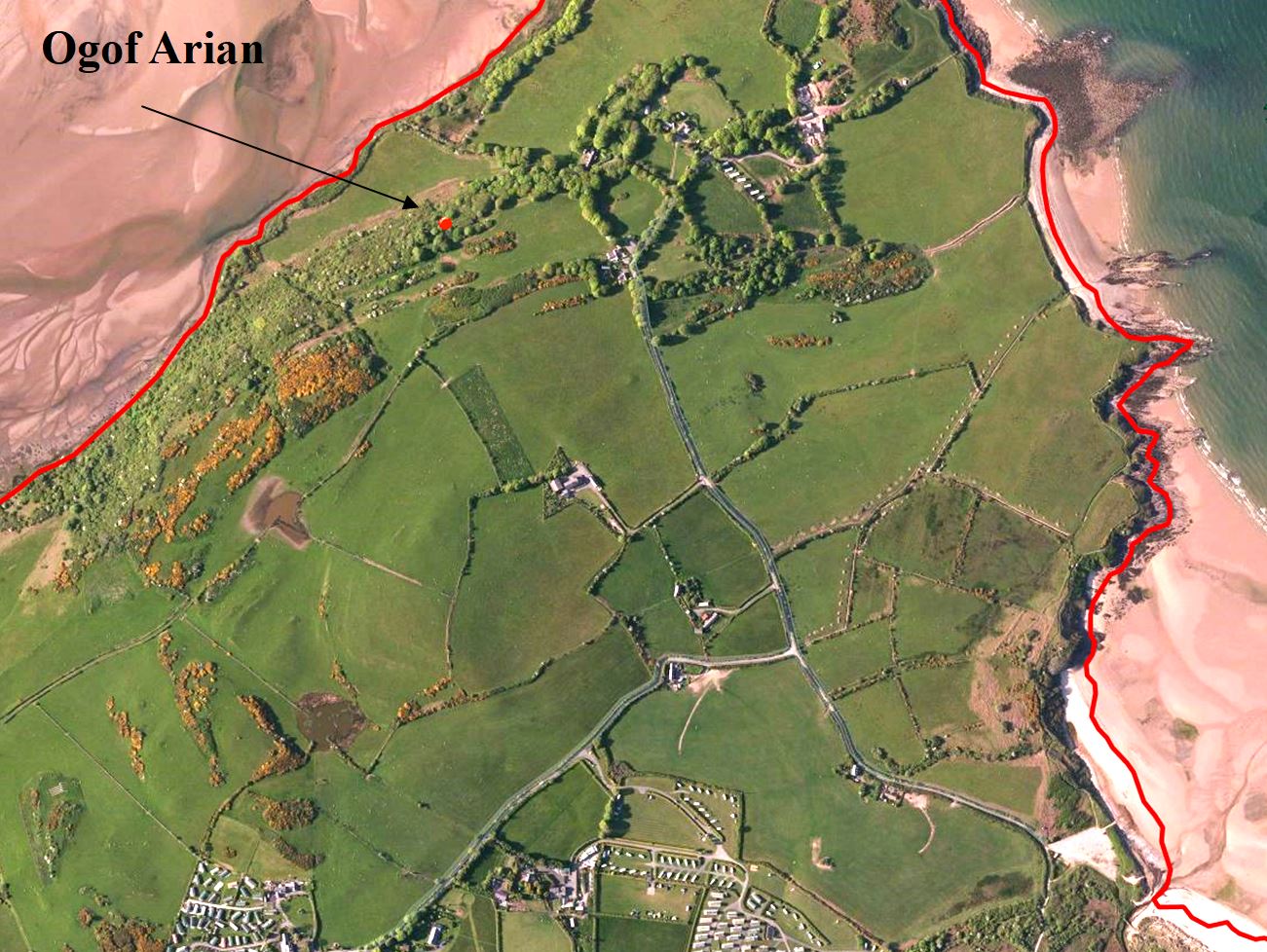
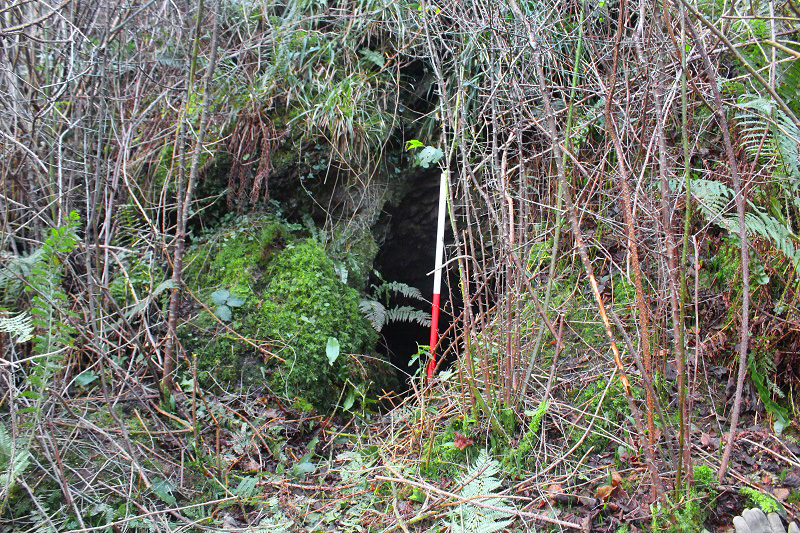
Ogof Arian
NGR: SH48528816 Length: 31m Archaeological site
Known locally as Ogof Ladren
Designated a Scheduled Ancient Monument (Ref. AN 106)
The cave consists of an outer chamber 1.5 to 2m wide x 1.3m high x 6m long, having a 25m long passage 1m wide and 1.5m high. It has a small platform outside the entrance (Cadw 1992).
Describing the passage leading from the entrance chamber: "It varies slightly in width and height along its length, but both usually between 0.6 and 0.8. It is approximately 25 metres in length. Just before the end, the tunnel veers slightly to the right, and to the left is loose material which could be a blocked entrance to another chamber. There is no evidence that the inner cave is a result of mining....... the cave is sunk into sandstone, but limestone may also be apparent in the roof and right side" (Cadw 1992).
The inner passage needs examining as it could be the result of early mining. No shot holes have been recorded.
Known locally as a smugglers cave.
Three 'prehistoric' flint scrapers were found in the entrance chamber and deposited with the National Museum of Wales by Lord Boston of Cae’r Borth, Moelfre (accession No. 42.404).
Permission: The cave is situated part way up a steep, heavily wooded slope and is difficult to get to and find.
It lies on a private estate and permission must be sought from the gamekeeper who has a workshop a few hundred metres away, before the end of the lane by the beach.
Sources:
Cadw site visit notes 1986 and 1992.
Catalogue of the Mesolithic & Neolithic Collections in the National Museums and Galleries of Wales (2003) by Steve Burrow, page 119.
The Prehistory of Wales (1951) by W.F. Grimes.
Entrance
Photo: Clwyd Powys Archaeological Trust
Entrance chamber with mined (?) passage continuing
Photo: Clwyd Powys Archaeological Trust
................................................................................
Ogo Dano
NGR:
SH486849
Not
a true cave, but a 2m wide chamber formed by rock movement (a large
block has slipped out, creating a cave in the void behind). Examined by the writer with Tony Jarratt in
1975.
"
The elusive Ogo Dano was eventually found after a prolonged slog through the undergrowth. It was located at the top of the cliff on the line of the production of the front door of a ruined cottage on the hill. It consisted of a rift entrance into a small room-like chamber with a collapsed 'window' at one side. Of no further interest as it is merely caused by rock slips and undercutting" (Source: The on-line diaries of Tony Jarratt, Volume 2, page 18 at: http://www.mcra.org.uk/logbooks/?dir=jrat ).
Robin Griffiths examined the area
along the escarpment near Ogof Dano
in 2015 and reports:
".......an interesting little river
valley at SH48218440. Interesting in that it cuts down up-dip of the
limestone. The valley itself is pretty much overgrown, but I did wonder
whether there may be some limited sinking there" (Source: Pers. Comm Sept. 2015)
...............................................................................
Ogof Moryn 1- 2
NGR: SH5059387178 +/-12ft
A typical sea cave in a tiny cove 30m wide next to the coastal path. The cove lies just to the south of
Porth Forllwyd Bay
. Requires equipment to descent a vertical 10m cliff drop to shore level. The cave entrance is 4m high by 3m wide. On the western side on the coastal path in a line with the cave, is a small closed shakehole which presumably once connected to the far end of the cave.
Visited by the writer in 2015. Time
did not allow Cave 2 to be examined. Does anyone
have any information?
View of the entrance looking north towards Porth Forllwyd Bay
Ogof Moryn entrance
Shakehole just to west of coastal path
Two
sea caves in small cove just past Porth Forllwyd bay (walking towards
Moelfre).
One is 6m long. The cave at the south end of the cove has two
entrances, one of which is at beach level, the other 2m above off to one
side
(Griffiths 1994b).
..................................................................................
Pentir Sea Caves
1 - 2
NGR:
SH625816
Tony Jarratt first described just one cave in 1975:
"Spent some time 'cave hunting' in this corner of Anglesey. Nothing of any interest was found on the limestone, and this sea cave is not worth a second visit, though it is somewhat photogenic. Itruns due east for around 70 feet (SH625816)".
(Source: Jarratt 1974-81 Entry for 22/3/75)
Then in 1994 two caves are described by Robin Griffiths.....
Cave 1
NGR:
SH62578164 Length: about 20m
The longest of the two: "A small sea cave with a blow-hole in a small headland"
(Griffiths 1994b).
Cave 2
NGR: SH62568157
Sea cave just around the corner (to the south) from Cave 1
(Griffiths 1994b).
...................................................................................
Puffin Island Caves
NGR: SH65298234
It appears that several caves are to be found on the island. Only one has been briefly described.....
"I found one shaft about 200 yards west of the station (the old Telegraph Station)
and running westwards. It dropped 30ft into a sea-cave. I climbed down to land on a dip-floor sloping up inland for about 15ft - to a blank wall. All the other caves seen from the boat (we were looking for seals in caves) were similar. The top of the island is densely covered with elder trees or alexanders, and rock is not much in evidence. Poor limestone pavement is visible here and there. Rain water must sink into something but we could see no springs. The Telegraph people got their water by collecting it off the roof and leading it into a tunnel about 40ft long running east-west under the station" (Davies 1974).
The island is designated as a Special Protection Area, chiefly due to its 750 pairs of cormorants. It is also privately owned by Edwin Morris and prior permission should be sought from the Baron Morris estate near Beaumaris.
................................................................................
Un-named sea cave
(rock arch)
NGR: SH63868140
Penmon Point
Simply a rock arch 2m high x 3m wide and 3m long formed by the collapse of thinly bedded limestone.
The surrounding rock is so unstable that the cave may not survive the next few winter storms.
Visited by the writer in 2015.
"There are another two limestone sea caves in the Penmon area, one near the coastguard building and the other near Trwyn Penrhyn"
(Griffiths 1994b).
Park at Penmon Point overlooking the lighthouse. The cave lies about 200 metres to the left (east) just beyond the shingle beach.
....................................................................................................
Minor potential sites of interest described by Robin Griffiths
Robin scoured the area and describes his findings in Ogofa No 3
(1994), the Journal of Gwynedd Cave and Pothole Club. A few of the sites he mentions are listed in brief here....
Ty
Canol Sink
SH49758217 – altitude 97m. Water from a drainage ditch
sinks amongst stones and branches. Water sinking amounts to about 20
litres a minute. Backs up in wet weather.
Possible cave
at Traeth Bychan
“Walking back to the car I saw what
might have been a cave entrance in a knoll marked 'Dinas' on the
Pathfinder OS map. Given the fact that there were lots of 'Private'
signs in evidence, I did not bother having a closer look”.
Two
small holes
at SH59438223 surrounded by shrubbery. These were at the
base of a small outcrop 1.5m high. The entrance on the east was about
18” wide and only 6” high. It had a gravel floor which would be
diggable. The other hole is about 3m around the corner and is
slightly larger but would also require digging to facilitate entry.
However, they are unlikely to be of any great extent.
Dry
river bed
at SH597820, in a fairly deep valley. The river bed itself
appears sizable being 2-3 feet wide but there was no water flowing.
The river rises about half a kilometre to the south near a farm
called Fargen Wen. It could well be worth exploring the course of the
river more fully – particularly during wetter weather. There were
two small choked holes in an outcrop about 30m to the south.
Other
areas which might be worth investigating are the outcrops at SH627805
and the disused quarry at SH635807.
Dwllban Point resurgence
can be found at
SH52788217
,
just north of
the point at the base of a cliff behind some old huts. A small stream
at a passage 18” high but only 5” wide
(Griffiths 1994b).
"One particularly interesting area is around Brynteg to the west of Benllech"
(Griffiths 1994b).
"Another interesting looking area on the map is around SH47818244. A little valley near the edge of the limestone with several springs, but footpaths are a bit scarce. The western end of the limestone in general seems to have several springs associated with it, and indeed the Lligwy River is more or less on the boundary for a significant distance, so I wonder what proportion of the river is derived from a spring line".
..............................................................................
References
Davies, Mel. (1974) The Non-caves of Puffin Island NWCC newsletter No.18.
Davies, Mel. (1975) A Small Pothole at Fedw Fawr, Anglesey. NWCC newsletter No.31.
Jarratt, Tony. (1974-81) Tony Jarratt's Caving Log Volume 2: http://www.mcra.org.uk/logbooks/files/JRatVol2.pdf
Griffiths, Robin. (1993)
The Caves of North Wales. Ogofa 1, Journal of GCPC)
Griffiths, Robin. (1994a)
Castell Mawr, Red Wharf Bay. Ogofa 2, Journal of GCPC)
Griffiths, Robin. (1994b) The Caves of Anglesey. Ogofa 3, Journal of GCPC
Horsley, Gus. (1990) Teifi Valley Caving Group newsletter No.2.
............................................................................
A YouTube video of a trip through Parliament Cave, South Stack.... on foot and by kayak: https://www.youtube.com/watch?v=4ZAhHB7p70E
Accessed by kayak:
https://kayakism.files.wordpress.com/2011/05/20110510-115152.jpg
http://2.bp.blogspot.com/-MAuOevQcGso/TcBjQjbo0xI/AAAAAAAAGTY/Ed7pTFg46fs/s1600/P1060732.JPG
http://www.damnfineviews.co.uk/wp-content/uploads/2013/05/IMG_5315.jpg
http://1.bp.blogspot.com/-Ghi1VDWo008/TmO79UW2S8I/AAAAAAAABtk/F9X8ui7bkDQ/s1600/P9010750.jpg
http://4.bp.blogspot.com/-1CxmcdoSdHE/Ux2K86N1kQI/AAAAAAAAHxI/mfabZdvjZKI/s1600/IMGP6311.JPG
http://grevel.co.uk/wp-content/uploads/2015/06/DSC02954.jpg
http://3.bp.blogspot.com/-jwQiff8IJSs/US5OMH2BN5I/AAAAAAAAERs/Brd95O6xh6Y/s1600/IMG_2091.JPG