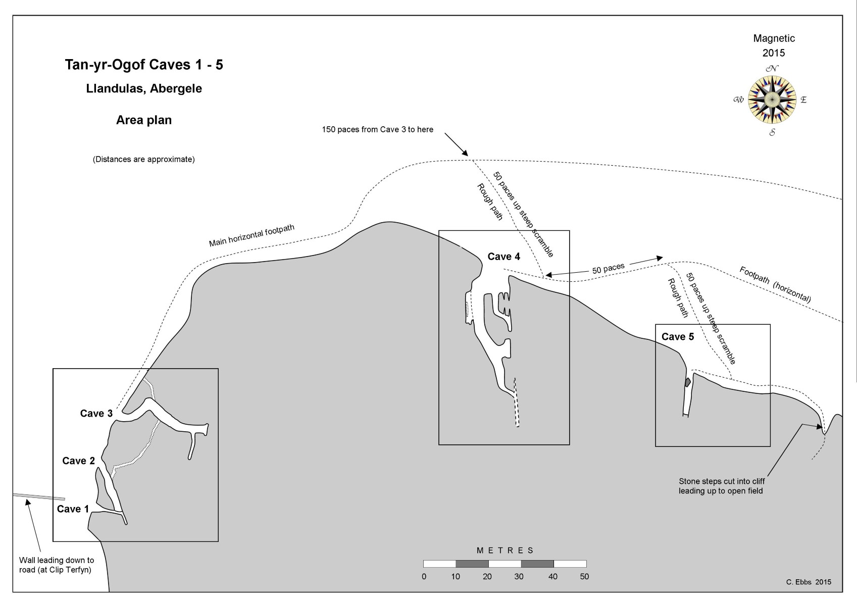
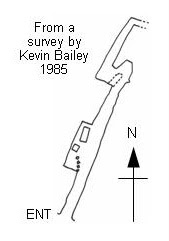
Area plan showing caves 1 - 5
A group of 6 caves in an imposing limestone outcrop overlooking the Irish Sea.
Ownership: Contact Gwrych Castle Preservation Trust, who in 2018 obtained ownership of Gwrych Castle.
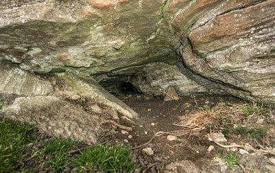
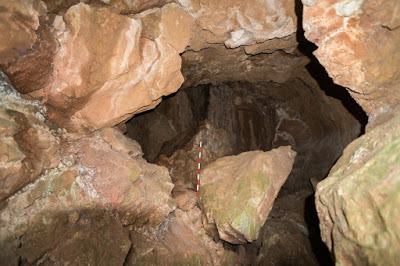
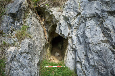
Cave 1: SH9139977893 +/-15ft Length: 7m (to Cave 2)

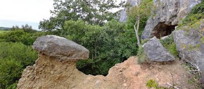
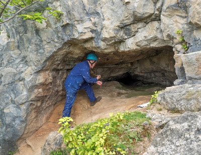
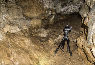
Photo: Jerry Dobby
At the top of the clay blockage is a crawl excavated by the writer and the late Tony Jarratt in the 1970s for 8 metres to a very small chamber blocked by further deposits (personal diary 1974). No archaeological material was found during this work.
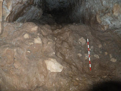
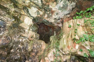
Unexcavated clay deposits block the end of the cave.
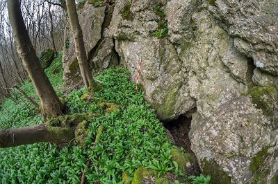
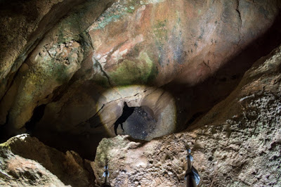
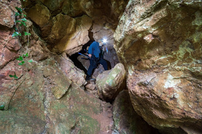
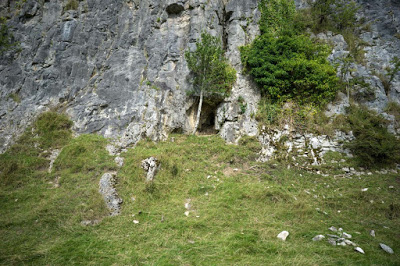
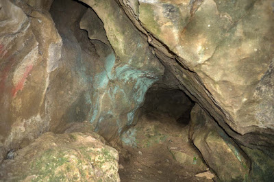
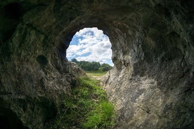
A few metres to the east of Cave 1 and 6m below it.
Part way into the cave are two tubes high in the passage wall (maypoling required) six metres above floor level. The tube in the south wall connects to Cave 2.
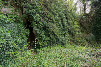
Unexcavated clay deposits block the end of the cave.
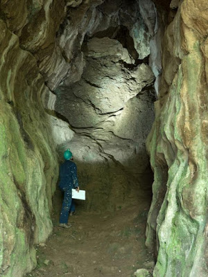
Cave 4:
SH9150377964 +/-18ft
Length: 67m
"The Ogo"
(after Baker & Balch 1907)
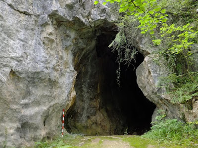
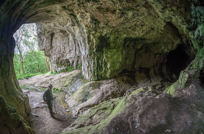
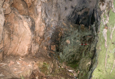
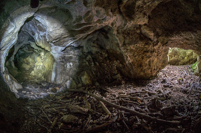
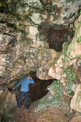
A 8m x 8m diameter entrance immediately splits into two passages. The left ends after 10m. The main right-hand passage passes beneath a rift in the roof leading up to surface, within which an awkward climb leads to a 6m passage. Some 35 metres from the entrance the main passage becomes more silted at a point where a small chamber can be seen on the left. The main route closes down after a further 7m.
Unexcavated clay deposits block the end of the cave.
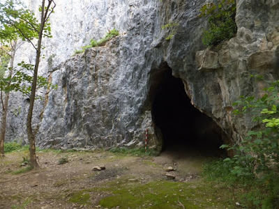
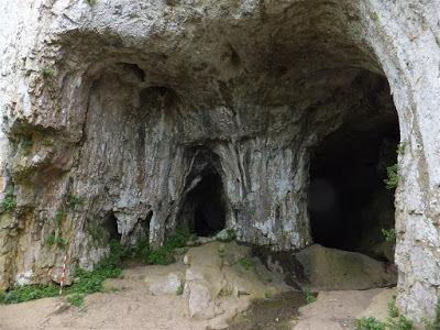
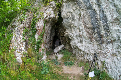
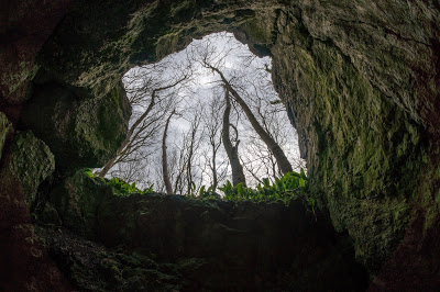
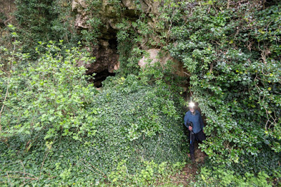
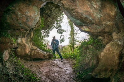
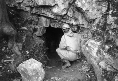
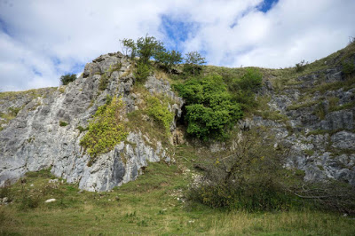
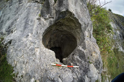
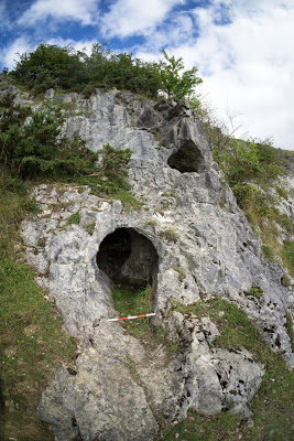
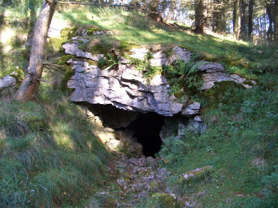
The largest of the entrances, facing north, lies a short walk further east around the outcrop (s ee Area Map above). It lies about 20m above the level of Cave No 3. It used to be clearly visible from the A55 expressway but trees now obscure the entrance.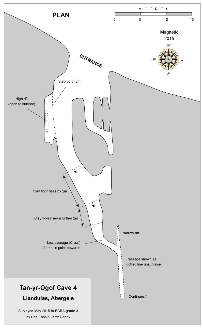
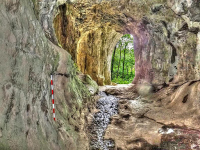
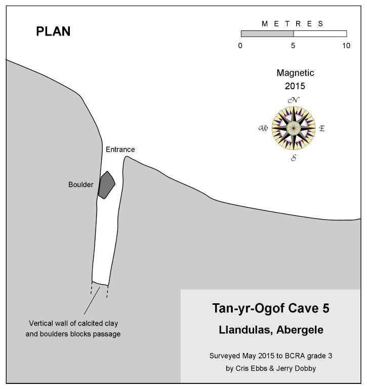
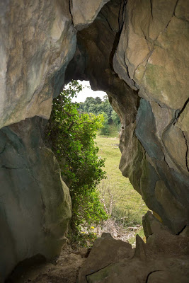
Cave 5:
SH9154477916 +/-20ft
Length: 12m
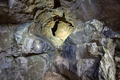
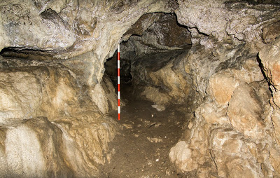
Entrance measures 2.1m wide by 4m high. A straight rift passage with an aven in the roof about 6m high.
The end of the passage terminates at a vertical wall of calcited till (clay and boulders), suggesting the point at which early excavation was halted.
From Cave 4, see Area Map above
.
Cave 6:
Length: 6m
A crawl becoming too tight.
This small cave was examined by John Blore in the 1960s.
NB
The writer has been unable to locate this cave. It may require climbing
gear to access from above as suggested by John Blore. If any reader knows its
whereabouts, will they please let this website know.
Trevor Flood Resurgence Cave SJ24874224 Length 25m Llangollen
All three risings drain Ruabon Mountain (south of World's End), a catchment area three miles in length in which very few caves are known. The areas presumed main cave system may only form at depth as a result of percolation.
Look for a small dry stream valley running down to the main road. The entrance is at the head of this valley beneath a track which leads into a small old quarry nearby.
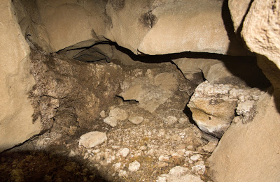
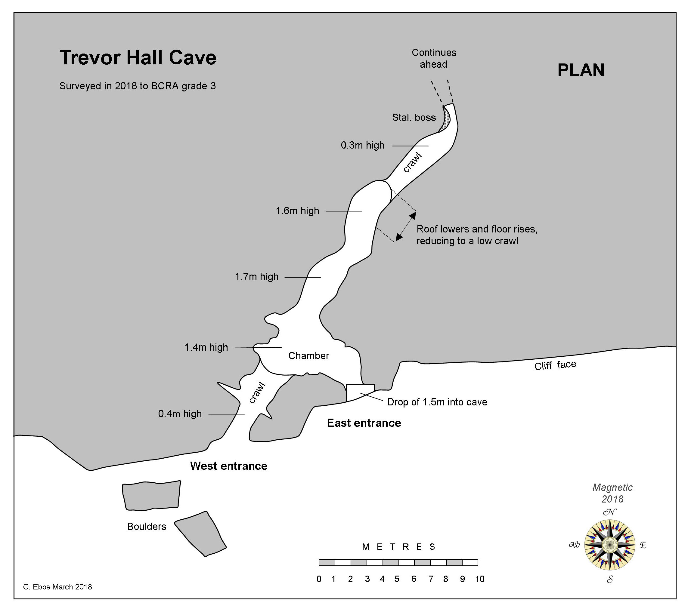
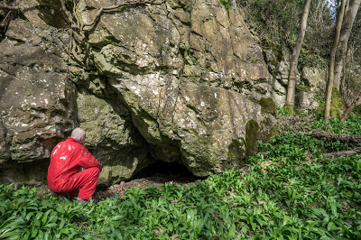
Trevor Hall Cave SJ2549142140 +/-17ft Length 25m Llangollen
First examined by cavers from Shropshire Mining Club in 1962.
Permission: Trevor Hall
South-west of Trevor Hall is a small triangular-shaped wood which can be clearly seen from the road. The cave lies at the base of a rock outcrop within this wood.
Park on the verge by a farm gate at SJ2555141910 (just room for a car without blocking access). Take the nearby public footpath leading from the road, past a private house crossing two stiles, then bearing off to the right (following the ascending path and skirting the woods). Just before a derelict house in the woods, take another stile into the woods. Follow the rough path for about 30 metres, then head up directly towards the cliffs above. The cave should be close by.
Appears to hold little promise beyond the Coke cans, bottles and boulders blocking the end.
-----------------------------------------------------------------------------------------------------------
The site is now difficult to reach, hence find the landowner and seek permission to visit.
------------------------------------------------------------------------------------------------------------
The close proximity of the three caves suggests they may once have been part of the same cave system. They do not however, appear to be connected.
Cave 1: Length: 18m
"The
largest entrance, and the cave is used as a household rubbish tip. A ten
feet drop, which requires a 20 foot rope, leads to sixty foot of high
rift passage in a rectangular plan. At the far end of the cave the rift
is at least thirty feet high and props were seen across the walls" (installed by the Victorian excavators or miners?).
Cave 2: (see note below) Length: 5m
"Is five feet vertically above Cave 1 but after 15 feet the passage is blocked by a wall of 'deads'" (evidence of mining).
Cave 3: Length : 15m
"Is
twenty feet west of Cave 1. Ten feet from the entrance a thirty foot
high aven leads to the top of the cliff. To the left the passage slopes
steadily upwards for fifty feet".
“Position: The entrance to these caves is hidden from the valley by a wall of rock, the space between this and the caves having been quarried away about 1850. The caves which are now practically inaccessible owing to growth of jungle, are in a dangerous condition as the rock is falling in".
"Exploration: ……… Owing to the proximity of Ty Newydd Cottage it was found impossible to approach the cave from the exposed front, so a cutting and tunnel through the solid rock had to be made from the hillside above. This work occupied the whole winter of 1896-97. The actual exploration was begun in March, 1897".
This description bears no relation to what was visible on the surface in 2019. Presumably the 'cutting and (mined) tunnel' simply provided excavators access to the lower passage of Cave 1, but has since been filled in.
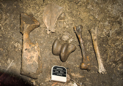
Ellis Davies also states that seven excavations took place in the eastern cave (Cave 1?), and although a depth of 8ft was reached, no rock floor was found. No bones or implements were found. In the western cave (Cave 3), excavations were carried out at intervals along the cave, but again, no rock floor was found. The only find was a fragment of tooth identified as lower molar of Rhinoceros, found almost 47ft from the cave entrance.
About 200 metres south of the Cilcain-Pantymwyn bridge in an outcrop next to the river. From the car park by the road bridge follow the river upstream on the east bank. Continue as far as possible next to the river then skirt the outcrop for a few metres. The entrance is 3m above river level.
-----------------------------------------------------------------------------------------------------------------
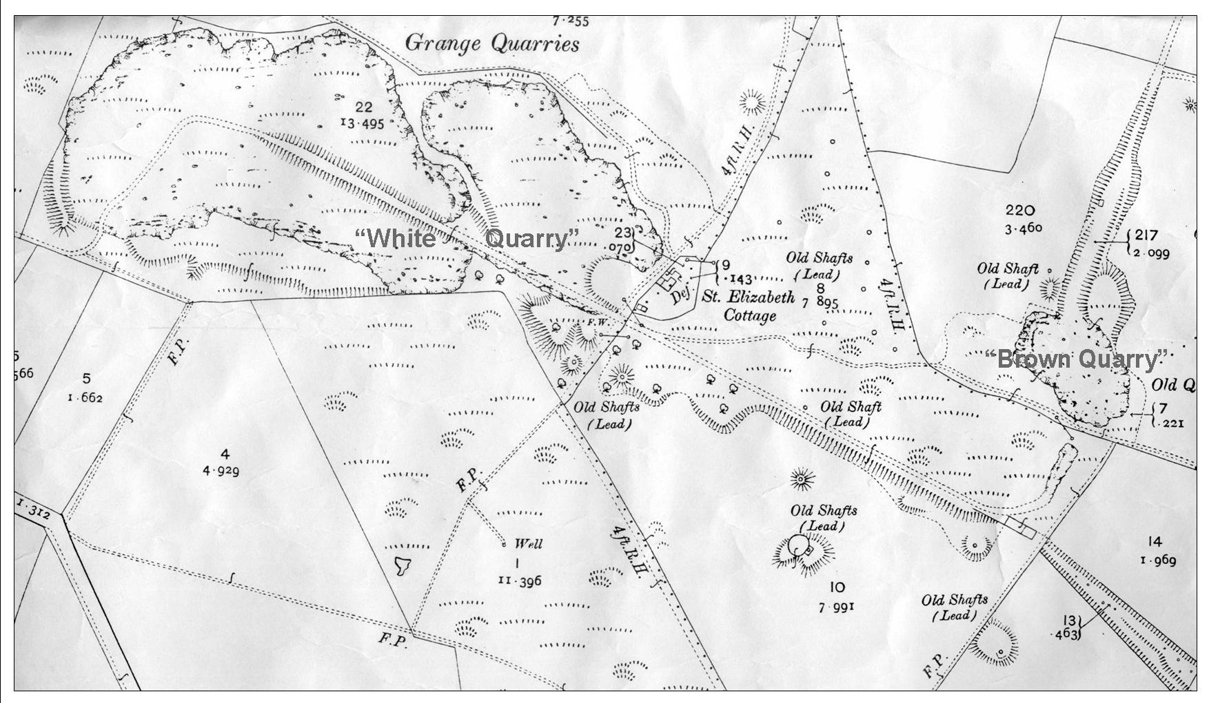
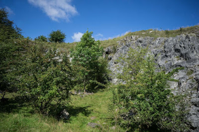
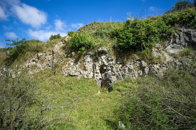
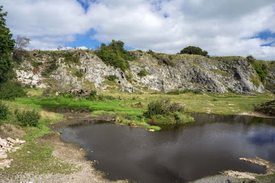
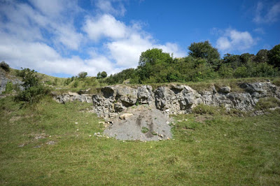
White Quarry and Brown Quarry Extract from the 25":1 mile OS sheet
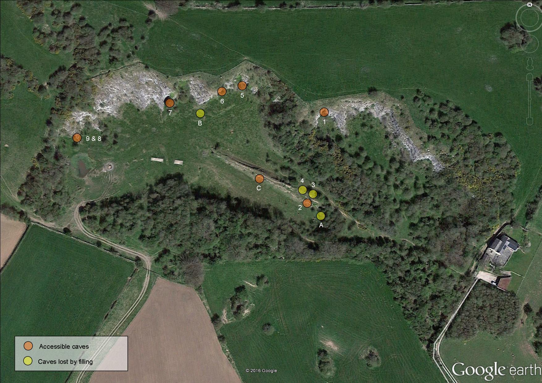
Google Earth plan of White Quarry
Although not worked for many years, it was re-activated for a short time in the 1980s in the hope of extending its expiring planning consent. At that time earth-moving machinery changed the quarry considerably, blocking some caves and revealing others previously unknown. Therefore some of the caves listed here should not be compared or confused with those mentioned in: Stride, A.H. & R.D. (1953) Britain Underground or Jenkins & Mason-Williams (1963 & 1967) Caves of Wales & the Marches, or elsewhere.
This is perhaps the largest cave to have been lost. Marked 'A' on the plan above, it was entered by the writer and the late Tony Jarratt in 1974. The entrance was excavated to reveal a vertical drop of about 15 feet, followed by a steep descent into a sloping-floored chamber about 9m long x 3m wide x 2.5m high. One wonders if this could perhaps have been the lost Barnewell Cave or Grange Farm Cave, mentioned in British Caving in 1953, although there is no evidence to support this.
"By digging through rubbish, we revealed a drop of 15ft to a steeply sloping passage terminating in a roomy chamber" (Source: writers diary 20/5/1974).
The visit is also mentioned in the on-line diaries of the late Tony Jarratt: "A
rubbish-choked hole was dug to reveal a hole dropping into about 80ft
of large natural (?) rift blocked by mud and some 30ft deep at the end" (Source: http://www.mcra.org.uk/logbooks/files/JRatVol2.pdf ). There is now no trace of the cave as its entrance appears to have been covered by several tons of earth.
A previously unrecorded tube was noticed in the quarry floor in 1987 after the quarry had been re-activated and again closed. Marked as 'B' on the plan above, it was a tube about 0.8m diameter running 3m to a single jammed boulder, where the way ahead continued beyond. There is now no trace of the cave.
A quarter of a mile east of Pantasaph Priory, take the signed public footpath north for 200m. Turn left where the path turns left and right, and the quarry entrance is on your right after about 30 metres.
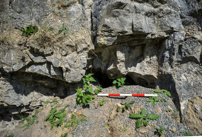
Cave 1: SJ1674975966 +/-15ft Length 2m
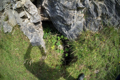
Entrance is just below the top of the cliff face. It may need a rope dropping down from above to climb up to the entrance. Not entered in 2016, but previously described as an uninspiring 2m tube.
Cave 2: SJ1673175886 +/-16ft Length: 3m
The entrance comprises a passage ahead becoming blocked after no more than 3m, and a narrow vertical rift partially blocked by a boulder at the top. The rift can be seen to descent to a depth of about 9m from the entrance, but it would need the entrance and boulder clearing away to see if the rift is wide enough to descend. Possibly the most promising of the White Quarry caves.
Cave 3 (Lost) : Length: 5m
A crawl leads to a low passage but the entrance is nearly blocked by boulders.
No trace in 2016: Appears to have been deliberately blocked by tipping.
Cave 4 (Lost): Depth: 4m
A narrow rift pot to a small chamber with no way on.
No
trace in 2016: Appears to have been deliberately blocked by tipping.
Cave 5: SJ1667975982 +/-10ft Length: 2m
Uninspiring. 2m to silt and boulders.
Cave 6: SJ1666575985 +/-9ft Length: 1m
A short tube blocked by deposits after no more than 2m.

Cave 7:
SJ1662475976 +/-15ft
Length: 20m
Half way up the cliff face is a roomy entrance 2m wide by 3m high. The passage soon reduces in size becoming block by undisturbed deposits after 6m.
Cave 8: SJ1654475956 +/-12ft Length: 8m
A 3m vertical pot with its entrance at the top. This connects via a crawl at floor level to Cave 9.
Cave 9: SJ1654475956 +/-12ft Length: 4m
A passage 1m in diameter is blocked after 3m. A crawl at floor level in the right hand wall leads after a metre or so to the foot of the 3m high tube which is Cave 8.
Cave C SJ1669175913 +/-9ft
A previously unrecorded
cave in the south side of the ramp leading up out of the quarry.
An attempt has been made to seal the cave with chippings, but quick work with a trowel will provide access to a short crawl that appears to run for a few metres.
World's End Cave Length 100m+ SJ234477 World's End
The possibility of other sealed caves nearby was mentioned in 1961: “On approximately the same bedding plane from which flows the World’s End stream, other low cave entrances can be seen in the cliffs on the southern side of the gorge. These all require digging out if they go anywhere at all being fairly well choked with gravel and earth. It was possible to see along one for about ten feet”. Source: “A General Reference to the Caving Areas of North Wales” 1961, Derbyshire Caving Club, Bulletin No.1.
------------------------------------------------------------------------------------------------------------------