The following are simply a selection of sites of speleological
interest,
to give a flavour of the north Wales caving area.
Although most of these sites
are only minor when compared with those of other areas, some of
them could repay organised excavation work.
-------------------------------------------------------------------------------------------------------------------------------
Alyn Gorge Swallows
The River Alyn has been known for centuries to disappear in river bed 'swallows' downstream of Loggerheads. In the past this caused flooding into the lead mines below. As a result, in the 1930s Halkyn District United Mines (HDUM) carried out a thorough programme of work aimed at identifying and sealing the main areas of leakage along the river bed. Despite dozens of individual swallows being cleared down to depths of over 20 feet, the major hydrological conduit was not found that could have been sealed to prevent flooding in the mines.
In the long-term however, their work had little effect, and today the river appears to run dry for long periods each year.
HDUM produced an unpublished report on this work which details the main areas of leakage and how each area was treated. A shortened version of the report has been digitised and is available as a PDF download at very bottom of page.
In 2018, a major swallow opened up in the river bed at Devil's Gorge and one of the nearby Leet caves collapsed internally, revealing a natural shaft in the floor. At the bottom of this shaft is a muddy chamber. The cave has since been gated by Natural Resources Wales and the large new swallow in the riverbed is being regularly monitored. Close to this new swallow, a collapse of debris lying against the cliff-face revealed a previously unknown cave chamber. This has been fenced off by Loggerheads Country Park and cavers are closely monitoing the situation. See the entry under Leet Caves for more information.
--------------------------------------------------------------------------------------------------------------------------------
Brasgyll Rising
SJ007714 River Elwy
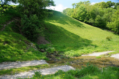
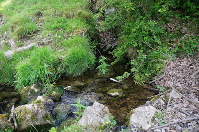
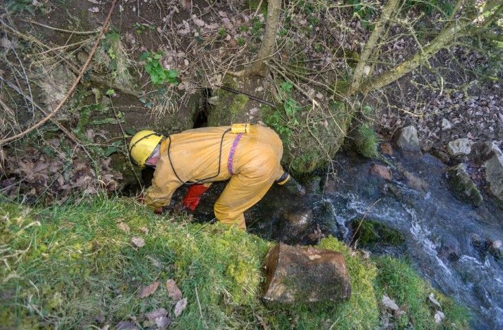
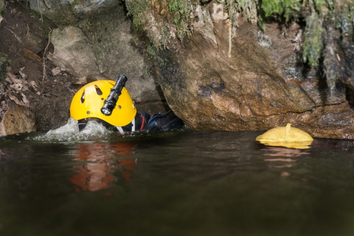
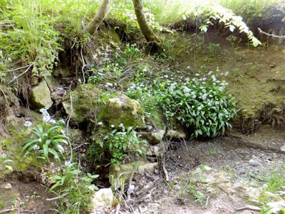
A permanent spring, the source of which are the many swallows of Brasgyll Gorge (see Brasgyll Caves) 200m away. Boulders blocking the entrance were cleared by Chris Jowett in 2021 and (with air bottle and mask) the passage ahead could be seen to continue below water level, albeit of small capacity.
In dry weather, the most interesting route is to stumble down past Brasgyll Caves and down through the narrow gorge almost to the River Elwy. The rising then lies about 30 yards across the field on the right. A faster, more direct route is through a farm gate from the road, directly above the rising.
With prior consent from Cefn Estate, parking is available just by the bridge over the gorge at SJ006714.
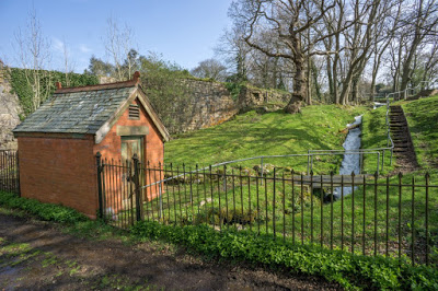
NB In wet weather a second rising can be seen issuing in front of a blue fishing hut about 100m upstream on the River Elwy. Behind the hut at the foot of the hill a slumped area possibly enters the passage leading to the second rising, although the local water table can be seen in a hole at the base.
Access:
Brasgyll Caves and risings form part of Cefn Estate belonging to Sir Watkin Williams Wynn and is therefore private property. Prior permission must be sought from the estate office at Cefn, where visitors will be asked to sign a disclaimer.
----------------------------------------------------------------------------------------------------------------------------------
Caerwys Sink
SJ12187401
Caerwys
A
small winter stream runs south terminating at a large grass-lined
depression. No solid rock visible and not inspiring, but
this is the only known active sink that's likely to supply St. Michael's
Well to the south (height difference: about 50m).
Take
the back lane (west of the village) leaving Caerwys in a north-westerly direction.
After 0.7 of a mile is a cross-roads (Barlows Caravan Site is just off
to the left here). Continue north-west over the cross-roads for a
further 200m looking for an overgrown path on the right leading to a
gate. The sink is in the field over the gate.
----------------------------------------------------------------------------------------------------------------------------------------------------
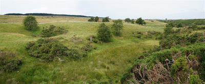
Cefn-y-gist Shakeholes
SJ232488
World’s End
A
line of shakeholes formed at the base of the limestone beds. One or two
take insignificant amounts of water. More water sinks at the most
southerly of these shakeholes (Ogof Cefn-y-gist 1: See page 7) which once found its way to Ffynnon Wen (see entry below),
the old resurgence at Minera, before mining lowered the local water table. The
line of shakeholes are arguably one of the most promising digging sites
in the area. Three shakeholes have been dug in the past, revealing stream passages
about 4m in width. Sadly the thinly-bedded ceilings are unable to
support such wide passages and large sections have collapsed. Two of the
caves discovered have been re-sealed due to the degree of instability. A
possibility would be to excavate others of the group in the hope of
finding a narrower, and therefore more self-supporting passage.
Dye testing has shown that water sinking at Cefn-y-Gist now re-appears in Ogof Llyn Parc (NWCC newsletter No 285, 2003)
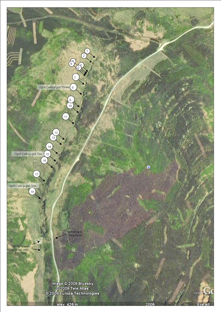
All shakeholes can be found by walking north from Ogof Cefn-y-gist
.
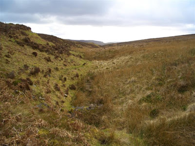
View looking south towards World's End. The road is off the picture to the left
CLICK IMAGE TO ENLARGE
Shakeholes marked 1-18: Ogof Cefn-y-Gist 1 being No 18
-----------------------------------------------------------------------------------------------------------------------------------------------------
Dinorben Farm Sink
SH96807467
St. George, Abergele
In the 1970s and 80s a small winter stream normally sank about 40m before reaching the dig. This
occasionally overflowed and the dig became active. Today however, there is no trace of the stream. Perhaps
it’s been piped underground or abstracted by the farmer upstream.
In 1983 a dig through rounded boulders reached a depth of 5m by heavy timbering following solid rock down
against the north wall. At that depth a short rift ran into the wall which pinched out.
The limestone wall continued down from the bottom of the dig, and further work would be needed to assess
the true potential. As the 1983 timbering will now be unreliable, the instability created by rounded boulders
requires scaffolding from the surface. No trace of the 1983 work is now visible.
Water sinking here in the 1970s was presumed to resurge at the walking-sized St. George Cave, the
entrance to which was lost due to quarrying, or may just be obscured by boulders. The entrance lay ¾ of a
mile to the north and 65m below the level of the dig.
Access: Seek permission from the nearby Dinorben Farm.
Warning:
Work here involves digging down through rounded stones and boulders and
therefore requires substantial scaffolded shoring (rounded boulders
being one of the most unstable mediums to dig through)
Steve Burzio at the dig in 1983
When re-visited in 2020, the small stream that once sank 20m before reaching the dig, did not exist and appears to have dried up entirely. There is also no trace whatsoever of the dig itself. The site remains a most promising location, not least because two large caverns were revealed in the area a few years ago, one to the east of the dig but now filled by Welsh Water; the other filled, blocked or blasted by the quarry company near the resurgence.
With thanks to Chris Jowett for the information on the lost caverns.
-------------------------------------------------------------------------------------------------------------------------------------------------------
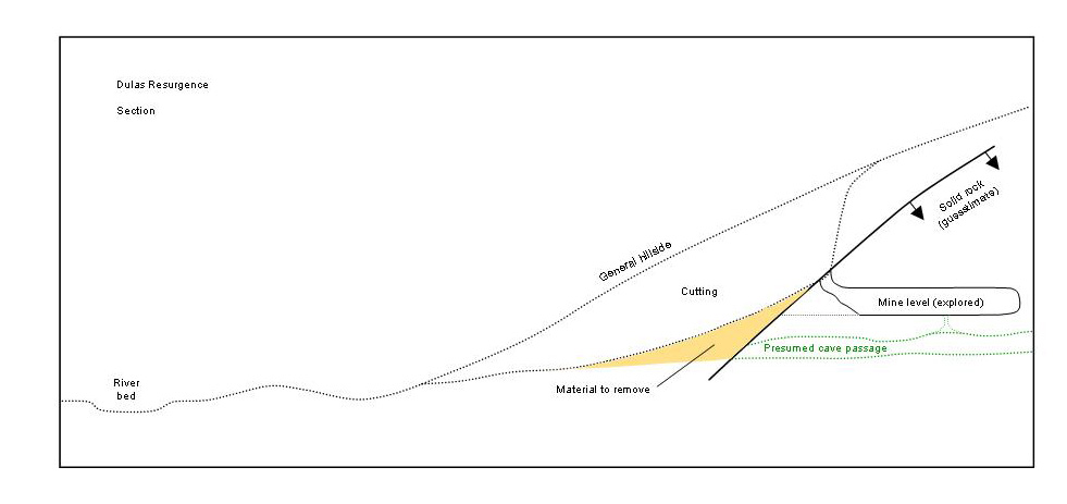
Dulas Resurgence
SH9086277712
+/-24ft Llandulas
A
promising rising on the bank of the River Dulas. Issues an impressive
flow when seen in flood conditions. Some work was done by the writer and
others here in 1974 and 1980, when a short blind mine level was entered at
the head of the cutting. This was driven directly above the point at
which the natural passage must lie. Inside the level the water
fluctuates, being in communication, via a small hole in the floor of the level, with
the spring below (see diagram below). The hill above the resurgence rises
by over 170m, although there are no known sinks. The writer was told by
a caver many years ago that, looking for bats he explored a blind mine
level in the hillside to the south after a period of heavy rain, and at
the end of the passage he could hear the sound of flowing water coming from the rock face
ahead. The location of the mine passage was pointed at as being very
approximately SH906770, and about half way up the hillside.
An old quarry lies about 500 metres to the west on the hill above the resurgence.
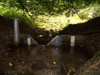
A dye-test was carried out in the quarry by the Environment Agency, who also took 200
samples at the resurgence between 1996 and 2004.
The
dye test was carried out before the quarry floor was fitted with a
polyethylene membrane, which was then covered in a metre of clay. The EA
discharged a tanker-full of water containing fluorescein dye into a
groundwater sink in the quarry at SH9035677418. Dye re-appeared at the resurgence after 38 hours (Source: Personal communication, Environment Agency 2010).
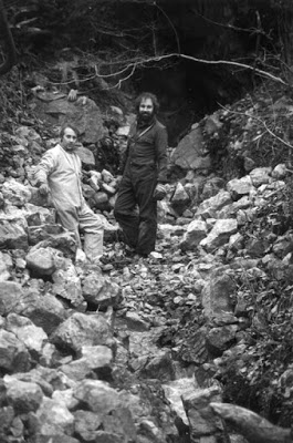
The
cutting leading to the resurgence requires excavation to lower the
depth by perhaps 2 metres in the hope of exposing the assumed cave
entrance. The work in 1974 began this task by shifting some 10 tons of
clay and rock. A JCB would make easy work of the task.
At
Llandulas, take the C-road due south from the old Llandulas - Abergele
road. After less than half a mile, the road crosses the River Dulas.
Park next to the bridge and take the stile on the right on the far side
of the bridge. Walk downstream for about 50 metres and the spring is on
your left.
CLICK IMAGE TO ENLARGE
Presumed cross-section of Dulas resurgence
Lowering the cutting in 1978
Environment Agency V-notch monitoring weir in 2009 (possibly now defunct)
----------------------------------------------------------------------------------------------------------------------------------
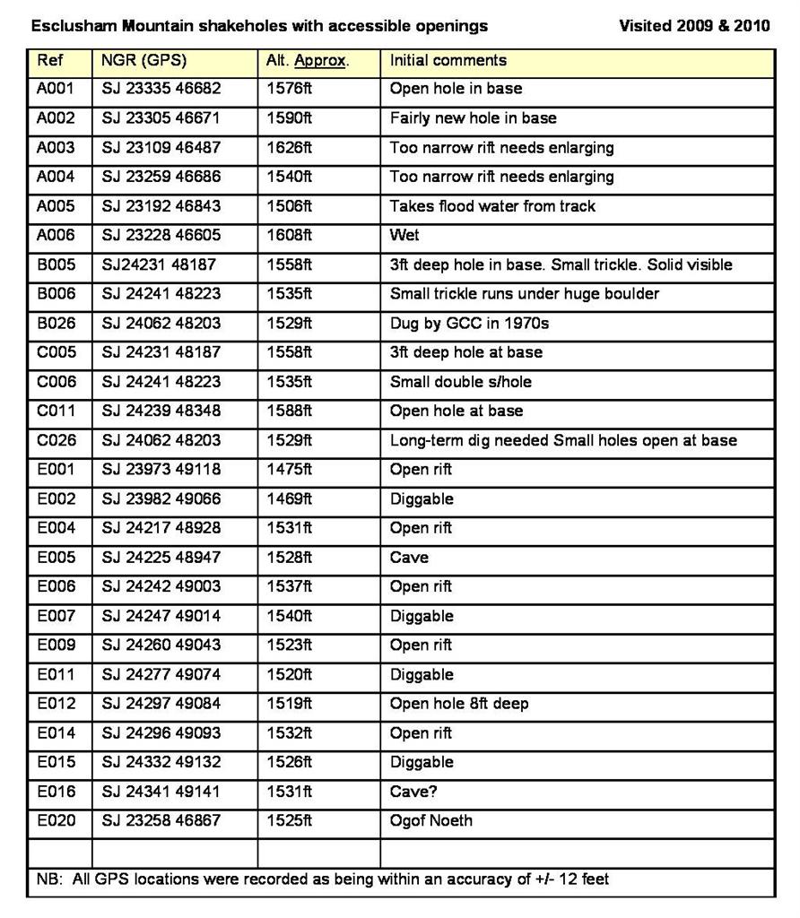
Esclusham Mountain Shakeholes
Minera - Llangollen
A
narrow band of limestone extends from Minera in the north, through
World’s End, to Llangollen in the south, the outcropping limestone being up
to half a mile in width. This area contains around two
hundred shakeholes. Most are closed and grass-covered at their bases,
but several are open and a few take small trickles of water. The whole
area is wild moorland carpeted with rough heather which makes walking
difficult.
The aquifer within this limestone area (World's End to Llangollen) is fed chiefly by percolation and resurges at the permanant Oerog Spring
at Trevor. Two other flood resurgences lie nearby, one of which can be
entered (Trevor Flood Resurgence Cave), although the passage descends below the water table and becomes
too tight.
Water sinking just to the south of World's End at Ogof Noeth is thought to resurge at World's End Cave. The nearby Kiln Cave at World's End acts as a flood resurgence only.
As
the shakeholes can be difficult to find, a survey was carried out by
the writer in 2009/10 to identify those with open holes at their bases.
Most shakeholes were flagged using Google Earth and, by using a free
computer programme (Tyre), these were transferred to a GPS (ETrex legend
HCx). Using this method it was possible to plot GPS routes to
the flagged shakeholes. This method was very successful in plotting
walking routes to include areas of cleared ground that avoided much of
the deep heather.
Almost
200 shakeholes were examined, of which 26 were found to have open holes
at their bases, although not all are promising. At the time of the
survey, none were examined internally, although most may have been
examined in the past. The table below may help future explorers at least
to find some of the more promising holes on the mountain.
CLICK IMAGE TO ENLARGE
Shakehole A002
Shakehole E014
-----------------------------------------------------------------------------------------------------------------------------------------------
Ffynnon Asaph
SJ07527894
Dyserth
Also known as Ffynnon Asa
A
powerful spring with a flow of 3 million gallons per day. The catchment
area contains no known caves. The water rises from a gently sloping
field and is contained within a locked water authority building. Sinks
within the catchment area include Brynglas Sink and Hendre Fawr
Sinks........
Brynglas Sink
SJ08777731
Trelawnyd
A
small winter stream sinks in a vertical-walled hole in clay. In 1974
the floor fell away leaving a 9m deep hole but no solid rock was
visible. Not known to pool up.
Not a particularly promising site but this is one of the few swallets associated with the Ffynnon Asaph system.
Close to the lane on the west side, in the north-east corner of the field.
Hendre Fawr Sinks
SJ097770
Trelawnyd
In wet weather two small streams converge and sink at several locations along the stream bed. Most swallows are
upstream of Hendre Fawr Farm. Upstream of the road bridge several
further sinks can be found at an old small stone quarry on the south bank (at SJ099769). Other swallows lie in the
stream-bed just downstream of the bridge, where solid
rock outcrops almost at surface. A dig in 1974 was carried out by the writer, opposite the farm on the
north bank, and reached a depth of 3m in loose and fissured limestone on the south side of the dig. It was however abandoned as it required serious scaffolding work at a time when most caving activity was centred on the Alyn Gorge following the discovery of OHA in 1973.
The overflow from Ffynnon Asaph in 1973 before the site was fenced off
The spring rises in a deep pool beside the stone building
2019
2019
---------------------------------------------------------------------------------------------------------------------------------
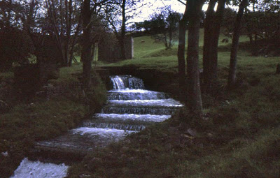
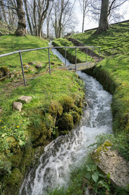
Ffynnon Ddyfnog
SJ07966334
Llanrhaedr, nr Denbigh
An
impressive resurgence in flood conditions, which gives the overall impression
of once being a wide, but now collapsed, bedding-plane. Water rises from several locations all within a few metres.
Difficult to know where to excavate but promising potential.
The spring
issues from the head of a blind valley near Llanrhaedr church. The
height difference from the main active sink of Ogof Rhewl (page 7) to Ffynnon
Ddyfnog is 100 metres, and the two locations are 1 mile apart, hence an
interesting cave system awaits discovery.
An ancient curative bath has been built in front of the spring where local clergy performed 'miracles': They knew that Ogof Rhewl and Ty Mawr Reservoir Sink
acted as feeders, so introduced red ochre into the sinking waters. After a specific time later, bathers were then introduced into the 'holy bath' and when
the water turned to 'blood or wine', all were allegedly cured. Described in early literature as “A mighty spring much frequented for the cure of scabs and itch, and some said it cured the pox”.
(Source: Francis Jones: The Holy Wells of Wales).
For an area plan showing the sinks,
resurgence and boundary of the carboniferous limestone,
see Ogof Rhewl
.
A little more on this spring, and a better photo of the bathing pool, can be seen at: https://wellhopper.wales/2011/06/15/st-dyfnog-llanrhaeadr/
Travelling
from Ruthin towards Denbigh, pass through Pentre Llanrhaeadr then turn
off left into the village of Llanrhaedr. 50m past the church turn left
taking the Prion road. A driveway 200m up on the left enters the
vicarage. Just 20 paces before the vicarage entrance is a narrow opening
in a high wall. Take this and scramble down following the
noise of the water.
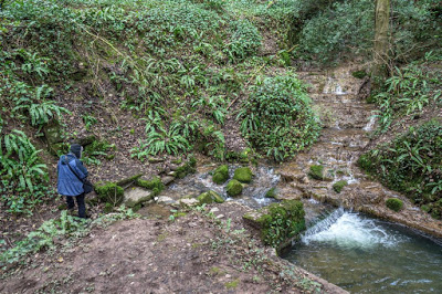
Ffynnon Ddyfnog bath and spring in dry weather in 2015
One spring issues just in front of the blue-jacketted figure.
The other issues via a flooded hole and pipe at the top of the cascade on the right
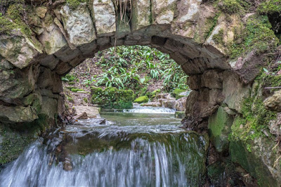
View of the bath from the overflow
---------------------------------------------------------------------------------------------------------------------------------
Ffynnon Leinw
SJ18316773
Hendre
An
old well that used to 'ebb and flow' until mining lowered the local
water table. A 'curative' bath has been built directly over a natural
spring. The bath was cleaned out by historians in the 1970s when the
cave passage supplying the bath could clearly be seen. When checked
out during a dry summer this passage was flooded, descending and
appeared too tight.
Prior to the lowering of the water table, the
spring issued from the Caleb Bell cross-course (a major north-south fault), upon which the spring
lies. The cross-course regularly caused flooding in nearby
North Hendre Mine.
Photos of the well and the small passage that supplied the well can be seen at the bottom of the page at this link:
https://wellhopper.wales/2011/06/01/ffynnon-leinw-hendre/
Driving
towards Denbigh from Hendre, pass the Royal Oak on the left. About 400
metres beyond, the well is on the left about 10 metres from the road.
Just past the well, woods on the left give way to open fields.
----------------------------------------------------------------------------------------------------------------------------------------
Ffynnon Wen
SJ261518
(approx) Gwynfryn
This
is now abandoned as a result of lowered water tables due to
mining. Pre-mining, Ffynnon Wen was the main resurgence for Esclusham
Mountain. Underground near this point, the waters from two caves once
converged before issuing at Ffynnon Wen namely: Ogof Llyn Du and Grand Turk Passage. Ogof Llyn Du supplied water from caves to the west, namely, Ogof Dydd Byraf and Ogof Llyn Parc, whereas Grand Turk Passage supplied water from the rest of Esclusham Mountain, from a cave system that remains to be discovered. One of the furthest sinks to feed this system is Ogof Cefn-y-gist almost 2.5 miles to the south-west (see also Cefn-y-gist Shakeholes and Reid's Shaft Caves).
------------------------------------------------------------------------------------------------------------------------------------------
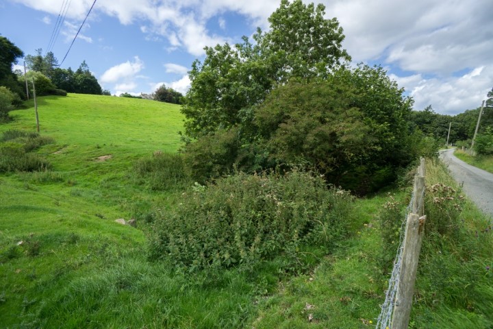
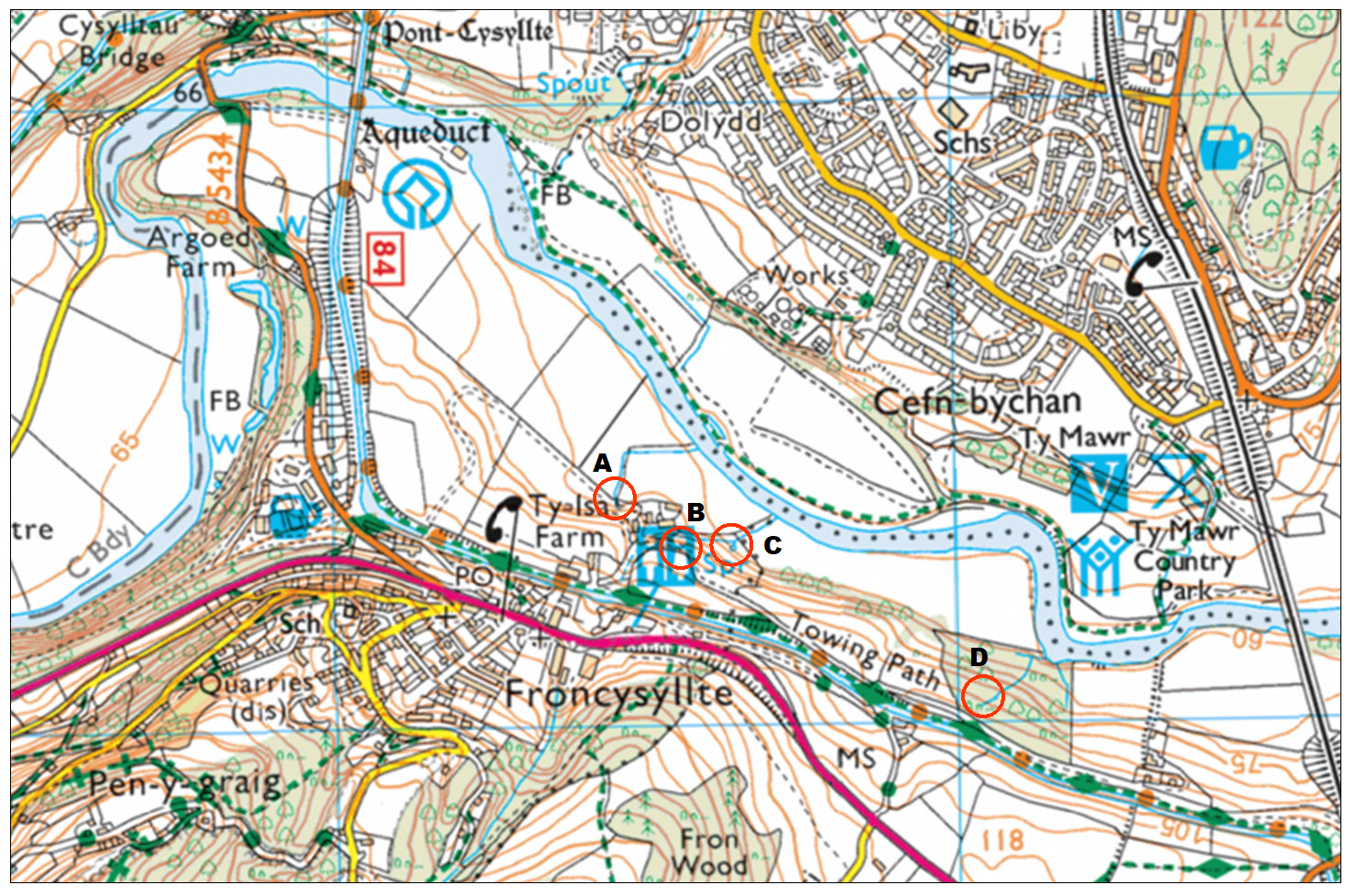
Froncysyllte Risings
SJ27624127
Froncysyllte, nr Llangollen
An interesting area that might repay a little work. Four small springs lie along the limestone boundary, all lying between the canal and the River Dee. They drain an isolated block of limestone that rises to the south some 230m above the springs, much of the area having been quarried.
Although only one spring appears to have any potential, the four are described in Ebbs’ diary for December 30th 1990 “under normal flood conditions”:
Spring A (SJ275414): Usually constant, but landowner said it dried out for a week last year. Lying in a gently sloping field, it’s been constructed as a well about 20 feet from a limestone outcrop. A further trickle issues from boulders about 5m to the west.
Spring B (SJ276410): Mid-way between the farm and Spring C in bank of stream behind V-notch weir. An uninspiring trickle.
Spring C (SJ27654130) at 65m AOD: An interesting site where bedock is visible. A waterboard V-notch weir creates a 4ft wide pool, water issuing from pebbles below the surface. The surrounding earth and sods need to be removed and the water level lowered, to check for horizontal passage development.
Spring D (SJ28054105) at 80m AOD: A small trickle runs from a flooded hole partially obscured by tree roots. Bedrock not visible but may lie just a few feet down. The water level was lowered by trenching without finding any horizontal development, water rising from lower down. Pebbles along the streambed are stained white, presumably calcited.
Access: Seek permission at the house in whose garden the spring lies.
------------------------------------------------------------------------------------------------------------------------------------------
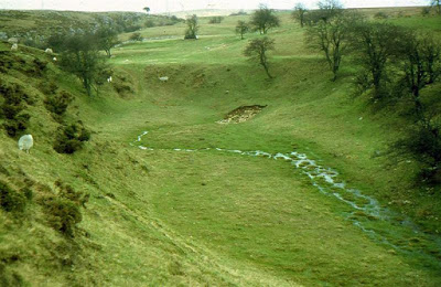
Gwter Siani Sinks
SJ24944982
Esclusham Mountain
A
stream flowing west sinks in a small blind valley. There are several
places where water here runs underground and several blocked holes
formed by subsidence. In flood conditions however, this area has been
seen to pool up and form a small lake. One hole was excavated in the
1980s but was abandoned when no solid rock was found, just large loose
boulders. No draughts have been identified. This site and Cefn-y-gist Shakeholes are the two main inlets for the undiscovered Esclusham Mountain master cave.
Park at
SJ251500
then walk south-east for about 80 metres to the blind valley.
-------------------------------------------------------------------------------------------------------------------------------------------
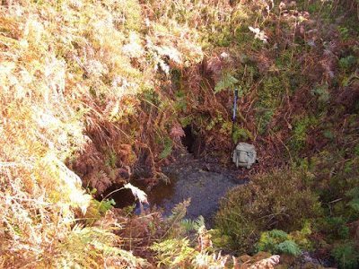
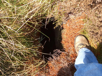
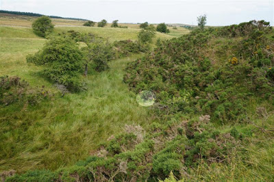
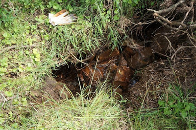
Lodge Farm Swallow
SJ03866685
Denbigh
A swallet which awaits excavation. Water sinking here is likely to resurge at Ogof Ewenol 2.4 miles to the north-west, although no dye testing appears to have been carried out to confirm this.
The swallet lies at 130m AOD and Ogof Ewenol at 40m, hence a height difference of 90 metres.
Access: Consent is required. Call at Bryn Nefydd Farm on the Denbigh - Henllan Road, immediately before turning off down the lane.
Drive out of Denbigh on the Henllan road. After passing Coppy Farm and the cliffs on the right, take the easily
missable left turn immediately after a solitary house. After about 100m
take the only track/footpath on the left. The sink is on the right
close to the track after about 50 or 60 metres and is now surrounded by 2m high fencing.
The current point at which water sinks amongst boulders within the collapse area (2012)
------------------------------------------------------------------------------------------------------------------------------------------
Oerog Spring
SJ26174205
Trevor, nr. Llangollen
The
main rising for Ruabon Mountain with a flow of about 720,000 gallons
per day. The point of issue is housed within a water authority
building. Water rises up through gravels and is therefore of little
caving interest. At times of heavy rain,
Trevor Flood Resurgence Cave becomes active and is presumably the overflow resurgence for Oerog Spring.
------------------------------------------------------------------------------------------------------------------------------------------
Oxford Pot
SJ18346562
Cilcain
A
sinkhole which enlarged considerably as a result of floods in 1976. The
farmer responded by inserting a Morris Oxford into the hole. GCC
cleared a route about 3m deep and 3m horizontally ending at impenetrable
fissures. May need digging deeper. Pre-glacially, the
River Alyn flowed north over this location (after Embleton 1957) and the
assumed cave below may represent an early swallet cave.
To
find the hole, just follow the only stream at this NGR. The stream is
piped under the road and into the sink about 20 metres away, close to
the track which runs down to Hesp Alyn Farm.
-----------------------------------------------------------------------------------------------------------------------------------------
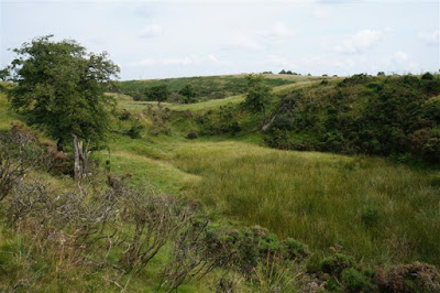
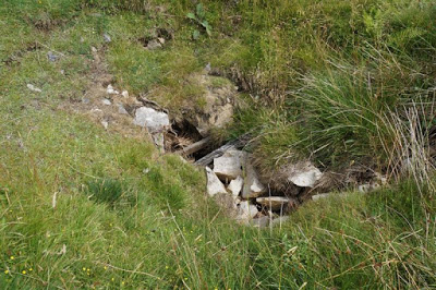
Park Farm Swallets
Approx: SJ245511
Esclusham Mountain
An area to the west of Aber Sychnant having several interesting shakeholes.
One has been excavated for 30m following a low passage (see under Park Farm Cave or PF2 below).
Several other swallets and open fissures can be found in the Aber Sychnant gorge and those that take water have a h
ydrological connection with the nearby Ogof Llyn Parc to the south-east.
The area was revisited in August 2013 when the following GPS locations were obtained for the most interesting sites.....
PF1 SJ 24633 51387 +/-10ft (Shakehole)
PF2 SJ 24577 51267 +/-7ft (Park Farm Cave)
PF3 SJ 24546 51195 +/-10ft (Shakehole)
PF4 SJ 24563 51116 +/-12ft (Shakehole)
PF5 SJ 24592 51132 +/-7ft (Shakehole)
PF6 SJ 24572 51056 +/-7ft (Swallet)
PF1 shakehole
PF1 shakehole. Takes a trickle only during wet weather
For PF2, see under Park Farm Cave
PF3 shakehole
PF4 shakehole
PF4 (upper left) and looking towards PF5 (right)
PF5 swallet in 1978. The stream now sinks at a swallet 100m upstream (see PF6 below)
PF5 shakehole in 2013
PF5 shakehole
. Showing the point of sinking in 1978 (see photo above)
PF6 Swallet looking towards PF5. Swallet indicated by lighter shaded oval.
PF6 swallet. This takes a permanent stream which can be heard falling below surface.
No evidence that excavation has taken place in the past
Aber Sychnant gorge looking north (downstream)
-----------------------------------------------------------------------------------------------------------------------------------------
Rhydlydan Rising
SJ13567350
Caerwys
This site is no longer open as it has been filled and no trace now exists (2018).
A
vertical rift 1m wide x 3m long excavated by the writer and others in
the 1970s to a depth of 5m to a flooded sump with fluctuating water levels.
At this depth the east wall veers away to form a roof with one or two
stalactites. The rift resurges in extreme floods and the land-owner claimed
that he once heard
roaring at his farmhouse (half a mile away), caused by
waters issuing from the rift after exceptionally severe flooding. Unfortunately the limestone bedding dip to the east, hence
any passage found is likely to lie below the water table. The site may possibly be of interest to cave divers, but the rift would need a drought followed by much work to remove remaining infill.
From the road, walk downstream on the east bank for about 30 or 40 metres The entrance is a little above stream level off to the left a few metres past the ruins of an old cottage.
It's also worth mentioning that there's a permanent spring (Ffynnon Deg) 400m further down the valley (SJ13357328)
and 500m further again there's a slot in a small outcrop where the
sound of a small underground stream (perhaps a trickle) can be heard (SJ13377280).
-----------------------------------------------------------------------------------------------------------------------------------------
Seven Springs
SJ1907059744 +/-12ft
Llanferres
Several
springs issue at or near a small shallow pool besides a footpath stile.
An old mine level was commenced close to the spot but nothing is known
of its history. The level was excavated by cavers for a few metres to
where it's questionable that it ever went further. The source of the
water is uncertain although a couple of shakeholes once existed in the
valley close to Burley Hill Quarry, before being filled by the quarry
company. In flood conditions water rises up from the footpath about 200m
to the south-east of the springs at the position of a north-south
cross-course (fault).
-----------------------------------------------------------------------------------------------------------------------------------------
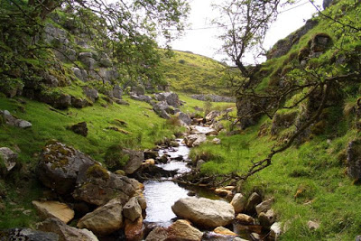
St. Michael’s Well
SJ12287292
Caerwys
A
tempting resurgence which issues from a flooded, low, descending
passage. Cave divers describe the passage as being partially blocked by boulders
and requiring underwater digging. Although being the resurgence for a fairly
large catchment area, the only active sink known is the uninspiring Caerwys Sink (see also Caerwys Caves higher up the valley).
Warning for cave divers: A small sewage plant overflow empties into the dry valley about 50m north of the well.
Although
not far down-valley from Caerwys Caves, access to the well is almost impossible
from the caves
. The well is better reached by taking the bridleway from
Caerwys golf course to a corner at SJ12307251.
Turn right by a stone post and follow a rough path through woodland
just beyond the golf course fence. At Coed Farm
(just visible above)
, turn downhill through
the trees to meet on obvious path
(a few metres)
below.
(This 'path' is a Forestry vehicle track leading to a junction within a few metres, one route leading down to the stream).
Follow this down to river
level. Walk upstream keeping to the river bank passing two mined
chambers at SJ12237275 to the well beyond.
(Access information: Dave Merchant)
NB
Not easily accessible in late Spring or Summer, due to brambles at stream level and footpath undergrowth (June 2018)
-----------------------------------------------------------------------------------------------------------------------------------------
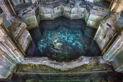
St. Winifride’s Well
SJ18537627
Holywell
A holy well still used for curative and remunerative purposes.
This was
the strongest resurgence in north Wales. The point of issue is enclosed
within a masonry shrine and a small charge is levied to enter the
grounds.
It was the resurgence for the
Halkyn Mountain cave system
, having a pre-mining flow of nearly 6 million gallons per day (over 4000 gallons per minute).
When
the Milwr Tunnel was being driven 2.7 miles to the south-east, it
intersected a cave system in 1917 causing the well to dry up entirely.
Water is now piped directly from the nearby Holywell Boat Level. The
well is "219.2 feet" (66.8m) AOD and its waters originally rose through fissures in
chert at the point where a major fault (the Caleb-Bell cross-course)
intersects the Old Holway vein.
St.
Winifride's Well is the resurgence for the
catchment area
of south-east Halkyn Mountain, from Holywell to Rhosesmor (lying east of
the impervious
Pant-y-Nef cross-course). The western catchment area (west of Pant-y-Nef cross-course) resurges at Ffynnon Asaph near Dyserth. There are also much smaller resurgences, such as St. Michael's Well, Caerwys which play a part in draining Halkyn Mountain. St. Michael's drains a small area between Caerwys and the A55 expressway to the north.
The legend and its religious significance can be found at http://www.saintwinefrideswell.com/
Analysis of the water in 1873 prior to draining by mining (Source: Strahan 1890) shows:
Temperature: 11 degrees C (52 degrees F)
Specific gravity: 1.0015
Carbonate of lime: 13.685 grains per imperial gallon
Carbonate of magnesia: 2.688 grains per imperial gallon
Sulphate of lime: 5.202 grains per imperial gallon
Chloride of sodium: 0.851 grains per imperial gallon
Chloride of calcium: 3.094 grains per imperial gallon
Carbonate of soda: 1.432 grains per imperial gallon
Silicic acid: 2.737 grains per imperial gallon
Further analysis of 1874:
Total solid impurity: 36.44 parts per 100,000
Organic carbon: 0.045 parts per 100,000
Organic nitrogen: 0.009 parts per 100,000
Chlorine: 6.30 parts per 100,000
------------------------------------------------------------------------------------------------------------------------------------------
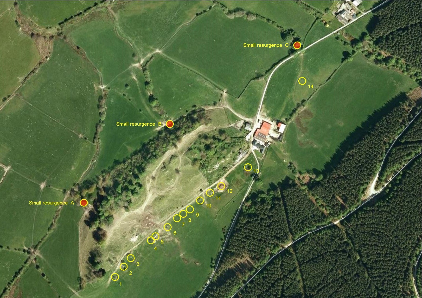
Ty Graig Swallets
SJ201504
Llandegla
Also known as Fourteen Swallets
In the 1980s there were 14 shakeholes or swallets formed along the Bryneglwys Fault. Numbers 1 to 13
extend south-west from Ty Graig house. Number 14
lay in the middle of a field about 100 metres north-east of Ty Graig (SJ20315070). It took a small winter stream which sank in fissures in solid rock, but the water that supplied it has
now been piped to the hole and the pipe buried, obscuring the swallet completely. Looking at the Google Earth image below, it appears that some shakeholes may have been lost by filling (up-to-date information required).
Only one
or two of the larger shakeholes seem to be worth digging, one being 5m
deep with a 2m pot at its base. They look easy work through loose boulders, but the distance to
either of the two risings is only a few hundred metres at most (Main
rising SJ20045061).
In
1965 flourescein was added to the small stream entering one of the furthest swallets from the farm (No 1 or 2?). After three days activated charcoal from "the
nearby resurgence" was tested and proved positive under UV light. This
followed an earlier negative dye-test which relied only upon visible
discolouration at the resurgence after just 35 minutes (Source: Ellis,
B.M. [1966] Some Caves of North Wales, in Shepton Mallet Caving Club Journal No 1 June 1966).
Access: Seek permission at Trefydd Bychan Farm next to Ty Graig.
CLICK IMAGE TO ENLARGE
NB The fourteen swallets numbered are those that existed in the 1980s.
PDF download below:
Click on the title to open. After opening a PDF below, please use your BACK button to return to this page