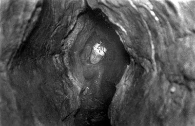
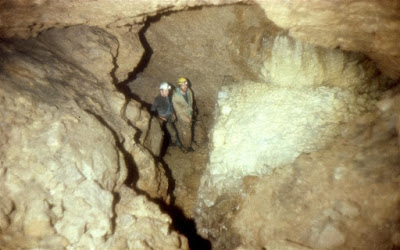
Cathole North Lode Chambers 1 – 2 SJ1948562986 Alyn Gorge
Chamber 2: The second but smaller chamber 5m x 7m x 2m high, is found a few metres from the entrance 3m above passage level.
Access: Now gated by Loggerheads Country Park to protect a bat population.
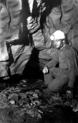
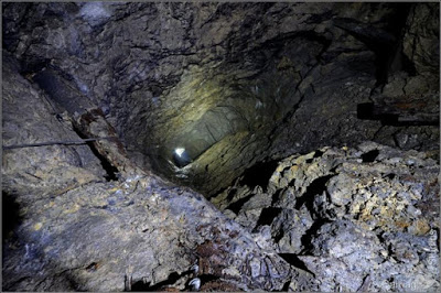
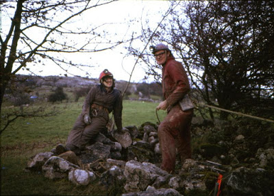
Cefn Mawr Cave SJ1976563088 Length 60m Alyn Gorge
Accessed through mine workings
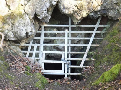
The entrance is a 40m mine shaft. This opens out at the bottom into a natural chamber 5m high and 7m in diameter. There is an aven in the roof but this doesn't go. A short passage modified by mining can be followed to an area which ascends at about 45 degrees and appears to be part natural, part mined. Although boulder-filled and unsafe, a draught can be felt about 15m up where a choke in the roof looks undiggable. The draught probably connects with blocked surface workings (6m deep trench) 50 metres to the south (see cross-section below).
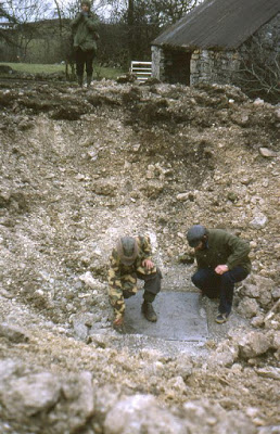
Find your way to the north side of Loggerheads Country Park at SJ19706305. Near Mine Post 8, take the path signposted ’Cadole’ to the south-east. After 120 paces this path crosses an old wall. Just BEFORE the wall take the vague path up to the left for 40 paces. Here leave the path and walk to the left (north) for 10 paces to a wire fence. Cross the fence and after another 40 paces you should see a circular fence marking the shaft. A stone slab covers the shaft but a way remains open in one corner. Condition of shaft walling needs checking before descending.
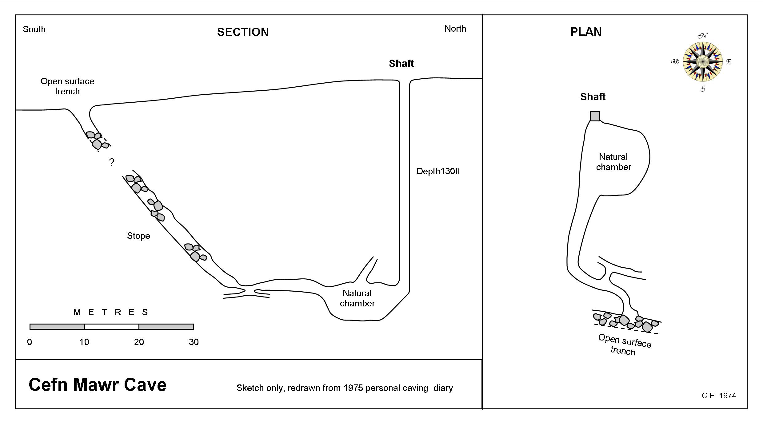
Plan and section
--------------------------------------------------------------------------------------------------------------------------
Chancewell Pot SJ18576831 Length 180m Hendre
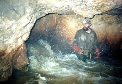
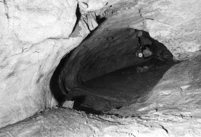
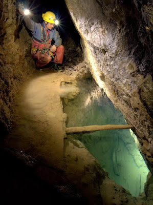
An unusual cave formed along the major north-south fault known as Caleb Bell Cross-course. The entrance is a mine shaft about 10m deep. A mine passage 3 metres long at the base of the shaft opens in the wall of a large natural rift passage. Another short pitch here leads to the floor within the cross-course. The rift passage is 10m high, up to 2m wide and runs north-south. It pinches out at either end. There is also a constricted clean-washed tube in the west wall which looks enticing, but was pushed in 2000 and found to close down just around a corner (See photo of tube passage below).
The entrance shaft was at one time used as a well, inferring that the rift was flooded before being drained by mining. North Hendre Mine not far to the south was known to have been much troubled by "inrushes of water from the cross-courses", and it seems likely that water from the Caleb Bell found its way into the mine prior to the lowering of local water tables. First re-discovered around 1980 by Alan Davis.
The entrance shaft is beneath an inspection cover in the courtyard of Cilcain Hall. Park near or over the entrance, and belay to your axle!
Permission: Cilcain Hall
---------------------------------------------------------------------------------------------------------------
Coed Du Mine Cavern Mine entrance SJ192665 approx. Alyn Gorge
A natural chamber formed in deep mine workings measuring about 20m in diameter and 18m deep.
The route through the mine includes an entrance shaft of 10m, a steeply inclined shaft of 14m and a final steep incline shaft of 25m (but step off at 15m).
The natural chamber descends at an angle of about 45 degrees before closing down to a boulder floor (a 30 minutes dig with a crow-bar required to break through?). Peering through the boulders here gives a clear view of the roomy chamber continuing below where, in the floor of the lower chamber (10m below), miners have timbered a 3m deep shaft against the north hanging wall which takes a small stream. This must be worth checking out.
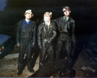
The trip to the cave is one of the dirtiest in the area. The mine appears to have had an underground pumping engine which used as its flue the route taken by cavers to descend. All surfaces are thickly encrusted with soot and there's even a liquid soot pool to be crawled through. Once down at adit level, the cave is reached by descending a further 25m internal shaft. The cave and workings below adit level have no soot deposits.
The mine was serviced by an adit. Although the portal is now blocked, the adit can be entered via a 2m climb down on the north side of the road just above the height of the River Alyn (at SJ1970366382 +/-10ft). Once in the adit, after a short distance, a shale collapse blocks the passage completely. If this could be cleared (a large-scale project), it would provide a cleaner and safer route into the mine.
A difficult entrance shaft to find as the area is heavily wooded.
Warning: The thick soot deposits make inspection of suspect walling almost impossible. The main route down involves a 14m winze with loose boulders. Not a trip to take on lightly.
------------------------------------------------------------------------------------------------------------------
Lead mines under Halkyn Mountain form a complex of which some 26 miles have been explored. During the process of ore extraction miners encountered many natural cave features such as water inlets, cave passages and chambers (known as 'vughs' or 'lochs' by the miners). Access to the mine workings is via the Milwr or Halkyn Tunnels, hence all caves are listed under this one heading.
Access: Contact GCC, NWCC or UCET for details.
For a more detailed account of lead mines of Flintshire including Halkyn Mountain, visit the sister site to this: http://www.cambrianmines.co.uk/flintshireleadmining/
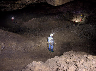
Cave 1: Powell's Lode Cavern
A natural chamber intersected during mining operations. When first discovered, the chamber contained two lakes, the shallowest of which was filled with waste rock. The chamber itself measures about 30m x 70m and about 30m in height over the lake, but narrowing and extending upwards to a height of 60m, close to the level of the Halkyn Tunnel. The cavern was first
entered by miners in 1932. At its southern end is a 20m diameter lake
which was, when plumbed by miners, at least 65 metres deep. The lake is
supplied by a nearby active passage which issues around 5000 gallons per
minute. This flow then runs off into the mine drainage tunnels. This flow
originally resurged at St. Winefride's Well, Holywell, five miles to the
north. The source of the water is likely to originate from the large
catchment area of Halkyn Mountain together with water flowing from the
south-west beyond the major Nant Figillt Fault (described in mining reports as being impermeable except at great depth).
Powell's Lode Lake was dived by Chris Jewell with assistance from UCET members in September 2015. The bottom lay at 42 metres below surface, but showed no obvious way on. In excellent visibility, a solitary mine cart was seen resting on a floor of rocks and sediment (With thanks to Les Williams for this information).
Presumably any downward continuation of the chamber will now be filled with waste rock tipped by miners over a number of years in the 1930s.
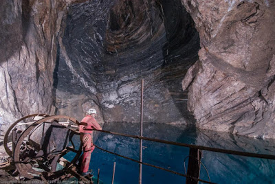
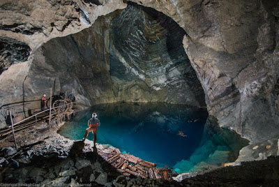
Note the caver in blue for scale
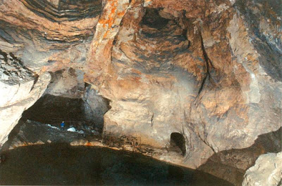
Cave 2: Barclays Caverns
A series of large chambers which, after almost 300 metres, dip below sea-level. Diving has been attempted here but the chances of finding dry passage seem unlikely. The floor of these chambers are covered in water, normally standing about 30cms above floor level. Barclay's Caverns adjoin the Powells' Lode Cavern, but are formed along the north-south Barclay's Lode (Powells' Lode being east-west).
Standing in Powell's Lode Cavern, Barclays Caverns lie immediately to the north, but a blockage prevents access. Take the cavers maypole route up the north wall to bypass this blockage.
Cave 3: Halkyn Lode Chamber
A chamber about 30m long x 10m wide x 38m in height. Miners filled the lower section with ‘deads’ and have made a ladderway up through the roof of the chamber into higher workings.
70m west of the junction with the Halkyn Lode and the Halkyn Tunnel.
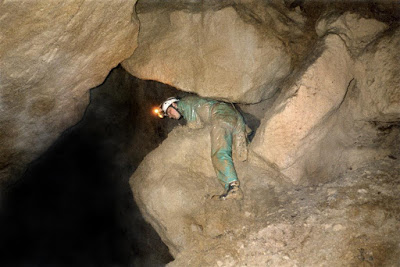
Cave 4: Cornel-y-Cae Chamber
A
chamber about 20m diameter x 20m high with a large boulder ruckle
rising up out of the floor. The chamber has been formed at the
intersection of the (east-west) Great Halkyn Lode and the (north-south) Cornel-y-cae cross-course.
Miners graffiti can be seen on the underhanging smooth passage wall between the Halkyn Tunnel and the chamber.
In 2017 a large collapse occurred and it is understood that the boulder climb shown in the photo below is no longer accessible.
This chamber lies at the far west end of the lode, a few hundred metres beyond Cave 3 (above).
Cave 5:
Rhosesmor Feeder Passage
Length: 60m
A tight crawl entrance doesn't get much bigger, but the passage can be pushed by squeezing for about 60 metres. May repay further work. This passage is marked as "Water Lode" on old mine plans. A dig in the floor of the branch tunnel opposite the caves entrance might locate the continuation of this cave to the north-east.
From Rhosesmor Mine, take the branch tunnel north-west in the direction of the Halkyn Tunnel.
The entrance is a small hole in the south-west wall at floor level.
Cave 6: Wern Sump
A small rift-chamber about 1m x 2m with a descending passage below water level.
From the Milwr Tunnel, take the Rhosesmor branch east. After about 50-100m the small entrance is seen on the right.
Cave 7: Wern Ave n
A vertical aven which has been climbed to a height of 15m. At the top is a small passage which becomes too tight.
A few metres beyond Cave 6 are mine workings on the left partially sealed off with mine rails. Squeeze through, then a short muddy crawl leads to the foot of the aven.
Cave 8: Lode 621 Chamber
A chamber about 10m diameter x 20m high. Solution marks in the walls indicate a strong upwards flow of water. Bolting up into the roof of the chamber by GCC (Oct. 2001) found a continuing passage. This ascends to the west where it enters a large open stope. The continuation of the chamber might be found elsewhere in the stope.
At the western end of Lode 621, at Milwr Tunnel level.
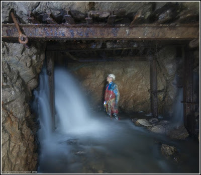
Cave 9:
Cathole Lode inlet passage
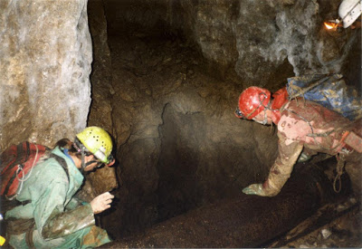
A large rift rises above tunnel level where a copious inlet enters from a tight flooded passage on the eastern side of the tunnel about 7m above tunnel level. Following the waters inlet passage upwards has so far proved impossible beyond a constriction. The rift above the inlet is blocked with clay and boulders. When the Milwr Tunnel was being driven towards Cathole Lode (lode 477), miner John Bellis reported that enormous amounts of mud and sand were coming from natural tubes in the wall. This partially blocked the tunnel and severely hampered operations for some time. He stated: "There must be a bloody big hole there somewhere".
At the southernmost end of the Milwr Tunnel (actual end of tunnel is wall behind figure in photo below) .
Cave 10: Lode 716 Cave Length: 490m
A single meandering rift passage which becomes active in wet weather.
The natural passage where entered from mine workings, can be followed to the left or right. To the left (west) the passage can be followed upstream for 80m. It involves bridging in a rift then a low crawl before sumping. The end has been named Armageddon, and is described as "a tricky-to-escape-from" sump.
To the right, walking downstream, involves a short crawl before Double 99 Chamber; a chamber with two 10m conical avens in the roof. Further downstream is Bell Chamber, beyond which the passage makes a few short drops to where the roof lowers to a mud sump. This point is about 410m from the ‘entrance‘.
Take the Halkyn tunnel north almost to Lewis's Shaft. Climb the rise to the right of the tunnel for 32m. At the top a short mine passage to the north leads to the cave.
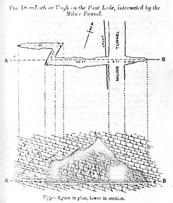
Cave 11: Pant Lode Vugh
A 'double rift' chamber with enormous potential but, it seems, little hope, as the rifts pinch out at each end. Water from Powells' Lode Cavern once passed through this 'vugh' or 'loch' (as miners called a natural cavity), on its way to resurge at St. Winefride's Well at Holywell. Water now enters a few metres above floor level from a narrow passage but it is reported as being too tight after a few metres. At floor level two springs entered where the chamber crosses the Milwr Tunnel; the spring on the east side is described in mine reports to be at a temperature of 49 degrees f. whilst that on the west was at a temp of 56 degrees. These have since dried up as water now enters the Milwr Tunnel direct from Powell's Lode. The Pant Lode vugh was first seen by miners in 1917 when the tunnel heading cut into it. The resulting flood washed loaded tubs down the tunnel and brought in thousands of tons of sand and gravel. The huge flow of water subsided after 6 weeks to 5000 gallons per minute. This lowered water tables in the area as far west as the Old Pant-y-nef cross-course, beyond which levels were unaffected.
About a mile to the north of Pen-y-bryn shaft in the main tunnel.
Cave 12: Llyn-y-pandy Lode inlet
A short active passage in the wall of a mine passage becomes too narrow and blocked by boulders after 6m. This is a major feeder into the mine and supplies about 4000 gallons per minute. The water originates from sinks along the River Alyn which then passes through the cave system of Ogof Hesp Alyn, but the route from the cave system towards the mines below must be of limited size, as in flood conditions Ogof Hesp Alyn floods and acts as a spring at its entrance.
Near the far western end of the of the Llyn-y-pandy Lode (Lode 576). Currently inaccessible due to a large collapse between the Milwr Tunnel and the inlet.
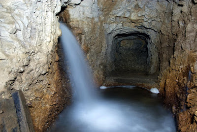
Cave 13: Halkyn Tunnel Vugh
A small chamber about 1.5m diameter x 6m deep in the floor of the Halkyn Tunnel. To ensure the flow of water over the chamber, a concrete 'launder' was constructed in the 1950s, ensuring a continued flow at the portal. A small hole at the bottom of the vugh is too tight for access. Winding cables from Lewis's Shaft discarded by the miners remain here.
Walking northwards along the Halkyn Tunnel towards Lewis's Shaft, the chamber is on the left, just a short distance before the shaft.
Looking down into the vugh near Lewis's Shaft, Halkyn
..... and another inlet at the Cathole end
of the Milwr Tunnel, offers good prospects for future work if the inlet can be enlarged
--------------------------------------------------------------------------------------------------------------------------------------
Lloyd’s Drift Cave SJ190646 Length: 6m Area: Alyn Gorge
First
encountered during the driving of a mining trial for spar in the late 1970s.
NB The entrance to the incline was blocked when last visited by the writer in 2012.
Entering the cave from the mined incline, a short crawl leads to a low chamber with a rift in the floor. Doesn’t appear to hold much promise but it is very close to the southern end of Ogof Hesp Alyn which passes about 50m below.
Access: Request permission from Mr Lloyd at the nearby house at the end of the track.
Walk west down the track from SJ193646. After about 400m the track bends to the left. Here, fork off to the right (north) for 100m. The mine entrance lies in a small but obvious quarry. From the entrance walk down the mine incline and the cave is in the left hand wall near the end of the passage.
--------------------------------------------------------------------------------------------------------------------------------------
Lot Farm Shaft Cave SJ19825828 Length 65m Eryrys
A chamber 12m square x 10m high with a large meandering passage off. Water enters the chamber near the roof, then runs off down the passage, sinking in a sandy floor against the wall. An aven in the roof doesn't go.
The trip to the cave through the mine involves an entrance shaft of 26m, followed by 10m then 9m pitches
into a mine level. Turn left at the level then turn right along a further mine passage which leads into the chamber.
Access: Contact GCC for the key and seek permission from Lot Farm.
Poor 1970s photo of the natural chamber
--------------------------------------------------------------------------------------------------------------
Maeshafn Mine Cave Mine entrance: SJ198610 Length 22m Maeshafn
From the mine entrance lid, follow a steep passage down to the start of a narrow open stope, to a small crawl-sized hole in the floor (Do NOT continue on ahead: Rotting false floor covered with boulders). Take the crawl under the left wall for 6m to a short climb down into a large descending passage. This is named as ‘Downhill Shaft' on mine plans and originally extended upwards to surface. Turn right near the bottom of the incline then right again at next junction. Passing a natural hole in the floor, after a few metres you come to the foot of a steep climb up (handline required). Climb here for 20m and the cave is at the top through a hole on the right.
Access: The mine is normally unlocked, but take a wrench for bolted lid. If locked, contact NWCC
Head west from the centre of Maeshafn village. Part way down the steep hill take the track which forks off to the right. Park soon after passing a few cottages. Walk back eastwards keeping below the track, and the entrance lies in a low outcrop.
---------------------------------------------------------------------------------------------------------------------------------
Picton Mine SJ177756 Pen-y-Ball, Holywell
Seen by miners only
"In the Picton Mine a cavern full of water was cut into with so little warning that the min ers barely escaped with their lives. The water disappeared in a short time, but St. Winifred's Well was temporarily discoloured. T he water is said to stand at about 540 feet below the surface, or only 30 feet above St. Winifred's Well .
Source: Smith, B. 1921 pages 59 & 60
------------------------------------------------------------------------------------------------------------------------------------
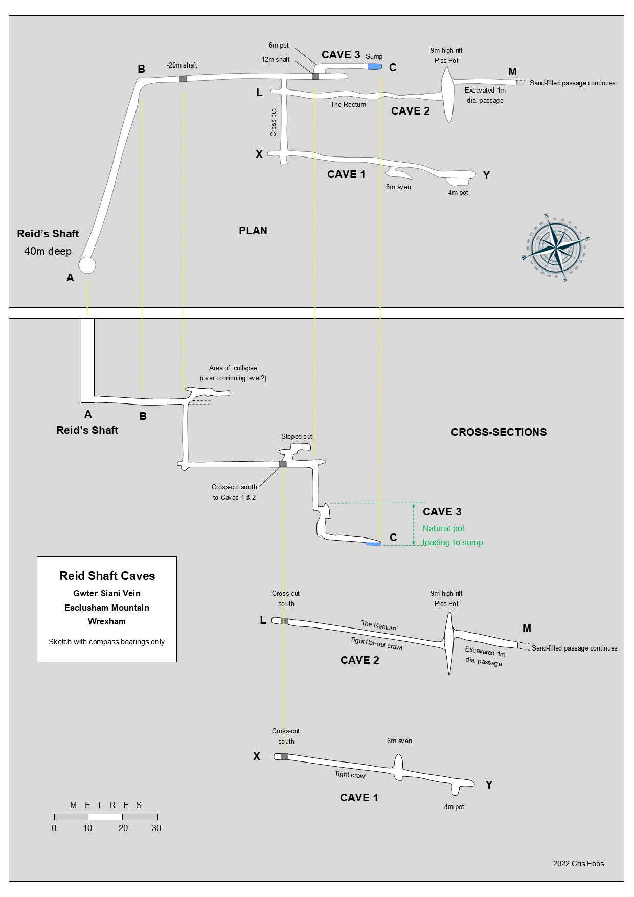
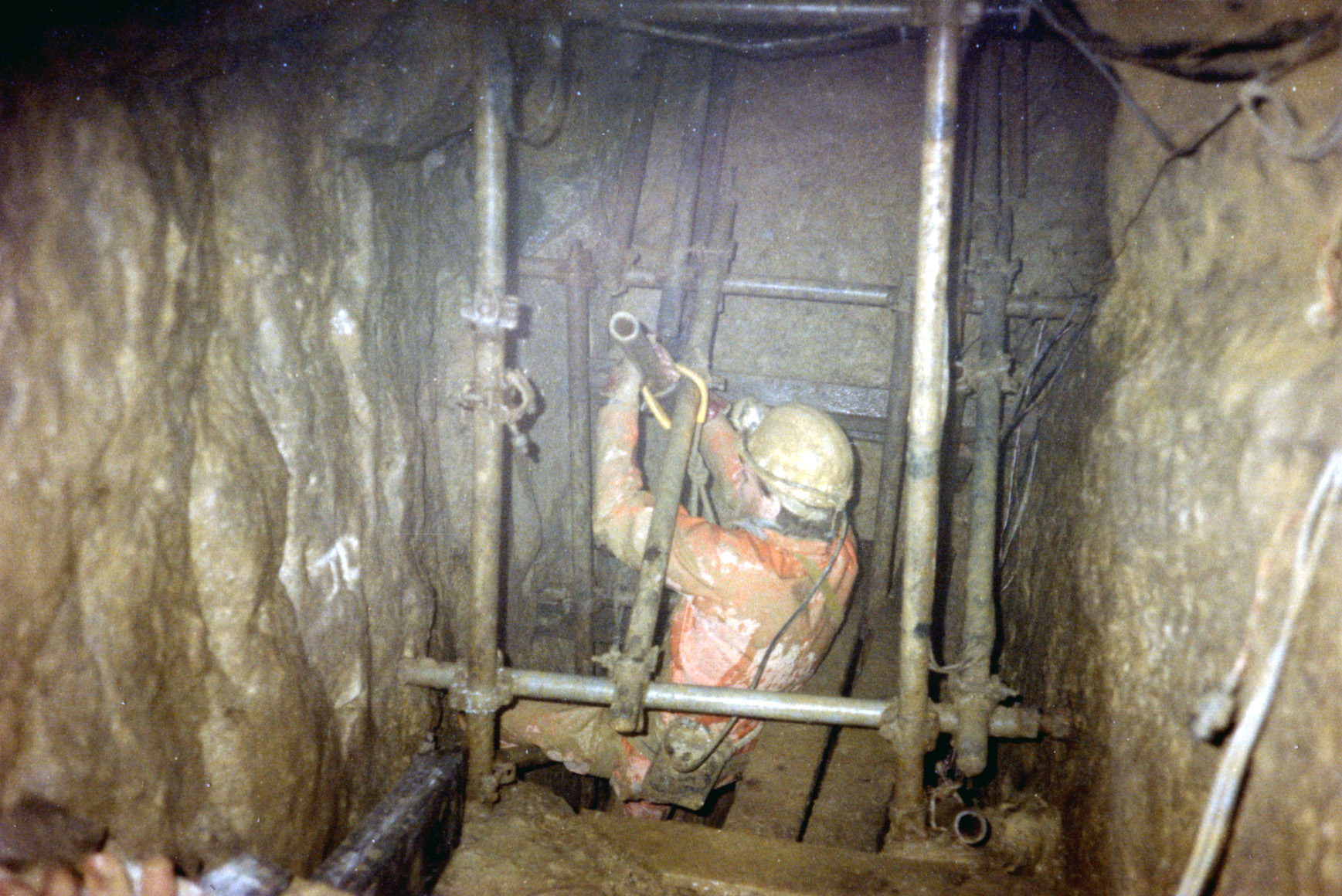
Reid’s Shaft is 35m deep and was blocked at the bottom until excavated in 1987 by GCC. A level runs north-east from shaft bottom then bends to the right following the Gwter Siani vein (bearing 110° in 1987). After about 80m from Reid’s Shaft the level leads to the top of an internal shaft 20m deep. Just beyond the top of this shaft is an area of collapsed ground lying above what could be the continuation of the level. The entrance is locked at the request of Wynnstay Estate.
Cave 1: Length: 30m
Cave 2: Length: 38m
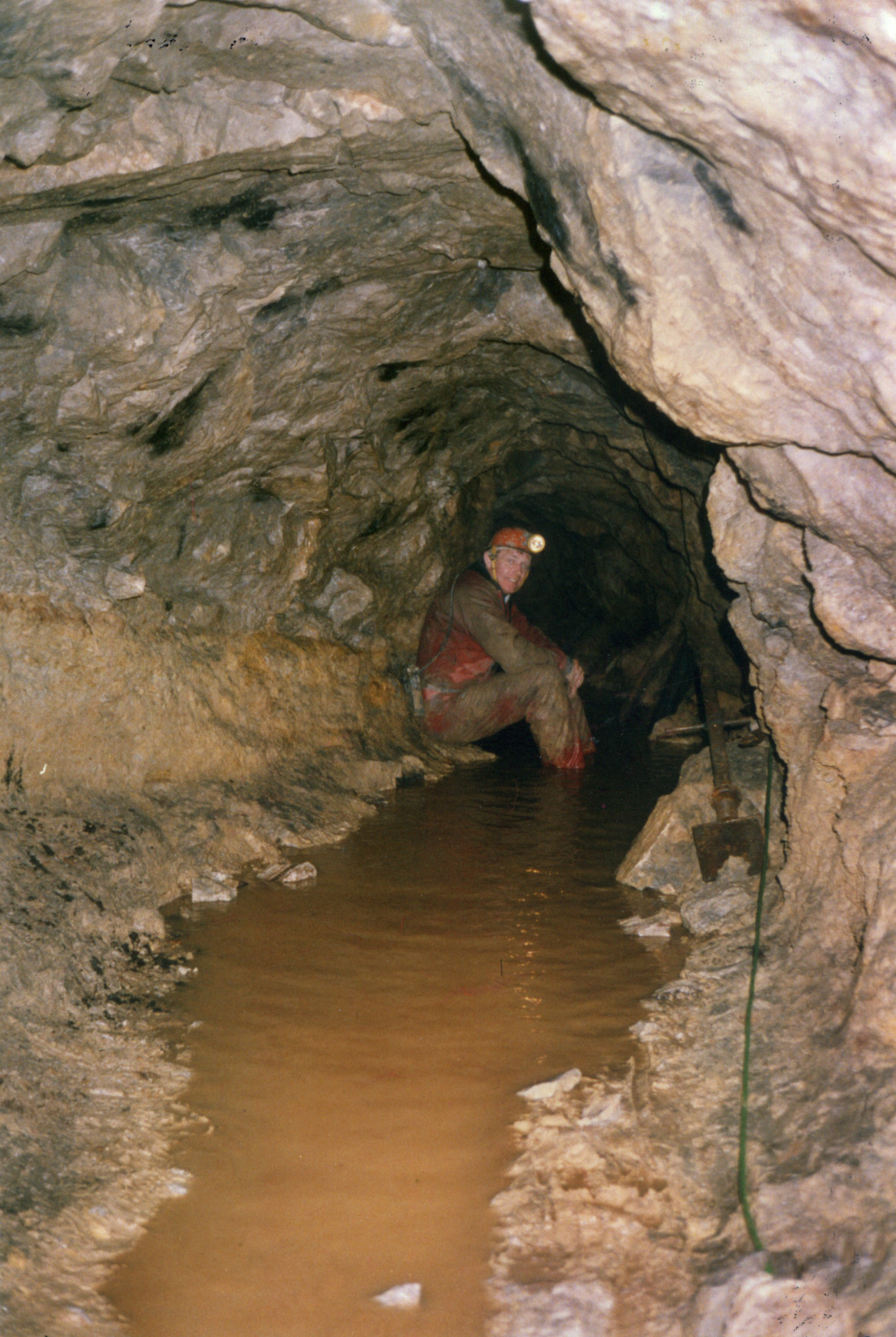
Cave 3: Length: 6m
At the base of the 20m shaft a further level continues, passing a crawl in the right-hand wall leading south to Caves 1 and 2. A further 15m internal shaft leads to a small natural hole at its base which opens onto the top of Cave 3.
Total depth below surface is 78m.
Source: GCC newsletters 23 (1987) and 36 (1989)
Warning: The club installed fixed ladders and platforms in the shaft which have not been maintained since 1987, hence lifeline, harness and care are advised.
Access: Contact GCC.
A tight crawl leads after 12m to a 6m high pot-cum-aven, offering some relief from the crawl. At the far end a small 4m deep offers little prospect of extending.
This was found by chance lying behind a dry-stone wall but was initially too tight. Repeated blasting revealed a low bedding passage which becomes a very tight squeeze descending gradually. This soon enlarges and after about 20m the passage emerges in the side of a 10m high rift at a point 5m above the floor. The passage is regained on the opposite side of the rift by climbing a few metres towards the roof. This passage is over 1m high and continues, again descending gradually, for a further 15m to a promising dig. The blockage here is clean, dry sand or soft clays. Digging progress is steady but requires a few enthusiasts to pass the buckets back to where they can be emptied into the rift.
A vertical pot about 10m deep which takes a trickle of water from the mine workings above. Below the pot a horizontal small rift passage has been enlarged by blasting to a sump which becomes too tight.
CLICK IMAGE TO ENLARGE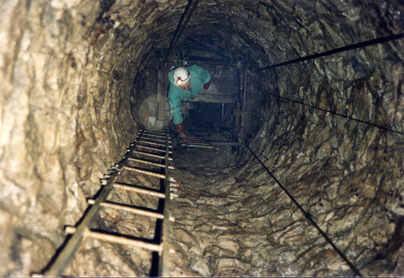
Thomas Evans Shaft Chamber SJ202580 Length 50m Eryrys
--------------------------------------------------------------------------------------------------------------
Westminster Mine Cave Length about 80m Eryrys
The crawl enters the main 'stream’ passage after about 10m. Downstream is sump 1 which can be passed in dry conditions to permanent sump 2 which allegedly closes down. Upstream the passage rises from stooping height to a rift 5m high. The rift is narrow and requires traversing up and down to find the only route. At times it's necessary to bridge at roof level where the once numerous straw stalactites are fast diminishing. Near the far end a chamber provides easier progress before the way ahead becomes blocked by miners' deads.
Access: The entrance shaft has been gated and locked as it lies on open ground used by passers-by: Contact NWCC or GCC for access details.