
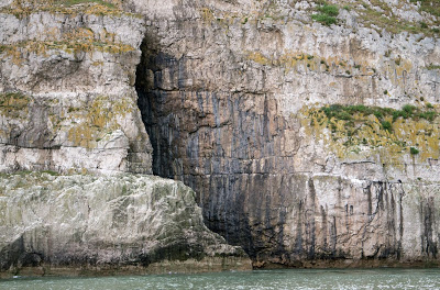
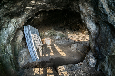
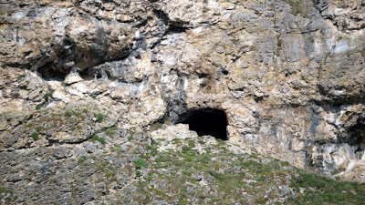
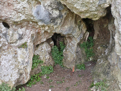
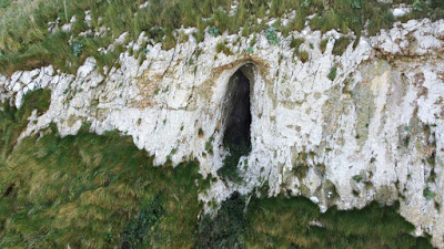
A small un-named sea cave exposed at low tide
Introduction
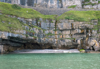
The 40 or 50 caves of the Great & Little Ormes at Llandudno are either erosional sea caves (generally having no passages leading off), or short passages choked with glacial debris, several of which contain significant archaeological deposits. Only two sites hold potential for being the longest caves of the area: Vivian's Shaft Cave (accessed via copper mine workings) and Ogof Deg (alleged to be a possible flood resurgence cave).
Several attempts have been made to describe the caves by those who have excavated or visited the caves by land or sea. These include original accounts by amateur cave archaeologists John Blore (1960s, 1970s and later), Tom Stone (1970s) and Mel Davies (1970s), plus visit reports by Robin Griffiths (1980s) and a precis account (1998) by Edric Roberts (see Bibliography). The most recent publication describing the caves of the area is by Nigel & Diane Bannerman in 2001: The Great Orme Explained. Copies are difficult to obtain, but your local library can order the title from Colwyn Bay library, who hold several copies. As the writer has not examined all of the Llandudno caves in person, these sources are relied upon heavily in several cave descriptions.
Archaeological discoveries in the area have almost invariably been the result of significant efforts by amateur cave archaeologists. Amongst these are Tom Stone (click the name to see an account of his work on the GOES website), Geoffrey David (St. David's College) and Duncan James (discoverer of Britain's first Bronze Age copper mine on the Great Orme). The two most notable excavators are John Blore (click the name to visit Blores "Lynx Cave" website) and the late Mel Davies (Download PDF notes on Mel and his work at the very bottom of this page entitled: "Mel Davies"). John Blore and Mel Davies can both be described as self-taught cave archaeologists notable for their persistence, life-long enthusiasm and breadth of experience. John Blore has excavated several sites around Llandudno and other areas of north Wales from 1961 onwards. He is still heavily involved in cave archaeology and in 2012 issued a final report celebrating his 50th year of excavation work at Lynx Cave, near Eryrys in Denbighshire. Mel Davies worked for the Nature Conservancy Council (now Natural Resources Wales) and also carried out many excavations in the Llandudno area. Like John Blore, Mel Davies was always keen to encourage others and pass on his knowledge to anyone interested in cave archaeology.
Little Orme note
From 2015, parts of the high exposed cliffs of the Little Orme have been scaled by caver Nick Jowett of Great Orme Mines, Llandudno. Using a method first pioneered by the late Mel Davies, Nick photographed the cliffs from the sea to identify locations, then set about abseiling down to each site. This revealed two small, but previously undocumented caves just to the west of North Face Cave (Upper and Lower Ogof Detritus), and a more interesting cave over 600 metres west of North Face Cave (Ogof Golau N ô s). See under each caves name for details. Also, John Blore’s archaeological site North Face Cave, was revisited where Nick found further human remains.

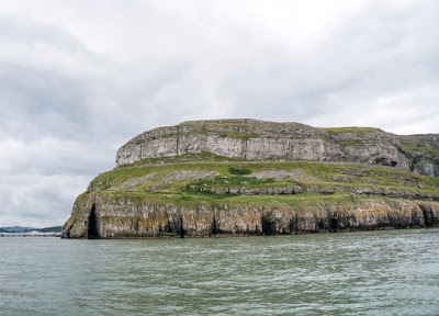
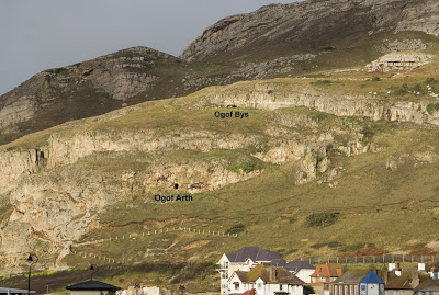
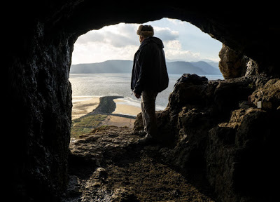
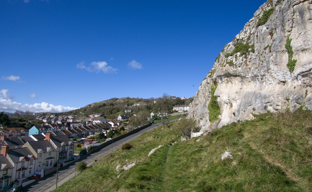
Locations of sea-facing caves (image taken from Llandudno pier)
--------------------------------------------------------------------------------------------------------------
Warning
Many
caves are located high in the limestone cliffs overlooking the sea and
are exposed and dangerous to access. Exploration should therefore only
be carried out by those fully competent in rope access techniques.
Due
to their inaccessible locations, some caves are also notoriously
difficult to find. Many cannot be seen at all from the land above.
Several of those described were initially identified by Mel Davies from a boat using a
camera to record the locations, enabling subsequent descents from above
down to each entrance (See NWCC newsletter 17, 1974 by Mel Davies).
--------------------------------------------------------------------------------------------------------------
AN ALPHABETICAL LIST OF LLANDUDNO CAVE NAMES CAN BE FOUND AT THE BOTTOM OF THE PAGE
--------------------------------------------------------------------------------------------------------------
On-line resources for Llandudno caves:
COFLEIN Database: http://www.coflein.gov.uk/
A database provided by the Royal Commission on Ancient and Historic Monuments Wales (RCAHMW), who describe it as “an online database for the National Monuments Record of Wales (NMRW), the national collection of information about the historic environment of Wales”. In describing the caves of Llandudno, the database is very patchy, some archaeological caves being incorrectly described, and others not described at all.
ARCHWILIO database:
http://www.archwilio.org.uk/
Entries for the caves of Llandudno are the responsibility of Gwynedd Archaeological Trust. The database contains some differing information to that offered by COFLEIN, although
both state that they give access to the HERs (Historic Environment
Records).
As is the case with Coflein, this information is also patchy. And before being granted access to the Archwilio
database, users must agree not to pass the information to any third
party or use it in any publication, despite the information being drawn largely from public sources.
CAPRA archaeological sources: http://caveburial.ubss.org.uk/wales/wales.htm
“A Gazetteer of Welsh Caves, Fissures & Rock Shelters Containing Human Remains. Sponsored by BCRA, the site is run b y Andrew Chamberlain, Department of Archaeology, University of Sheffield”.
This is an excellent resource for those seeking details of early archaeological reference material.The Great Orme Explained by Nigel & Diane Bannerman (2001) . An excellent account of caves, mines and other interesting sites: http://www.nbannerman.co.uk/The_Great_Orme_Explained.pdf
Female human remains of an individual named 'Blodwen ' have at last been returned from Bacup to Llandudno Museum. They were found in a fissure on Little Orme (of which all traces have been quarried away) and have been on display at the Museum since May 2015: http://www.bbc.co.uk/news/uk-wales-north-west-wales-31477681
Kendrick’s Cave artifacts; a BBC feature on Llandudno Museum’s : http://news.bbc.co.uk/local/northwestwales/hi/people_and_places/history/newsid_8326000/8326792.stm
Great Orme Coast & Caves http://www.greatorme.org.uk/coast.html
------------------------------------------------------------------------------------------------------------
-
Correcting the many gaps and errors in the Historic Environment Record
- Identifying the extent of unexcavated deposits remaining in known archaeological caves
-
Examining previously un-assesed caves for their archaeological potential
- Identifying and reporting on caves which might be under threat
-
Carrying out C14 dating on sample bone from all Llandudno's archaeological caves (Very few have had their dates confirmed).
-
Identifying
sites that might contain early cave art (it appears that neither
Archaeological Trust nor Cadw have carried out any searches for cave art
in North Wales)
--------------------------------------------------------------------------------------------------------------
The Caves................
Abbreviations used below include:
AW – Archaeology in Wales
NWCC – North Wales Caving Club
SWCC – South Wales Caving Club
GOES – Great Orme Exploration Society
GCPC – Gwynedd Cave & Pothole Club
BCRA – British Cave Research Society
WPCST – William Pengelly Cave Studies Trust
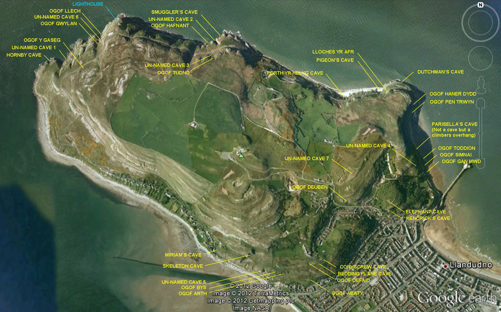
Approximate locations of Great Orme caves
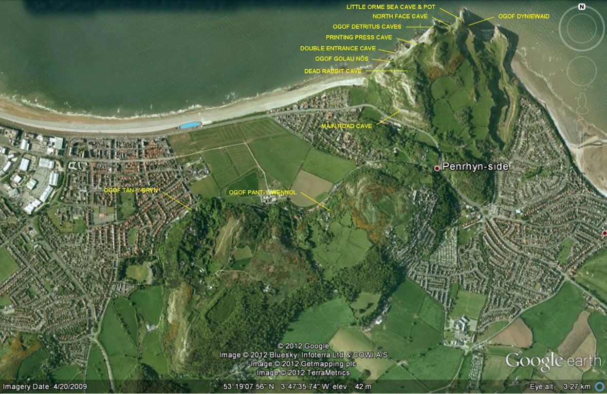
Approximate locations of Little Orme caves - corrected 2018
---------------------------------------------------------------------------------
Bedding Plane Cave
(Great Orme) SH7715682410
+/-5m
Length: 9m+
A south-facing chamber 3m wide wide x almost 2m high with a crawl at the rear of at least 3m.
---------------------------------------------------------------------------------------------
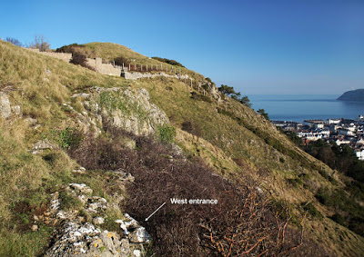
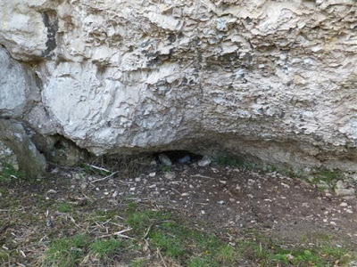
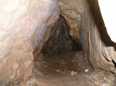
Corkscrew Cave
(Great Orme)
SH7733882428 +/-10ft
Length 25m
Archaeological (human)
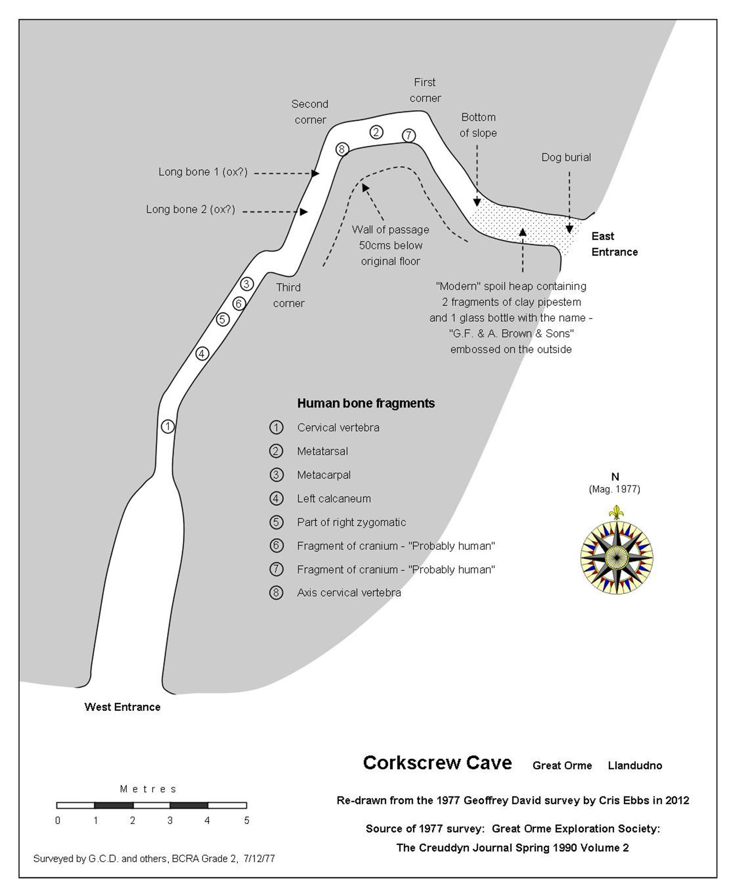
A single passage less than 1m in width and up to 1.5m high connecting two entrances.
Excavated by Geoffrey David and pupils of St.David’s College in 1977 when human remains were uncovered.
The human remains were all identified by Mel Davies between 1977 and 1985.
As the remains were found in 'packed earth - not clay', Geoffrey David suggests that they may have originated in clays at the entrance area, subsequently being disturbed and moved by animals further into the cave (David 1990).
The
passage walls are described (by David 1990) as being rough and unlike
normal cave passage with no signs of clay deposits or a speleothem
floor.
Drive
up the only road from Llandudno town that leads to the summit of the Orme
following the tram track. Turn off to the left and park
somewhere near SH772825.
A few metres further is a gate providing access to the open hillside. Immediately through the gate turn left (east). Follow the wall for perhaps 50 metres, dropping to the east, and the East Entrance is in a small rock outcrop off to the right.
Primary references:
David, G.C. (1979) Archaeology in Wales, 19.
David, G. C. (1990) Little Holes for Little People. Journal of the Great Orme Exploration Society, Vol. 2.
Archaeological
NGR: SH77278240
SMR: 5033
Excavation: St David's College, Llandudno, 1977
Curation: ?
Burials: 1+
Finds: animal bones
Date: unknown (5)
Source: http://caveburial.ubss.org.uk/wales/wales.htm

----------------------------------------------------------------------------------------------
Dead Rabbit Cave
(
Little Orme)
SH 8135682462 +/-12ft (2012)
Archaeological (human)
Also known as Letterbox Cave
Discovered 1959 by John Blore.
Excavated 1961 by John Blore (who named the site Dead Rabbit Cave).
Excavated 1978 by Geoffrey David (mistakenly naming the site Letterbox Cave).
The entrance is at the southern end of an
overhanging cliif-face and is almost 1.5 metres wide. A low crawl leads to two
chambers. At the northern end, a small rock-chimney rises to the surface
above.
In 1961 a small sample of soil from beneath the chimney was
excavated by John Blore who found the remains of Small Ox and Roe Deer.
Further excavations took place in 1978 by Geoffrey David and the pupils of St. David's School, Llandudno. Mel Davies examined the bones and identified them as Red Deer, Ox, Sheep, and Fox.
Several human bones were also found below a stalagmite floor, belonging to an individual aged about 17-25.
The entrance to this Cave is well-concealed under a large 10 metre long overhang, in a rock escarpment east of the summit of the Little Ormes Head.
(Source: Personal communication with John Blore 2012)
-------------------------------------------------------------------------------------------------
Double Entrance Cave
(Little Orme) NGR not yet known
A cave first seen by boat by Mel Davies in 1974 who describes it as: "Double-entrance cave, the lower one reachable by climbing".
---------------------------------------------------------------------------------------------------
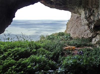
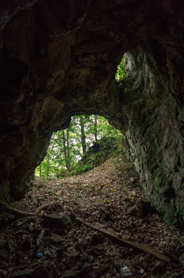
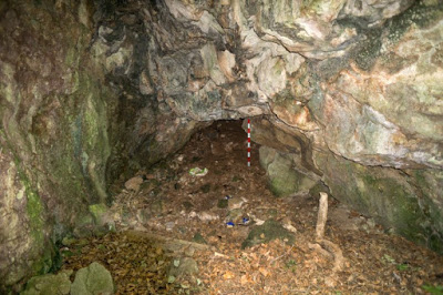
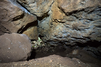
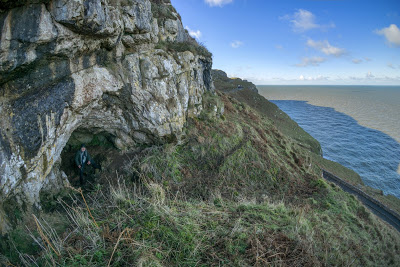
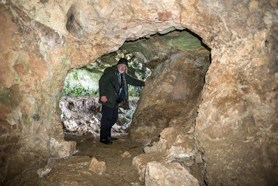
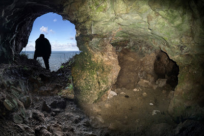
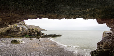
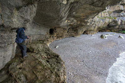
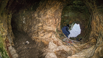
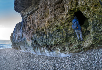
Dutchman's Cave (Ogof Ellmyn) (Great Orme) SH78008390
A sea cave having a large entrance but very little internal extent.
The end of the cave can just be seen in the third photo below.
---------------------------------------------------------------------------------------------------
Dyniewaid Cave
(Little Orme) SH81708274 Length 2m
"It received two days of careful excavation in May 1974 when we pushed it to 7ft and 3ft deep, but the trench only revealed a fox's den".
(Source: Davies, M. NWCC N/L No. 220, Feb. 1996).
--------------------------------------------------------------------------------------------------
Ede's Cave (Great Orme) Grid Ref not yet available
An oval entrance first noted from a boat by Mel Davies in 1972. “An abortive attempt was made to enter the cave from above by D. Ede in 1973. This brave attempt failed as he missed the cave by about five yards during a 120ft descent. Ede was only with difficulty rescued from the incoming tide. D. (Duncan) James laddered to it but the 45ft used was too short. It was now seen that the cave was only a deep rock shelter".
Nearby cave:
Another cave is described as: "A round, small cave just above and west of No.4 (Ede's Cave) reachable by ladder".
Source: Mel Davies, NWCC newsletter 17, 1974
NB Neither cave is accessible from above without full climbing equipment.
---------------------------------------------------------------------------------------------------
Elephants Cave (Great Orme) SH78008290 Length 90m
A natural cave intersected by the mining of a large chamber at Happy Valley Quarry.
“Happy Valley Quarry ceased work in 1897. Elephant Cave dig, in right wall of first cavern, a dog-leg passage leading to outside cavern. Brenda’s Stream Passage in right wall, backing onto the two houses Ardwy Orme and Glain. ‘Builders Grave’ a slit in the ground leading to the second cavern, collapsed by Dante Roberts then owner of Tyn-y-Coed Quarry. These are parts of the Elephant Cave system, a theory put forward by D.Jones in the 1970s, this system would include Ogof Haner Dydd”
(Source: Journal No 1, Goes, 1998).
In the right-hand wall of Happy Valley quarry (Chwarel y Fach). A few metres west of the western edge of Haulfre Gardens.
-----------------------------------------------------------------------------------------------------
Hornby Cave (Great Orme) SH75118419
"Named after the wreck of the Brigantine Hornby. It's sole survivor, John Williams was
thrown ashore from the bowsprit to the rocks in 1824 during the early hours of the morning of New Years Day. Somehow in the darkness he managed to scale the cliffs in a dazed condition and at five in the morning crawled into a mine smithy near the cliff tops. The miners doubted his tale until dawn broke and the remains of the brig could be seen. He forsook the sea and became a local copper miner. An entrance 20' high 15' wide leads to a 25' long cave [at low water] and a 40' high rift leads to the surface".
(Source: Bannerman, Diane & Nigel. The Great Orme Explained (2001). Available on-line: http://www.nbannerman.co.uk/The_Great_Orme_Explained.pdf
The
entrance is 20ft high x 15ft wide. The cave extends for 25ft with a 40ft
rift to daylight above. There are no passages off.
"It is little wonder that when the brig 'Hornby' struck the cave in a storm she foundered and was lost with all hands except one who was flung onto the rocks above the cave apparently from the rigging and was saved".
Abseiled from above by Duncan James in 1974,
the landing is in deep water in the centre of the cave. A dry landing can only
be made from a boat to a ledge inside the cave on the right-hand side,
but this is only exposed at low tide +/- 1 hour.
(Source: Mel Davies, NWCC Newsletter 17 1974).
NB Not accessible from above without full climbing equipment.
Nearby cave:
Mel Davies describes: "An arched sea-cave about 80 yards east of Hornby Cave directly under a pronounced gully to the top of the cliffs. There was a gravel beach exposed inside the cave at low tide, but no way on".
(Source: Mel Davies, NWCC Newsletter 17 1974).
---------------------------------------------------------------------------------------------------
Kendrick's Cave
, Lower
(Great Orme)
SH7798282813 +/-9ft
Archaeological (human)
Designated a Scheduled Ancient Monument No. CN191 (also includes the upper cave)
See also Kendrick's Cave Upper, below
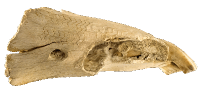
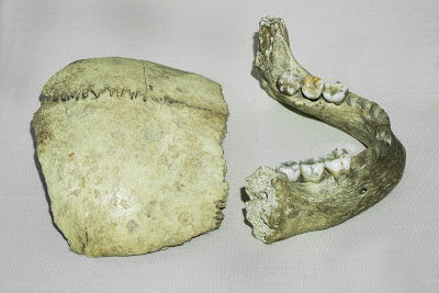
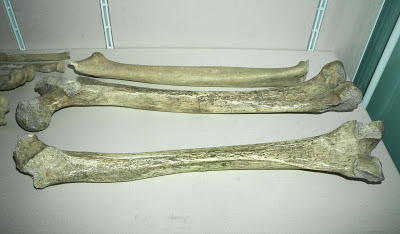
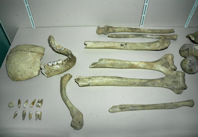
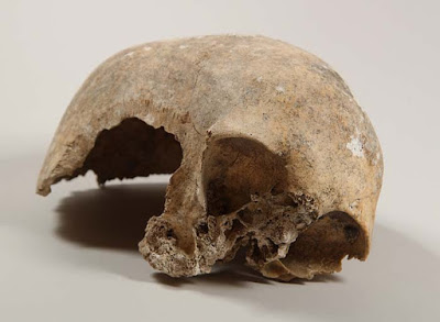
Kenrick's Lower Cave fronted by a Victorian summerhouse, is where Thomas Kendrick in 1879 or 1880, found the remains of three human adults and one child together with bones of bison and other animals.
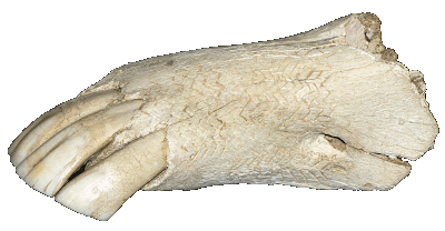
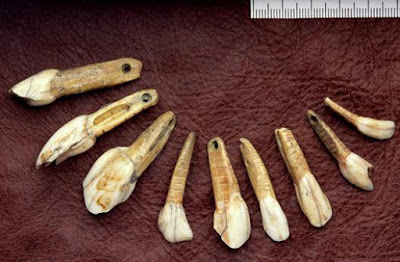
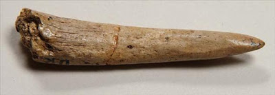
He also found Wales's oldest artwork, a horse's lower jaw (mandible) C14 dated between 12,000 and 13,000 years old.
The entrance lies behind the summerhouse in
the garden Ardwy Orme, a residential property close to the tram station. Access is not normally possible, and additional consent would be required from Cadw.
The 2015 Project
Funded
by Llandudno Town Council, C.R Archaeology carried out test excavations at Kendrick's Cave.
Although the excavation work was undertaken in the Upper cave, the report also researched the histor
y
of both lower and upper c
aves and that of Thomas Kendrick. This extensive research is described in the report by archaeologist Catherine Rees.
It draws together
all primary documentary sources, including the normally-overlooked caving club
publications and the amateur excavation reports of Mel Davies and Tom Ston
e. It also provides some clarification regarding conflicting accounts about the cave and Thomas Kendrick.
T he following information ( in this colour ) is taken from th e report. D irect quotes are in italics ......
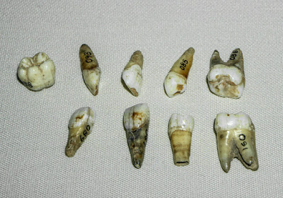
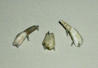
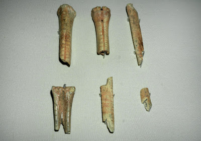
Despite some earlier published opinions, the initial finds were all made inside Kendrick's Lower Cave , including the engraved horse mandible, four human burials, pierced bear teeth and a smaller teeth necklace.
Early primary documents confirm that the discoverer of the human bones was Kendrick himself (a s evidenced in papers by Boyd Dawkins and Eskrigge in 1880). This was disputed in several subsequent secondary accounts, but the author of the 2015 report (Catherine Rees) describes the reason for this as being "class or academic snobbery, and it would appear that many of the later sources all suffer from this bias". It is clear that Kendrick was well aware of the archaeological importance of his finds, and it was he who brought the finds to the attention of professional archaeologists. In fact, Kendrick left a number of bones in situ, sticking out of the cave deposits, and it was in this condition that they were first examined by Boyd Dawkins and Eskrigge.
Kendrick spent many years adding to his collection of bones and other artifacts, many of which were sourced from the surrounding area. But just four months after his death in December 1897, his sister Anne offered the collection up for sale. Although the horse's jaw bone was among the first items to have been sold (to a Dr. F. Dally of Birmingham), much of the collection was purchased at that time by Llandudno Public Library committee for the sum of £120. It was noted however, in an article of 1907, that the collection then was "not as complete as when submitted to Professor Boyd Dawkins". It was hoped that a museum could be established in the town, but the money was not forthcoming at the time. Plans to extend the library and display the collection there also failed to materialise.
In 1932 a number of items from
the original library collection were being auctioned
at
a private house and
contents sale at Glynllivon Park, Caernarvon. How they came to be in private
hands remains a mystery.
T
he horse's jaw bone
and a few other Kendrick's items must have been sold on by Dr. Dally, as thankfully, they
were purchased by the British Museum in 1956 from a Mr J.R. Wright who had
purchased them from a shop in the Worcester area. By 1971, the Llandudno Library collection
was described as being "a fraction of the size when originally
purchased". The collection is now held by Llandudno Museum and "brings
together the known surviving pieces"
. It includes the engraved horse mandible, at last returned to Llandudno in 2014 from the British Museum.
In recent years a number of bones from Kendrick's Cave have been carbon dated, the dates of which are stated as:
- Engraved horse mandible (2 samples): 12,950 - 11,950BP
- Three humans (4 samples): 11,760 - 12,090BP
- Bison: 12,410 +/-100BP
- Decorated bone tally: 11,795 +/-65BP
Isotope analysis was also carried out on the human bone which showed that only "around 30% of their dietary protein was obtained from marine sources".
The summerhouse of Kendricks Lower Cave was not erected by Thomas Kendrick, as stated in several sources, but about 30 years after his death by the family of the current owners, using the frontage taken from a local bank.
Source: U npublished report describing both the Upper and Lower caves: "Upper Kendrick's Cave, Great Orme, Llandudno " (2015) by Catherine Rees of C.R. Archaeology, funded by Llandudno Town Council.A much shorter account, based upon that of 2015 was published in 2017: "Recent Archaeological Investigations at Upper Kendrick's Cave, Great Orme, Llandudno " by Catherine Rees and George Nash [Proceedings of University of Bristol Spelaeological Society, 2017, 27(2), 185-196].
Archaeological:
NGR: SH 7798 8281 (slightly different to the NGR above)
SMR: 635
SAM: Cn 191
Excavation: Kendrick, 1879-1880
Curation: British Museum, London; Llandudno Public Library; Rhos on Sea Museum, Colwyn Bay; National Museum of Wales, Cardiff.
Burials: 4+ (3 adult, 1 child)
Finds: Polished stone axe and knife, flint flakes, worked bone and teeth, animal bones
Date: ? Neolithic (4)
14C: 10,000 bp (OxA-111) on worked animal bone
Source: http://caveburial.ubss.org.uk/wales/wales.htm
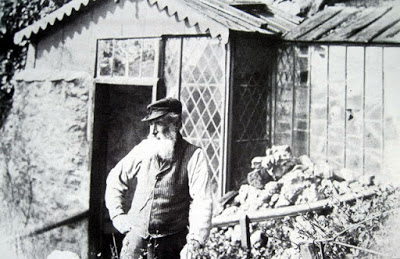
Thomas Kendrick - Miner and lapidary
Thomas Kendrick was born
Thomas Cynric in 1821, being the oldest of four children. His father
William worked in the local copper mines, but died when Thomas was 14. The four
children and mother Ann were then sent back to Ysceifiog, the birth-place of the
father, the Poor Law Commissioner for Ysceifiog giving Ann a sum of money in
1836.
In the 1851 census, Thomas and one of his brothers are shown to have returned to Llandudno where they were working in the copper mines. They had by this time changed their surname to Kendrick. They lived at what was then known as 4, Dan-yr-Ogof Cottages. Further census reports show that by 1871, Thomas had changed his occupation from copper miner (with occasional agricultural work) to lapidary: He scoured the beach for stones that he polished and sold to the growing number of tourists; numbers boosted by the arrival of the railway around 1858.
Intending to use a
cave in his garden as a workshop, in 1879 or 1880 Kendrick began enlarging it
by excavating its deposits. During the process he found ancient human remains
and the now-famous decorated horse mandible. Recognising their importance,
Kendrick informed professional archaeologists, resulting in visits from
Eskrigge & Dawkins. The finds were displayed at the entrance to the cave
for the many visitors.
Profits from tourism
allowed him to purchase the Great Orme’s camera obscura for which he charged
visitors a fee of 2 pence.
Thomas Kendrick died in 1897 at the age of 76 and is buried at St. Tudno’s Church, on the Great Orme. He never married and had no children. He left the substantial sum of £436 to his sister Anne.
This information is taken from “Thomas Kendrick – Llandudno’s Cave Ma n” (2014) by Cleanth Jones. This website is grateful for his kind permission to reproduce it here. For information on the privately published booklet, e-mail the author at: cleanthjones@gmail.com
Another account of Thomas Kendrick can be found in "Rhiwledyn and Little Orme: Historical and Social Survey " by Kenneth Dribble, 1995).
Links:
Read a feature on LLANDUDNO MUSEUM by the BBC : http://news.bbc.co.uk/local/northwestwales/hi/people_and_places/history/newsid_8326000/8326792.stm
See article on the caves 12,000 year old engraved horse jawbone; "The oldest work of art from a Welsh cave":
http://heritageaction.wordpress.com/2011/11/20/wales-the-kendrick%E2%80%99s-cave-horse-jawbone/ Several photos of the cave can be seen here: http://www.themodernantiquarian.com/site/7895/kendricks_cave.html
Photo: Courtesy of Catherine Rees, archaeologist
Photo: Courtesy of Catherine Rees, archaeologist
Photo: Courtesy of Catherine Rees, archaeologist

Photo: Courtesy of Catherine Rees, archaeologist
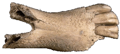
Photo reproduced with the kind permission of Llandudno Museum
Two side views of the same mandible photographed in Llandudno Museum in 2016
Reproduced with the kind permission of Llandudno Museum
Reproduced with the kind permission of Llandudno Museum

Photo by courtesy of John Lawson Reay
Source: http://threetownsforum.co.uk/forum/index.php?topic=1290.0
-------------------------------------------------------------------------------------------------------
Kendrick's Cave, Upper
(Great Orme)
SH7798282813
+/-9ft
Archaeological (human)
Designated a Scheduled Ancient Monument No. CN191 (also includes the lower cave)
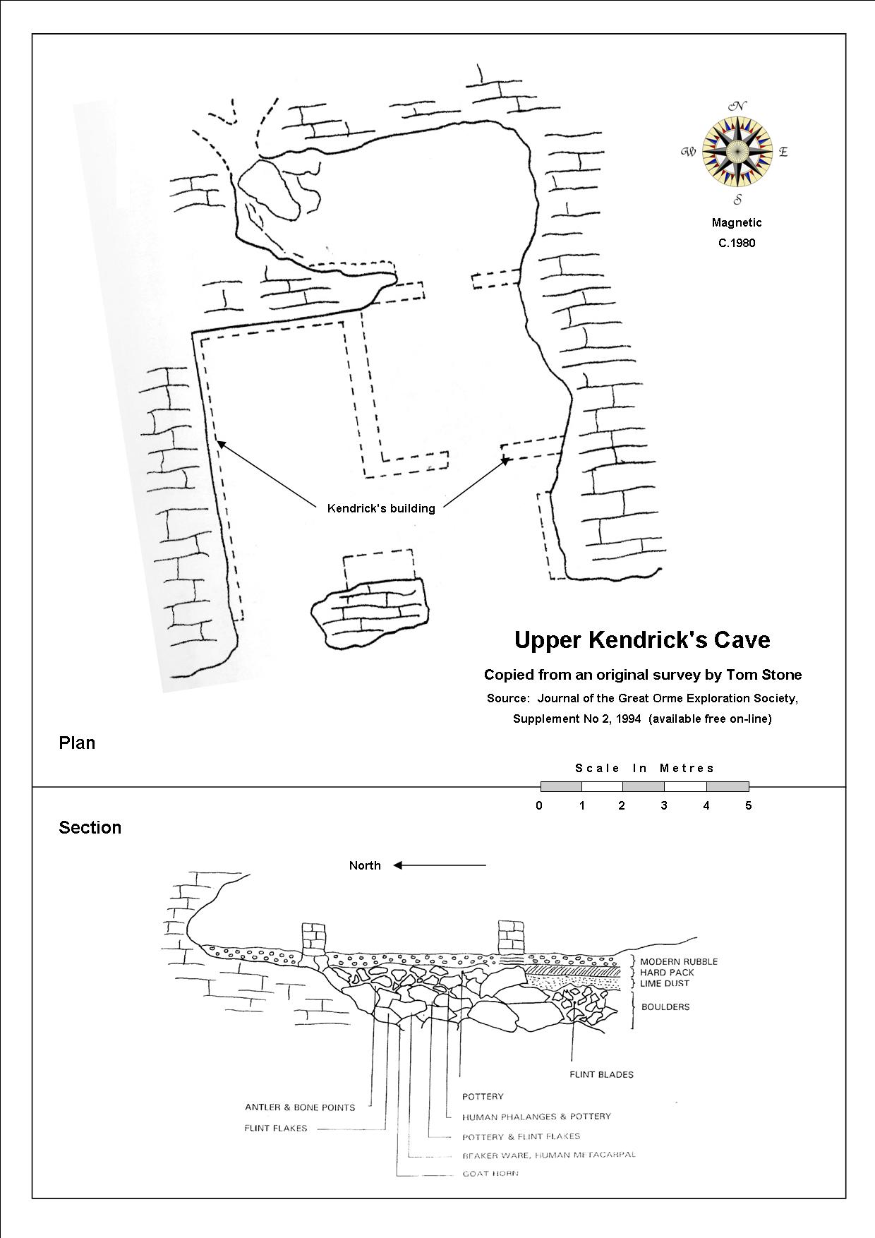
A
single chamber 11m wide by 14m from entrance to rear of cave. It has two south-east-facing entrances, the most westerly entrance having been enlarged by blasting.
Stone walls once existed inside creating four small rooms, but only parts of their foundations now remain.
The cave lies about 8 m directly above Kendrick's Cave Lower, situated on a south-east-facing slope of the Great Orme and accessible by a short walk from the nearby road. Approach the cave from the west across waste land lying just above the road.
2015 Project
For over four decades the cave was neglected by professionals, being used for human habitation and contaminated with excrement, discarded hypodermic needles etc.. Consequently in 2015, Llandudno Town Council funded a project that now protects the caves remaining deposits by the installation of grilles across the two entrances. The project also produced a fascinating report on the cave and Thomas Kendrick, a few details of which are reproduced below.....
Although the caves early history is not known, the first recorded excavations were carried out in 1974, 1977, 1978 and 1979 by Mel Davies and Tom Stone. Finds included scattered human remains, three bone points, several stone pot boilers, a well battered hammer stone and charcoal. An unpatinated flint knife and several waste flakes were also found below a stalagmite floor.
A building was constructed in front of the entrance to the upper cave by Thomas Kendrick (not to be confused with the Victorian summerhouse fronting the lower cave) . No trace of this now remains but it is shown in a photograph within the report. The building was used to entertain visitors but was removed some time between 1888 and 1901.
Excavations by Mel Davies and Tom Stone had to be halted in one area when a draught rising from the floor of the upper cave indicated the proximity of a 9m high aven in the roof of the lower cave.
Unexcavated deposits were deliberately left untouched by Mel Davies and Tom Stone, hence the cave still contains material for future excavation. The report notes that the area to the rear of the cave still retains " significant archaeological potential ".
The 2015 report rightly acknowledges that "
of particular note are the excavations led by Mel Davies and Tom Stone during the 1970s, the results of which are key in highlighting the wealth and significance of the archaeological resource of the caves of the Llandudno area
". It adds that their excavations at the cave "
were carefully conducted, and are well documented - particularly for their era, and the stratigraphy is recorded in detail
".
It is good to see that the 2015 report recognises Davies and Stone men for their excavations at the cave and for their published works, when so often in the past they have been wholly ignored and marginalised by local professionals.
Source: Unpublished report: " Upper Kendrick's Cave, Great Orme, Llandudno " (2015) by Catherine Rees of C.R. Archaeology, funded by Llandudno Town Council. Available as a PDF here: http://www.walesher1974.org/her/groups/GAT/media/Non_GAT_Reports/CRArchaeology_report_CR1142015_compressed.pdf
For clarification regarding confusion over the upper and lower caves, and where the most important artifacts were found, please see the entry for Kendick's Cave Lower, on this page.
PDF download:
A
brief primary source by Mel Davies describing the excavation work
from 1974 to 1977 is available as a free PDF download at the very
bottom of this page (as 'Mel Davies Report.pdf')
Primary sources:
Davies, M., AW, 15, 1975; NWCC, 60, December 1977.
Stone, T. A. 1977/78 Excavations at Upper Kendrick's Cave. An original report scanned from his notebook by Sue Chapman of ancient-arts.org is now on-line: http://www.ancient-arts.org/upper%20kendricks%20cave.pdf
Davies, M. & Stone, T.A., WPCST, 31, March 1978 (with figures).
Davies, M., AW, 18, 1978; AW, 19, 1979; WPCST, 32, February 1979, pp 7-9; Studies in Speleology , 1983, IV, 45-52, The Excavation of Upper Kendrick's Cave, Llandudno; Studies in Speleology , 1988.
Stone, T.A. & Davies, M., AW, 17, 1977.
Gillespie, R., et al . (1985). Radiocarbon dates from the Oxform AMS system. Archaeometry Date list 2, 27 part 2, 237-46.
Rees, Catherine (2015)
Upper Kendrick's Cave, Great Orme, Llandudno. Unpublished but available as a PDF (see link above under 'Source').
Archaeological
NGR: SH 7800 8284
SMR: 5029
SAM: Cn 191
Excavation: M. Davies, 1977-79
Curation: National Museum of Wales, Cardiff
Burials: 1 (adult)
Finds: Peterborough & Beaker pottery, flint blades, flakes & knife, antler & bone points, hammer stone, RB pottery, marine shells, animal bones
Date: Neolithic or EBA (4)
Source: http://caveburial.ubss.org.uk/wales/wales.htm
Gating protects the archaeological deposits that lie a metre or two below floor level

--------------------------------------------------------------------------------------------------------
Little Orme Sea Cave & Pot SH81648276 Depth 150ft
Also named on a 1910 postcard as "The Devil's Cave". See link below
A vertical pothole, claimed to be the deepest natural shaft in Wales in 1974.
At low tide a descent from the top entrance to the shingle beach inside the large sea cave measures 150 feet. The entrance to the pot measures 8ft x 5ft. After the first 15 feet, the descent is entirely free-hanging.
Explored in 1974 when it was described as:
"Sea cave. Entered
(by boat)
and found to have a fine shaft upwards to daylight about 150ft above. Apparent chamber and rifts leading off from the shaft. The shaft top was later noted
using binoculars".
More to find?
"The climb (down) was spectacular as the shaft quickly opens into a chamber 20ft wide but over 60ft long. Neither we nor Duncan (Duncan James) could see the end of this chamber stretching inland into blackness and it may be possible to climb into it from about the 120ft level via a clay slope. On the surface the far side of the shaft has a stalagmited false floor of glacial drift and it is possible that the sea has undermined a large rift-type cave".
"At low tide the landing in the shaft would be on the shingle beach dimly lit by daylight filtering through into the sea-cave.......... (but)........It is certainly not safe to try and reach the chamber by climbing after alighting from a boat".
Directions of top entrance: "Locate the ruined brick tower on the northern extremity of the Little Orme. In front of it, facing the Isle of Man, are two gullies and the pot is in the vertical western one about half way down. Access is only feasible via the eastern gully. Drop a 120ft rope (to approach the entrance) as a handline or abseil rope over the slope into the eastern gully. There is a short vertical stretch on this descent, for which 25ft of ladder can be used. Then traverse out of the gully using a lifeline for 40ft into the other gully arriving at the lip of the pot. There is just standing room for party and tackle at the edge; belay from pitons. Boat access is only possible at low tide +/- 1 hour".
(Source of above in italics: Mel Davies, NWCC Newsletters 17 and 19 1974).
Warning:
Not accessible from above without full climbing equipment.
If life-lining the pot, communication with the person on the ladder is
very difficult because of the noise of the waves below and echoes in
the cavern.
Exploration is not advised during June and July because of disturbance of nesting sea birds.
A 1910 postcard showing the cave at low tide can be seen here: http://threetownsforum.co.uk/forum/index.php?action=media;sa=item;in=804
--------------------------------------------------------------------------------------------------
Lloches-yr-Afr
(Great Orme)
SH77828385
Archaeological (animal only)
Not a cave, but merely the remnants of a rock shelter beside Marine Drive, where remains of hyena and other animals were found.
Mel Davies's excavations at the site demonstrate the first signs of human occupation during the Mesolithic, about 8,000 years BP.
Excavated 1973-1974 by Mel Davies and others. The excavation was inspected by the Ancient Monuments section of the Department of the Environment. Help with identification of bones and pottery were provided by UCNW.
(Source: Mel Davies, NWCC Newlsetter 19, 1974).
"A thermoclastic scree base layer indicating deposition during the cold climate and containing a few bones probably crunched by hyena, was overlain by a soft, calcite powder containing mesolithic flint. The calcite was believed to be the equivalent of stalagmite in other caves. Above the calcite was brown cave earth showing intensive occupation with successive hearth layers containing limpet shells, bone fragments (some burnt), and identified pottery".
(Source: Davies, M. NWCC N/L No.35, 1975).
(Source: Mel Davies; Cave Archaeology in North Wales, in Limestones & Caves of Wales, 1989).
Primary sources:
Davies,
M., AW, 13, 1973; AW, 14, 1974; NWCC, 12, November 1973; NWCC, 13,
December 1973; NWCC, 19, July, 1974; SWCC, 1978, December 1974; WPCST,
24, January 1975 (with photographs)
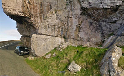
Photo: Google Street View
-----------------------------------------------------------------------------------------------------
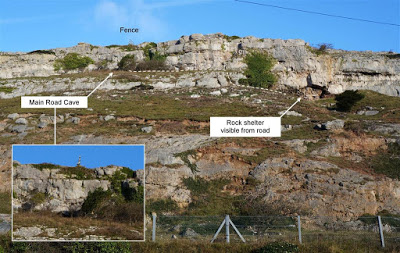
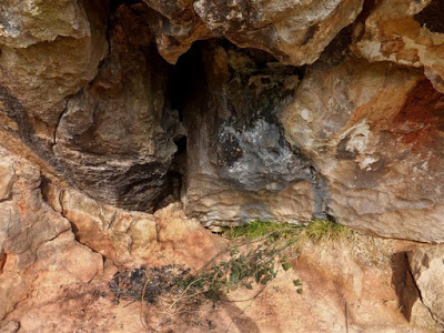
Main Road Cave (Little Orme) SH81258220
(Also known as Colwyn Road Cave)
A tight tube having a floor of clay.
Excavated by Mel Davies & Duncan James in 1974 without finding archaeological remains.
The
rock shelter visible from the road may also be of interest. Clay
deposits block what could be a filled passage and scallop marks in the
rock (shown in the photo) indicate once-flowing water.
Access:
Take the public footpath (for the Little Orme) from the gate beside the
main road, but veer off to the left when almost at the same height as an
obvious large rock shelter. The photo above marks the approximate route
to the cave entrance from the rock shelter, as a dotted line.
-----------------------------------------------------------------------------------------------------
Miriam's Cave (Great Orme) SH76418250
A small cave beside Llandudno's Marine Drive occupied for many years by Isaac and Miriam Jones, who raised 13 children there.
The family were forced to move out during the widening of Marine Drive.
What little remains of the cave today lies behind a garage beside the road and has not been seen by the writer.
The 1861 census shows that Isaac aged 50 lived in the cave, that he was married and his occupation was boatman.
The 1871 census shows just Miriam and five children living in the cave.
The 1882 Gossiping Guide records that the family were evicted from the cave when the new Marine Drive was built, and that she "had given birth to, and reared thirteen children in it, and was far happier there than in her present civilized habitation".
At the age of 91 Miriam was making a living by selling refreshments to visitors walking around Marine Drive.
She died aged 92 in 1910 when her story was widely reported.
Source:
U
npublished report: "Upper
Kendrick's Cave, Great Orme, Llandudno
" (2015) by Catherine Rees of C.R.
Archaeology, funded by Llandudno Town Council.
This account was found on an Internet forum:
Miriam was a remarkable woman, she lived in a cave which I believe
was on the old maps as Gogarth cave and the cave is now hidden by the
garage door in St Petrocks. The cave was in the way for the construction
of the Marine Drive but Miriam refused to leave the cave unless Mostyn
Estates gave her a cottage which they did. She ran a business from the
cottage called Gogarth Tea Rooms and the remains of the cottage are
still there.
I pass it often when I walk around the Orme and the kitchen tiles are still there and well preserved.
Source: http://threetownsforum.co.uk/forum/index.php?topic=471.110;wap2
------------------------------------------------------------------------------------------------------
North Face Cave
(Little Orme)
SH81548268
(John Blore)
Archaeological (human)
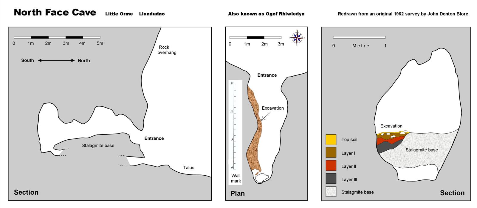
A very narrow passage leads to a small chamber within 30 feet. This has a sloping stalagmite floor and is dry but draughts (Source: Mel Davies NWCC n/l 15, 1974).
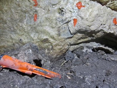
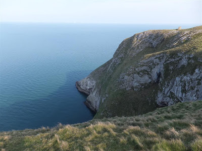
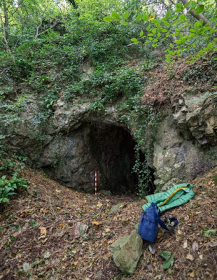
The entrance to the cave is well-concealed beneath a large flowstone curtain at the base of a large overhang. Access to the cave is very precarious and can only be made down a steep grass bank that ends in a sheer drop some 80 metres above the sea. At the time of excavations a narrow sheep track skirted around a rock out-crop to where the entrance could be seen above. The sheep track no longer exists and the entrance can't now be seen from above.
The difficulties of access are highlighted in this 1960s account by John Blore:
The cave was first named in 1959, as North Face Cave by John Blore, who excavated the cave between 1962 and 1976, finding hominin remains of four individuals.
A further small sample was excavated by Mel Davies in 1974 when further hominin remains were recovered from a speleothem floor, belonging to an adult.
Confusingly Mel Davies renamed the cave Ogof Rhiwledyn, explaining his reasoning thus: "Blore called this North Face Cave but, as there are other caves on the Little Orme cliffs, we changed the name" (Source: Davies, M. NWCC N/L No. 220, Feb. 1996).
NB This cave should not be confused with Printing Press Cave which was surveyed in 1962 (survey: Coflein Cat. No. C409110) but mistakenly entitled "Ogof Rhiwledyn" by Douglas Hague of RCAHMW. Some subsequent secondary sources therefore conflict. An explanation of the confusion is given under Printing Press Cave on this page.
Updates
2015:
Nick Jowett examined the site and found that someone had
disturbed
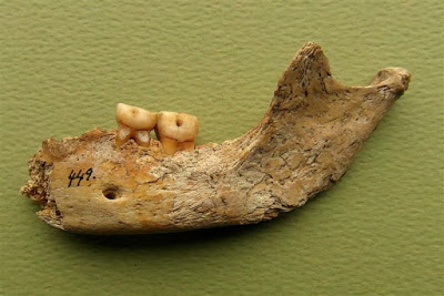
deposits at the back of the cave. Protruding from the top of the disturbed ground he spotted teeth (see photo). They were part of a human maxilla and may represent the upper jaw of the mandible found by John Blore many years ago belonging to a child aged 10 - 12. The finds are on display at Great Orme Mines (http://www.greatormemines.info/).
Nick has had the maxilla carbon dated to 3,365 - 3,178 BP with an accuracy of 95% (SUERC-62072).
2017:
John Blore has produced a nine page report giving Radiocarbon dates and more recent information of the finds from the cave. It is available simply by registering on the Academia.edu website: https://independent.academia.edu/JohnBlore With John's kind consent, the PDF is also available by clicking the link at the very bottom of this page, entitled: 'Radiocarbon date: North Face Cave'.
2018
: John Blore has gifted his collection of North Face Cave artifacts to Great Orme Mines, who now therefore hold the entire collection.
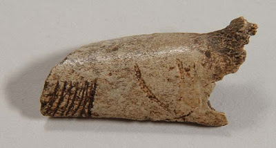
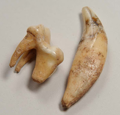
Maxilla as found (just visible at end of torch) Photo: Nick Jowett
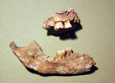
The 2015 maxilla (above) and John Blores Mandible Photo: Nick Jowett
Archaeological:
SMR 5067
Excavation J D Blore 1962-1976
Curation Wallasey, Wirral.
Burials 4 individuals: 4 years of age; 8/9 years; 10/12 years & 18 + years
Artefacts Amber bead, slate tools, antler tool and pot boilers
Date Early Bronze Age (Beaker)
C 14 -
A
Bronze Age
human femur found in the cave is held by the National Museum of Wales. It has been C14 dated to 2878 +/-37 BP (Acc. No. 2000.50H/1)
Primary sources:
Davies M. (1973) AW, 13.
Davies M. (1974 ) NWCC 15.
Blore J D. (1977) 'Preliminary Report on the North Face Cave' (in "Excavations on the Little Ormes Head") 1977.
Blore J D. (2012) 'Archaeological Excavation at North Face Cave Little Ormes Head 1962-1976 (Updated 2012)'.
NB Not accessible without full climbing equipment and by those experienced in its use
North Face Cave Photo: John Blore
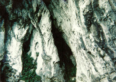
North Face Cave lies in these exposed cliffs and cannot be seen from above
------------------------------------------------------------------------------------------------------
Ogof Abaty
(Great Orme)
SH77208228
Length 9m (?)
The entrance is 1m wide by 2m high, but becomes smaller before leading to a small chamber. First named as Ogof Abaty by Robin Griffiths.
(Source: GCPC, Ogofa 2, 1994 by Robin Griffiths).
The walls are covered with small nodules. It has a dirt floor and contains some rubbish.
(Source: Journal No 1, GOES, 1998).
----------------------------------------------------------------------------------------------------------
Ogof Arth (Bears Cave) (Great Orme) SH7692582305 +/-15ft Archaeological (animal only) ?
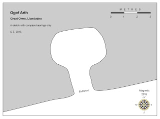
A small chamber about 3m in diameter and almost 2m in height with no redeeming features except the view over the breakwater.
Several shot-holes can be seen in the walls and roof, indicating significant modification by mining in search of minerals. Remaining mineral deposits can be seen around the walls.
The cave is unusual in that much of the roof and walls are festooned with old, dusty spiders webs. These do not belong to the common cave threshold spider, Meta Menardi, but another species presumably attracted by the mineral deposits. At the time of the visit a hornet flew in and appeared to feed on the deposits.
Although Neolithic animal remains are said to have been found here, a trial excavation could prove the caves archaeological potential.
(Visited by the writer Dec. 2015)
Neolithic animal remains were found in the cave, which was inhabited in the early 1900s by a Liverpudlian farm labourer to whom Lady Augusta donated a bed. Also used as a scout hut in 1960 until they were driven out by the smell of goat (Source: Journal No 1, GOES, 1998).
---------------------------------------------------------------------------------------------------
Ogof Bys (Great Orme) SH7691582360 +/-15ft
A small cave with archaeological potential, having unexcavated deposits lying below a speleothem floor.
The deceptive entrance appears to reveal simply a tiny rock-shelter, but just a metre or so inside, it is possible to stand, and the passage becomes 4 to 5m in width. The passage seems to continue ahead as a crawl (can anyone provide further information?).
A 1m x 1m hole has been excavated in the south-eastern corner to reveal the thickness of the speleothem floor and the underlying stony deposits.
(Visited by the writer Dec 2015).
For location photo, see 'Ogof Arth' above.
Access is possible by climbing the footpath at the far north end of West parade, passing beneath Ogof Arth, but this involves several contour lines.
An easier approach is to drive up the road towards the summit of the Orme, but turning off and parking somewhere near SH772825. A few metres further is a gate provides access to the open hillside. Walk south-west, dropping down about 15m to skirt the first limestone outcrop. Follow this outcrop to the west passing two caves until the outcrop dies away. Continue about 100m further looking for a rough footpath that doubles back and descends to the next outcrop below. The cave lies a few metres ahead.
Poor photo, but shows the speleothem floor and the crawl ahead
-------------------------------------------------------------------------------------------------
Ogof Caseg (Great Orme) SH75398408
Mare's cave
"10m from the road, a small chamber 3ft x 3ft x 3ft with dirt fill on the left that could be removed".
(Source:
Bannerman, Diane & Nigel. The Great Orme Explained (2001). Available on-line: http://www.nbannerman.co.uk/The_Great_Orme_Explained.pdf
-------------------------------------------------------------------------------------------------
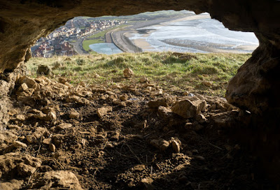
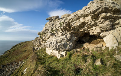
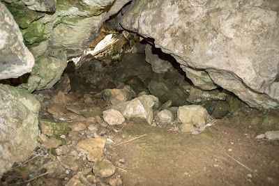
Ogof Defaid (Sheep Cave)
(Great Orme)
SH7708882402 +/-3m
Also known as Lady Butler's Cave
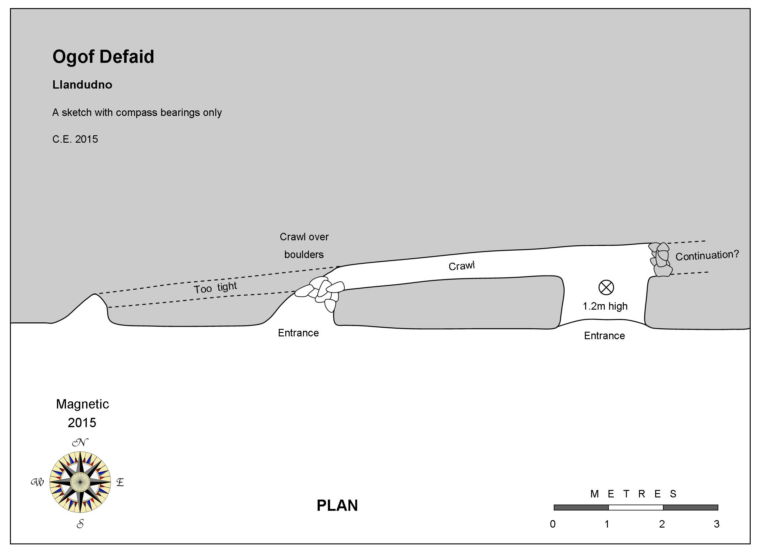
A small entrance with a crawl off to the left. This leads back to surface after a crawl over boulders. The crawl can be seen to continue towards a third entrance, but is too small.
The survey above suggests that the passage may possibly continue eastwards beyond the clay and boulder blockage.
(Last visited by C.E. Dec 2015)
Drive up the road towards the summit of the Orme, but turning off and parking somewhere near SH772825. A few metres further at the end of the road, is a gate providing access to the open hillside. Walk south-west, dropping down about 15m to skirt the first limestone outcrop. Follow the outcrop west, passing Bedding Plane Cave, and Ogof Defaid lies about 50m further west.
----------------------------------------------------------------------------------------------------
Ogof Deg
(Great Orme) Awaiting a grid reference
The description below suggests the existence of an intermittently active resurgence (or mine?). If confirmed, this would be the only active cave known on the Great Orme…..
“Found on 12 June 1993 (after the Great Flood). This is of unknown possibilities, but from the amount of water that comes out after heavy rain, this could be the best hope of the big one. This is into hard limestone and I understand would be filled with glacial debris, stones and clay. It was completely hidden by boulder clay until this was washed away during the rainstorm of 10 June 1993. The conglomerate and clay overhanging the entrance is in an unstable condition. With a bit of effort one can get into the entrance and look into the tunnel. I would suspect one sees the phreatic tube at the top of the tunnel and the main tunnel is loosely filled with glacial spoil. Walking away from the entrance large blocks of tufa have been dislodged and rounded boulders are lying around. This may mean the original tunnel running through the boulder clay has collapsed with the volume of water coming through the tunnel ”.
(Source: Journal No 1 of GOES, 1998).
----------------------------------------------------------------------------------------------------
Ogof Detritus, Lower
(Little Orme)
A cave or rock shelter about 2m wide which peters out into narrowing rifts after 3m. First documented by Nick Jowett of Great Orme Mines in 2015.
Although of little interest speleologically, being close to North Face Cave, the site could have archaeological potential.
See entry for Ogof Detritus, Upper (below) for a location photo.
----------------------------------------------------------------------------------------------------
Ogof Detritus, Upper
(Little Orme)
A roomy rock shelter 20m wide and 2m in height ‘becoming more cave-like to one side’. First documented by Nick Jowett of Great Orme Mines in 2015.
The upper and lower caves are in a cliff known to climbers as ‘Detritus Wall’. One of the original climbing routes from sea level to the top of the cliff is called Detritus and has a final belay in the upper cave.
A drone video of the cave entrance by Nick Jowett can be seen here: https://www.youtube.com/watch?v=r9dMXI5tMK8
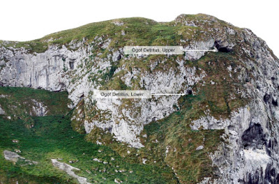
Locations of upper and lower caves Photo: Nick Jowett
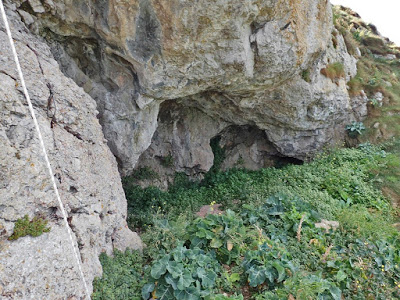
Photo: Nick Jowett
---------------------------------------------------------------------------------------------------
Ogof Deuben (Great Orme) SH77628295
A fossil cave of standing height, although it quickly pinches out after just 5m.
Directions: Driving up the Great Orme, follow the tram tracks to the first steep bend to the right. Park here. The cave lies in the obvious lower scarp opposite, and a vague footpath can be followed to the right, skirting the outcrop. The path passes beneath a couple of cave-like recesses in the cliff, but continue a little further to the entrance of Ogof Deuben, which is accessible after a 2m climb up.
(Source: Journal No 1, GOES, 1998).
View from Ogof Deuben
Ogof Deuben entrance
View from Ogof Deuben
----------------------------------------------------------------------------------------------------
Ogof Dyniewaid
(Little Orme)
SH81708274
A low arch excavated to a depth of a metre lowering to a crawl.
Archaeologically excavated in 1974 by Mel Davies & Duncan James, without finding archaeological remains.
"Cave near Porth Dyniewaid. Small entrance high in the cliff"
(Source: Davies, M. NWCC N/L 17, 1974).
"A small cave facing the sea on the Little Orme. It received two days of careful excavation by D. James and myself in May 1974 when we pushed it to 7ft and 3ft deep, but the trench only revealed a fox's den".
(Source: Davies, M. NWCC N/L No.220, 1996).
“A small cave situated on the headland to the west of Porth Dyniewaid was examined by Mel Davies in May 1974. The cave entrance is on a narrow platform in the cliff formation, extending into the limestone for a short distance before closing down to a narrow fissure. The only materials recovered were modern bones consistent with the cave being used as a fox den”.
NB May only be accessible from above with full climbing equipment (?).
----------------------------------------------------------------------------------------------------
Ogof Gan Mwd
No references have been found for this cave. But see location map here: https://en.mapy.cz/zakladni?x=-3.8345426&y=53.3289598&z=17&source=osm&id=149254757
One of three tabs shows a helpful location map.
----------------------------------------------------------------------------------------------------
Ogof Gloddaeth
SH8037480767
+/-15ft Length: Approx 80 metres
Named after Gloddaeth Hall, now St Davids College.
An interesting cave first thought to have been explored in the 1960s or '70s by caver-cum-teacher Geoff David of St. David's College, and then in the late 1980s by Chris Jowett, also from the college.
In September 2016, Chris Jowett and pupils of the college decided to take a closer look at the site. The cave has been partially exploited by miners and comprises a 6m fixed ladder descent from the entrance, followed by another fixed ladder climb leading to three roomy chambers and terminates at a narrow pot 6m deep at the caves lowest point.
The site was used as a well, thought to have supplied the estates gardens: A brass pump remains in situ at a depth of about 14 metres below surface, but is partly buried beneath modern debris fallen from above. A small concrete sump has been constructed underground to supply water for the pumps inlet.
It appears that the cave was examined by miners some time before the pump was installed, perhaps by ancient miners, although no evidence has yet been found to confirm this. No mineralisation has been found, but a stalagmite floor up to 0.6m thick has been partially removed from the main chamber. A thick layer of laminated clays lies beneath a speleothem floor. The clays may be suitable for paleomagnetic chronology dating.
Full assessment of the site has begun in order to address some unanswered questions: The geological origin of the site is unclear. It appears to the writer that extensive dissolution has taken place in the cave, which may have been created hydrothermally. But this is only conjecture and requires inspection by a qualified geologist.
The entrance is gated and locked.
As the cave is a bat roost, access must be restricted to the period of May to September.
Access details or further information: Contact Chris Jowett of St David’s College.
---------------------------------------------------------------------------------------------------
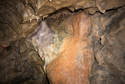
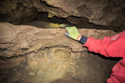
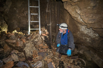
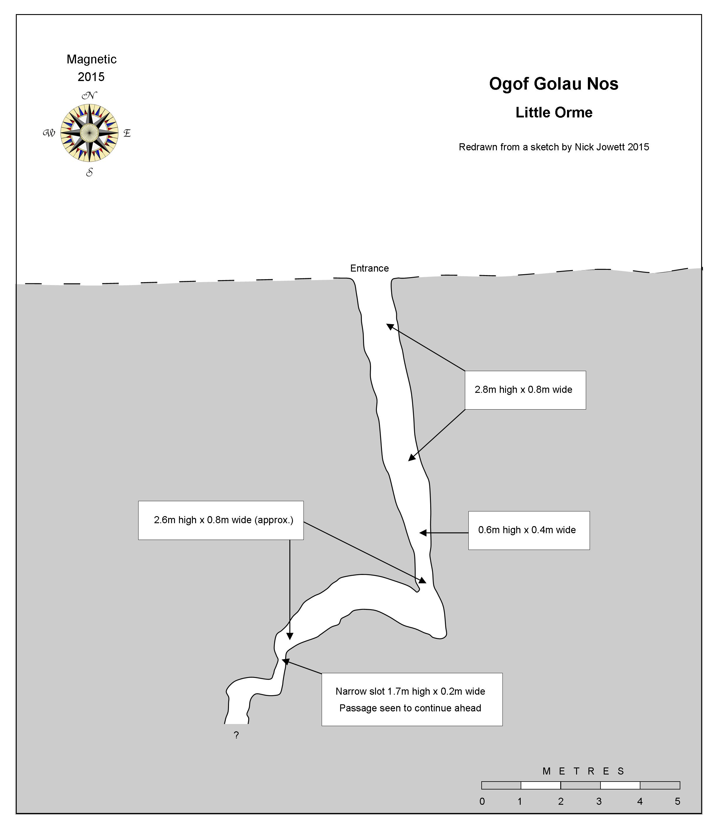
Ogof Golau N
ô
s
(Little Orme)
Length: 16m
Named after a climbing route known as "the wall of evening light".
A winding rift passage about 0.8m wide and 2m high. First documented in 2015 by Nick Jowett of Great Orme Mines.
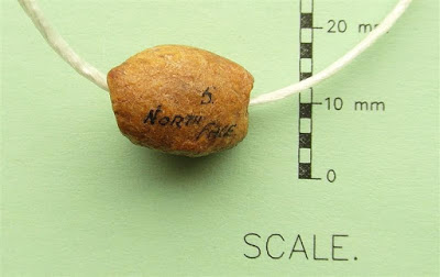
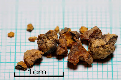
Nick Jowett excavated a small test pit down to bedrock in 2015 at a depth of about 0.3m. The spoil was taken away for washing, sieving and close examination. It contained two fragments of pottery, possibly Bronze age, and what appear to be tiny fragments of amber (see photos).
A cave of interesting archaeological potential.
---------------------------------------------------------------------------------------------------
Ogof Goleudy Gogarth NGR not yet known
Awaiting description.
Mentioned by Mel Davies who describes another two caves nearby:
The first: "A cave which appears to be very difficult of access and situated some 100 yards east of Ogof goleudy Gogarth. It is fronted by a great overhang".
The second: "A cave on a grassy ledge exactly below Ogof Goleudy Gogarth. It is not well viewed from below as it lies about 80ft above HWM (high water mark). It is on the second ledge below the patch of Hedera helix (Common or English ivy) and 200ft east of it"
(Source: Davies, M. NWCC N/L No. 17 1974)
----------------------------------------------------------------------------------------------------
Ogof Gwylan (Great Orme) SH75548426 Alt: 65m
The cave lies 3m up a vertical cliff-face. The entrance overlooks a steep grass slope at the base of which is a long vertical drop down to the sea. Was not entered in 1994 but the entrance appeared to measure 6ft x 4ft. Directions: After passing the lighthouse, just below the second limestone terrace.
(Source: GCPC, Ogofa 3, 1994 by Robin Griffiths).
“A steep path leads down from the car park towards the sea. The entrance is 3m up a sheer wall in the second from top limestone terrace ”.
(Source: Journal No 1, GOES, 1998).
NB May not be accessible from above even with full climbing equipment.
---------------------------------------------------------------------------------------------------
Ogof Hafnant (Great Orme) SH76408428
In a bay about 100 yards across, the entrance is 20ft high and less than 20 feet wide just above the high tide mark, but it “obviously doesn't go''. Difficult to access but it can be reached using a 120ft rope attached to a piton from above, to a ledge just 10ft above the beach. The beach is only exposed on the two lowest tides of the year. The entrance is encrusted with tufa deposits.
(Source: Mel Davies, NWCC newsletter 4, 1973)
For a sketch of its cliff-face location, see under Ogof Tudno below
NB Not accessible from above without full climbing equipment.
----------------------------------------------------------------------------------------------------
Ogof Haner Dydd (Great Orme) Length 30m SH78148376
Midday Cave
At 12 noon on the 21st March and the 21st September the sun shines directly into the mouth of the cave.
(Source: Journal No 1, GOES, 1998).
A short distance east of Dutchman's Cave.
---------------------------------------------------------------------------------------------------
Ogof Llech (Great Orme) SH75508435
Also known as Hiding Cave or The Monk’s Cave
Listed as Llech Cave on Coflein database
A natural recess in the cliff-face modified into a grotto by the addition of stonework. It measures about 2m in height and 2m in diameter. A weather-worn human face was carved into the rock outside the entrance, but this is now difficult to identify.
An early Welsh poem dated 1683 mentions the cave and its 'new' stonework. The earliest graffiti is dated 1718. The stonework has been analysed by the BGS as sandstone from quarries at Gwespyr.
A small fresh water spring (trickle) passes through the cave.
Possibly used as a monks cell, a footpath connected it to Gogarth Abbey
at one time [Wm. Ashton 'Evolution of a Coastline' page 190, 1920].
During the 1920s a dentist, Mr Hopper, often fished from 'Hopper's Rock.
While attempting to improve the path he uncovered steps already cut
into the rock.
(Source: Journal No 1, GOES, 1998).
The path to the cave used by Mel Davies and the writer in 1975 has now collapsed and is impassible: The result of a huge landslip following very heavy rains.
NB Access to the cave is now only by boat or with the aid of climbing equipment.
More on the history (or legends) of Ogof Llech can be found here: http://www.greatorme.org.uk/coast.html
.... and in: Nigel & Diane Bannerman (2001) "The Great Orme Explained".
Based upon research in recent years by George Hillier, Nigel Bannerman suspects the dressed stonework within the cave to date from 1300 or so (Pers. comm 2016).
Mel Davies at Ogof Llech 1975
----------------------------------------------------------------------------------------------------
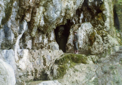
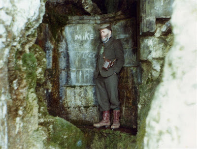
Ogof Pant-y-Wennol
(SW of Little Orme)
SH80828161
Length 9m
Archaeological (human)
Designated a Scheduled Ancient Monument
No. CN190
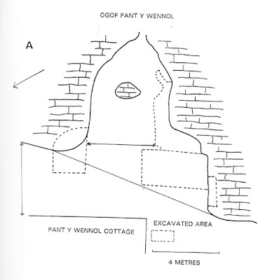
Taken from Great Orme Exploration Society journal, available on-line: http://www.goes.org.uk/assets/Journals/1994_GOES_Journal_2.pdf
An important archaeological cave site having an entrance 4m wide by 2m high. The roof soon lowers to a 5m long crawl which becomes too tight.
The cave was first identified as Palaeolithic by amateur archaeologist Duncan James in 1974.
Subsequent excavations by amateur archaeologists Mel Davies, Tom Stone and others revealed bone of rhinoceros thought to be around 22,000 years old, and Neolithic human remains.
The accumulated rubbish that has for many years littered the cave was finally removed in September 2021, by the owners Mostyn Estates. The cave now appears to be in good condition with the majority of its en situ deposits undisturbed. Despite its importance as a Palaeolithic cave site, no professional excavation has taken place since the work by amateur archaeologists in the 1970s. The cave still contains large quantities of unexcavated deposits.
From the main road near Little Orme, drive along the country lane known as Bodafon Road. Immediately before a village school, take an even narrower road off to the left. Follow this up the hill behind the school, and look for a parking spot after a hairpin bend. Walk from here, following the road a little further until it ends at a house. Here, take the obvious footpath off to the left. After a few metres, pass through a metal swing-gate, then turn left. After perhaps 50m, a small clearing gives a fine view over Llandudno. The cave lies directly below this point, but is best reached by following the path a little further, looking for a place to scramble down into the wooded area below. Descend for about 15m and the entrance lies off to the left.
Archaeological notes:
An account of the complete works was published by Mel Davies in 1978 in the Transactions of the Penmaenmawr Historic Society
.
Human crania were C14 dated in 2002 by Dr. Rick Schulting, providing the date of 3,940 - 3,655 BC.
"Stable isotope analysis was also carried out and interestingly the values were characteristic of a diet based almost entirely on terrestrial sources, with very little fish or shellfish consumed, despite the proximity of the site to the sea".
(Source:
U
npublished report: "Upper
Kendrick's Cave, Great Orme, Llandudno
" (2015) by Catherine Rees of C.R.
Archaeology, funded by Llandudno Town Council).
Fragments of four adult skeletons and two children were found above a stalagmitic false floor, and Mesolithic flint tools were found beneath it.
(Source: Davies, M. NWCC N/L No.35, 1975).
In 1975 the cave yielded an astragalus of rhinoceros, probably from the left leg. This was confirmed by two experts from Manchester Museum; Dr. R.M.C. Eagar and Dr. D. Yaldon. Comparisons of the bone and deposits with similar finds suggests an age of around 22,000 years.
(Source: Davies, M. NWCC N/L No.32, 1975).
"This cave, with an entrance 12ft wide and 6ft high, is so well hidden in the woods near Llandudno that no one knew of its existence until D. (Duncan) James and D. Jones stumbled across it last year. It also happens to be on private property behind an old cottage....... the cave goes on as a low crawl for about 15ft and the continuation from there is a tunnel now almost filled with gravel or clay".
(Source: Davies, M. NWCC N/L No.19. 1974).
Discovered by Duncan James in 1974 (the amateur who first proved by C14 dating that Llandudno's copper mines were worked in the Bronze age, despite being ridiculed by some professionals at the time).
Excavated by Duncan James and Mel Davies 1974-77. They were joined in 1975 by Tom Stone and K. Mason who did not lead the excavation.
(Sources: Davies, M. NWCC N/L No.220 Feb. 1996) and
Dribble,
Kenneth
"Rhiwledyn and Little Orme: Historical and Social Survey
" 1995.
The cave yielded undisturbed deposits indicating occupation in Mesolithic and Neolithic times. Significant areas remain undisturbed within the cave and at the entrance platform for future excavation. Human remains and bones of woolly rhinoceros, horse, reindeer and hyena were found. Mel Davies published several reports in NWCC newsletters from 1974, but these have been superseded by the source below.
(Source: Mel Davies; Cave Archaeology in North Wales, in Limestones & Caves of Wales, 1989).
Finds of Mesolithic and Neolithic date recorded in addition to a bone needle characteristic of the Creswellian period.
(Source: Coflein database: RCAHMW)
As well as the human crania above, C14 dated to around 5,800 BP, the National Museum of Wales holds further dated human bone:
Crania (acc. No. 2000.49H/233): 4982 +/-36 BP
Crania (acc. No. 2000.49H/234): 4962 +/-32 BP
Crania (acc. No. 2000.49H/235): 4657 +/-32 BP
Primary sources:
Davies, M., AW, 14, 1974; NWCC, 19, July 1974; NWCC, 21, September 1974; NWCC, 24, December 1974; SWCC, 77, September 1974; SWCC, 78, December 1974; AW, 15, 1975; NWCC, 32, August 1975;NWCC, 35, November 1975; SWCC, 81, December 1975;WPCST, 25, September 1975 (with plan); AW, 16, 1976;
WPCST, 28, January 1977; WPCST, 29, July 1977.
Stone, T.A. & Smith, B. (1979). AW 19, page 12.
Archaeological
NGR: SH 8082 8161
SMR: 4570
SAM: Cn 190
Excavation: M. Davies, 1974-77; T.A. Stone & B. Smith, 1979
Curation: National Museum of Wales, Cardiff
Burials: 7 (5 adults, 2 children)
Finds: Neolithic & LBA pottery; Mesolithic flint & chert scrapers, flakes, & blades; bone needle, animal bones
Date: Neolithic or EBA (4)
Source: http://caveburial.ubss.org.uk/wales/wales.htm
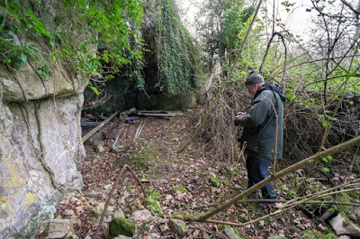
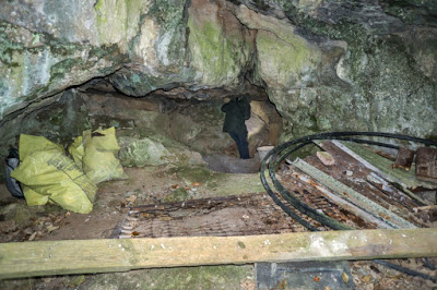
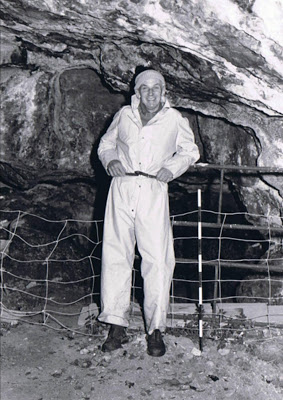
Photo courtesy of Sue Chapman, of Ancient Arts.
Reproduced with the kind permission of Llandudno Museum
Reproduced with the kind permission of Llandudno Museum
Reproduced with the kind permission of Llandudno Museum
----------------------------------------------------------------------------------------------------
Ogof Pen Trwyn (Great Orme) SH78118368
The writer has only found one reference to this cave; a photo of the entrance about 40m from Ogof Haner Dydd: http://www.geograph.org.uk/photo/4642647
----------------------------------------------------------------------------------------------------
Ogof Rhiwledyn (Little Orme)
The entry for this cave has been moved. It can now be found above, under its original and correct name of North Face Cave
----------------------------------------------------------------------------------------------------
Ogof Sinmai
No references have been found for this cave. But see location map here: https://en.mapy.cz/zakladni?x=-3.8345426&y=53.3289598&z=17&source=osm&id=149254757
One of three tabs shows a helpful location map.----------------------------------------------------------------------------------------------------
Ogof Tan-y-Bryn
(Great Orme)
SH79948160 Length 12m Archaeological (human)
Designated a Scheduled Ancient Monument Ref: CN 204

The cave lies within the garden of Tan-y-Bryn Care Home.
A large entrance passage/chamber reduces in width and height after 5 metres or so, to where a 1m high scramble up a slope enters a chamber about 3m x 3m and 4m in height.
This end chamber has a roof of compacted conglomerate, and may not be far from the surface above.
Amateur archaeological excavations in the 1970s by Duncan James and Mel Davies proved the cave to be of archaeological importance, it being used by humans around 12,000 years ago.
Large quantities of undisturbed deposits remain, and the cave therefore holds significant archaeological potential.
One or two places in the cave may lead to further passage, but requires some work.
(Visited by the writer October 2018)
Access: Permission should be obtained from the home before visiting the cave, which is rather obscured by vegetation and lies about 15m above, and overlooking, the car park.
The following are extracts from early primary sources:
Initially several flints and bone fragments were found by Duncan James "two of which were recognisable tools"...........
"The entrance faces north-west and is 3.4m wide, 3m high in the middle, and the passage is lofty for 5.5m. The stratification was simple - 10 to 20cm of disturbed, brown earth underneath the leaf litter, lying directly on an undisturbed, stony, yellowish-brown silty clay containing the flint and bone. The flint is completely patinated and the blunted-back blade is of Upper Palaeolithic origin".
(Source: Davies, M. NWCC N/L 30, 1975).
A preliminary examination was carried out in June 1974 by Duncan James of Conway and Mel Davies. This and further work in May 1975, showed that about 2m depth of deposits including clay, earth and stalagmite, had been removed at some time in the past, possibly as a source of garden soil. A brief one square metre trial excavation 20cms deep in the entrance yielded eight patinated flints with hacked bone fragments from large animals, contained in an undisturbed, silty clay. Two of the flints were clearly Creswellian tools (approx 12,000 years BP – ed).
Mel Davies published several reports in newsletters from 1975 (see list below), but these have been superseded by: Mel Davies; Cave Archaeology in North Wales, in Limestones & Caves of Wales, 1989.
A north-west-facing cave 3m high 3.4m wide and lofty for 5.5m.
An
examination of 1m square area near the entrance revealed that 2m of
deposits had already been removed. Patinated palaeolithic flints
suggested undisturbed deposits remain. The rear of the cave appears
undisturbed, and the presence of a now blocked pothole in the ceiling - a
former animal trap? - suggests the cave has great potential
(Source: Coflein database: RCAHMW, although the entry makes no reference to the primary sources by Mel Davies above, from which their information derives).
Primary sources:
Davies, M., AW, 15, 1975;
Davies, M., NWCC, 30, June 1975;
Davies, M., SWCC, 81, December 1975.
Davies, M,. Cave Archaeology in North Wales, in Limestones & Caves of Wales, 1989 .
----------------------------------------------------------------------------------------------------
Ogof Toddion
No references have been found for this cave. But see location map here: https://en.mapy.cz/zakladni?x=-3.8345426&y=53.3289598&z=17&source=osm&id=149254757
One of three tabs shows a helpful location map.
--------------------------------------------------------------------------------------------------
Ogof Tudno
(Great Orme) Main entrance: SH7642984164 +/-12ft Archaeological
(Also known as Badger's Cave and Ogof Pryf Llwyd)
One large entrance, two small entrances and a 40ft deep shaft comprise Ogof Tudno.
Although some passages clearly resemble natural caves, it is possible that the entire cave results from the ancient mining of mineral-rich 'flats' or 'pipes'.
The main (most westerly) entrance is about 3m x 3m and leads to a series of passages.
Ogof Tudno Shaft (the most easterly) was excavated to a depth of 40ft by Great Orme Exploration Society, although it appears that this work has not connected the shaft with the workings (?) associated with the other three entrances. The shaft top is protected by a locked metal grille. Details of the work with a series of photos, can be seen here: http://www.goes.org.uk/html/ogof_tudno1.html
Prior to the 1996 work by
Great Orme Exploration Society (GOES), e
xcavation work was also carried out by Tom Stone in the 1970s.
A three or four page description of the site is given by Nigel & Diane Bannerman in: "The Great Orme Explained" (2001) available online: http://www.nbannerman.co.uk/The_Great_Orme_Explained.pdf
Please note:
The site is thought to contain ancient archaeological remains. It is vital therefore, that no unauthorised excavation work is carried out. For further details contact GOES.
The age of the deposits is indicated on page 40 of 'The Great Orme Explained': "When the A.M.S. date finally arrived it was far older than expected, indicating that the charcoal was from a period several thousand years before copper mining was supposed to have occurred in this part of the world ".
Quotes from other sources:
“In 1976 T.A. Stone of Llandudno excavated a trench under an overhang just to the east of the cave’s main entrance. It revealed a connection with the main entrance and signs of limited occupation sealed by stalagmite. These comprised a hearth containing bones of sheep or goat, pig, hare, fox, fish and others, with numerous limpet and mussel shells. The remains were disturbed by badger burrowing, and it is clear from the coal and bottle-glass fragments that miners had cleared out the main entrance to provide access for their wheelbarrows during a search for copper ores. The system has a complex of interconnecting crawl-tunnels where further relics may yet be found” .
(Source: Mel Davies; Cave Archaeology in North Wales, in Limestones & Caves of Wales, 1989).
"A mine adit (possibly prehistoric) within a natural cave follows a copper vein for 40m. Miners deads are cemented with flowstone and stalagmitic formation. In places are hammer-stone marks on ore-bearing rock. Tom Stone reports finding a typical Bronze Age pointed bone mining tool approximately 25m from the entrance. Three metres to the left of the entrance, below a small overhang, a low passage runs east for 3m and ends at a sharp turn to the south".
(Source: Journal No 1, GOES, 1998).
Park on Marine Drive by a gate at SH7654884243. Walk up the hill towards the west (right), passing a mined trench leading to 'Un-named Cave 3', and the entrances to Ogof Tudno lie about 10m higher and 30 or 40m further on.
Primary sources:
Stone, T.A., AW, 15, 1975.
Davies, M., NWCC, 32, August 1975; NWCC, 35, November 1975.
Stone, T.A., AW, 16, 1976.
Bannerman, Diane & Nigel. The Great Orme Explained (2001). Pages 37-44 under the name of Badger's Cave. Available on-line: http://www.nbannerman.co.uk/The_Great_Orme_Explained.pdf
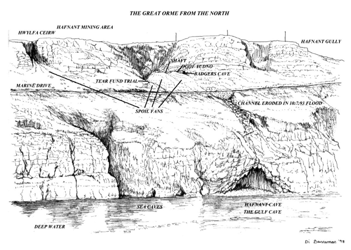
Area around Ogof Tudno and Ogof Hafnant, taken from "The Great Orme Explained" (see Primary references, above)
Reproduced with the kind consent of Diane Bannerman
Photos below taken in 2016.....
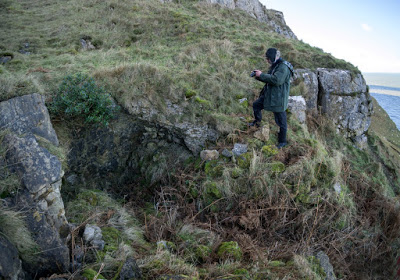
Location: SH7645184150 +/-12ft
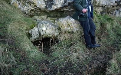
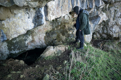
A third entrance just 3 metres east of the the main entrance
View from main entrance
---------------------------------------------------------------------------------------------------------
Ogof y Gaseg (Great Orme) SH75398408
(Mare’s Cave)
Small
entrance 10m from the road above the “Ffynnon Gaseg” signpost.
A crawl leads to a
small chamber measuring 1m long, wide and high.
Lies
about 200m north-east of the coastguard lookout
.
(Source: GCPC, Ogofa 2, 1994 by Robin Griffiths).
--------------------------------------------------------------------------------------------------------
Pigeon's Cave
(Great Orme) Width 30m SH7785983833
+/-15ft
(Ogof Colomennod)
A
typical sea cave, best described as a rock shelter. The overhanging roof is about 6m high.
Although merely a sea cave, the location has a certain magic. Seals sometimes rest on the shingle beach here, and there are several obscured small mine workings (in search of copper) at beach level. These entrances may be blocked by pebbles requiring just a few minutes work to gain entry.
Directions: Park on the cliff side of the road directly beneath a large overhang at
SH7793183884.
Directly opposite is a gap in the cliff wall where a descending footpath begins.
Follow the indistinct path down to a broad limestone shelf about 10 metres above sea level. Follow this shelf to the left for about 30m horizontally to where the tiny bay and rock shelter of Pigeon's Cave can be seen ahead.
The easiest route down to the shingle 'beach' is by continuing along the limestone shelf to where it narrows to about a metre wide beneath the overhanging rock. Just beyond this point is a small mine shaft in the floor of the shelf about 4 m deep (climbing gear or electron ladder and lifeline required). At the bottom is a step to the side where a further awkward free-hanging descent of 3m reaches the stony beach.
A single 25 foot electron ladder is sufficient to reach the beach from the shelf above. Two belay points are drilled into the rock 3 or 4 metres from the top of the shaft.
NB: The beach may not be accessible an hour or two either side of high tide (depending on the days tide height).
More mine workings
At
the bottom of the first 4m shaft, just off to one side, a blocked shaft was
discovered by GOES in 1986 and dug to a depth of of a few metres before
it flooded. It has since been filled in. Also at the bottom of the first 4m shaft, a blind
level runs southwards for 30 metres, partially filled with storm-washed
sand. Back at the top of the
4m shaft the ledge
(or shelf)
continues until it peters out. A traverse across regains the ledge
further on near another mine level about 10 metres long and curving to
the right.
"East
of the Pigeon's Cave on a broad ledge there is evidence of limestone
extraction which, by tradition, took place during the building of the
Cob, the Telford Suspension Bridge (1848) at Conway. Several large
blocks of limestone with shot holes can be seen"
(Source: Robin Griffiths).
---------------------------------------------------------------------------------------------------
Porth yr Helyg Cave (Great Orme) SH77468380
"The Great Orme Explained" (2001) by Diane & Nigel Bannerman refers to.......
“A very low washed-out bedding plane going back 2 - 3m. Which contains
stalagmitic gour pools formed by one of the calcium carbonate rich springs of Ffynnon Porth yr Helyg. SH 7746 8380.
Several springs are to be found at this location that appear to run quite strongly all year round”. Their fascinating report is available online: http://www.nbannerman.co.uk/The_Great_Orme_Explained.pdf
Porth yr Helyg Adit also lies nearby and is reported by the Bannermans to run for 274 metres.
----------------------------------------------------------------------------------------------------
Printing Press Cave
(Little Orme)
SH81418260
(as stated by John Blore)
Archaeological (human)
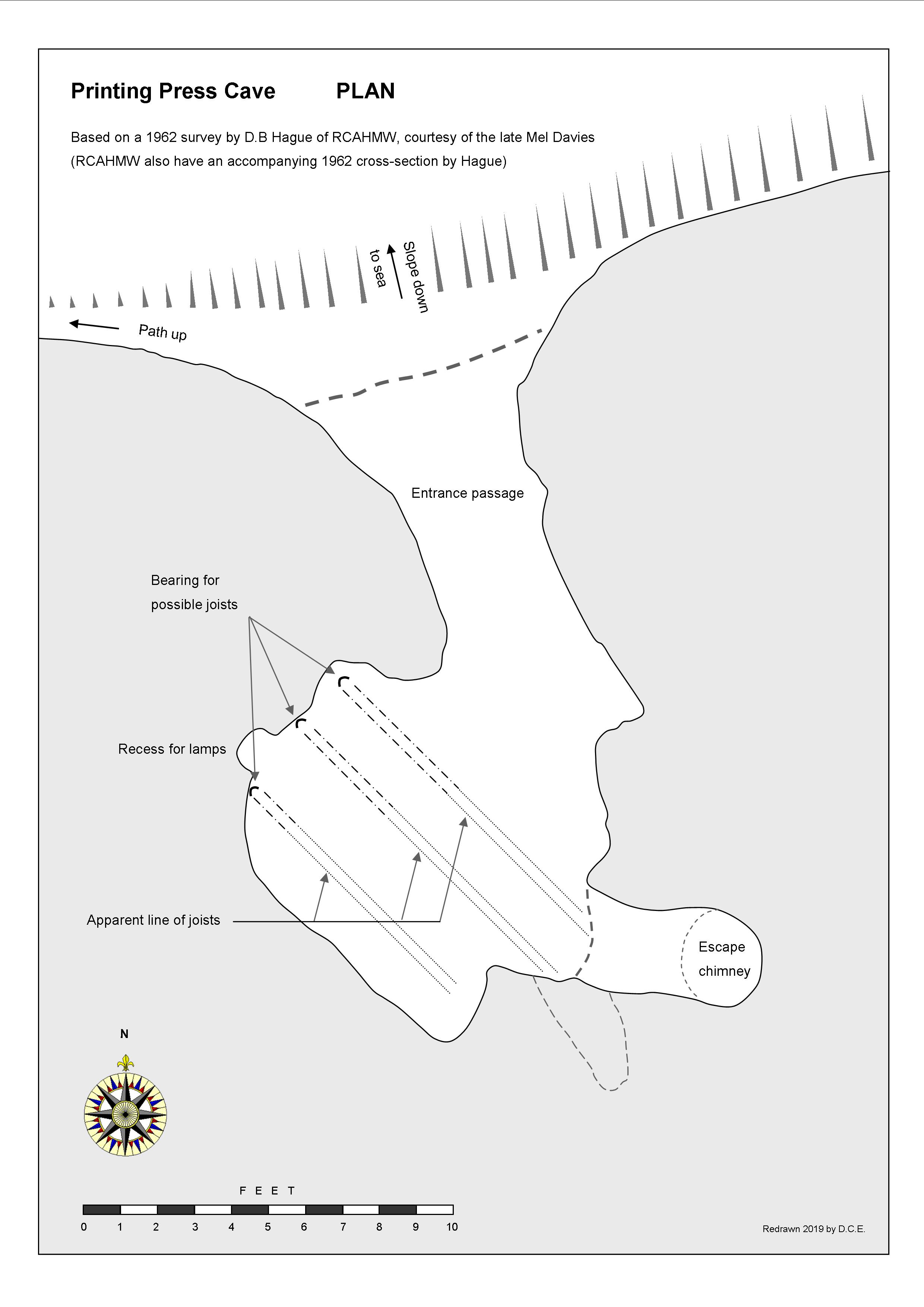
Re-discovered in 1959 by John Blore.
Excavated in 1961 by Douglas Hague of the Royal Commission on Ancient and Historic Monuments (See his account in "The Countryman" Winter 1962).
Excavated 1962-1963 by J. D. Blore.
The cave is situated in a gully 100 metres above sea level. A small, well-concealed entrance has a short passage that opens into a chamber 3 metres across. At the back of the cave is a small 'chimney' in the roof that opens in the cliff above.
Confusion over the naming of this cave may have occurred in 1957. John Blore explains: " Purely by accident I came across a paper with the minutes of the annual meeting of the Welsh Bibliographical Society in 1957. A talk was given by Dr. Geriant Gruffydd (Bangor University). His subject was Gwasg ddirgel yr ogof yn Rhiwledyn, the secret printing press and where it was. The part we are interested in roughly translates as, the cave in Rhiwledyn, the Welsh name for the Little Orme is Creigiau Rhiwledyn. At the time of his talk he was just referring to a cave in the Little Orme (Rhiwledyn) and not Ogof Rhiwledyn/Rhiwledyn Cave". Presumably the lecturer in 1957 was unaware of the location of the cave.
When Blore excavated the cave in 1962 he found evidence in the lower layers (450mm below the joist marks) of the butchered and cooked bones of Ox and Sheep. and the tooth of an 11/12 year old Child. In 1963 the cave was vandalised with the remaining soil deposit thrown over the cliff face. Blore recovered some of this material including a human tibia belonging to an adult.
Notes on Printing Press Cave
In 1586, the reign of Queen Elizabeth 1st life became difficult for local Catholics and magistrates were ordered to condemn any unlawful assembly of Catholics. Fortunately some of them were pre-warned of the impending danger and took refuge in a cave on the Little Orme. They remained there for about 9 months, and in that time managed to produce a small book on a press they had assembled inside the cave. The book. Y Drych Gristianogwal (The Christian Mirror) was possibly the first book ever printed in Wales. It is believed by Hague that Printing Press Cave was the cave the Catholics took refuge in and subsequently printed the book in.
(Source: Personal communication with John Blore 2012).
The cave is situated about 80ft below the cliff top and 300ft above the sea in a steep grass slope…… The cave opening, only two feet high faces north with an entrance passage 7ft long leading to the cave measuring about 10ft by 12ft with a roof rising to 12ft. Very little or no daylight would penetrate the interior. A feature of the cave was a 15ft shaft which could have formed an escape route for the occupants or possibly a chimney discharging or diffusing smoke from the cave.
The position of the cave and its dimensions are not at variance with the brief description of the clandestine printers hiding place by the magistrate, William Griffith, in his letter to the Archbishop of Canterbury of 1587 and the poem “Mawl Penrhyn” by Robert Pugh’s grandson, Gwilym Pugh in 1676. Mawl Penrhyn also attributes discovery of the printing press to smoke observed rising from a cave on the Little Orme.
NB Not accessible from above without full climbing equipment.
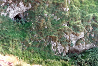
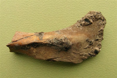
---------------------------------------------------------------------------------------------------
Skeleton's Cave
(Great Orme)
SH76708254
Length 9m
Archaeological (human)
A small cave where human remains were found embedded in stalagmite. These are now thought to be held by the National Museum, Cardiff.
"Neolithic skeleton found within, now in Cardiff. Gully between cliffs at the top of a slope with a large overhang, 3m up on the left a small entrance 1 metre by 1 metre. After 3 metres this intersects a larger mud-floored passage, choked to the right. Left continues down to a low termination. On the east side is what appears to be a choked passage. On the west side there is a small 40 x 40 centimetre entrance obscured by brambles. This extends for 3 metres. The floor is covered in snail shells. 10 metres to the west at the base of a cliff there is a small square shaped entrance about 40 x 40 cemtimetres and 2 metres long".
(Source: Journal No 1, GOES, 1998).
An 1860 report was published by a William Brown, to promote archaeological finds he had made at the cave. This is available as a PDF download at the bottom of this page under the title: '1860 Skeleton's Cave'.
Brown describes the cave thus:
“The dimensions of the cave at its entrance are about five feet in length, two feet six inches in height, and two feet from the front to the back part, where a passage resembling a chimney, not visible on inspecting the cave from the outside , rises and conducts at the height of three or four feet from the floor to a dark narrow cavity six or seven yards long descending towards the west, and another, which passes upward in an oblique direction towards the east, where the human bones were deposited. The men who made the discovery, were induced to search the dark inner cave, in which the human relics were found, by observing a rudely constructed wall at its entrance, consisting of stones put together without mortar or any other cement, according to the custom of the ancient Britons. The approach to the cave, which is situated about 350 feet above the level of the sea in the neighbouring Conway bay, is so precipitous as not to be accessible without difficulty, and the mountain above is nearly perpendicular”.
(Source: "An account of human bones found within the limestone mountain of the Great Orme's head at Llandudno, in North Wales" [1860] by William Brown). With thanks to Catherine Rees for supplying a copy, obtained from Conway Archives in Llandudno.
Drive up the road towards the summit of the Orme, but turning off and parking somewhere near SH772825.
A few metres further, at the end of the road, is a gate providing access to the open hillside.
Walk west, following the main footpath. after about half a mile, the outcrop containing the entrance can be seen as photographed in the first image below (at SH7684482431). It may be possible to avoid the direct steep scramble up, by skirting around the bottom of the outcrop from the right.
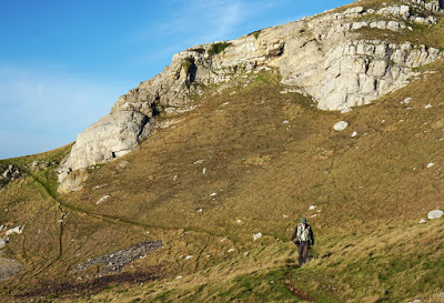
The cave lies at the highest point of the steep grassy slope behind a large overhang
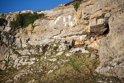
----------------------------------------------------------------------------------------------------
Smuggler’s Cave (Great Orme) SH76508435
Details not yet available.
(Source of NGR: Journal No 1, GOES, 1998).
----------------------------------------------------------------------------------------------------
Un-named Cave 1 (Great Orme) SH75118419 approx.
(near Hornby Cave)
An arched sea cave. At low tide a gravel beach is exposed, but no passages lead off.
The cave lies about 80 yards east of Hornby Cave and directly under a pronounced gully leading to the top of the cliffs.
(Source: Mel Davies, NWCC newsletter 17, 1974).
NB May not accessible from above without full climbing equipment.
----------------------------------------------------------------------------------------------------
Un-named Cave 2 (Great Orme) SH764843 approx.
(near Ogof Hafnant)
A cave at the eastern end of the small bay containing Ogof Hafnant . A great arch at sea level, a true sea cave, having a second entrance above with two passages leading off, each containing 'true stalactites' (as opposed to tufa deposits? – ed).
Because of the overhang, the cave can't be reached from above. Access requires a rigid extending ladder (or bolting, and the report doesn't mention if the cave can only be reached at low tide, as Ogof Hafnant -ed).
(Source: Mel Davies, NWCC newsletter 4, 1973).
-----------------------------------------------------------------------------------------------------
Un-named "Cave" 3
(Great Orme) SH7646384162 +/-9ft
Not a cave, but mine workings. The following from GOES......
"Tear Fund Trial (Geoff David)/Happy Birthday Trial/Llandudno North Adit.
The 120 centimetre high entrance closes down after 2 metres. There is a small hole in the floor covered in boulders. This can be descended by moving the boulders (replaced on exit) to drop into a mine level. It can be seen from within that the adit has had a wall built across it to prevent entry. A walking passage continues for about 10 metres to a deep shaft in the floor. Scaffold pipes have been laid across the shaft to a continuation of the level beyond. There are a few small natural solution cavities in various parts of the roof. Geoff David working with a party from St. David's school dug out the entrance and named the trial after the Tear Fund charity".
(Source: Journal No 1, GOES, 1998).
Ogof Tudno lie about 10m above and 30 or 40 metres to the west.
Park on Marine Drive by a gate at SH7654884243. Walk up the hill towards the west (right), and the entrance lies at the top of a mined trench, about 25m above the road.
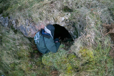
Entrance
View from entrance looking up towards Ogof Tudno
-----------------------------------------------------------------------------------------------------
Un-named Cave 4 (Great Orme) SH78158319
Item number 41 simply states 'Cave' with the above grid reference.
(Source: Journal No 1, GOES 1998)
-----------------------------------------------------------------------------------------------------
Un-named Cave 5 (Great Orme) SH76808234
"Ten feet down ending in a 'T' shape"
(Source: Journal No 1, GOES, 1998).
-----------------------------------------------------------------------------------------------------
Un-named Cave 6 (Great Orme) SH75578426
A small entrance lies 50m to the north-east of Ogof Gwylan and at the same height. May not have been entered as it require abseiling from above to gain access.
(Source: GCPC, Ogofa 3, 1994 by Robin Griffiths).
NB Not accessible from above without full climbing equipment.
------------------------------------------------------------------------------------------------------
Un-named Cave 7 (Great Orme) SH77618318
“Small square quarry, open one side with cave in the opposite wall to north. Back filled, with several possible crawls off”
(Source: Journal No 1, GOES, 1998).
Access information required.
--------------------------------------------------------------------------------------------------
Un-named Cave 8
(Great Orme)
Simply a sea cave formed by wave action, becoming too tight after no more than 4 metres.
Un-named cave close to the Grand Hotel
“Off Vivian’s Shaft at the Great Orme Mines is a crafty little system with a water-worn chamber and a rather good looking scalloped roof. This has been partly filled with mined waste and other debris. Its only access is approximately 10m down the shaft, hard to access, and needs a few days hard excavation to find its extent. The survey of this area would suggest that the system goes out into the Pyllau valley towards the Cromlech end, approximately under the new smelting hut. From the look of it, it seems this may be a contender for the longest cave system yet found”.
(Source: Journal No 1, GOES, 1998).
--------------------------------------------------------------------------------------------------
A short passage about 1.5m in height having an entrance at either end. Altitude 114m.
It does not appear to have been previously documented, hence provisionally named here as Watt’s Cave, after Mick Watt who kindly brought it to the website's attention in 2021. Please get in touch if already named.
Directions:
Follow the footpath from the main road at SH804821 for 300 paces. Here, a bench and 1.5m long boulder can be seen on opposite sides of the path. Looking back, a vague path can be seen rising west. Follow this for 100 paces to a stile. The cave can be seen in the outcrop ahead and to the right.
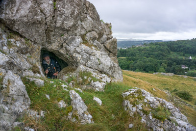
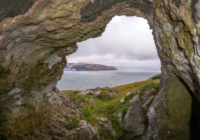
Further caves
It is thought that further undocumented caves exist around the cliffs of the Great Orme, most only accessible from above using rope techniques.
The late Mel Davies photographed many by boat in the 1970s, and explored several, but although he intended to document them all, it appears he never completed this work.
--------------------------------------------------------------------------------------------------
Index of Llandudno cave names
Badger Cave (see under Ogof Tudno)
Bears Cave (see under Ogof Arth)
Bedding Plane Cave
Blodwen's Fissure (see "Little Orme Fissure" on page 14: Lost & Non-caves)
Chimney Cave (see under Printing Press Cave)
Colwyn Road Cave (see under Main Road Cave)
Corkscrew Cave
Dead Rabbit Cave
Double Entrance Cave
Dutchman's Cave
Dyniewaid Cave
Ede’s Cave
Elephants Cave
Hiding Cave (see under Ogof Llech)
Hornby Cave
Kendrick's Cave
Kendrick's Cave, Upper
Lady Butler’s Cave (see under Ogof Defaid)
Letterbox Cave (see under Dead Rabbit Cave)
Little Orme Fissure (see page 14: Lost & Non-caves)
Llech Cave (see under Ogof Llech)
Little Orme Sea Cave & Pot
Lloches-yr-Afr
Main Road Cave
Miriam's Cave
Monk's Cave (see under Ogof Llech)
North Face Cave
Ogof Abaty
Ogof Arth
Ogof Bys
Ogof Caseg
Ogof Colomennod (see under Pigeon’s Cave)
Ogof Defaid
Ogof Deg
Ogof Deuben
Ogof Dyniewaid
Ogof Ellmyn (see under Dutchman’s Cave)
Ogof Gan Mwd
Ogof Gloddaeth
Ogof Gwylan
Ogof Hafnant
Ogof Haner Dydd
Ogof Llech (Hiding Cave)
Ogof Pant-y-Wennol
Ogof Pen Trwyn
Ogof Pryf Llwyd (see under Ogof Tudno)
Ogof Rhiwledyn (see under North Face Cave)
Ogof Sinmai
Ogof Tan-y-Bryn
Ogof Toddion
Ogof Tudno
Ogof y Gaseg
Pigeon's Cave (Ogof Colomenod)
Porth yr Helyg Cave
Printing Press Cave
Sheep Cave (see under Ogof Defaid)
Skeleton's Cave
Toby’s Cave (see under Ogof Arth)
Un-named Caves 1-8
Vivian’s Shaft Cave, Great Orme Mines
Watt’s Cave
---------------------------------------------------------------------------------------
| 1860 Skeletons Cave.pdf | (1055k) | An Account...illustrated with an engraving; Birmingham (1860) |
| Mel Davies; Kendricks report.pdf | (284k) | [ex Cambrian Caving Council Annual Journal 5 1978-79] |
| Mel Davies_the man.pdf | (186k) | Cris Ebbs, |
| Radiocarbon Date North Face Cave.pdf | (812k) | J.D.Blore (2017) |