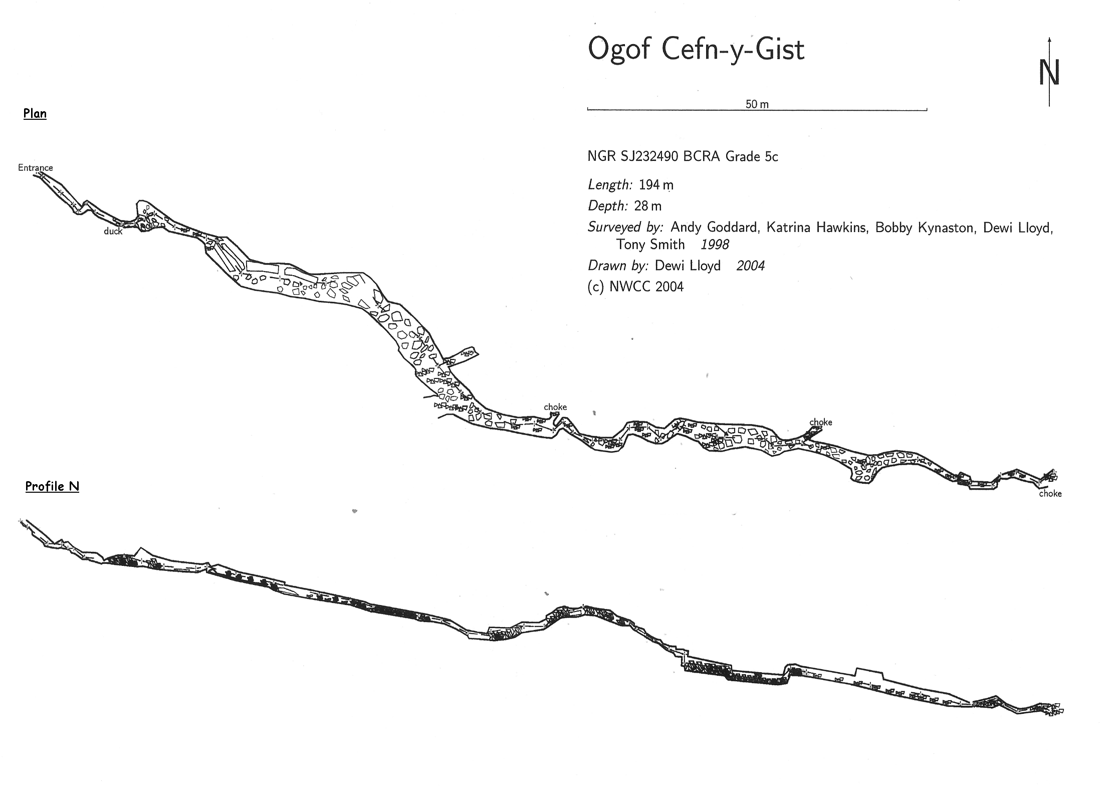
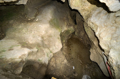
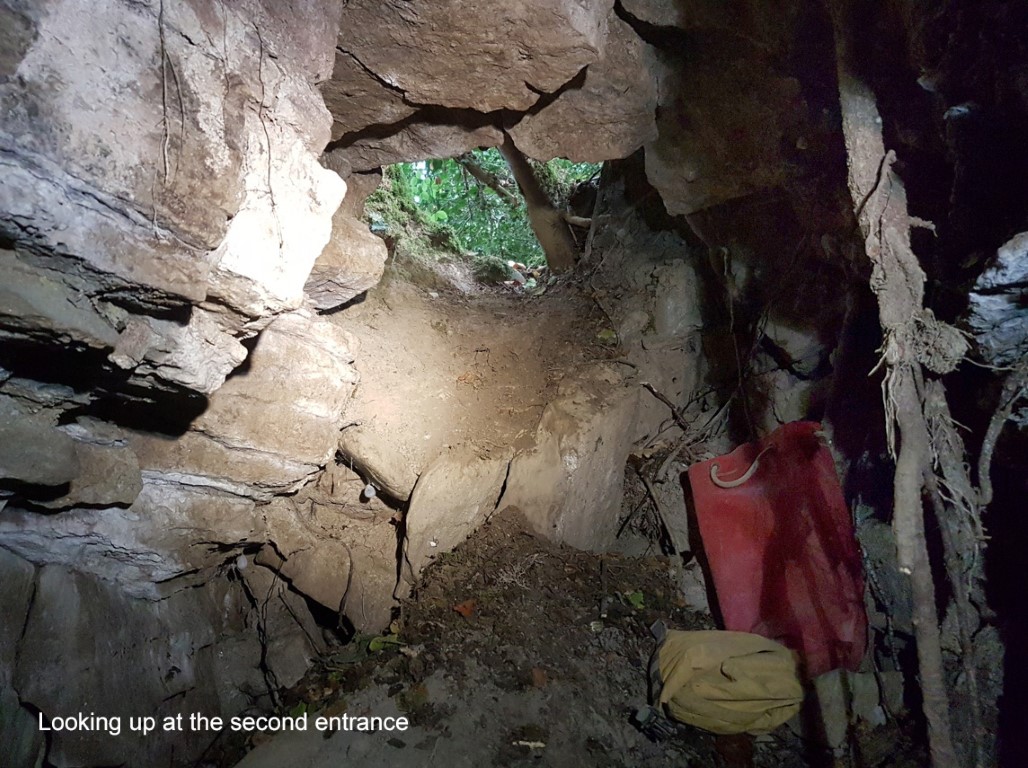
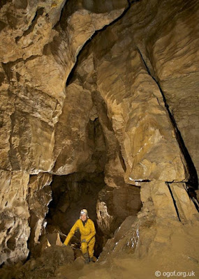
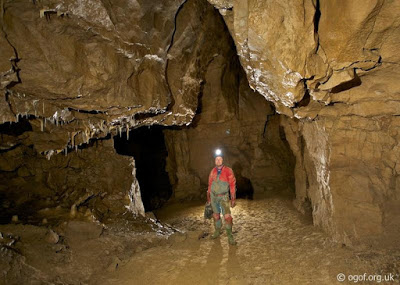
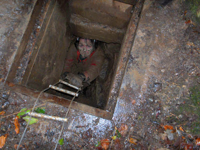
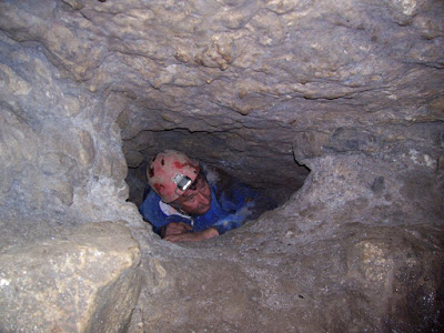
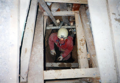
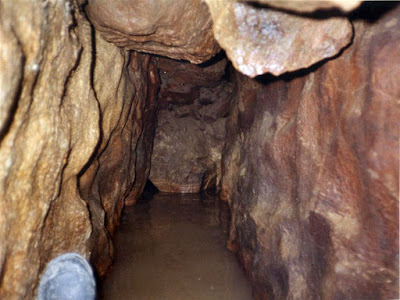
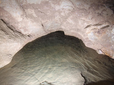
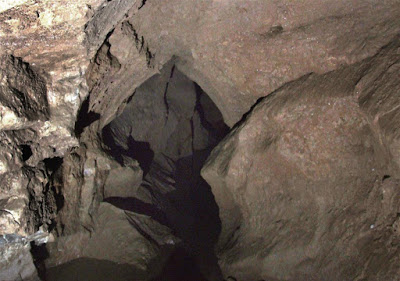
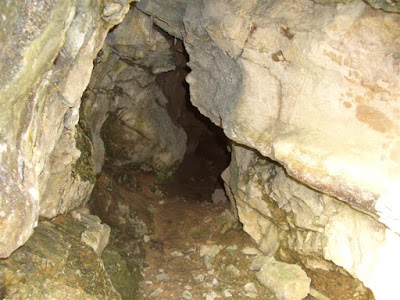
The entrance is protected by a steel hinged lid (not locked) to prevent sheep loss. After a years work, the cave was first entered on December 27th 1975. An excavated passage descends to the stream where it's necessary to crawl through an unstable area. About 30m from the entrance, a letter-box slot opens at the point the dig broke into the cave. The passage at this point opens to 6m wide and high enough to stand. Walking over fallen slabs, the passage can be followed to a further area of breakdown. Digging has forced a route through this to a further open section of passage to the third blockage. This also has been dug through into more passage but no obvious way could be found at the end. At this point, the draught felt at the entrance and the stream cannot be traced. Some years ago, blasting in the floor caused a massive section of the roof to fall, blocking the end of the cave, although the stream (and continuing passage) is likely to be found under boulders before the end of the cave.
A climb down in the floor near the end of the first section of open passage leads to a route under the right-hand wall and Bink's Passage, an ascending well-decorated passage terminating very close to the surface.
Dye testing has shown that water sinking at Cefn-y-Gist re-appears in Ogof Llyn Parc (NWCC newsletter No 285, 2003)
Warning: Instability is a problem. Please treat with respect. Several roof collapses have already occurred.
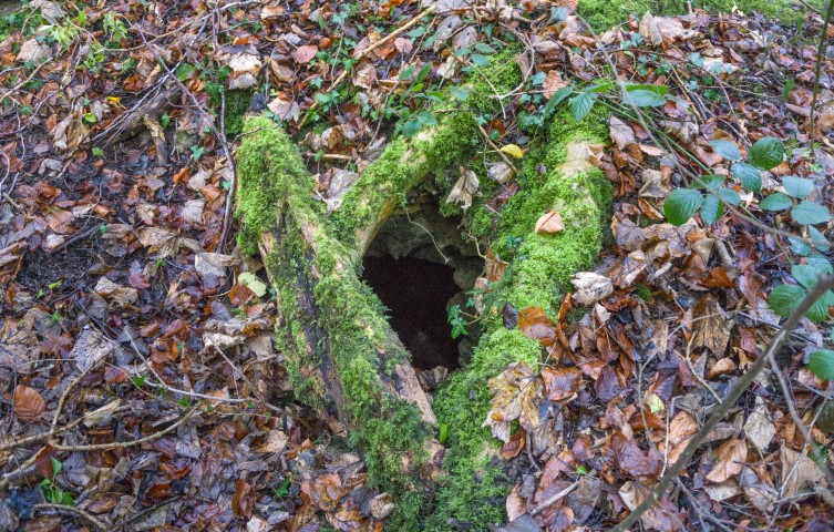
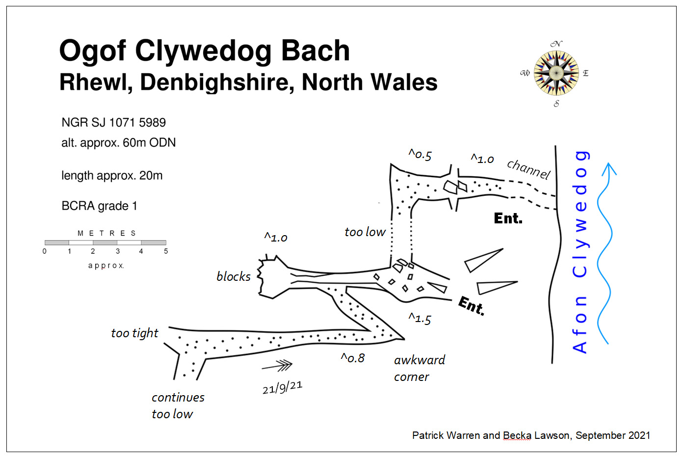
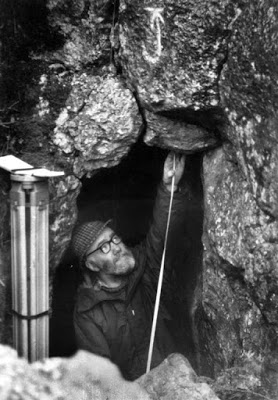
“A small joint-controlled, abandoned stream cave” first documented in 2022 after its exploration by Patrick Warren and Becka Lawson in 2021.
Source: (Craven Pothole Club Record No 145, January 2022).
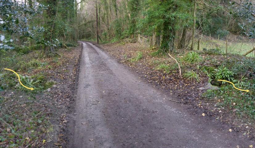
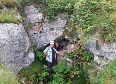
Take the Denbigh Road out of Ruthin for 1.5 miles to the hamlet of Rhewl. Immediately after passing the Drovers Arms, turn left into Lady Bagot’s Drive which looks like a private drive, but isn’t. Keep to the left passing a row of houses, then an old brick building. The public highway then stops at a cream house a little further on. The track continues as a public footpath through private land. About 100m from the cream house, an old leet passes under the track from left to right (see photo). At this point, head directly towards the river at 90 degrees from the track to the cave entrance.
You may need to park nearer the main road and walk from there.
CLICK TO ENLARGE
Ogof Colomendy
SJ2020162773 (+/-9FT) Altitude: 746.15 ft AOD
Loggerheads Archaeological (human)
Also known as Colomendy Cave
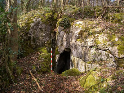
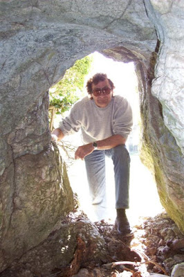
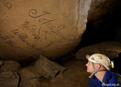
A tiny cave or rock shelter where many human bones and teeth were discovered on August 3rd 1975 by caver Edwin Carr of Wavertree, Liverpool.
Because
the deposits were in highly disturbed, un-compacted and non-stratified ground, the site
was excavated by cavers under the direction of cave archaeologist Mel
Davies between 1975 and 1979. Hundreds of bones were found which included
those representing three humans. Part of a flint arrowhead was also
found. The human remains were considered by Mel Davies to be 3000 years
old, although at that time no carbon dating was carried out.
Most
of the bones are on loan to the National Museum of Wales, Cardiff (but see 'Where are the bones today' below), on the clear proviso that they be returned to the area if ever a
suitable museum is established in North Wales (NWCC newsletter No 104 Aug 1981). A
small selection of hominin and animal remains (see photos below), were held by the writer until 2018 when they were given to Denbighshire Countryside Services at Loggerheads, where it is hoped that they can be shown to the public on an occasional basis.
Further
bones and artifacts are likely to remain in the disturbed deposits
forming the platform outside the cave entrance, as the 1970s
excavations by no means exhausted the caves archaeological potential.
The height of the cave entrance datum point (see photo below) was ascertained using a Distomat DI 10 survey instrument and a three-prism reflector. A Wild theodolite was used from the nearest bench mark at 805.64 feet OD (in the woods above Loggerheads). Measuring the altitude of seven survey legs, each accurate to within one centimetre, led to the new datum point above the cave entrance. This was confirmed as being 746.15 ft OD (or 227.43m OD).
Source: How High is Ogof Colomendy, by Mel Davies. North Wales Caving Club newsletter No 99, March 1981.
Update:
Test excavation in 2015 - 2016
by
Clwyd Powys Archaeological Trust
unearthed
nineteen human (or possibly human) additional bone fragments
. Radiocarbon dating proved those tested to be of Neolithic age, having a 'Conventional radiocarbon age' of 4408 +/-33BP (SUERC-66486[GU40395]), confirming Mel Davies's 1970s 'Neolithic' assessment.
Source: CPAT Report No. 1380: Caves of North East Wales - Archaeological Evaluation 2015-16.
The human fragments identified were:
- Three cranium
- Four teeth
- Two vertebrae
- Three ribs
- Three scapula
-
Two hand phalanges
- One tarsal
-
One foot phalanx
The report makes the following comments:
Results of the radiocarbon dating "indicate a most likely date between cal. 2900 BC and cal. 3100 BC".
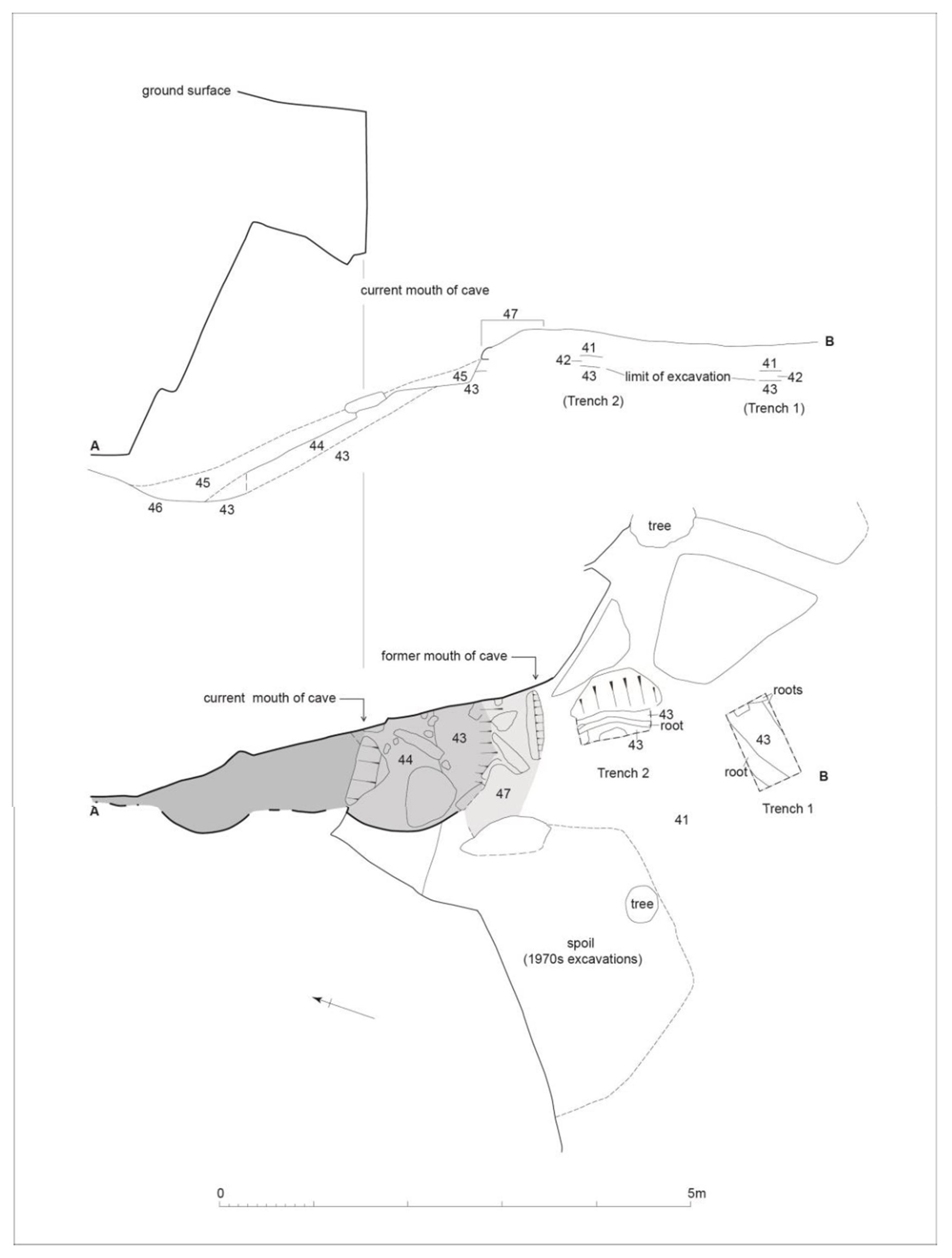
"..... that the cave had been truncated by historic quarrying was confirmed by investigation during the course of fieldwork in 2015-16............ it seemed that the mouth of the cave had formerly been about 2m further to the south-south-east".
"The most significant feature of the cave is the roughly constructed wall (47 on plan below) which defines the former extent of the cave, prior to its reduction by quarrying. This was about 0.7m high and 0.6m thick and had been left in situ by the 1970s excavators; it could represent the deliberate blocking of the entrance when it was used as a place of burial in the prehistoric period, something found at a number of cave burial sites in the region......... and this potentially represents a rare survival of a feature of cave burials which, although recorded by 19th century excavators at many of the sites in north-east Wales, was always removed by them in gaining access to the deposits".
The report does not provide any evidence in support of the 'historic quarrying' hypothesis.
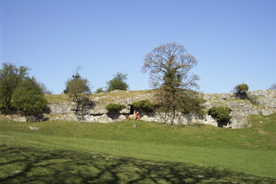
Directions: From the boundary stone beside the road (mid-way between Loggerheads and Cadole), take the track into the Country Park. Ignore the main track which bears slightly to the left, and take the smaller path which runs up the hill at right angles to the road. Just before reaching the highest point, turn left and the cave is 55 paces from the track just below a small rock outcrop.
CLICK TO ENLARGE
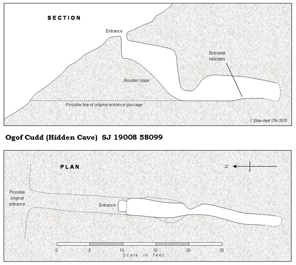
Plan & section of site copied from CPAT Report No. 1380: Caves of North East Wales - Archaeological Evaluation 2015-16
Below are four images of the bones given
by the writer
to Denbighshire Countryside Services (at Loggerheads) in 2018:
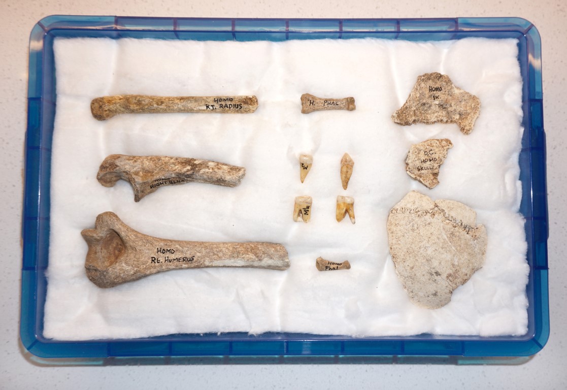
Human remains from Ogof Colomendy (Box 1)
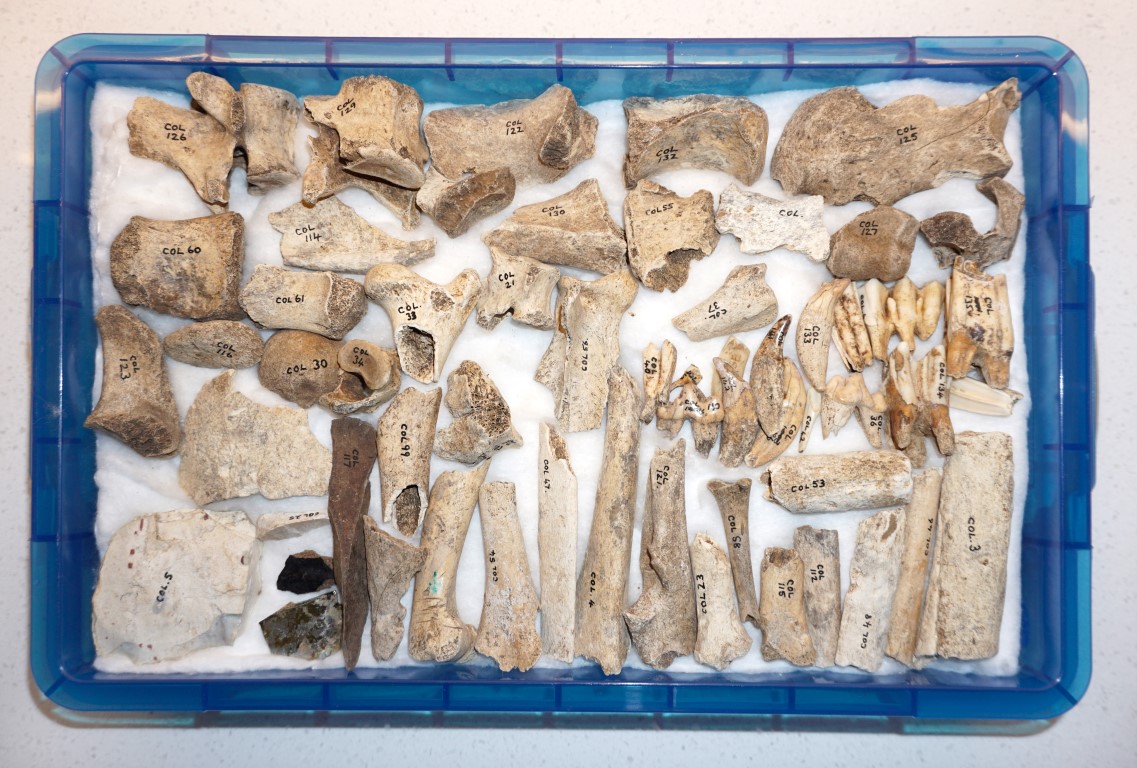
Animal remains from Ogof Colomendy (Box 2)
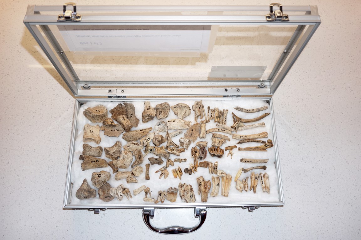
Animal remains from Ogof Colomendy (Box 3)
History of excavation
1975
August 3rd
Although the cave was first noticed by Ted Carr two weeks
earlier, the first excavation at the site was carried out on August 3rd.
Heavily disturbed ground was cleared which revealed many human bones and at
least 13 teeth, at which point digging was halted and the finds reported to a
cave archaeologist.
1975 December 14th The second excavation by cavers with Mel Davies directing. After just four hours work two bucketfuls of bones had been unearthed, many of which were obviously human. All finds were found in very loose earth, although undisturbed clay deposits were reached at a depth of about a metre inside the cave. These however, were not found to contain archaeological material.
1976 March 21st Excavated by cavers with Mel Davies. Work continued excavating loose earth and boulders for three hours, after which a further bucketful of bones were found. Mel commented that “one bucket of bones equals two months work!"
1976
October 24th
Carefully excavated by cavers, following Mels guidelines. A day was spent excavating the platform
in front of the entrance, although several large boulders had to be cleared.
The bones found were cleaned and dried and sent to Mel Davies for identification.
1977 April 3rd
Fourteen cavers and Mel Davies carefully excavated at the site. The
disturbed deposits within the cave were now found to be lacking in
bones. Mel Davies
stated that the main area for future work lay within the platform
outside the entrance.
Amongst the finds from the cave held by the National Museum at Cardiff are:
6879g of animal bones
2981g of human bones
A leaf-shaped arrowhead
The above items are on loan from North Wales Caving Club (accession no. 82.2H)
Source: Steve Burrow (2003) Catalogue of the Mesolithic and Neolithic Collections in the National Museums & Galleries of Wales.
Primary sources:
PDF Downloads:
A. The first 1975 and 1976 accounts of the discovery of bones (from North Wales Caving Club newsletters) are available at the very bottom of this page under: Ogof Colomendy Earliest references.
B. Two brief reports with list of finds by Mel Davies dated 1977 and 1978 can be downloaded at the very bottom of this page, under the title: Colomendy 1 & Colomendy 2. (from Cambrian Caving Council newsletters).
C . Notes on the late Mel Davies' contribution to cave archaeology in Wales can be downloaded as a PDF from the very bottom of Page 13: Archaeological caves
And where are the bones today - National Museum of Wales puts ‘pounds before people’
The large majority of the Ogof Colomendy bone collection resides in the vaults of the National Museum of Wales (NMW), where they have remained, unseen by the public, for 40 years. As the museum also holds collections from a number of other North Wales caves, NMW were approached asking if this website might use one or two of their photographs. The museum however, does not encourage the sharing of information in this way, as indicated by their response:
“ The use of our photographs is available for the fee of £150 a year for each image, and we will need you to sign the paperwork for a licence to use it online ”.
It should be stated that NMW are in the process (in 2018) of photographing some of their oldest and most important finds from Palaeolithic caves, and making these available online. But it may be many years, if ever, they decide to include the unseen collections from the other North Wales caves, many of which are Neolithic.
NMW were then asked if we might visit the museum to take our own photographs. They replied:
“If we agree to you photographing the item we will need you to sign the paperwork for a license and we will ask you to assign the copyright of your photographs to us . We would not though charge a fee for you to put these on your website ". Such a licence would need to be renegotiated each year and would have unacceptable conditions attached.
As several small museums have freely provided information and photos for ' Caves of North Wales' , our concerns were raised with the museum over poor access to their collections, and how this conflicted with several statements in their Policy Documents. Despite several assurances that we would receive a response soon, this did not happen. It took four different e-mails, to four senior staff members, a formal complaint, and five months, before NMW felt inclined to respond. Their eventual reply referred to their “ mismatch between our organisational goals and the effect of some of our policies ”, They explained this as being due to pressures to maximise revenue. This appears contrary to the museums statement: “The collections are held in trust for the people of Wales and exist to serve society”.
As things stand, the public are unlikely to see any Neolithic remains from North Wales caves for many more decades.
Regarding NMWs Ogof Colomendy bone collection, n o photographs of these exist. But as they are one of the few bone collections that are merely ’On loan’, the only way in which cavers or the public are likely to see or photograph them, is for North Wales Caving Club (the owners) to request their return. Until that happens, the public are unlikely to see them again.
The National Museum of Wales proudly boasts: “ The collections exist to serve society ” - it seems not.
C.E. July 2018
--------------------------------------------------------------------------------------------------------------------------------------------------
(Cave of the Shortest Day)
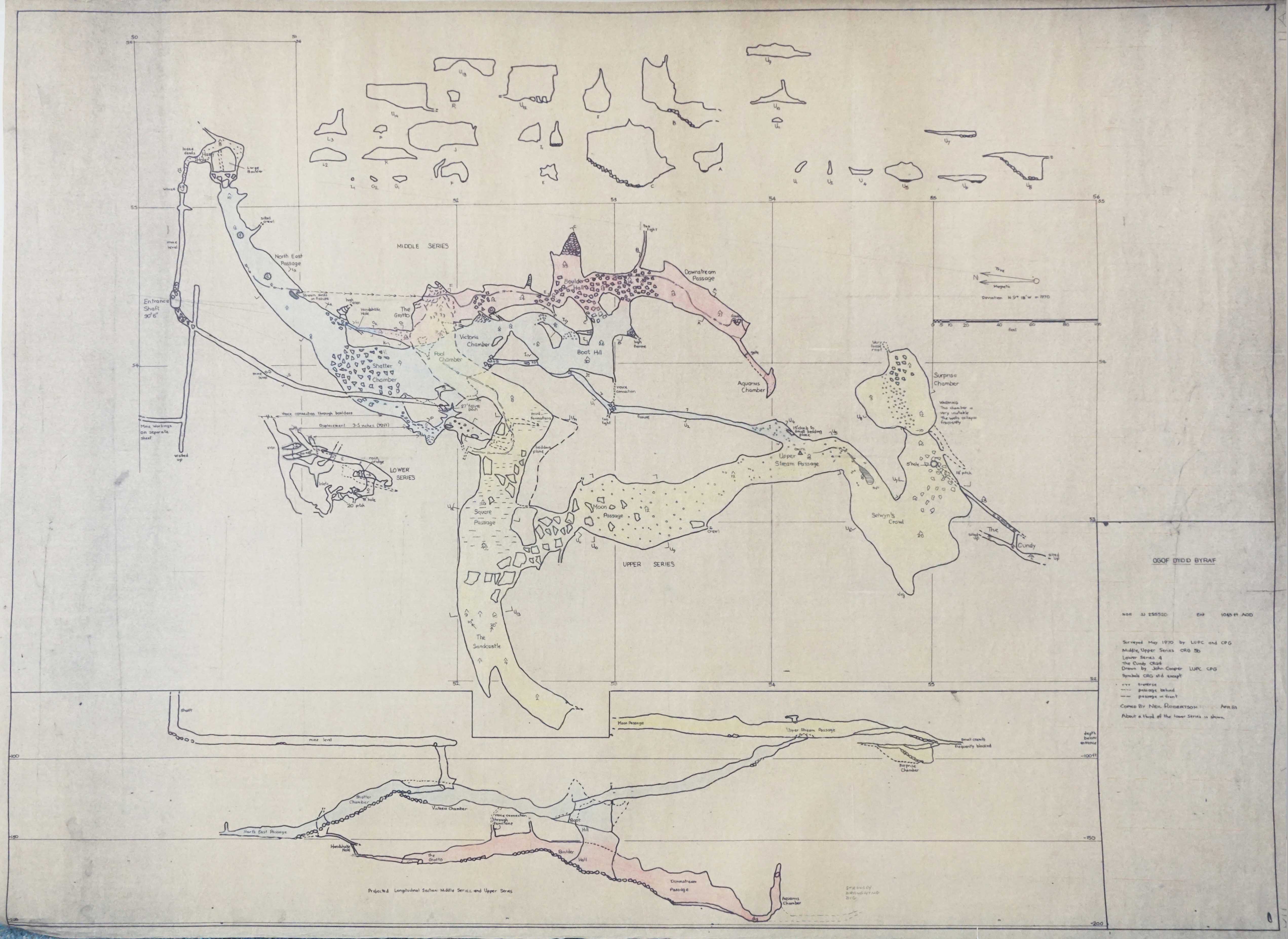
The earliest 1960s survey by the CUNDY group
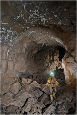
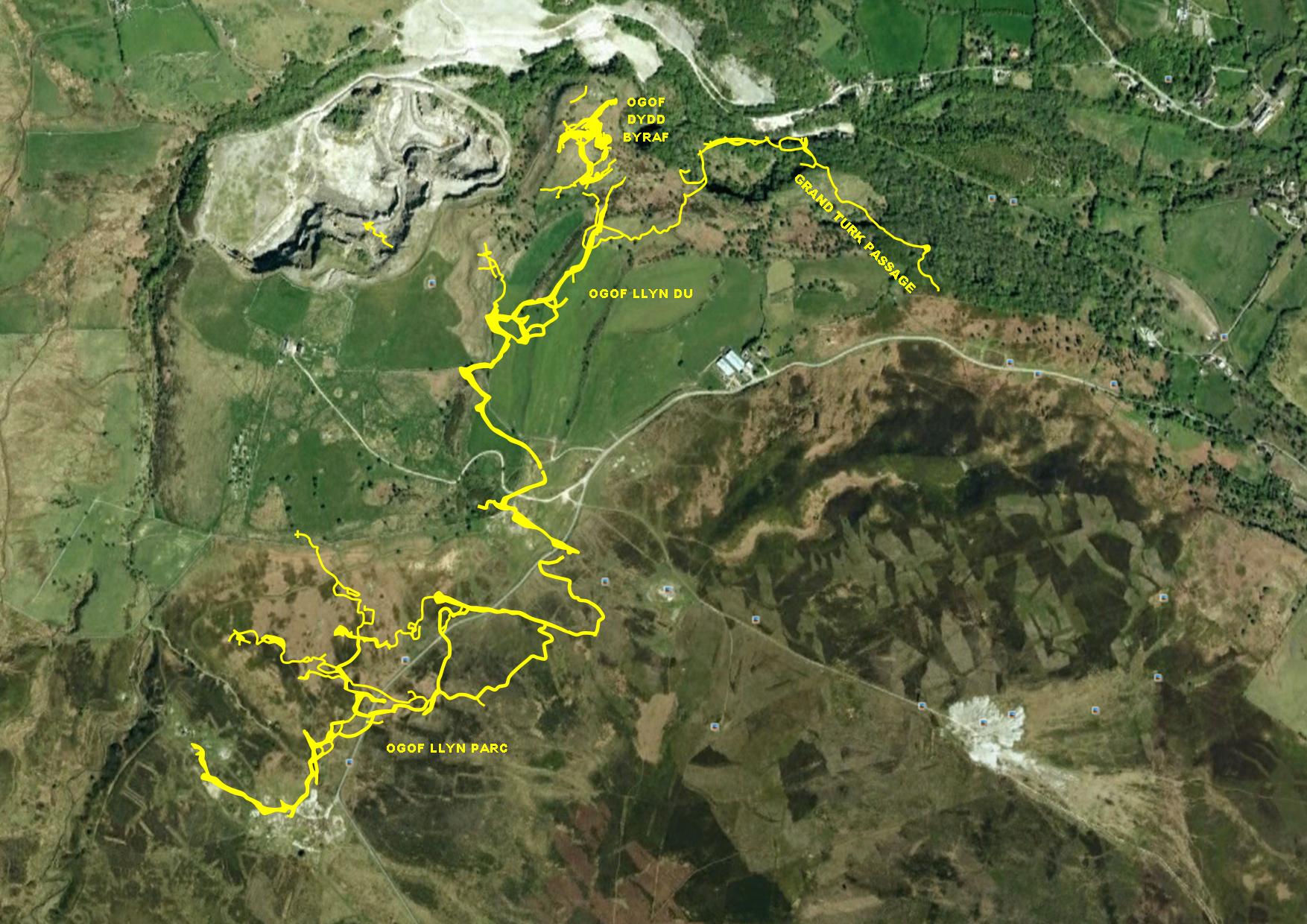
Discovered in 1964 by Wrexham Caving Club, this was the first sporting cave to be found in North Wales. Although originally only half a mile in length, it offers large passages, tight crawls, many interesting formations and numerous places with digging potential. ODB, Ogof Llyn Du, Ogof Llyn Du 2 and Ogof Llyn Parc are all part of the same cave system, although not at first connected by cavers. Prolonged digging eventually, in 2013, connected ODB with the dived 'Whybro extension’ of Ogof Llyn Du 2. See a video of their work in the dig: http://www.youtube.com/watch?v=z8uwpx_dIqE
ODB, LLyn Du 1 and 2 and Parc Western shaft have all now been connected: A through trip was made ( via the sump between Llyn Du 2 and 3, and the gravel crawl between 3 and Parc Western ) in the Summer of 2014 by five NWCC members. The trip is reported as being "very high maintenance re syphoning the sump between ODB and Llyn Du 2, and the sandy crawl between 2 and 3 needing constantly re-digging, so not been done since".
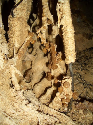
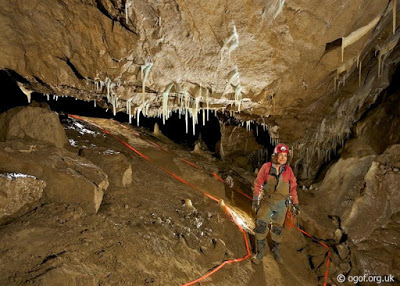
An upper series consists of large passages up to 10m square having an ascending passage which ends within a metre or two of the surface (voice connection established in the 1960s). A middle series has several large, well decorated chambers whilst a lower series, reached via a narrow natural shaft near the entrance rift, is a network of small tubes with some interesting helictites.
In 2017 Minera Quarry was purchased by North Wales Wildlife Trust for £1. It opened to the public on June 2nd 2018. This may offer an opportunity to secure access for the future for all local caving clubs. The current NWWT position states: "NWWT is aware of the unique cave system in the quarry area and with the Minera Quarry Trust, has made an initial assessment of the caving options. We understand that Tarmac licenses current activities on an annual basis, and as long as this is carried out safely and in sympathy with a SSSI nature reserve, we would look to continue this. At the current time, we have not produced a Management Plan for the future of the quarry, but we would welcome proposals (with funding and safety details specified) which do not adversely impact this unique area" (pers. comm. Frances Cattanach, NWWT, Nov 2016).
Ogof Elinor SJ122508 Length 10m Llanelidan, south of Ruthin
The cave is named after farmer Powell’s daughter.
Access: Call at Garreg Einioes Farm for permission.
Ogof Enfys SJ21406231 Length 10m Gwernymynydd
Ogof Ewenol SJ0227170317 +/-40ft Length 30m Cefn
(Cave of White Water)
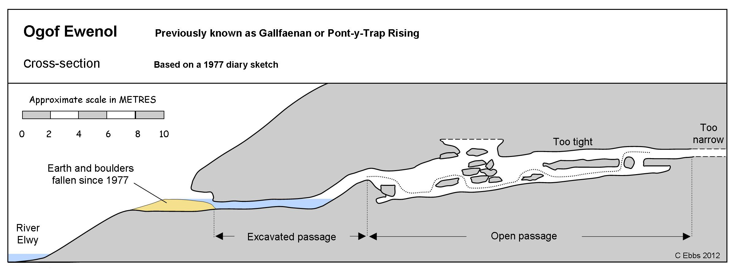
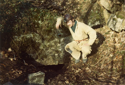
The water issuing from the cave was known variously as Ffynnon Galltfaenan, Galltfaenan Rising or Pont-y-Trap Rising prior to the discovery of the cave here in 1977.
At
the time of its discovery, an entrance duck rose after 8m to a short
climb up into a rift passage of up to 3m in height. The cave terminated
where water entered from a passage at roof level but was just too tight
to negotiate. Blasting on three occasions managed to extend the passage
by a few metres, but the passage continued of a similar size requiring
further enlarging (Source: Writers diary April 1977).
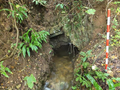
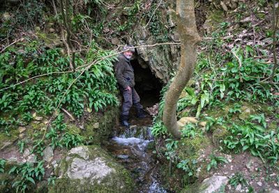
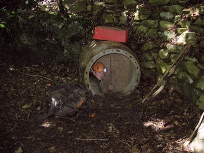
The
cave is currently inaccessible due to falling-in of the approach trench
as shown on the drawing above. Almost 2 metres depth of earth would
need to be cleared from the trench to provide access (compare 1st &
2nd photos below).
Although
discovered by the writer and others after digging through consolidated
clay and boulders, the discovery could not have been made without the
good work put in during the 1960s by Shropshire Mining Club and Shepton Mallet Caving Club who lowered the water level at the entrance by excavating the floor of the trench considerably.
The source of this water is likely to be Lodge Farm Swallow 2.4 miles to the south-east, although this remains to be dye-tested. An article published in 1962 also describes other sinks in Henllan village "The sinks, which I have not seen....... may lie in private gardens" (Source: "Ffynnon Galltfaenan, Denbigh, N. Wales" by A.W. Ashwell. Cave Research Group newsletter, No.85, Sept 1962, pages 7 & 8).
The
height of Ogof Ewenol is about 40m AOD. Lodge Farm Swallow lies just
under the 130m contour, hence a height difference of about 90 metres between sink and resurgence.

The excavated passage lies just above water level
Ogof Gwaun SJ2033455461 Length 5m Llanarmon-yn-ial
(Meadow Cave)
Access: Although a public footpath runs just past the cave, it would be wise to ask at Creigiog Ucha farm beforehand.
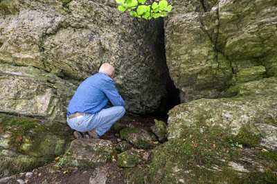
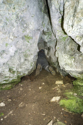
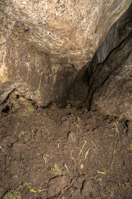
Ogof Gwen Goch SJ064781 Dyserth
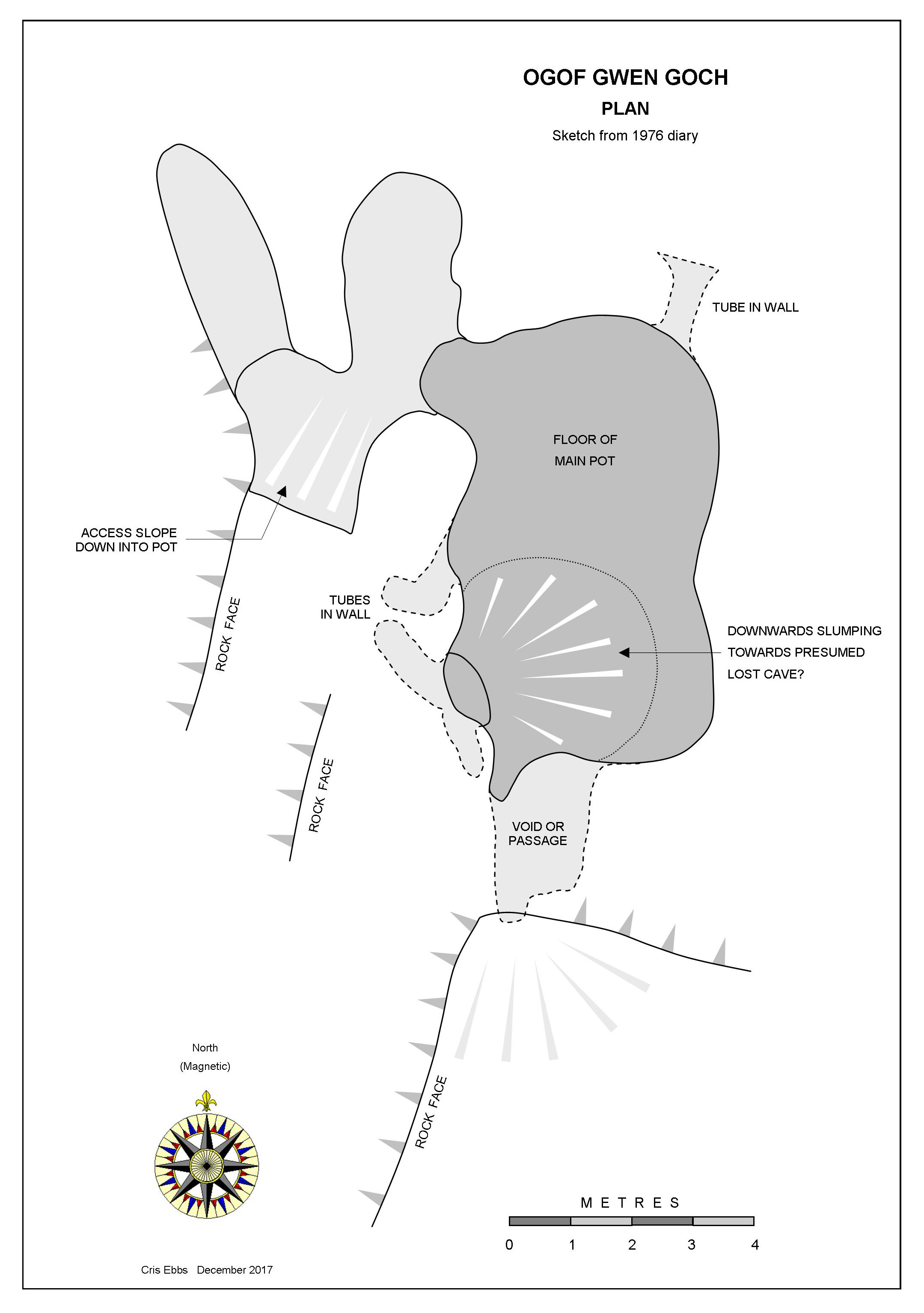
Appears to be a vertical pothole partially blocked by miners waste from nearby haematite mines. The impressive 5m deep vertical-walled pot measures 6m long and 3m wide. Its location is not where one might expect to find such a pot, being close to the top of Moel Hiraeddug, but the pre-glacial River Alyn passed this way (after Leake & Embleton) and it could therefore be a pre-glacial swallet cave.
The 1930s caver Peter Wild possessed a book of 1699 which described 'Ogof Gwen Goch' as 'this remarkable cave' on Moel Hiraeddug. He felt sure that this is the same cave. Assuming it to be the correct location, the quote
suggests more than currently meets the eye. The early reference to Red Gwen's Cave suggests that the site may have been occupied at some time. Presumably 'Red' Gwen's colouring was the result of the abundant haematite deposits and clays found on Moel Hiraddug.
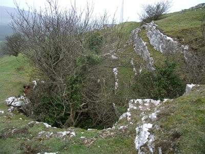
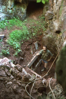
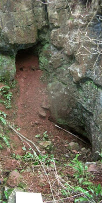
Photo: Dave Tyson
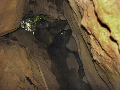
Ogof Helygain SJ1937971212 +/-9ft Length 16m Halkyn Mountain
(Halkyn Cave)
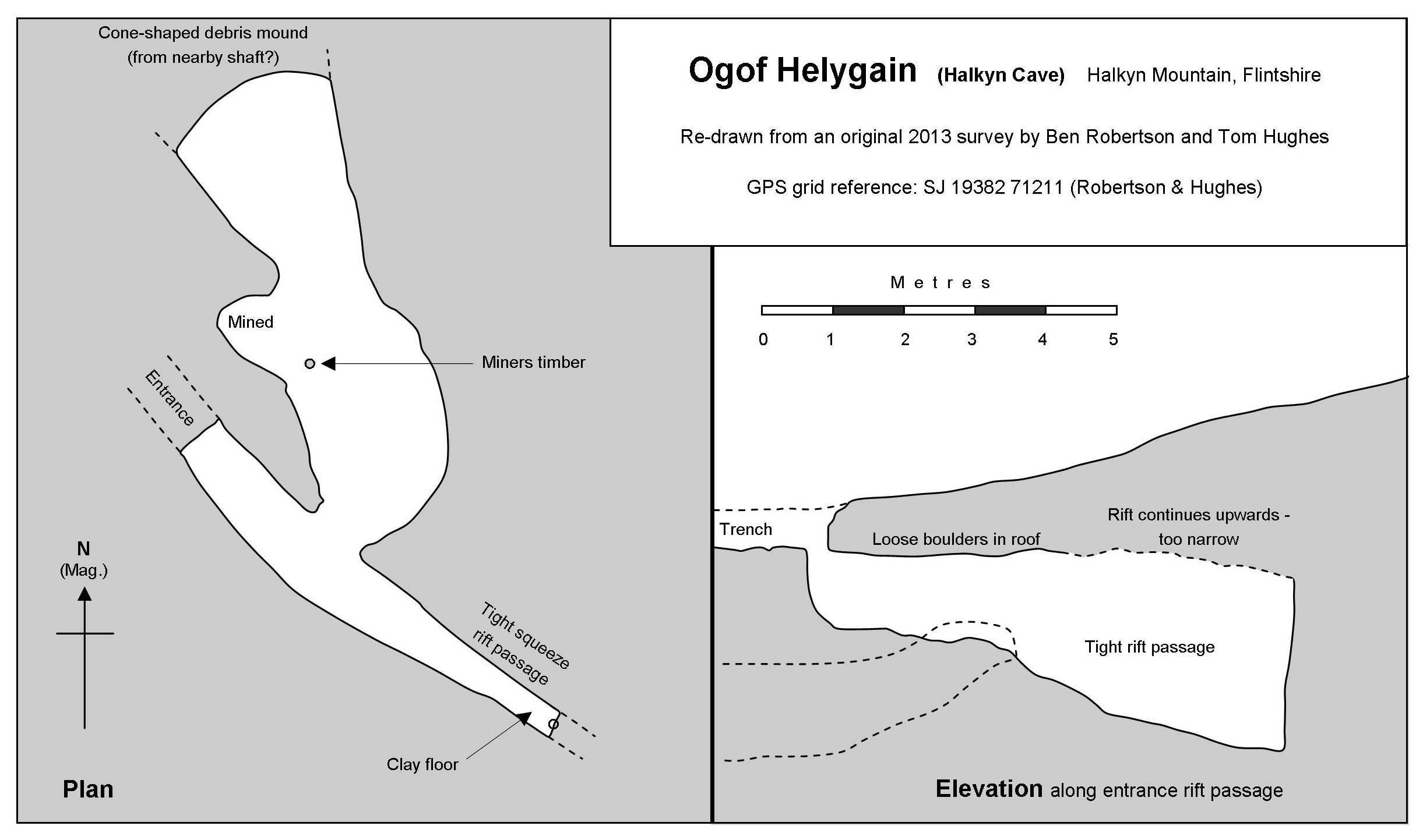
The plan and elevation above are not an accurate representation, but merely from
drawings based upon measured distances and compass bearings.
First explored and reported in 2013 by Ben Robertson and Tom Hughes after a little enlarging of the entrance.
A descending rift passage becomes too tight after 6 metres. A descending passage in the north wall terminates after 10 metres at a blockage which may connect with a nearby blocked mine shaft.
The cave is naturally formed although it has been modified in places by miners.
NB The GPS grid reference above (taken by the writer) differs slightly from the one indicated on the survey (by Ben Robertson), illustrating the variation possible using GPS devices.
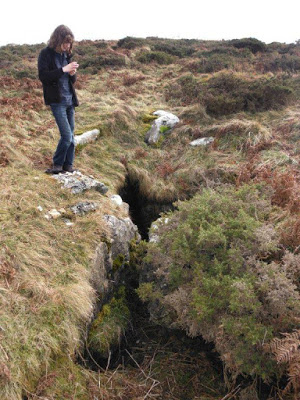
Photo: Neil Robertson
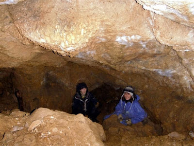
Photo Neil Robertson
---------------------------------------------------------------------------------------------------------------------------
A
cave entered by miners in the search for ore.
Just inside the entrance is a climb down through boulders. This leads to a couple of passages, some parts of which are cave-like
in appearance, whilst others show clear evidence of mining activity.
Va rious places in the cave might me worthy of excavation. Could prove interesting due to its proximity to the lost Minera Quarry Cave.
An inclined track in a cutting leads out of Minera quarry to the south-west. The small entrance can be found a few feet up the bank on the south-east side of the track .
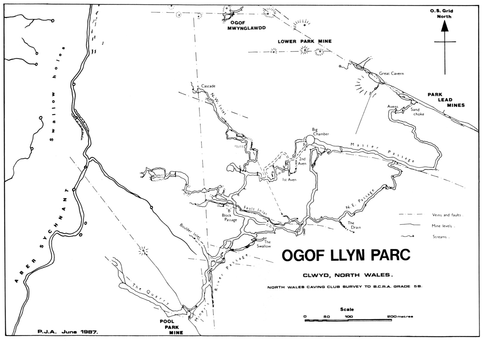
Ogof Hesp Alyn SJ1919565539 Length 1.5km Altitude 142.89m OD Alyn Gorge
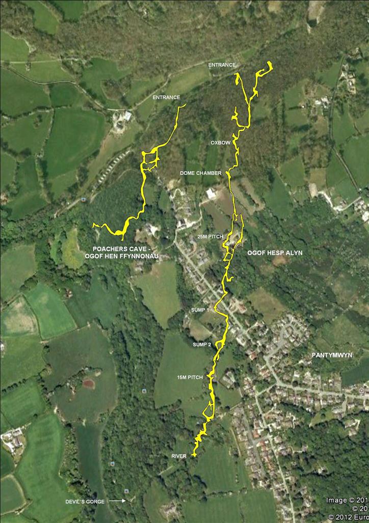
Ogof Hesp Alyn & Ogof Hen Ffynnonau (Poachers Cave)
Based on surveys by North Wales Caving Club in 'Limestones & Caves of Wales' (1989) edited by Trevor D. Ford
The whole cave drains into mine workings at a point about 130 metres below the entrance (see Halkyn Mines Cave No 12 under page: 10. Caves Found in Mines).
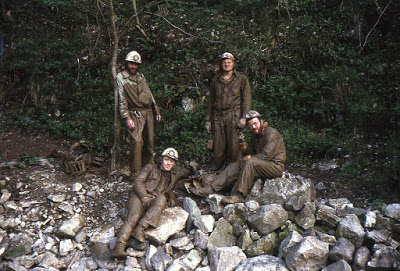
Discovered in 1973 by NWCC when it was first entered by the late Tony Jarratt.
From the car park at Cilcain bridge at SJ18776518 walk up the steep road towards Pantymwyn to where the road bears to the right by a yellow council grit container. A scramble down the steep bank here leads to the footpath which continues downstream. The low entrance to Poachers Cave is clearly visible to the right of the footpath a few hundred metres downstream. Continue past this entrance for a further 200m or so, and the entrance is at river level down the steep bank.
Although dry for much of the year, the system can become active and fill unpredictably.
At times of flood the mine connection is too restricted to take the whole flow, and the entire cave can flood, when the entrance becomes a spring.
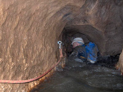
The Canal Photo: Ian Adams
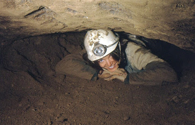
The 'Sand Crawl' often needs excavating after each Winters floods.....
Ogof Llyn Du SJ2568151910 +/-22ft (corrected 2021) Length 1.2km Gwynfryn
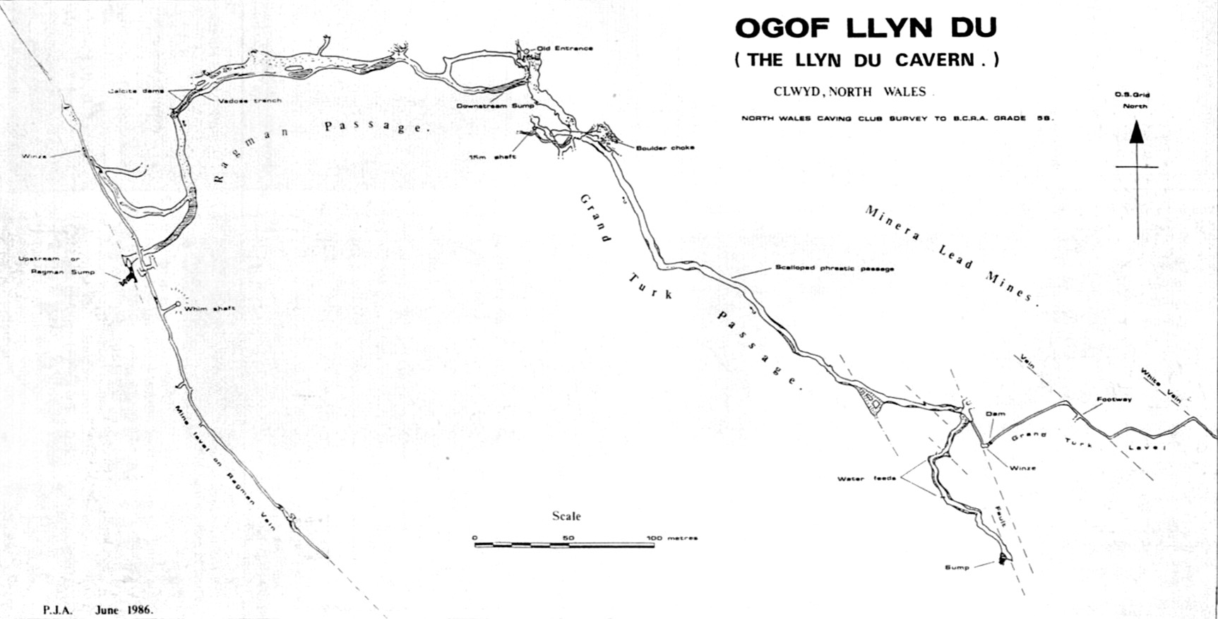
Source: Caves & Caving The Bulletin of the British Cave Research Asssociation Number 33 August 1986
ODB, Ogof Llyn Du, Ogof Llyn Du 2 and Ogof Llyn Parc are all part of the same cave system. Prolonged digging eventually, in 2013, connected ODB with the dived 'Whybro extension’ of Ogof Llyn Du 2. See a video of their work in the dig: http://www.youtube.com/watch?v=z8uwpx_dIqE
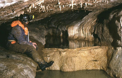
Extensive digging in ODB broke into Ogof Llyn Du 2 in 2012 and now provides a dry route into this part of the system (See photos below).
Access: Gated and locked. Contact NWCC
A more up-to-date survey was being completed in 2012 and should now be available. Contact NWCC for further information
Discovered by miners no later than 1862 but re-entered by NWCC in 1984.
Access: The entrance shaft is gated and locked. Contact NWCC who operate a guide system and organise regular winch trips.

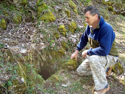
Ogof Malwen SJ25465200 Length 81m Gwynfryn
The cave was first found to exist by cavers taking resistivity readings on the hillside above the cave in the late 1960s. A quick dig in the wall of a mine shaft crater revealed the entrance and 15m of stooping-sized passage with a 6m high aven on one side.
in 1973, Graham Baldock, Mike McCarthy and the writer had recently started caving, and were searching for the nearby Ogof Dydd Byraf. Finding Ogof Malwen by chance, they excavated where the known passage ended (the deposits were non-archaeological sediments). After excavating a crawl of 2m, new passage was entered 66m in length, much of it of walking height (but with a further short crawl part way along). The cave ends at a clay blockage which pools up in wet weather. Although muddy, it could be extended with further work, but only in the dry summer months.
The cave is likely to connect with the nearby Ogof Dydd Byraf
.
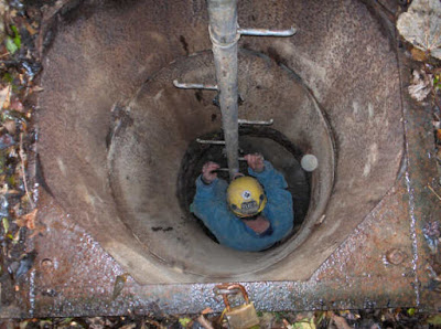
A
hole in the floor about 20m from the entrance (see photo below) was
excavated vertically in 1973 for 1.5m to where the roof of a passage 1m
wide could be seen running off horizontally
(Source: Writers diary 15/7/1973).
This dig appears to have remained flooded since its excavation, but could be worth examining in drought conditions.
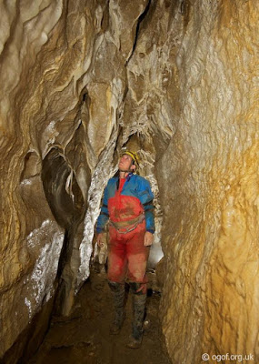
Ogof Mwynglawdd SJ25045136 Length 145m Gwynfryn
Access
to the cave is via Stewart's Shaft, about 40m or so in depth. A crawl
follows of about 5m then a 2m climb down into the main cave with some
formations. Although not extensive, the cave has potential and a
draught.
Contact NWCC for details.
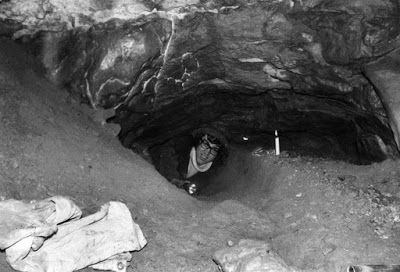
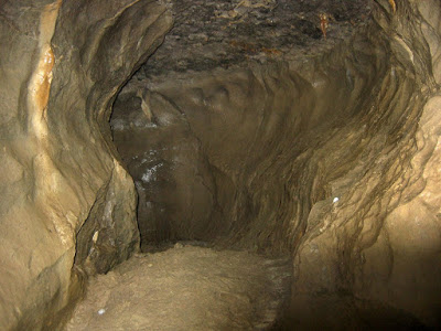
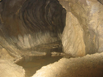
Ogof Nadolig SJ1898365570 Length 250m Alyn Gorge
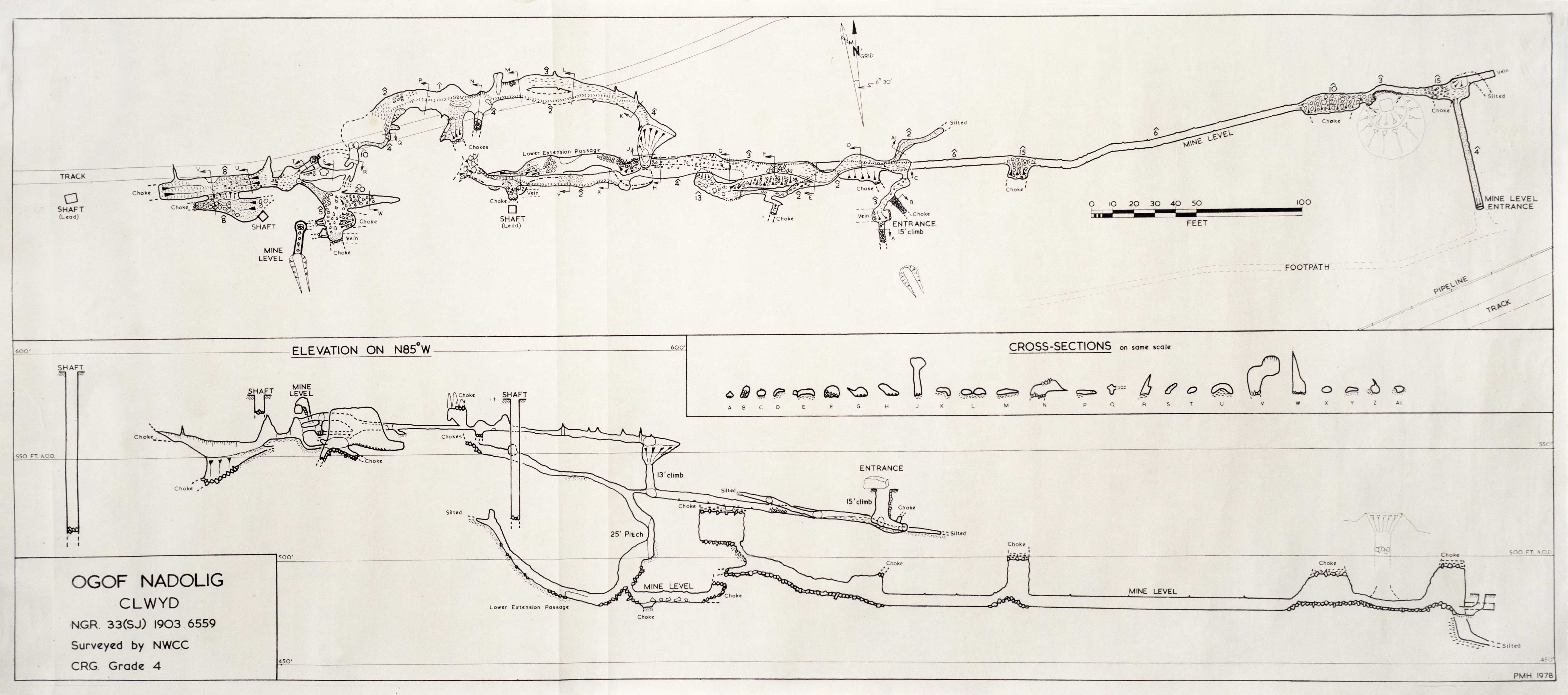
Survey kindly supplied by NWCC
A 4m deep entrance shaft is followed by a hands-and-knees passage to the foot of an awkward rope climb. At floor level is 'The Blasted Crawl', a squeeze which leads to a 10m pot and ends at a blockage of miners deads. Taking the rope climb up, the passage becomes low and a little damp before entering a couple of chambers. A squeeze at floor level just before the end chamber enters a short mined passage and the foot of Valentine's shaft which is locked at surface (contact GCC for key).
Ogof Noeth SJ2325846867 +/-10ft Length 100m World’s End
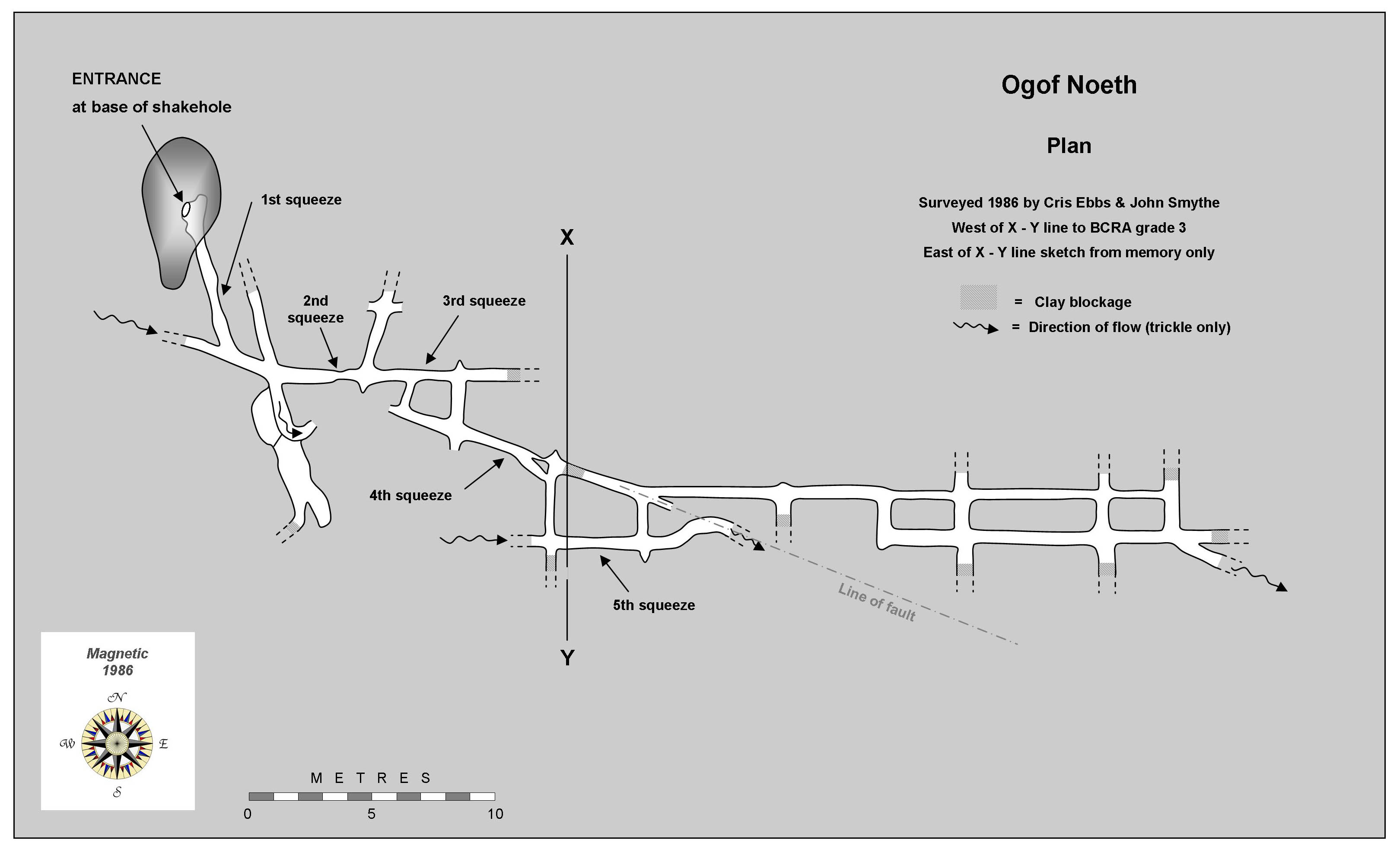
Named Ogof Noeth as it was initially necessary to remove clothing to gain entry.
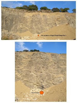
Three short caves in the disused Pistyll Gwyn Quarry. A fourth cave of 25m was found in 1973 in the south-east face about 12m above the quarry floor, but the entrance has been quarried and the cave is now lost. The same fate became an active cave which now lies below the quarry floor and can be seen to issue spouts at several locations in flood conditions. A dig in the quarry floor revealed a north-south active rift passage, but this was blocked by boulders where the roof has been removed by quarrying (see the two photos below).....
Cave 1: Length: 70m
A stooping-sized phreatic tube descends at about 20 degrees for 30m. It then bends to the right where an 8m long canal is met in a passage up to 2m high. This sumps immediately to the left and has been dived for 21m to a depth of 10m to a low bedding passage. To the right the roof soon lowers to about 20cms above water level. This duck is about 3m long after which walking is again possible for a few metres. The passage then lowers to sump 2. This has been dived and descends to a depth of 8m to "a blockage which could be dug" (Welsh Sump Index. Cave Diving Group journal 1986).
Upstream sump first dived in Summer 1984 by Paul Whybro.
Several other dives in 1985 by Neil Robertson pushed the sump to 21 metres.
In wet weather the canal becomes active and the water level can rise and resurge in the quarry floor.
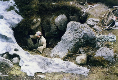
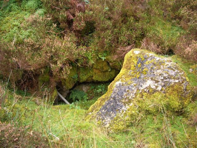
The entrance was blocked in November 2007 as a result of landscaping work and now lies under soil and boulders. A quick dig down through boulders should reveal the entrance.
At
the far north end of the quarry, just behind piles of loose rock close
to quarry floor level (see location photos below, although further
material was added above the entrance after the photos were taken. The
entrance now lies about 3m down).
Cave 2: Length: 15m
A crawl to a junction after 3m. Straight on gets too tight and is close to the quarry face, but to the right is a very tight descending tube which has been pushed to a limit of 12m where it really is too tight.
Take the ramp on the right-hand side of the quarry up to the first bench. Follow this around to the far north-west end of the quarry. The crawl entrance can be seen ahead just beyond a blasted scree slope.
Cave 3: Length: 2m
A rift-shaped pot about 4m deep. Now partially filled with boulders.
Beyond the far north end of the quarry above Cave 2, about 20m north of the cliff face.
Ogof Rhewl to resurgence horizontal distance = 1568m. Sink to resurgence height difference = 100.8m.
First explored by H. Owen of Denbigh in the 1960s.
See also Ty Mawr Reservoir Sink feeding the same system.

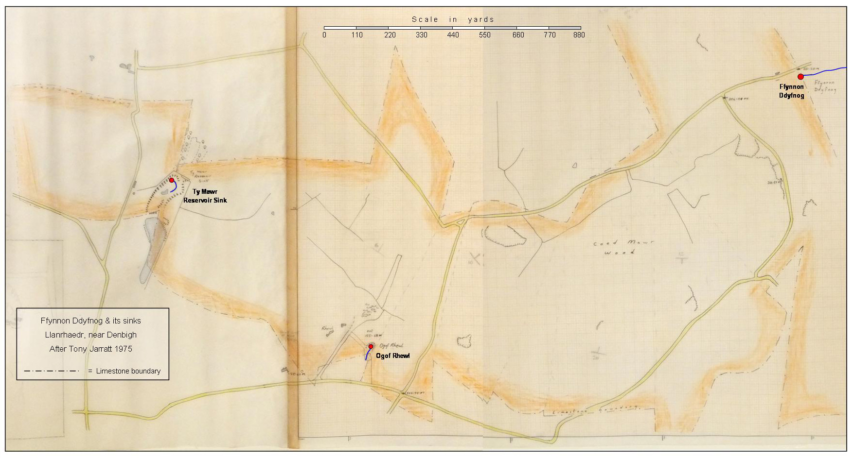
Ffynnon Ddyfnog and its sinks
Errors by CPAT added to the Historic Environment Record (HER)
Access: Contact GCC for the key.
In about 2020, the entrance to the cave was sealed off with a wall of boulders. Presumably this was done by the new landowner, as much of the Big Covert has been sold to private interests in small lots. The nearby Scouse Pot has also been partly blocked by branches pushed down the entrance shaft.
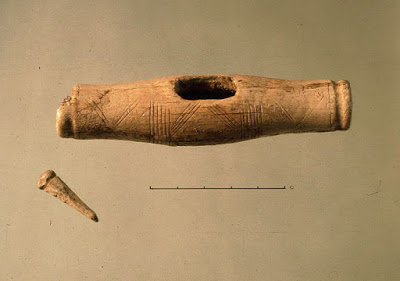
The artifacts from Orchid Cave were identified in 1981 by self-taught cave archaeologist Mel Davies. They include remains of three human individuals and a rare bone toggle with incised decorated markings. His list of finds can be downloaded as a PDF at the very bottom of this page, entitled: Bone identification by Mel Davies .
Roughly 100 metres east of Maeshafn Cave. Difficult to find without a GPS being in the midst of woodland.
It appears that no archaeologist was present during the excavations and sadly no report was published: It is the opinion of most archaeologists (and cavers) that excavation of a proven archaeological site without publishing the results, is considered an act of gross vandalism.
Although archaeologists were informed of the finds at the time of their discovery, CPAT did not see fit to protect the cave from further damage by scheduling.
Non-archaeological digging of bone-bearing deposits continued for some years after 1981 by persons unknown, although they did save the bones they discovered which they left in a plastic bag within the cave. These were found and removed for safe-keeping by John Blore and can be seen in an image below.
The bone toggle with peg and a flint scraper are currently held by the National Museum of Wales (accession no: 83.55H).
In attempting to pin-point Orchid Cave, t wo site visits by CPAT resulted in two different grid references. Compounding the error, they named these as 'Orchid Cave 1' and 'Orchid Cave 2'. After this website informed CPAT of the error, it was corrected in the Historic Environment Record (HER) to just the one 'Orchid Cave'. However, because CPAT cannot remove a faulty record once it has been created (pers. comm Frances Lynch of CPAT), they have applied a new (April 2012) name of 'Clwyd Forest Cave' (PRN 34750) to the non-existent 'Orchid Cave 2'. Hard to believe, but true!
Archwilio ref: PRN 103035
SMR: 103035
Excavation: 1981
Curation: National Museum of Wales, Cardiff (92.23H)
Burials: 3+
Finds: Bone artefacts, flint scraper, animal bones
Date: Neolithic (1)
14C: 4170 bp (OxA-3817) on human bone
Source: http://caveburial.ubss.org.uk/wales/wales.htm
Courtesy of Clwyd-Powys Archaeological Trust (Photo Ref: CS81-002-0018)
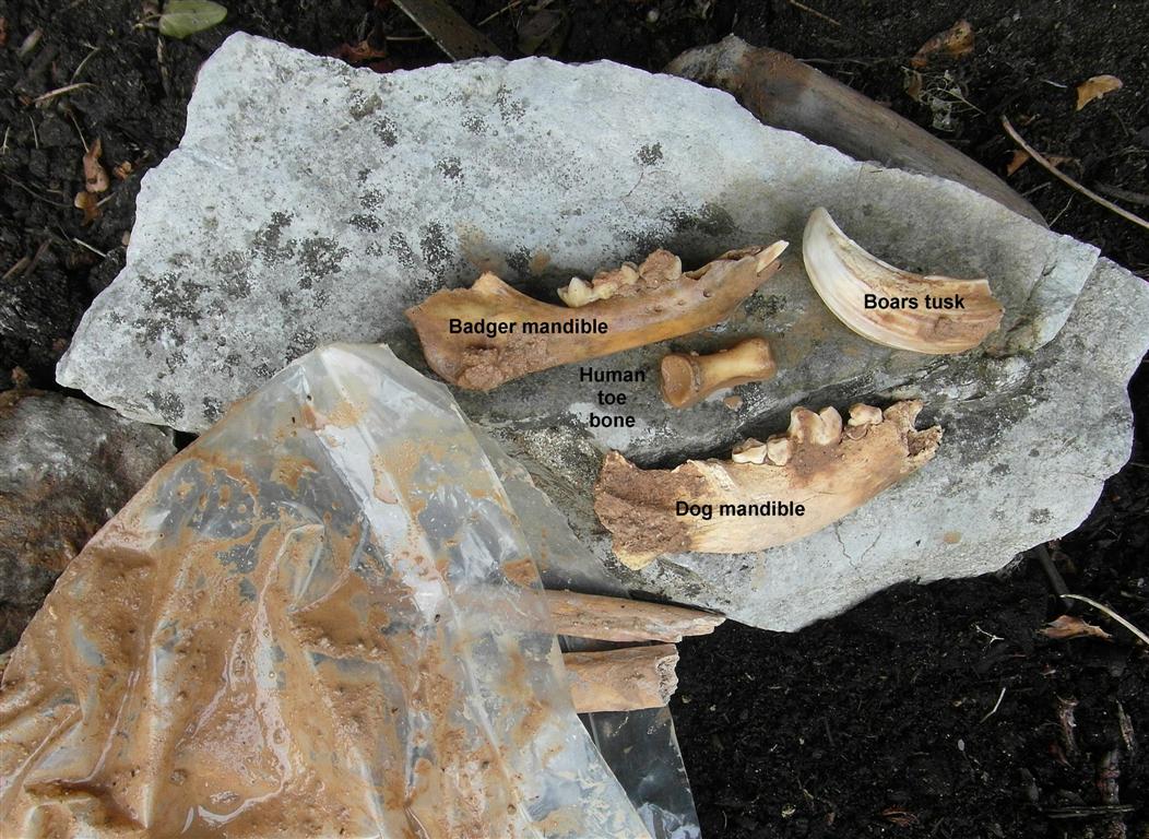
Human and animal remains rescued from Orchid Cave Photo: John Blore
Many of the bones in the bag have been damaged by digging implements
---------------------------------------------------------------------------------------------------
Click on the title to open