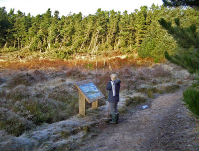
Information re Lady Bagot's Drive
"Twixt the small hamlet of Rhewl in the Vale of Clwyd, and village of Bontuchel, tucked into the folds of the Denbigh Moors, lies a gorge scoured by the tumbling Afon Clywedog. Alongside the river runs a footpath known to the chosen few as Lady Bagot's Drive. For generations this has inspired cyclists from as far away as Merseyside and Cheshire to include it in their route for the day. The ‘Drive’ is of Edwardian provenance and was laid as a carriageway by Lord Bagot (of Pool Park, Bontuchel) for his wife at the time Clocaenog Forest was planted.……...There is a large stone monument on a hill in the forest to the memory of Lord Bagot. Known as the Pennant Stone this also featured regularly on runs lists. Some years ago a 'No Cycling' sign appeared at the Rhewl entrance to the Drive. This is of dubious legal status although it should be appreciated that whilst there is a pedestrian right of way along the entire length of the gorge, sections are in the private ownership of various parties".
Source: Cycling in North Wales website: http://www.cyclingnorthwales.co.uk/pages/lady_bagots.htm
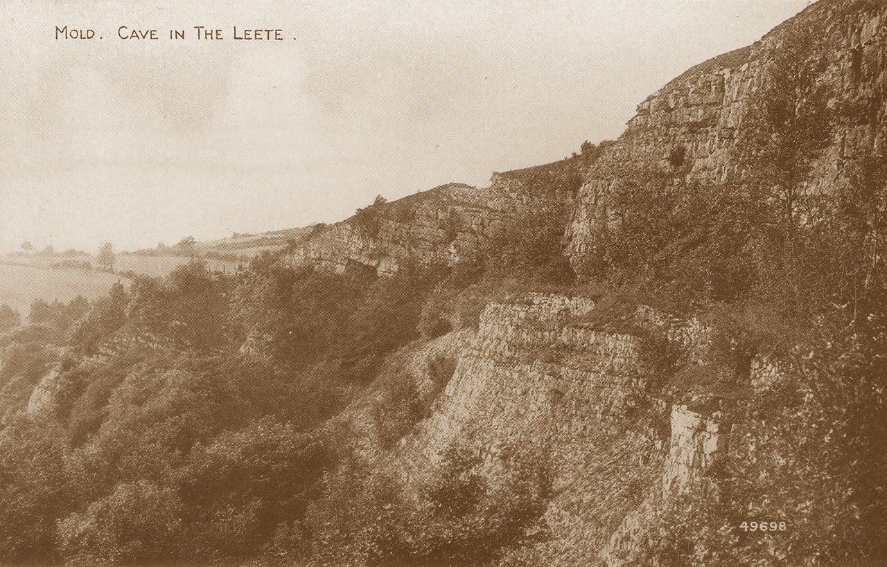
An old postcard showing the entrance beside the footpath in the distance
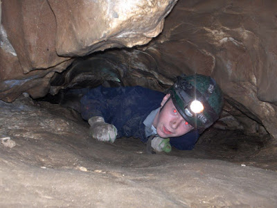
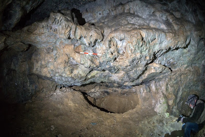
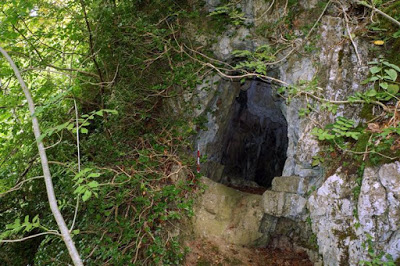
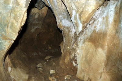
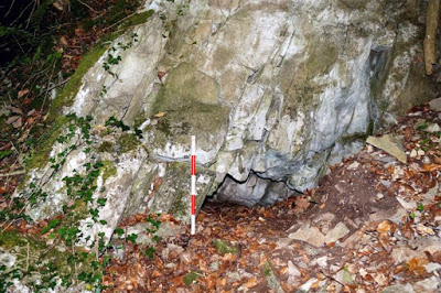
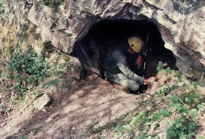
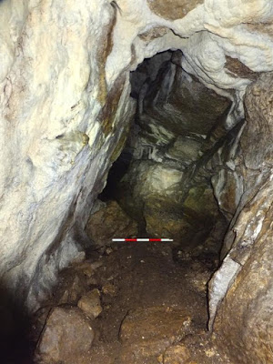
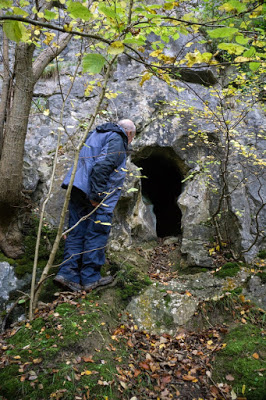
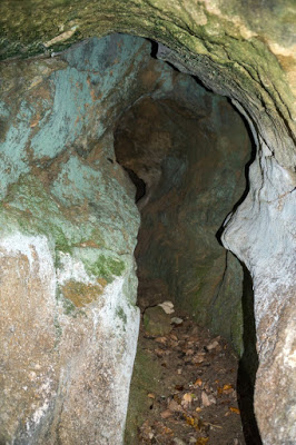
The cave consists of a single chamber 2m high with a blocked passage at floor level.
Currently blocked off by heavy duty netting which protects walkers from the collapsing cliff-face above.
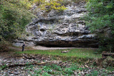
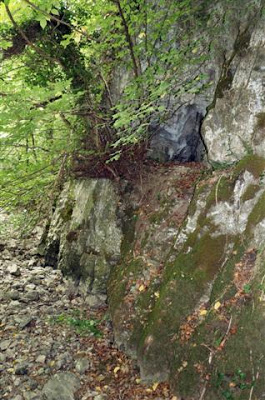
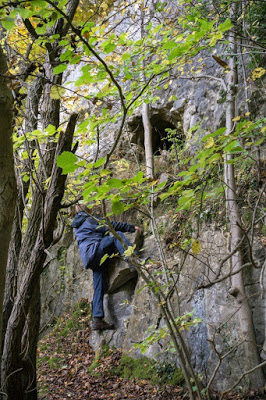
From car park at Pont Newydd/Cilcain bridge (SJ188652) walk up the steep road towards Pantymwyn. Shortly after the road bends to the right, take the public footpath on the right for 200. The cave sits beside the footpath.
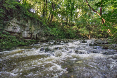
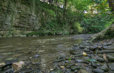
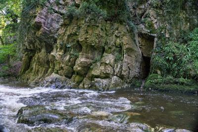
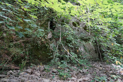
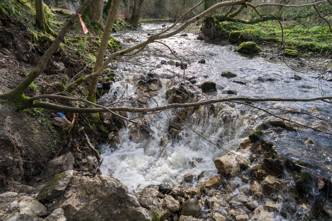
Leet Caves 1- 9 NGR: SJ188643 Area: Alyn Gorge
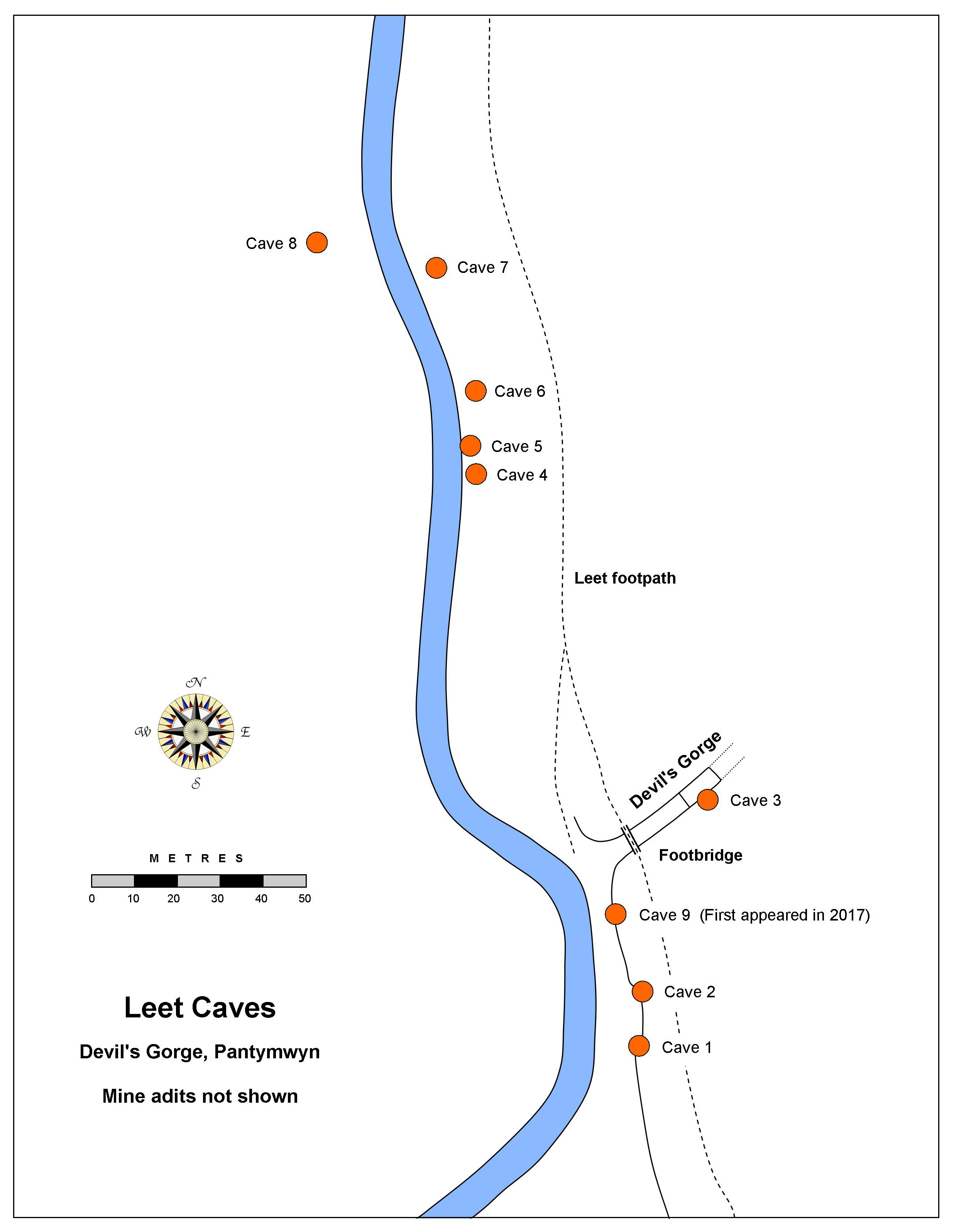
A group of small caves centred around the area of the River Alyn known as Devil's Gorge.
A
50m stretch of the river bed at Devil's Gorge has been subject to
occasional, small collapses due to erosion of the many river bed
fissures which take water underground. Such 'swallows' can be found in
several area of river bed between Loggerheads and Rhydymwyn. But in
2016, the floor of a tiny cave (see
Leet Cave No.2
below) collapsed to reveal a 20m pothole leading to a lower chamber.
Subsequent surface collapses suggest that the scale of underground voids
is larger than was previously thought. Much of the River Alyn's winter
flow now sinks underground at Devil's Gorge, and as a result the river
bed downstream is currently dry (Feb.2019).
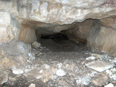
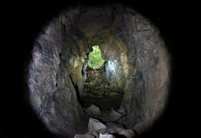
Cave 1: SJ1888264291 (+/-15ft) Length 40m
A low crawl for 8m to a small ‘chamber‘ having two passages leading off, one above the other. The longest of the two passages is at roof level and is a descending crawl of about 16m to a clay blockage which pools up in wet weather. This point is thought to be close to the termination of Cave No 3.
The other passage is at floor level and becomes too low after a metre or two.
At the end of the upper passage an echo was reported in 1962:
The cave “…. goes in for 30ft. to a chamber from which go two passages to the left, situated one above the other. The lower one goes for 4 feet to a pool of water; the upper one goes for 50 feet through a good water-worn passage to a muddy choke, from behind which a good echo can be heard” (Source: Shropshire Mining Club yearbook 1961-62, page 34).
The yearbook is available online: http://www.shropshirecmc.org.uk/yearbooks/SMC_Year_Book_1961-62_w.pdf
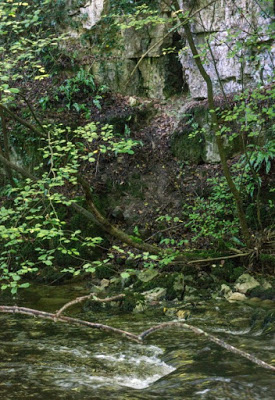
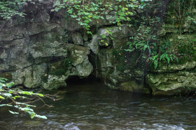
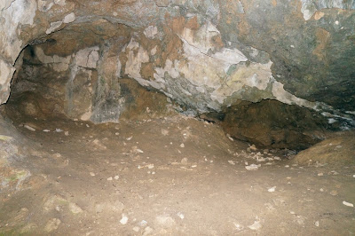
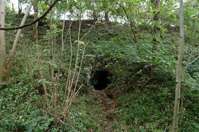
At river level, a few metres upstream of Devil's Gorge
Caves 1 and 2 both lie in this rock-shelter (Cave 1 to the right, Cave 2 to the left)
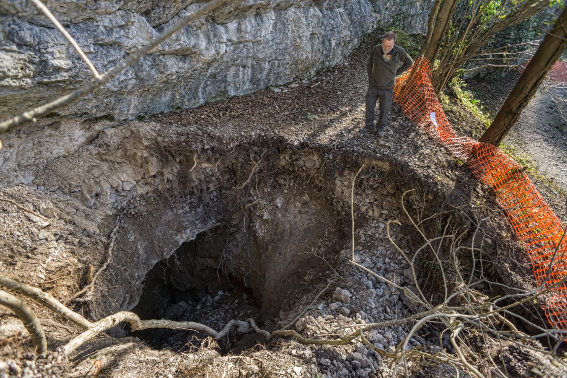
Cave 2: SJ1886964292 (+/-15ft) Length 5m
The entrance opens immediately into a chamber 5m across with a 6m aven in the roof.
In January 2016 a hole appeared in the floor about 5m deep.
Over
the winter of 2016/17 the hole in the floor again dropped away to
reveal a shaft about 15m deep into a muddy, boulder-strewn area tending
downwards and in the direction of the river bed.
It is thought that winter floods might cause further settlement.
There
are hopes that future work here might provide a route to the as yet,
unexplored upstream section of the Ogof Hesp Alyn system, or to the
southern end of Ogof Help Alyn.
Following the initial collapse in 2016 and subsequent dog rescues, NRW
in consultation with Loggerheads Country Park and local cavers,
have gated and locked the entrance to safeguard the casual visitor and
protect the few bats that used the entrance chamber. Consequently,
access to cavers is not permitted during bat roosting season
October to April (inclusive)
.
Cavers will be permitted to visit the cave
from May to September (inclusive)
.
At river level, a few metres upstream of Devil's Gorge
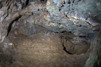
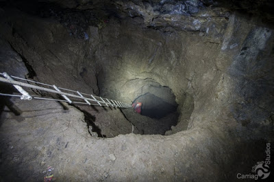
2017 View
looking down into the new collapse
Photo: Tim Watts
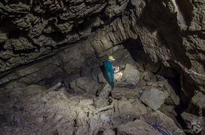
Cave 3: Poor GPS reception Length: 30m
A short passage leads through a cemented-in-place dustbin to a small sloping chamber. May connect with Caves 1 with enough digging.
From the river, walk under the gorge foot bridge to the beginning of the steep slope down. Entrance is in right-hand wall about 3m above floor level. It requires a long log or maypole & electron ladder to get in.
Cave 4: Poor GPS reception Length: 2m
Entrance measures 1m x 1m but quickly tapers down to clay floor.
Limited, un-excavated floor deposits remaining.
Almost exactly 100m downstream from Devil's Gorge. In the east bank j ust above river level.
Cave 5: Poor GPS reception Length: 9m
A tube runs for 5m to a cross-rift 4m long before becoming too tight.
Just 6m north of Cave 4. In rock face in the east bank, 3m above river level.
Cave 6: Poor GPS reception Length: 10m
A chamber almost 2m high x 4m long with a 6m crawl at floor level and a tight tube in the roof.
Has been extended by digging in the last few years and could benefit from further work.
Just 8m north of Cave 5. In rock face about 9m above the river.
Cave 6
Cave 7: SJ1883964447 +/-23ft Length: 3m
A 3m long crawl
over leaves and loose earth,
passing through a low chamber 2m x 2m x 0.3m high.
Could easily be enlarged, and possibly extended with a little work.
Just 22m north of Cave 6. Entrance faces south and is 4m above the river.
Cave 8: SJ1881864456 +/-23ft Length: 16m
The entrance shows evidence of natural formation, although the site has been much extended by mining.
A 10m long passage with three short passages off, the longest being 3m.
In west bank about 10m metres downstream of Cave 7.
Warning: The roof above the entrance is unstable and boulders have fallen here recently.
Cave 8
Leet Cave No. 9 SJ18876430 Length: 6m
A bank of scree and mining waste collapsed in 2017 exposing a previously unknown cave in a cliff-face a few metres from Devil’s Gorge. Although the 3m diameter entrance suggests caving potential, no open passage has been found beyond the entrance chamber. It appears that cave development continues vertically down below the floor of clay and boulders.
A large swallow 6m away in the river-bed occurred around the same time and connects with Cave 9 at depth. The water sinking in the river-bed is likely to be eroding glacial fill from previously filled passage below. The floor of Cave 9 however, floods during wet periods demonstrating a fluctuating local water table. This infers that the conduits draining the area are of limited capacity or significantly blocked. The fluctuating water table may also explain the appearance of the ‘new’ pothole that appeared the previous year in the floor of Cave 2; the continued wetting from below of glacial clays, causing them to progressively fall away from within the vertical shaft.
---------------------------------------------------------------------------------------------------------------
Llanarmon Castle Cave Length 50m SJ19315613 Llanarmon-yn-ial
A tight, low, wet crawl with spiders opens into a chamber containing helictites. There is also a flooded passage at floor level. A short passage rises from the chamber towards a point on the surface at the south-west side of the 'Tomen-y-Faerdre'. A dig from the surface should provide easier access and could prove to be of archaeological interest.
In
the 1980s the landowner created a low bank of earth in the field in
front of the entrance. This can cause water to back up the roof of the
entrance passage. During dry periods however, the water level drops
sufficiently to allow access, although some enlarging at the entrance
may be needed (see photo below).
Access: Call at Tyn Llan Farm at top of hill on right immediately before the Raven Inn.
Driving south over the bridge towards Llanarmon village, the cave is at the foot of the limestone mound to the left. It lies opposite the large entrance of Llanarmon Cave on the other side of the road.
---------------------------------------------------------------------------------------------------------------
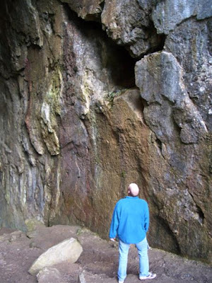
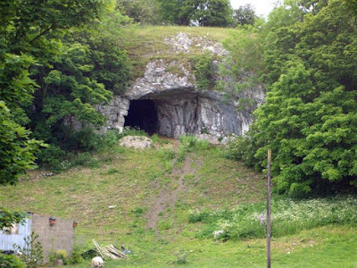
Llanarmon Cave SJ19315628 Length: 22m Llanarmon-yn-ial Archaeological (human)
Entering
Llanarmon-yn-ial
village via the road bridge over the River Alyn, it's difficult to miss
the impressive cave entrance overlooking the river above Plas Isaf.
Although the entrance is about 4 metres square, the roof gradually
tapers down
to a clay floor after a distance of just 22 metres.
"The cave was partly explored in 1905 by the late Mr. Rouw, Chemist, Ruthin, and others. The only find made was a finely-worked flint arrowhead, broken in two, measuring about 3/4 inch in length. This was shown to the writer by Mr. Rouw in May, 1913. Since Mr. Rouw's death, which occurred not long afterwards, it has been lost sight of". Source: The Prehistoric and Roman Remains of Denbighshire (1929) by the Reverend Ellis Davies, page 179.
One
or two documentary sources refer to the cave by the name of ‘Big Cave’,
although the name ‘Llanarmon Cave’ appears to be the first documented title (in
‘Caves in Wales & the Marches’ by Jenkins & Mason-Williams, 1963).
Excavations:
-
First excavated in 1905 by Mr Rouw of Ruthin, but no detailed account of the work is known to exist.
-
It
was excavated again between 2003 and 2005 by CWP Archaeology with Mark Olly.
Amongst the finds from several excavation trenches, they
unearthed many flint bladelets and an undated human toe bone.
A brief CWP report (as a PDF file) is available on request from this website.
- In October 2012, a shallow exploratory pit was excavated by Rob Dinnis of the British Museum accompanied by John Boulton of Devon Speleological Society with local volunteers. A flint cutting tool was identified and a metatarsal of wild horse or deer was also found. The excavators hope that radiocarbon dating will be carried out on the bone.
- In August 2013 Rob Dinnis and John Boulton returned to carry out further work, when more stone cutting tools were found. Although these are merely small worked flint bladelets of no more than an inch across, they do suggest early human activity within the cave and may justify further excavation work.
-
In September 2016
Rob Dinnis and John Boulton spent four days excavating at the cave.
Access: Seek permission from the Plas Isaf house below the cave.
----------------------------------------------------------------------------------------------------------------
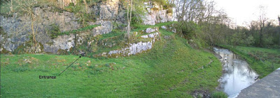
Llandegla Caves A - L Area: SJ187534 Llandegla Includes five archaeological caves
Ten caves are known here, five of which were excavated between 1869 and 1872 by William Boyd Dawkins (see Cave Hunting, 1874).
Dawkins originally named the five archaeological caves as:
Cave No. 1
(or
Perthi Chwareu Cave No.1)
Cave No. 2 (or Perthi Chwareu Cave No.2)
Cave Rhosdigre, No 1
Cave Rhosdigre, No 2
Cave Rhosdigre, No 3
Finds in this group of caves include remains of bear, deer and a wild boars tusk 'of remarkable size' plus 16 humans from one site and 5 from another.
Dawkins also identified the first platycnemic leg bones in Britain amongst the remains from Llandegla (first identified by George Busk about 6 years earlier at caves in Gibralter). Platycnemia is a flattening of the shin bones often thought to be the result of adopting a frequent squatting posture. Whilst this may be the case, it is also now accepted to be the result of the stress of 'habitual activity patterns' (Lucas 2007) which could suggest a people accustomed to hunting over rough terrain.
Cave confusion
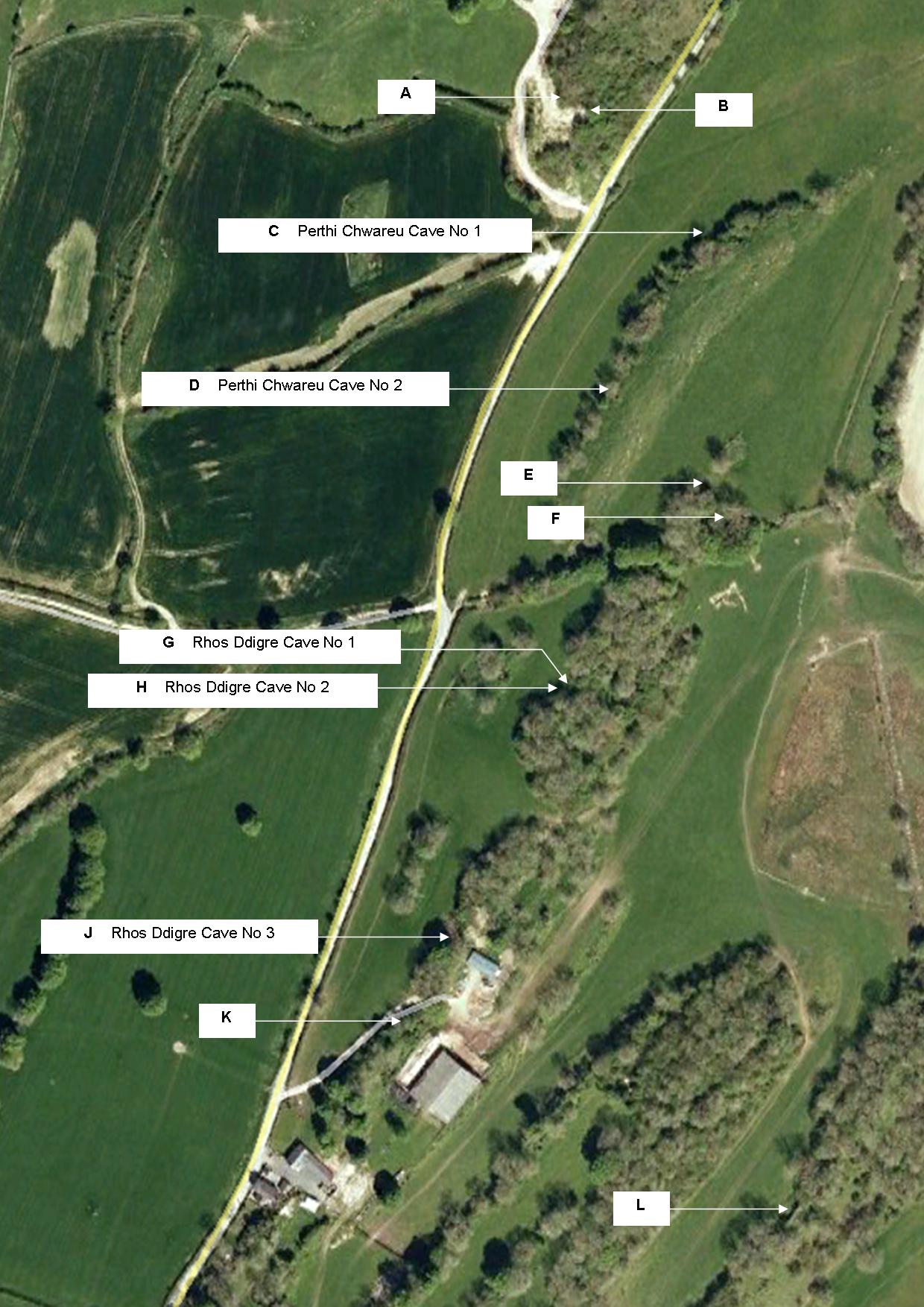
Please note that although Dawkins used the name of the farm Rhosdigre to name three of the caves, the name of this property was changed some time after Dawkins time to Rhos Isaf (Source: Tithe map, Ruthin Records Office). Hence some later sources refer to Rhos Isaf Caves. Half a mile to the south lies another property which has also been renamed, and is now confusingly called Rhos Ddigre. Due to further confusion over which caves Dawkins excavated, some now have up to four different incorrect names or reference numbers applied by archaeologists. Survey work by the writer in 2011 and 2012 has identified the location of Dawkins's ' Perthi Chwareu Cave No 1' ( Ebbs, Cris. 2013). This suggests that some of the remaining Dawkins caves may have been incorrectly identified. The locations of all Dawkins's caves are therefore proposed below in order to stimulate further debate. To avoid further confusion, an area plan is shown below indicating the known caves. This is followed by GPS locations of each cave and internal surveys of those where access was possible. There may be further caves in this area not identified at the time of the survey. The caves are identified below alphabetically as shown on the plan for simplicity. The letters are not intended to represent additional cave names.
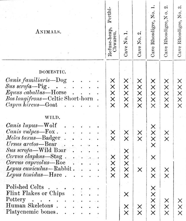
Boyd Dawkins table of finds, copied from Cave Hunting 1874
References
Boyd-Dawkins, W. (1874)
Cave Hunting
.
Includes a chapter on his work at the caves near Llandegla (Rhos
Ddigre, Rhos Isaf and Perthi Chwareu Caves). The writer has a first
edition for sale (details from: cavecomment@hotmail.co.uk)
Lucas, Peter. (2007) Charles Darwin, "little Dawkins" and the platycnemic Yale men: introducing a bioarchaeological tale of the descent of man
. Archives of Natural History 34 (2): 318-345.
Ebbs, Cris. (2013)
William Boyd Dawkins Llandegla caves re-assessed
. Denbighshire Historical
Society Transactions Vol 61, 11-28. This can be downloaded free (although you need to register) from: http://independent.academia.edu/CrisEbbs
Hankinson, Richard. (2016)
CPAT Report No. 1380: Caves of North East Wales - Archaeological Evaluation 2015-16
. Excavation work at four caves are described, one of which is described below as Cave C.
..... and for those who wish to know more about the life and works of Boyd Dawkins: White, Mark. (2016)
William Boyd Dawkins and the Victorian Science of Cave Hunting
available at: https://www.amazon.co.uk/William-Dawkins-Victorian-Science-Hunting/dp/1473823358
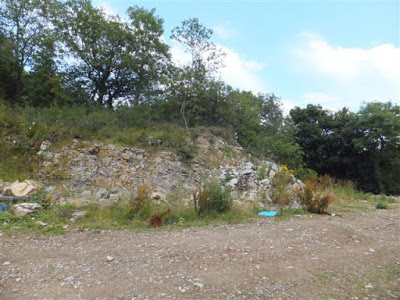
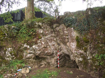
Cave A Grid Ref: SJ 1875 5379 (approx) Length: 3m
Name: Limekiln Cave
This cave entrance is now lost, possibly buried.
A north-facing entrance 1m in diameter provided access to a straight, descending passage 3m long. This terminated at a clay blockage (source: writers diary notes 1974). The passage beyond the clay blockage was likely to connect, after a few metres, with a south-facing cave which is also now buried (see Cave B below).
Excavated and named by J. D. Blore & L. Robinson in 1984 without finding archaeological remains.
The entrance lay on the west side of the Llanarmon-Llandegla road in what remains of an old quarry about 50m to 70m south of Perthi Chwareu house. A limekiln existed a few metres from the entrance in 1974 but this and the cave entrance were lost during ground clearance work.
Limekiln Cave in 1984 Photo: John Blore
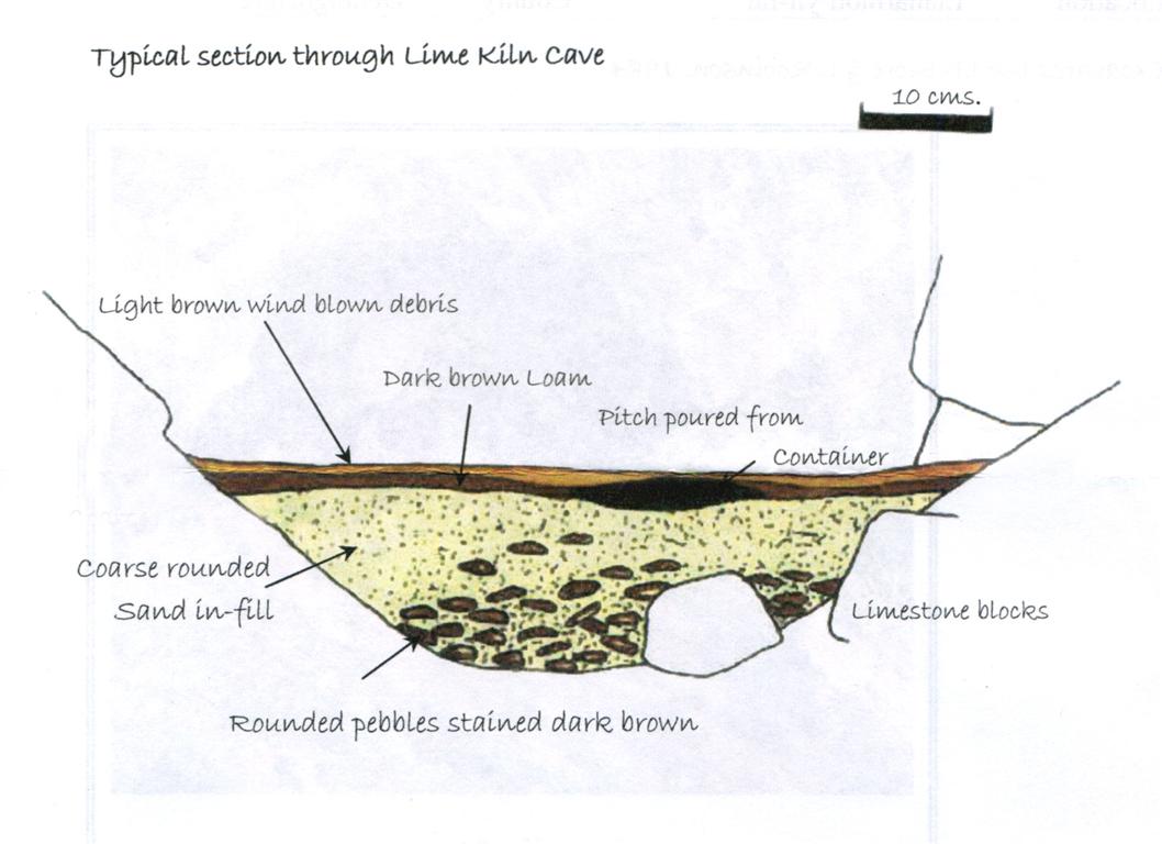
Limekiln Cave in 1984. Cross-section of deposits Photo: John Blore
-- -- -- -- -- -- --
Cave B Grid Ref: SJ 1875 5379 (approx) Length: 4m
Name: Un-named
This cave entrance is now lost, possibly buried.
A south-facing entrance 1m in diameter provided access to a straight, ascending passage 4m in length. This terminated at a clay blockage (source: writers diary notes 1974). The passage beyond the clay blockage was likely to connect, after a few metres, with a north-facing cave which is also now buried (see Cave A above).
The entrance lay on the west side of the Llanarmon-Llandegla road a few metres east of what remains of an old quarry about 60m to 80m south of Perthi Chwareu house. The cave entrance was lost during ground clearance work.
-- -- -- -- -- -- --
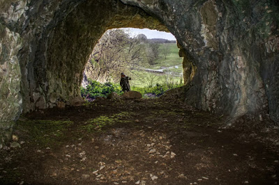
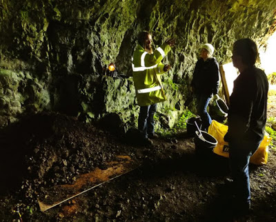
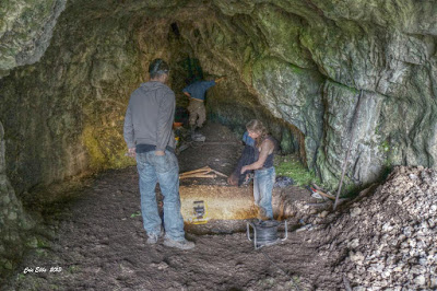
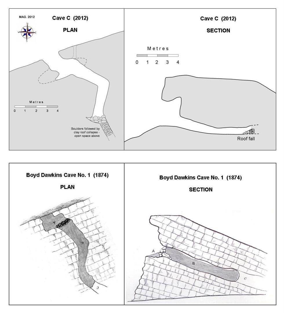
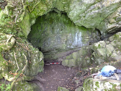
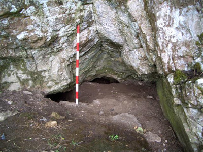
Cave C Grid Ref: SJ 18850 53704 (+/- 12ft) Length: 7m (in 2012) Archaeological (human)
Name: Cave No. 1 or Perthi Chwareu Cave No. 1 (after Boyd Dawkins, 1874)
Other name: 1A (Cadw)
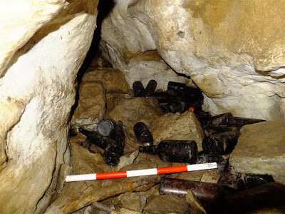
A roomy entrance rift chamber: 2.7m high x 4m wide having, at floor level, a 1m high passage 7m in length, terminating at a collapse of clay and boulders. The collapse material is unconsolidated, appearing to have fallen since Boyd Dawkins’s time. The end of the cave is littered with discarded bottles, suggesting the cave may have been used by an itinerant at some time.The 2012 survey below is similar to the Boyd Dawkins survey of 1874, strongly suggesting that this cave is the same as that named by Dawkins as Cave No.1.
Finds from this cave initially included remains of five humans, and further work by revealed flint flakes or chips and a final total of 16 humans (Cave Hunting, 1874, page 167).In 2016 a report by Clwyd Powys Archaeological Trust detailed the examination of four cave sites: "CPAT Report No. 1380: Caves of North East Wales - Archaeological Evaluation 2015-16". One of the caves examined was this cave where in 2015 two small trenches were excavated, one inside the cave and one just outside the entrance.
The report makes the following comments:
cannot quite be seen at floor level to the left of the ranging pole
-- -- -- -- -- -- --
Cave D NGR: SJ 1879253626 (+/- 10ft) Length: 7m Archaeological (human)
Probable name: Cave No. 2 or Perthi Chwareu Cave No. 2 (after Boyd Dawkins, 1874)
Scheduled Ancient Monument Ref: De 119A
Various other, but incorrect names: Cave 874 (Ordnance Survey) : Rhos Ddigre Cave 1 (Cadw) : Cave A (RCAHMW)
The cave entrance lies about 6m above field level near the top of a rock outcrop. From the entrance, a crawl 2m long enters, at floor level, a chamber 4m x 2m x 2m high. A 4m long crawl bears south from the chamber ending in a clay blockage and discarded bottles. The sloping chamber floor comprises clay deposits which may be waste material resulting from excavation of the continuing passage.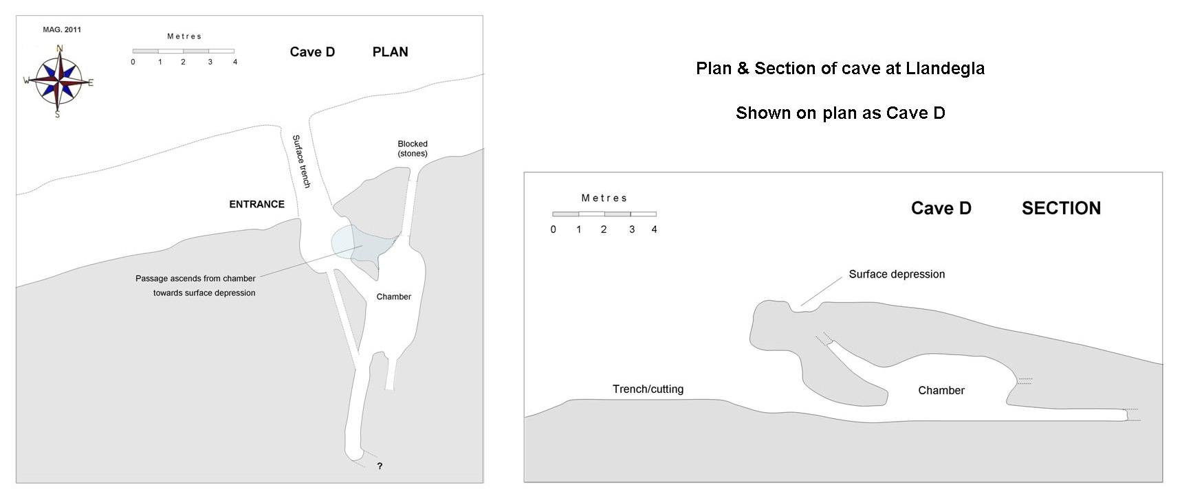
-- -- -- -- -- -- --
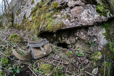
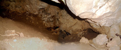
Cave E NGR: SJ 18827 53579 (+/- 9ft)
A previously undocumented cave first noted in 2011.
A north-facing entrance which appears to have been revealed by animal activity. The entrance is currently blocked with boulders.
The internal view below was obtained by lowering a camera at arms length down between boulders.
It may form part of a single passage connecting to Cave F, perhaps 20-25 metres to the south.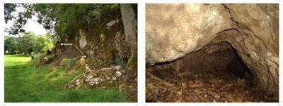
-- -- -- -- -- -- --
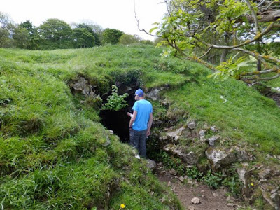
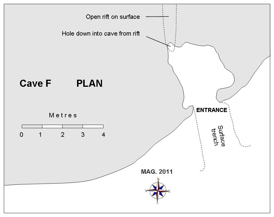
Cave F NGR: SJ 18851 53554 (+/- 9ft)
Scheduled Ancient Monument Ref: De 119B (this cave however, is unlikely to be one of Dawkins' five archaeological caves and may have been scheduled in error)
Various other, but incorrect names:
Cave 884(Ordnance Survey); Rhos Ddigre Cave 2 (Cadw); Cave B (RCAHMW)
A low, south-facing
cavity 2m x 2m x 0.4m high lying about 10m north of the Offa’s Dyke Path.
Above the cave, just 2 metres north of the entrance, is an open rift in the surface 2m long. A hole in the south end of this rift connects with the roof of the cave below.
An examination of the
floor deposits in the form of a test pit might confirm if they are undisturbed.
If so, the minimal height of the cave of 0.4m would suggest that this was not one of
the ‘Boyd Dawkins five’, and the status of the cave as an Ancient Monument may need
to be reassessed.
View looking north at entrance to Cave F
-- -- -- -- -- -- --
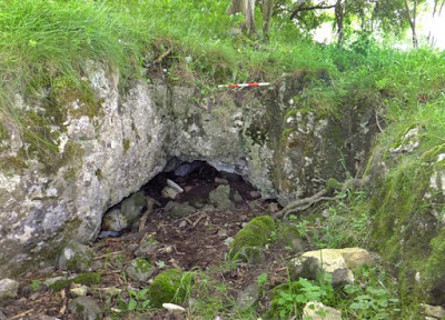
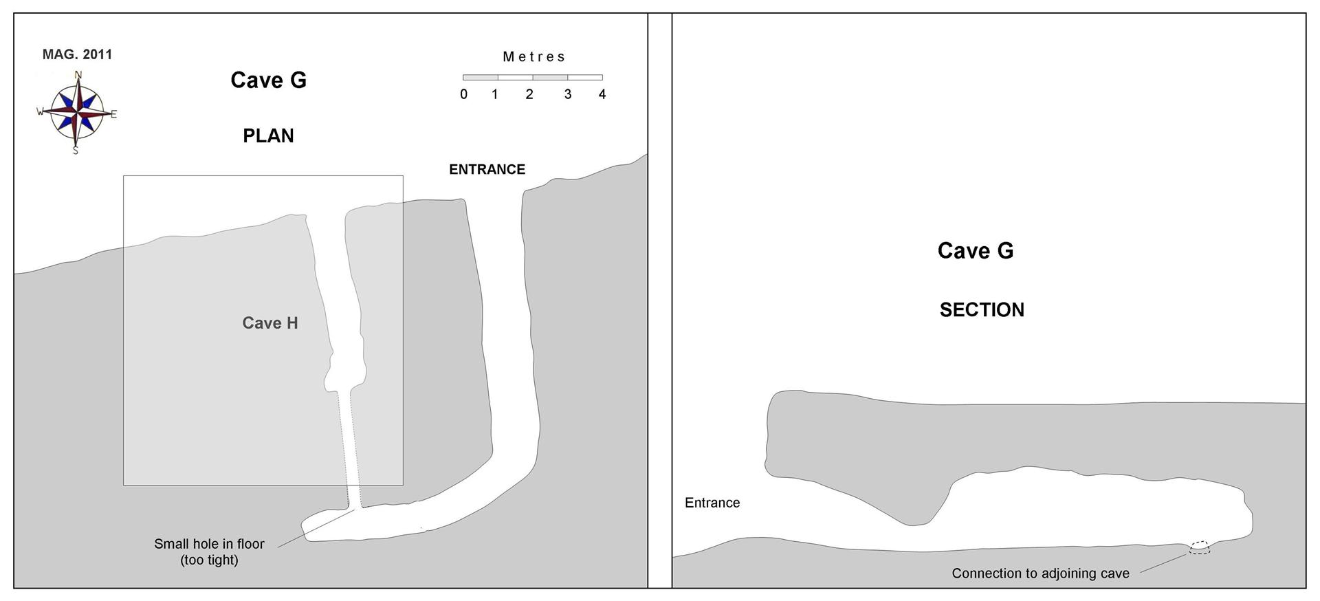
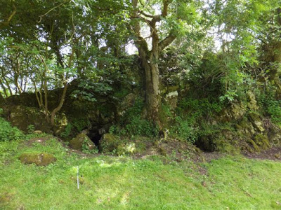
Cave G NGR: SJ 18769 53457 (+/- 12ft) Length: 14 metres Archaeological (human)
Probable name: Cave Rhosdigre No. 1 (after Boyd Dawkins, 1874)
Scheduled Ancient
Monument Ref: De 119C
Various other, but incorrect names:
Cave 1752 (Ordnance Survey); Rhos Ddigre Cave 3 (Cadw); Cave C (RCAHMW)
The cave entrance measures 2m high x 2m wide. Six metres from the entrance the passage reduces to 1metre in height, then bears to the right and increases again to 2 or 3 metres in height. A small hole at floor level near the end of the passage is too small to enter, but connects with the adjoining Cave H.
Pristine white or cream crystalline speleothem deposits are in the process of formation on the roof at the end of the cave. These may possibly have a biological component of a similar nature to ‘moonmilk’.

Cave G
-- -- -- -- -- -- --
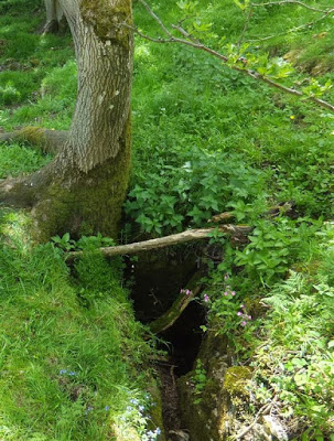
Cave H
NGR: SJ 18765 53454
(+/- 12ft) Length: 5m Archaeological (human)
Probable name: Cave Rhosdigre No. 2 (after Boyd Dawkins, 1874)
Scheduled Ancient Monument Ref: De 119D.
Various other, but incorrect names: Cave 1752 (Ordnance Survey): Rhos Ddigre Cave 4 (Cadw): Cave D (RCAHMW)
The entrance measures 1.3m high x 1.3m wide, but the passage quickly reduces to a crawl, becoming too tight to negotiate 5m from the entrance. At this point a passage of smaller dimensions can be seen to continue towards the adjoining Cave G. The floor ahead appears to comprise deposits that may be undisturbed.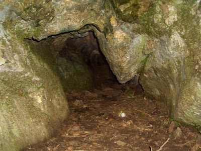
-- -- -- -- -- -- --
Cave J
NGR: SJ 18702 53323
(+/-
10ft)
Archaeological (human)
Probable name: Cave Rhosdigre No. 3 (after Boyd Dawkins, 1874)
Other names: Cave 1753 (Ordnance Survey)
No cave passage is currently accessible, although the location of the entrance is indicated by animal burrows. The father of the current landowner states that the cave once had a large entrance and was used for storing hay bales. These became wet and were abandoned. Significant animal activity then accelerated the sealing process.
If this cave can be confirmed as being Cave Rhosdigre No. 3 as mentioned by Boyd Dawkins, its Ancient Monument
status will need to be re-assessed, as the cave is currently unprotected.
-- -- -- -- -- -- --
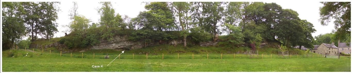
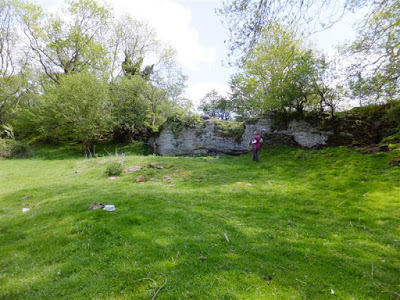
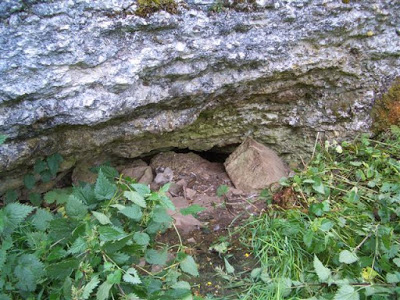
Cave K NGR: SJ 18663 53272 (+/- 12ft)
Other names: Cave 1754 (Ordnance Survey)
Merely a shallow rock shelter or overhang.
Marked as ‘Cave’ on Ordnance Survey Archaeological Record card (1963).
-- -- -- -- -- -- --
Cave L
NGR:
SJ 18881 53165 (+/- 9ft) Length: 6m
Name: Basil’s Cave
A low crawl-sized passage first revealed by animal activity. Exploratory excavation work was carried out by the writer in 1984 and 1985 when a trench was excavated just outside the entrance. This yielded 66 animal and bird bones of no archaeological interest. The remains were found in the top 10cm only, and appeared to have been thrown out of the cave by burrowing animals. In 1986, the landowner’s dog Basil became trapped in the cave. Although a low passage was enlarged by the landowner for a distance of approximately six metres, the dog had pushed further ahead and was not recovered. Subsequently the excavated passage and resulting spoil were briefly examined for archaeological remains without success. The entrance is currently sealed with boulders. Significant deposits remain within the cave, requiring a more determined archaeological examination.
Cave L showing low platform of deposits excavated by the land-owner

--------------------------------------------------------------------------------------------------------------------------
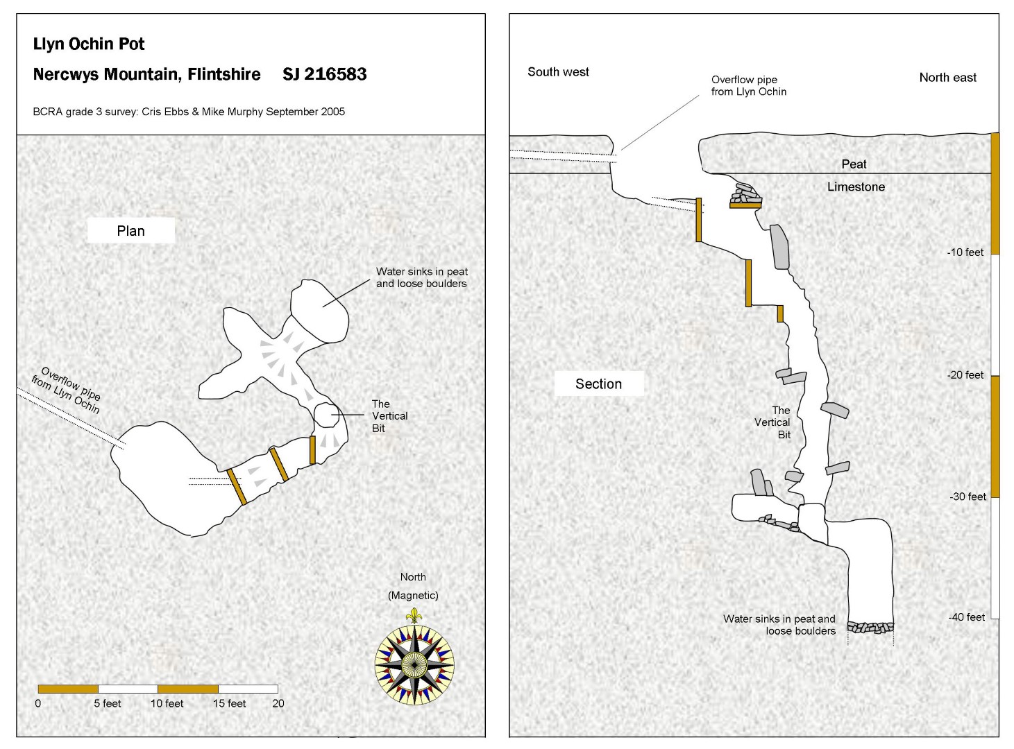
Llyn Ochin Pot Depth 18m SJ21525835 Eryrys
A bog surrounded by pine forest (but since felled around 2012) has an outflow at its eastern end which has been channeled into the entrance (active only in wet weather). A vertical narrow rift can be free-climbed to a depth of 12m. At the bottom, a short crawl then a squeeze enters a chamber 3m long, formed on a fault on the limestone/sandstone boundary. A slope down under the east wall leads into the top of the final chamber having a floor of boulders about 3m below. The pot is heavily peat-stained.
Excavated intermittently by GCC and Wessex CC, the last work possibly being around 2006.
From the south entrance to Nercwys Forest ( SJ21715775 ), take the new footpath into the forest keeping left at any junctions. After half a mile or so, at the most westerly point on the route, the path leads past the dried bog of Llyn Ochin. The pot is indicated by the small square fenced-off area near the path.
Warning: Beware of unstable areas in the narrow vertical section
The pot lies in the small fenced area in centre of photo
Although once a shallow lake, Llyn Ochin is now a boggy marsh
----------------------------------------------------------------------------------------------------------------------------
Loggerheads Cave SJ199628 Length: 10m Area: Loggerheads
A small tube festooned with cave threshold spiders ( Meta Menardi) which rises to the north and soon becomes silted.
High in the right-hand side of the cliff face overlooking the road. Visible from near 'We Three Loggerheads Inn'. Accessible by climbing down from above.
Loggerheads Quarry Caves 1-2 SJ201625 Area: Loggerheads
Two small tubes in an old disused limestone quarry.
From
the bridge at Loggerheads, travel in the Mold direction for 200m to a parking spot on
the right. A track here leads south-west to an old quarry. The caves are in the
east wall of the quarry face.
Cave 1: Length: 8m
Uninspiring
tube about about 1m high.
From the locked gate at the quarry entrance, walking into the quarry the cave is in the far left-hand corner
Cave 2 (Ogof Brogaod or Cave of frogs): Length: 16m
A single tubular passage running into the hill. Excavations in 2021 and 2022 by Dave Tyson and others extended the cave from 6 to 16 metres in length. Much of the passage is now around a metre in diameter.
Approximately 10m to the right of Cave 1.
------------------------------------------------------------------------------------------------------------------------